61:
73:
747:
49:
413:
In the township the population was spread out, with 24.9% under the age of 18, 5.5% from 18 to 24, 28.0% from 25 to 44, 25.8% from 45 to 64, and 15.8% who were 65 years of age or older. The median age was 40 years. For every 100 females there were 99.5 males. For every 100 females age 18 and over,
409:
living together, 6.4% had a female householder with no husband present, and 24.3% were non-families. 20.0% of all households were made up of individuals, and 7.5% had someone living alone who was 65 years of age or older. The average household size was 2.57 and the average family size was 2.99.
377:
of 2000, there were 764 people, 280 households, and 211 families residing in the township. The population density was 36.9 inhabitants per square mile (14.2/km). There were 309 housing units at an average density of 14.9/sq mi (5.8/km). The racial makeup of the township was 99.48%
60:
1118:
417:
The median income for a household in the township was $ 35,568, and the median income for a family was $ 43,333. Males had a median income of $ 31,786 versus $ 23,125 for females. The
858:
675:
898:
365:, the township has a total area of 20.8 square miles (54 km), of which 20.7 square miles (54 km) is land and 0.1 square miles (0.26 km) (0.58%) is water.
17:
1157:
973:
968:
948:
72:
983:
953:
913:
848:
843:
893:
883:
958:
863:
853:
908:
888:
868:
878:
993:
943:
928:
933:
903:
668:
1056:
963:
1061:
661:
614:
350:
923:
48:
988:
978:
938:
918:
442:
107:
653:
539:
470:
346:
1016:
387:
825:
785:
1095:
815:
685:
637:
589:
391:
362:
330:
112:
1046:
1011:
810:
800:
288:
273:
258:
1026:
805:
780:
775:
215:
83:
1082:
1036:
1003:
835:
820:
790:
731:
405:
There were 280 households, out of which 35.7% had children under the age of 18 living with them, 66.8% were
326:
39:
1066:
770:
757:
395:
1041:
726:
619:
207:
337:, United States. The population was 710 at the 2020 census, a decrease from the figure of 771 in 2010.
1102:
1051:
795:
736:
707:
399:
196:
765:
718:
383:
379:
421:
for the township was $ 16,064. About 7.6% of families and 11.3% of the population were below the
516:
559:
490:
418:
186:
571:
502:
1151:
224:
220:
88:
422:
334:
100:
700:
95:
1133:
1120:
177:
425:, including 14.5% of those under age 18 and 8.1% of those age 65 or over.
406:
374:
203:
182:
609:
657:
745:
633:
585:
464:
462:
460:
1075:
1025:
1002:
834:
756:
717:
214:
193:
176:
168:
160:
152:
147:
139:
131:
123:
118:
106:
94:
82:
28:
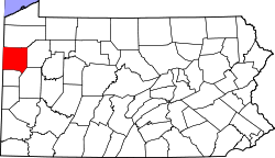
65:Location of French Creek Township in Mercer County
18:Frenchcreek Township, Venango County, Pennsylvania
669:
8:
540:"City and Town Population Totals: 2020-2021"
471:"City and Town Population Totals: 2020-2023"
676:
662:
654:
402:of any race were 0.79% of the population.
231:
25:
77:Location of Mercer County in Pennsylvania
1158:Townships in Mercer County, Pennsylvania
434:
213:
175:
146:
117:
81:
57:
45:
23:Township in Pennsylvania, United States
610:"National Register Information System"
567:
557:
498:
488:
251:
192:
167:
159:
151:
138:
135:20.72 sq mi (53.67 km)
130:
127:20.86 sq mi (54.02 km)
122:
105:
93:
69:
7:
615:National Register of Historic Places
351:National Register of Historic Places
143:0.13 sq mi (0.35 km)
684:Municipalities and communities of
517:"Census of Population and Housing"
241:
14:
71:
59:
47:
347:Bridge in French Creek Township
1:
445:. United States Census Bureau
687:Mercer County, Pennsylvania
638:United States Census Bureau
590:United States Census Bureau
443:"2016 U.S. Gazetteer Files"
363:United States Census Bureau
172:36.00/sq mi (13.90/km)
161: • Estimate
32:Mercer County, Pennsylvania
1174:
15:
1091:
743:
698:
315:
302:
287:
272:
257:
250:
245:
240:
237:
70:
58:
46:
37:
53:Farmstead on Carter Road
16:Not to be confused with
414:there were 95.9 males.
750:
30:French Creek Township,
1134:41.45000°N 80.03306°W
749:
634:"U.S. Census website"
620:National Park Service
586:"U.S. Census website"
323:French Creek Township
316:U.S. Decennial Census
233:Historical population
195: • Summer (
1104:United States portal
169: • Density
1139:41.45000; -80.03306
1130: /
1097:Pennsylvania portal
538:Bureau, US Census.
469:Bureau, US Census.
234:
1076:Former settlements
751:
570:has generic name (
546:. US Census Bureau
501:has generic name (
477:. US Census Bureau
349:was listed on the
232:
153: • Total
140: • Water
124: • Total
1113:
1112:
859:East Lackawannock
419:per capita income
361:According to the
320:
319:
230:
229:
132: • Land
1165:
1145:
1144:
1142:
1141:
1140:
1135:
1131:
1128:
1127:
1126:
1123:
1105:
1098:
1017:Reynolds Heights
964:South Pymatuning
748:
710:
703:
693:
688:
678:
671:
664:
655:
648:
647:
645:
644:
630:
624:
623:
606:
600:
599:
597:
596:
582:
576:
575:
569:
565:
563:
555:
553:
551:
535:
529:
528:
526:
524:
513:
507:
506:
500:
496:
494:
486:
484:
482:
466:
455:
454:
452:
450:
439:
388:Pacific Islander
253:
248:
243:
235:
200:
75:
63:
51:
26:
1173:
1172:
1168:
1167:
1166:
1164:
1163:
1162:
1148:
1147:
1138:
1136:
1132:
1129:
1124:
1121:
1119:
1117:
1116:
1114:
1109:
1103:
1096:
1087:
1071:
1028:
1021:
998:
830:
752:
746:
741:
713:
708:
701:
694:
691:
686:
682:
652:
651:
642:
640:
632:
631:
627:
622:. July 9, 2010.
608:
607:
603:
594:
592:
584:
583:
579:
566:
556:
549:
547:
537:
536:
532:
522:
520:
515:
514:
510:
497:
487:
480:
478:
468:
467:
458:
448:
446:
441:
440:
436:
431:
407:married couples
371:
359:
343:
246:
194:
78:
66:
54:
42:
33:
31:
24:
21:
12:
11:
5:
1171:
1169:
1161:
1160:
1150:
1149:
1111:
1110:
1108:
1107:
1100:
1092:
1089:
1088:
1086:
1085:
1079:
1077:
1073:
1072:
1070:
1069:
1064:
1059:
1054:
1049:
1044:
1039:
1033:
1031:
1027:Unincorporated
1023:
1022:
1020:
1019:
1014:
1008:
1006:
1000:
999:
997:
996:
991:
986:
981:
976:
971:
966:
961:
956:
951:
946:
941:
936:
931:
926:
921:
916:
911:
906:
901:
896:
891:
886:
881:
876:
871:
866:
861:
856:
851:
846:
840:
838:
832:
831:
829:
828:
826:West Middlesex
823:
818:
813:
808:
803:
798:
793:
788:
786:Jackson Center
783:
778:
773:
768:
762:
760:
754:
753:
744:
742:
740:
739:
734:
729:
723:
721:
715:
714:
699:
696:
695:
683:
681:
680:
673:
666:
658:
650:
649:
625:
601:
577:
530:
508:
456:
433:
432:
430:
427:
370:
367:
358:
355:
342:
339:
318:
317:
313:
312:
309:
307:
304:
300:
299:
296:
294:
291:
285:
284:
281:
279:
276:
270:
269:
266:
264:
261:
255:
254:
249:
244:
239:
228:
227:
218:
212:
211:
201:
191:
190:
180:
174:
173:
170:
166:
165:
162:
158:
157:
154:
150:
149:
145:
144:
141:
137:
136:
133:
129:
128:
125:
121:
120:
116:
115:
110:
104:
103:
98:
92:
91:
86:
80:
79:
76:
68:
67:
64:
56:
55:
52:
44:
43:
38:
35:
34:
29:
22:
13:
10:
9:
6:
4:
3:
2:
1170:
1159:
1156:
1155:
1153:
1146:
1143:
1106:
1101:
1099:
1094:
1093:
1090:
1084:
1081:
1080:
1078:
1074:
1068:
1065:
1063:
1060:
1058:
1055:
1053:
1050:
1048:
1045:
1043:
1040:
1038:
1035:
1034:
1032:
1030:
1024:
1018:
1015:
1013:
1010:
1009:
1007:
1005:
1001:
995:
992:
990:
987:
985:
982:
980:
977:
975:
972:
970:
967:
965:
962:
960:
957:
955:
952:
950:
947:
945:
942:
940:
937:
935:
932:
930:
927:
925:
922:
920:
917:
915:
912:
910:
907:
905:
902:
900:
897:
895:
892:
890:
887:
885:
882:
880:
877:
875:
872:
870:
867:
865:
862:
860:
857:
855:
852:
850:
847:
845:
842:
841:
839:
837:
833:
827:
824:
822:
819:
817:
816:Sheakleyville
814:
812:
809:
807:
804:
802:
799:
797:
794:
792:
789:
787:
784:
782:
779:
777:
774:
772:
769:
767:
764:
763:
761:
759:
755:
738:
735:
733:
730:
728:
725:
724:
722:
720:
716:
712:
711:
704:
697:
692:United States
689:
679:
674:
672:
667:
665:
660:
659:
656:
639:
635:
629:
626:
621:
617:
616:
611:
605:
602:
591:
587:
581:
578:
573:
561:
545:
541:
534:
531:
518:
512:
509:
504:
492:
476:
472:
465:
463:
461:
457:
444:
438:
435:
428:
426:
424:
420:
415:
411:
408:
403:
401:
397:
393:
390:, 0.13% from
389:
385:
381:
376:
368:
366:
364:
356:
354:
352:
348:
340:
338:
336:
332:
331:Mercer County
328:
324:
314:
310:
308:
305:
301:
297:
295:
292:
290:
286:
282:
280:
277:
275:
271:
267:
265:
262:
260:
256:
236:
226:
222:
219:
217:
209:
205:
202:
198:
188:
184:
181:
179:
171:
163:
155:
142:
134:
126:
114:
111:
109:
102:
99:
97:
90:
89:United States
87:
85:
74:
62:
50:
41:
36:
27:
19:
1115:
1047:Clarks Mills
1012:Lake Latonka
899:Lackawannock
874:French Creek
873:
706:
641:. Retrieved
628:
613:
604:
593:. Retrieved
580:
568:|last1=
548:. Retrieved
543:
533:
521:. Retrieved
519:. Census.gov
511:
499:|last1=
479:. Retrieved
474:
447:. Retrieved
437:
423:poverty line
416:
412:
404:
372:
369:Demographics
360:
344:
335:Pennsylvania
322:
321:
101:Pennsylvania
1137: /
1029:communities
974:Sugar Grove
969:Springfield
949:Sandy Creek
924:Otter Creek
811:Sharpsville
801:New Lebanon
702:County seat
392:other races
303:2023 (est.)
1125:80°01′59″W
1122:41°27′00″N
1057:Indian Run
989:Wolf Creek
984:Wilmington
979:West Salem
954:Sandy Lake
939:Pymatuning
919:New Vernon
914:Mill Creek
849:Deer Creek
844:Coolspring
806:Sandy Lake
781:Grove City
776:Greenville
643:2008-01-31
595:2017-03-05
544:Census.gov
475:Census.gov
429:References
373:As of the
216:Area codes
148:Population
1083:Wheatland
1062:Maysville
1037:Amsterdam
894:Jefferson
884:Hempfield
836:Townships
821:Stoneboro
791:Jamestown
732:Hermitage
357:Geography
353:in 1988.
178:Time zone
1152:Category
1067:Transfer
959:Shenango
864:Fairview
854:Delaware
771:Fredonia
758:Boroughs
560:cite web
491:cite web
396:Hispanic
386:, 0.26%
382:, 0.13%
327:township
40:Township
1042:Carlton
909:Liberty
889:Jackson
869:Findley
727:Farrell
550:26 June
523:June 4,
481:July 1,
449:Aug 14,
341:History
84:Country
1052:Hadley
879:Greene
796:Mercer
737:Sharon
719:Cities
709:Mercer
400:Latino
375:census
238:Census
113:Mercer
108:County
994:Worth
944:Salem
929:Perry
766:Clark
384:Asian
380:White
325:is a
311:−1.1%
298:−8.0%
204:UTC-5
183:UTC-4
96:State
1004:CDPs
934:Pine
904:Lake
572:help
552:2022
525:2016
503:help
483:2024
451:2017
345:The
289:2020
283:0.9%
274:2010
259:2000
247:Note
242:Pop.
119:Area
398:or
329:in
306:701
293:709
278:771
263:764
225:814
221:724
208:EDT
197:DST
187:EST
164:701
156:709
1154::
705::
690:,
636:.
618:.
612:.
588:.
564::
562:}}
558:{{
542:.
495::
493:}}
489:{{
473:.
459:^
394:.
333:,
252:%±
223:,
677:e
670:t
663:v
646:.
598:.
574:)
554:.
527:.
505:)
485:.
453:.
268:—
210:)
206:(
199:)
189:)
185:(
20:.
Text is available under the Creative Commons Attribution-ShareAlike License. Additional terms may apply.