38:
191:
226:
233:
198:
496:). Training at the field had stopped and it became the site for the storage of American and foreign aircraft. Freeman Field was closed and declared surplus on December 30, 1946. It was deactivated in November 1948 and turned over to local civilian authorities for use as a civil airport.
485:". The mutiny is generally regarded by historians of the Civil Rights Movement as an important step toward full integration of the armed forces and as a model for later efforts to integrate public facilities through civil disobedience.
750:
147:
633:
452:
688:
760:
611:
481:, trained at Freeman Field. In April 1945, several black officers tried to integrate an officers' club resulting in what became known as the "
755:
225:
190:
417:
388:
80:
538:
For the 12-month period ending
December 31, 2017, the airport had 20,786 aircraft operations, an average of 57 per day: 78%
474:
745:
140:
563:
37:
639:
531:: 14/32 is 5,502 by 100 feet (1,677 x 30 m) and 5/23 is 6,001 by 100 feet (1,829 x 30 m). It also has two unpaved
440:
700:
593:
477:
in 1942, it became first USAAF helicopter training school in June 1944. Black aviators, including a group of
448:
654:
456:
130:
17:
482:
589:
550:. In April 2022, there were 67 aircraft based at this airport: 42 single-engine, 8 multi-engine, 2
420:
83:
712:
682:
535:
runways: 18U/36U is 1,200 by 100 feet (366 x 30 m) and 9U/27U is 1,000 by 100 feet (305 x 30 m).
451:, United States. It is owned by the Seymour Airport Authority. This airport is included in the
547:
409:
401:
69:
58:
539:
524:
461:
444:
122:
607:
493:
478:
632:"Appendix A: List of NPIAS Airports with 5-Year Forecast Activity and Development Cost".
728:
739:
432:
492:, Freeman AAF became a storage depot of many captured German and Italian aircraft (
489:
718:
551:
46:
162:
149:
520:
516:
436:
722:
543:
512:
428:
706:
528:
276:
263:
751:
Transportation buildings and structures in
Jackson County, Indiana
638:. Federal Aviation Administration. October 4, 2010. Archived from
532:
508:
42:
608:"IATA Airport Code Search (SER: Seymour / Freeman Municipal)"
597:. Federal Aviation Administration. effective April 21, 2022.
635:
National Plan of
Integrated Airport Systems (NPIAS) Reports
499:
The airport announced plans for new t-hangars in 2022.
373:
365:
356:
262:
178:
139:
128:
118:
110:
102:
97:
28:
507:Freeman Municipal Airport covers an area of 2,100
16:For the World War II use of the airport, see
8:
453:National Plan of Integrated Airport Systems
362:
25:
655:"Plans for New T-hangar are Taking Off"
612:International Air Transport Association
575:
585:
583:
581:
579:
7:
14:
685:(OFFICIAL site for Freeman Field)
231:
224:
196:
189:
36:
689:FAA Terminal Procedures for SER
389:Federal Aviation Administration
109:
761:1942 establishments in Indiana
212:Location of airport in Indiana
1:
691:, effective September 5, 2024
653:McDonald, Lori (2 May 2022).
590:FAA Airport Form 5010 for SER
475:United States Army Air Forces
253:Show map of the United States
756:Airports established in 1942
707:airport information for KSER
696:Resources for this airport:
729:aeronautical chart for KSER
701:airport information for SER
564:List of airports in Indiana
232:
197:
777:
519:of 583 feet (178 m) above
366:Aircraft operations (2017)
15:
441:central business district
398:Freeman Municipal Airport
385:
361:
283:
280:
275:
271:
183:
114:Seymour Airport Authority
53:
35:
30:Freeman Municipal Airport
713:accident history for SER
683:Freeman Field Air Museum
135:583 ft / 178 m
503:Facilities and aircraft
449:Jackson County, Indiana
455:for 2021–2025, which
374:Based aircraft (2022)
163:38.92528°N 85.90694°W
18:Freeman Army Airfield
483:Freeman Field Mutiny
746:Airports in Indiana
723:live flight tracker
719:airport information
473:Established by the
439:) southwest of the
250:(the United States)
215:Show map of Indiana
168:38.92528; -85.90694
159: /
427:) is a public use
596:
488:After the end of
431:located two
395:
394:
381:
380:
352:
351:
768:
670:
669:
667:
665:
650:
644:
643:
629:
623:
622:
620:
618:
604:
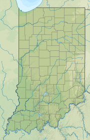
598:
592:
587:
554:and 15 gliders.
540:general aviation
462:general aviation
363:
273:
272:
266:
254:
235:
234:
228:
216:
200:
199:
193:
174:
173:
171:
170:
169:
164:
160:
157:
156:
155:
152:
123:Seymour, Indiana
90:
89:
76:
75:
65:
64:
40:
26:
776:
775:
771:
770:
769:
767:
766:
765:
736:
735:
679:
674:
673:
663:
661:
652:
651:
647:
631:
630:
626:
616:
614:
606:
605:
601:
588:
577:
572:
560:
505:
494:Operation Lusty
479:Tuskegee Airmen
471:
391:
264:
258:
257:
256:
255:
252:
251:
245:
244:
243:
242:
236:
219:
218:
217:
214:
213:
210:
209:
208:
207:
201:
167:
165:
161:
158:
153:
150:
148:
146:
145:
129:Elevation
93:
87:
79:
73:
68:
62:
57:
49:
31:
24:
21:
12:
11:
5:
774:
772:
764:
763:
758:
753:
748:
738:
737:
734:
733:
732:
731:
725:
715:
709:
703:
694:
692:
686:
678:
677:External links
675:
672:
671:
645:
642:on 2012-10-27.
624:
599:
574:
573:
571:
568:
567:
566:
559:
556:
504:
501:
470:
467:
433:nautical miles
393:
392:
386:
383:
382:
379:
378:
375:
371:
370:
367:
359:
358:
354:
353:
350:
349:
346:
343:
340:
336:
335:
332:
329:
326:
322:
321:
318:
315:
312:
308:
307:
304:
301:
298:
294:
293:
290:
286:
285:
282:
279:
269:
268:
260:
259:
246:
238:
237:
230:
229:
223:
222:
221:
220:
211:
203:
202:
195:
194:
188:
187:
186:
185:
184:
181:
180:
176:
175:
143:
137:
136:
133:
126:
125:
120:
116:
115:
112:
108:
107:
104:
100:
99:
95:
94:
92:
91:
77:
66:
54:
51:
50:
41:
33:
32:
29:
22:
13:
10:
9:
6:
4:
3:
2:
773:
762:
759:
757:
754:
752:
749:
747:
744:
743:
741:
730:
726:
724:
720:
716:
714:
710:
708:
704:
702:
698:
697:
695:
693:
690:
687:
684:
681:
680:
676:
660:
656:
649:
646:
641:
637:
636:
628:
625:
613:
609:
603:
600:
595:
591:
586:
584:
582:
580:
576:
569:
565:
562:
561:
557:
555:
553:
549:
545:
541:
536:
534:
530:
526:
523:. It has two
522:
518:
514:
510:
502:
500:
497:
495:
491:
486:
484:
480:
476:
468:
466:
464:
463:
458:
454:
450:
446:
442:
438:
434:
430:
426:
422:
419:
415:
411:
407:
403:
399:
390:
384:
376:
372:
368:
364:
360:
355:
347:
344:
341:
338:
337:
333:
330:
327:
324:
323:
319:
316:
313:
310:
309:
305:
302:
299:
296:
295:
291:
288:
287:
278:
274:
270:
267:
261:
249:
241:
227:
206:
192:
182:
177:
172:
144:
142:
138:
134:
132:
127:
124:
121:
117:
113:
105:
101:
96:
85:
82:
78:
71:
67:
60:
56:
55:
52:
48:
44:
39:
34:
27:
19:
717:FlightAware
662:. Retrieved
658:
648:
640:the original
634:
627:
617:December 24,
615:. Retrieved
602:
537:
506:
498:
490:World War II
487:
472:
460:
447:, a city in
424:
413:
405:
397:
396:
247:
239:
204:
103:Airport type
659:The Tribune
457:categorized
166: /
141:Coordinates
740:Categories
727:SkyVector
664:29 January
570:References
552:helicopter
465:facility.
357:Statistics
154:85°54′25″W
151:38°55′31″N
47:orthophoto
45:3-27-1998
521:sea level
517:elevation
277:Direction
558:See also
548:military
544:air taxi
515:) at an
459:it as a
435:(4
387:Source:
325:18U/36U
320:Asphalt
306:Asphalt
284:Surface
705:AirNav
546:and 1%
529:runways
525:asphalt
469:History
445:Seymour
429:airport
339:9U/27U
281:Length
265:Runways
98:Summary
23:Airport
542:, 21%
527:paved
369:20,786
342:1,000
328:1,200
317:1,677
314:5,502
311:14/32
303:1,829
300:6,001
119:Serves
106:Public
511:(850
509:acres
348:Turf
334:Turf
297:5/23
111:Owner
721:and
711:ASN
699:FAA
666:2024
619:2012
533:turf
414:KSER
410:ICAO
402:IATA
345:305
331:366
131:AMSL
74:KSER
70:ICAO
59:IATA
43:USGS
594:PDF
443:of
425:SER
421:LID
418:FAA
406:SER
289:ft
248:SER
240:SER
205:SER
179:Map
88:SER
84:LID
81:FAA
63:SER
742::
657:.
610:.
578:^
513:ha
437:km
423::
416:,
412::
408:,
404::
377:67
292:m
86::
72::
61::
668:.
621:.
400:(
20:.
Text is available under the Creative Commons Attribution-ShareAlike License. Additional terms may apply.