42:
975:
636:
562:
living together, 10.2% had a female householder with no husband present, 5.1% had a male householder with no wife present, and 37.3% were non-families. 30.5% of all households were made up of individuals, and 5.1% had someone living alone who was 65 years of age or older. The average household size
607:
In the town, the population was spread out, with 27.5% under the age of 18, 10.6% from 18 to 24, 28.8% from 25 to 44, 20.0% from 45 to 64, and 13.1% who were 65 years of age or older. The median age was 34 years. For every 100 females, there were 119.2 males. For every 100 females age 18 and over,
293:
in 1878, when the railroad was built into the area. The town was named for George P. Goodwin, a railroad official. A post office has been in operation in
Goodwin since 1878. It is still running today. On May 30, 2022, the town was struck by a tornado that would damage many homes and businesses and
603:
living together, 6.6% had a female householder with no husband present, and 36.1% were non-families. 29.5% of all households were made up of individuals, and 11.5% had someone living alone who was 65 years of age or older. The average household size was 2.62 and the average family size was 3.28.
579:
of 2000, there were 160 people, 61 households, and 38 families residing in the town. The population density was 337.4 inhabitants per square mile (130.3/km). There were 63 housing units at an average density of 132.8 per square mile (51.3/km). The racial makeup of the town was 95.00%
566:
The median age in the town was 40 years. 27.4% of residents were under the age of 18; 10.3% were between the ages of 18 and 24; 19.8% were from 25 to 44; 31.5% were from 45 to 64; and 11% were 65 years of age or older. The gender makeup of the town was 51.4% male and 48.6% female.
41:
611:
The median income for a household in the town was $ 34,688, and the median income for a family was $ 36,875. Males had a median income of $ 20,250 versus $ 22,500 for females. The
908:
539:
was 310.6 inhabitants per square mile (119.9/km). There were 62 housing units at an average density of 131.9 per square mile (50.9/km). The racial makeup of the town was 88.4%
675:
1101:
1096:
1086:
901:
813:
244:
757:
A History of the Origin of the Place Names
Connected with the Chicago & North Western and Chicago, St. Paul, Minneapolis & Omaha Railways
62:
894:
254:
195:
116:
886:
1091:
791:
1056:
869:
817:
704:
585:
303:
771:
918:
270:
121:
47:
505:
490:
475:
460:
445:
430:
415:
400:
385:
370:
355:
340:
278:
959:
940:
232:
94:
1043:
660:
775:
599:
There were 61 households, out of which 34.4% had children under the age of 18 living with them, 45.9% were
993:
589:
548:
821:
1013:
998:
558:
There were 59 households, of which 33.9% had children under the age of 18 living with them, 47.5% were
1063:
1038:
1003:
593:
552:
205:
1033:
1023:
581:
540:
964:
615:
for the town was $ 14,249. None of the families and 9.4% of the population were living below the
544:
536:
843:
612:
755:
725:
535:
of 2010, there were 146 people, 59 households, and 37 families residing in the town. The
1080:
237:
616:
274:
109:
51:
661:
U.S. Geological Survey
Geographic Names Information System: Goodwin, South Dakota
933:
306:, the town has a total land area of 0.47 square miles (1.22 km), all land.
104:
77:
64:
186:
600:
559:
220:
670:
668:
576:
532:
212:
191:
985:
951:
290:
32:
890:
973:
619:, including no under eighteens and 18.2% of those over 64.
865:
700:
277:, United States, where the population was 147 at the
1022:
984:
950:
253:
243:
231:
219:
202:
185:
177:
169:
164:
156:
148:
140:
132:
127:
115:
103:
93:
23:
754:Chicago and North Western Railway Company (1908).
726:"U.S. Census Bureau: Goodwin town, South Dakota"
563:was 2.47 and the average family size was 3.16.
902:
8:
909:
895:
887:
596:of any race were 3.12% of the population.
555:of any race were 10.3% of the population.
313:
20:
780:. University of South Dakota. p. 40.
749:
747:
1102:1878 establishments in Dakota Territory
628:
242:
218:
184:
163:
155:
126:
92:
57:
38:
656:
654:
333:
695:
693:
252:
230:
201:
176:
168:
147:
139:
131:
114:
102:
7:
1097:Populated places established in 1878
588:, and 1.88% from two or more races.
1087:Towns in Deuel County, South Dakota
547:, and 2.1% from two or more races.
152:0.00 sq mi (0.00 km)
144:0.47 sq mi (1.23 km)
136:0.47 sq mi (1.23 km)
18:Town in South Dakota, United States
917:Municipalities and communities of
844:"Census of Population and Housing"
323:
14:
637:"ArcGIS REST Services Directory"
40:
777:South Dakota place-names, v.1-3
1:
732:. United States Census Bureau
678:. United States Census Bureau
639:. United States Census Bureau
181:310.13/sq mi (119.68/km)
870:United States Census Bureau
818:United States Census Bureau
705:United States Census Bureau
304:United States Census Bureau
1118:
920:Deuel County, South Dakota
794:. Jim Forte Postal History
160:1,998 ft (609 m)
1052:
971:
931:
814:"US Gazetteer files 2010"
519:
504:
489:
474:
459:
444:
429:
414:
399:
384:
369:
354:
339:
332:
327:
322:
319:
58:
39:
30:
772:Federal Writers' Project
608:there were 110.9 males.
676:"Census Population API"
978:
1092:Towns in South Dakota
977:
866:"U.S. Census website"
701:"U.S. Census website"
520:U.S. Decennial Census
315:Historical population
204: • Summer (
78:44.87750°N 96.84972°W
25:Goodwin, South Dakota
1065:United States portal
294:would be rated EF3.
178: • Density
1058:South Dakota portal
824:on January 25, 2012
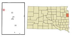
316:
83:44.87750; -96.84972
74: /
979:
537:population density
314:
170: • Total
149: • Water
133: • Total
1074:
1073:
613:per capita income
524:
523:
302:According to the
264:
263:
141: • Land
50:and the state of
1109:
1066:
1059:
976:
943:
936:
926:
921:
911:
904:
897:
888:
881:
880:
878:
876:
862:
856:
855:
853:
851:
840:
834:
833:
831:
829:
820:. Archived from
810:
804:
803:
801:
799:
788:
782:
781:
768:
762:
761:
751:
742:
741:
739:
737:
722:
716:
715:
713:
711:
697:
688:
687:
685:
683:
672:
663:
658:
649:
648:
646:
644:
633:
335:
330:
325:
317:
209:
89:
88:
86:
85:
84:
79:
75:
72:
71:
70:
67:
44:
21:
1117:
1116:
1112:
1111:
1110:
1108:
1107:
1106:
1077:
1076:
1075:
1070:
1064:
1057:
1048:
1025:
1018:
980:
974:
969:
946:
941:
934:
927:
924:
919:
915:
885:
884:
874:
872:
864:
863:
859:
849:
847:
842:
841:
837:
827:
825:
812:
811:
807:
797:
795:
790:
789:
785:
770:
769:
765:
753:
752:
745:
735:
733:
724:
723:
719:
709:
707:
699:
698:
691:
681:
679:
674:
673:
666:
659:
652:
642:
640:
635:
634:
630:
625:
601:married couples
573:
560:married couples
529:
328:
312:
300:
287:
227:
203:
82:
80:
76:
73:
68:
65:
63:
61:
60:
54:
35:
26:
19:
12:
11:
5:
1115:
1113:
1105:
1104:
1099:
1094:
1089:
1079:
1078:
1072:
1071:
1069:
1068:
1061:
1053:
1050:
1049:
1047:
1046:
1041:
1036:
1030:
1028:
1024:Unincorporated
1020:
1019:
1017:
1016:
1011:
1006:
1001:
996:
990:
988:
982:
981:
972:
970:
968:
967:
962:
956:
954:
948:
947:
932:
929:
928:
916:
914:
913:
906:
899:
891:
883:
882:
857:
835:
805:
792:"Deuel County"
783:
763:
743:
730:www.census.gov
717:
689:
664:
650:
627:
626:
624:
621:
572:
569:
528:
525:
522:
521:
517:
516:
513:
511:
508:
502:
501:
498:
496:
493:
487:
486:
483:
481:
478:
472:
471:
468:
466:
463:
457:
456:
453:
451:
448:
442:
441:
438:
436:
433:
427:
426:
423:
421:
418:
412:
411:
408:
406:
403:
397:
396:
393:
391:
388:
382:
381:
378:
376:
373:
367:
366:
363:
361:
358:
352:
351:
348:
346:
343:
337:
336:
331:
326:
321:
311:
308:
299:
296:
286:
283:
262:
261:
258:
251:
250:
247:
241:
240:
235:
229:
228:
225:
223:
217:
216:
210:
200:
199:
189:
183:
182:
179:
175:
174:
171:
167:
166:
162:
161:
158:
154:
153:
150:
146:
145:
142:
138:
137:
134:
130:
129:
125:
124:
119:
113:
112:
107:
101:
100:
97:
91:
90:
56:
55:
45:
37:
36:
31:
28:
27:
24:
17:
13:
10:
9:
6:
4:
3:
2:
1114:
1103:
1100:
1098:
1095:
1093:
1090:
1088:
1085:
1084:
1082:
1067:
1062:
1060:
1055:
1054:
1051:
1045:
1042:
1040:
1037:
1035:
1032:
1031:
1029:
1027:
1021:
1015:
1012:
1010:
1007:
1005:
1002:
1000:
997:
995:
992:
991:
989:
987:
983:
966:
963:
961:
958:
957:
955:
953:
949:
945:
944:
937:
930:
925:United States
922:
912:
907:
905:
900:
898:
893:
892:
889:
871:
867:
861:
858:
845:
839:
836:
823:
819:
815:
809:
806:
793:
787:
784:
779:
778:
773:
767:
764:
760:. p. 78.
759:
758:
750:
748:
744:
731:
727:
721:
718:
706:
702:
696:
694:
690:
677:
671:
669:
665:
662:
657:
655:
651:
638:
632:
629:
622:
620:
618:
614:
609:
605:
602:
597:
595:
591:
587:
584:, 3.12% from
583:
578:
570:
568:
564:
561:
556:
554:
550:
546:
542:
538:
534:
526:
518:
514:
512:
509:
507:
503:
499:
497:
494:
492:
488:
484:
482:
479:
477:
473:
469:
467:
464:
462:
458:
454:
452:
449:
447:
443:
439:
437:
434:
432:
428:
424:
422:
419:
417:
413:
409:
407:
404:
402:
398:
394:
392:
389:
387:
383:
379:
377:
374:
372:
368:
364:
362:
359:
357:
353:
349:
347:
344:
342:
338:
318:
309:
307:
305:
297:
295:
292:
284:
282:
280:
276:
272:
269:is a town in
268:
259:
256:
248:
246:
239:
236:
234:
224:
222:
214:
211:
207:
197:
196:Central (CST)
193:
190:
188:
180:
172:
159:
151:
143:
135:
123:
120:
118:
111:
108:
106:
99:United States
98:
96:
87:
59:Coordinates:
53:
49:
43:
34:
29:
22:
16:
1008:
939:
873:. Retrieved
860:
848:. Retrieved
846:. Census.gov
838:
826:. Retrieved
822:the original
808:
796:. Retrieved
786:
776:
766:
756:
736:February 20,
734:. Retrieved
729:
720:
708:. Retrieved
680:. Retrieved
641:. Retrieved
631:
617:poverty line
610:
606:
598:
574:
565:
557:
543:, 9.6% from
530:
310:Demographics
301:
289:Goodwin was
288:
275:South Dakota
271:Deuel County
266:
265:
110:South Dakota
52:South Dakota
48:Deuel County
46:Location in
15:
1026:communities
935:County seat
710:January 31,
682:October 15,
643:October 15,
586:other races
571:2000 census
545:other races
527:2010 census
279:2020 census
81: /
1081:Categories
1044:Tunerville
960:Clear Lake
942:Clear Lake
623:References
575:As of the
531:As of the
257:feature ID
165:Population
69:96°50′59″W
66:44°52′39″N
798:March 18,
298:Geography
245:FIPS code
233:Area code
187:Time zone
157:Elevation
994:Altamont
875:June 21,
828:June 21,
774:(1940).
590:Hispanic
549:Hispanic
249:46-24820
221:ZIP code
1014:Toronto
1009:Goodwin
999:Astoria
850:June 4,
291:platted
285:History
267:Goodwin
260:1267406
95:Country
1039:Moritz
1004:Brandt
952:Cities
594:Latino
577:census
553:Latino
533:census
425:−19.9%
380:−10.8%
320:Census
117:County
1034:Bemis
986:Towns
582:White
541:White
500:−8.7%
485:27.0%
470:−9.4%
455:21.9%
410:−7.2%
226:57238
215:(CDT)
213:UTC-5
192:UTC-6
122:Deuel
105:State
965:Gary
877:2012
852:2015
830:2012
800:2015
738:2022
712:2008
684:2022
645:2022
515:0.7%
506:2020
491:2010
476:2000
461:1990
446:1980
440:0.9%
431:1970
416:1960
401:1950
395:8.6%
386:1940
371:1930
365:8.3%
356:1920
341:1910
329:Note
324:Pop.
255:GNIS
128:Area
33:Town
592:or
551:or
510:147
495:146
480:160
465:126
450:139
435:114
420:113
405:141
390:152
375:140
360:157
345:145
238:605
206:DST
173:147
1083::
938::
923:,
868:.
816:.
746:^
728:.
703:.
692:^
667:^
653:^
334:%±
281:.
273:,
910:e
903:t
896:v
879:.
854:.
832:.
802:.
740:.
714:.
686:.
647:.
350:—
208:)
198:)
194:(
Text is available under the Creative Commons Attribution-ShareAlike License. Additional terms may apply.