146:
38:
724:
741:
716:
702:
311:
In 1820, the town of Good Hope, D.C., was founded around a tavern located near the current intersection of Marion Barry Ave SE and
Alabama Avenue SE. Businesses began to construct buildings along Upper Marlborough Road toward the village of Good Hope, and a
190:
are nearby. Good Hope is bounded by Fort
Stanton Park(Fort Circle Hiker-Biker Trail) SE, Alabama Avenue SE, Naylor Road SE, and U Street SE. The proposed Skyland Shopping Center redevelopment project is within the boundaries of the neighborhood.
339:. The oppressive need for housing during the war, brought about by a massive influx of federal workers to the capital, led to extensive development of Southeast Washington and the linking of Good Hope with other parts of southeast D.C.
225:, naming the river the "Nacotchtank". War and disease decimated the Nacochtank, and during the last 25 years of the 17th century the tribe ceased to exist as a functional unit and its few remaining members merged with other local
295:
created the need to provide housing for the many new employees working at the facility, but little land was available for new construction in the area and housing prices were high. Consequently, in 1818, the privately owned
563:
259:
granted ownership of the Good Hope area and much of what is now
Southeast D.C. (giving it the name "Chichester") to John Meeks in 1664. "Anacostia Fort" was built on the heights at the present-day neighborhood of
267:
The area became part of the
District of Columbia in 1791. Congress passed the Residence Act of 1790 to establish a federally owned district in which would be built the new national capital, and
795:
304:, this bridge was designed to permit easy access to Anacostia so that housing could be constructed on the eastern shore of the Anacostia River. A road was built from the bridge to the town of
1605:
335:
were the focus of most housing and retail development until 1940. Even these communities remained isolated from one another, and most of the land between them was undeveloped until
497:"Anacostia Historic District - National Register of Historic Places Inventory - Nomination Form." National Park Service. United States Department of the Interior. October 10, 1978.
1600:
788:
237:
557:
51:
661:
37:
781:
1574:
603:
1398:
1034:
256:
206:
145:
1549:
1463:
918:
832:
827:
1458:
1044:
862:
686:
654:
332:
328:
285:
1317:
852:
804:
730:
631:
591:
394:
1493:
1256:
1246:
1049:
1039:
755:
1373:
1332:
1221:
1191:
1074:
994:
923:
872:
1529:
1423:
1226:
1125:
1105:
979:
233:
1448:
1413:
1337:
1266:
1135:
1095:
913:
691:
647:
1554:
1443:
1438:
1368:
1281:
1211:
1201:
1196:
1186:
1130:
1115:
1059:
893:
857:
372:
Humphrey, Robert L. and
Chambers, Mary Elizabeth. "Ancient Washington: American Indian Cultures of the Potomac Valley."
324:
276:
252:
1579:
1544:
1539:
1524:
1433:
1271:
1216:
1145:
948:
898:
867:
760:
320:
172:
157:
1569:
1498:
1468:
1353:
1241:
1231:
999:
969:
681:
316:
was established in the area and named Good Hope
Station. In 1849, the post office's name was changed to Anacostia.
241:
1170:
750:
261:
1165:
964:
943:
305:
355:
Dyke, Lynne. "A Tough Sell: SE's Shabby
Skyland Shopping Center Faces An Upscale Battle Against Development."
1014:
938:
485:
A History of the
National Capital from Its Foundation Through the Period of the Adoption of the Organic Act.
245:
184:
561:
D.C. Historic
Preservation Office. Office of Planning, District of Columbia. Washington, D.C.: March 2007.
522:
1312:
1019:
214:
209:
were the first settlers to inhabit the area now known as Good Hope, living and fishing along the nearby
1327:
1140:
1069:
1029:
292:
248:
1251:
928:
297:
639:
1478:
1120:
1004:
288:
case, purchased much of the "Chichester tract" some time in the late 18th or early 19th century.
281:
226:
437:
vessel may have brought
European explorers to the Anacostia River around 1550 C.E. See: Bryan,
1378:
974:
627:
587:
390:
268:
496:
1534:
1488:
1403:
1383:
1307:
1110:
808:
187:
160:
96:
1564:
1408:
1358:
1206:
1100:
567:
527:
272:
210:
1473:
1276:
1064:
1024:
984:
837:
1594:
1363:
1297:
1261:
1160:
1150:
1090:
903:
847:
199:
Good Hope was the first permanent modern settlement of size in Southeast Washington.
176:
86:
773:
1453:
1302:
933:
908:
842:
822:
336:
168:
137:
433:
There is some evidence that Smith was not the first European to visit the area. A
507:
418:
359:
September 10, 2006; Shin, Annys. "Wall Street Investment May Resurrect Skyland."
271:
picked the current site in 1791 (a choice ratified by Congress later that year).
1559:
1483:
1418:
1393:
1009:
989:
419:
Burr, Charles R. "A Brief History of Anacostia, Its Name, Origin, and Progress."
313:
301:
203:
180:
1519:
1155:
1054:
222:
546:
Old Anacostia, Washington, D.C.: A Study of Community Preservation Resources.
66:
53:
1514:
164:
42:
Map of Washington, D.C., with the Good Hope neighborhood highlighted in red
1388:
1236:
888:
119:
232:
European settlement in Southeast Washington first occurred in 1662 at
308:, and named Upper Marlborough Road (called Good Hope Road SE today).
218:
149:
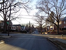
The intersection of 31st and W St., SE, in Good Hope, December 2017
584:
District of Columbia Interments, January 1, 1855 to July 31, 1874.
434:
144:
1322:
777:
643:
508:
Crew, Harvey W.; Webb, William Bensing; and Wooldridge, John.
472:
Records of the Columbia Historical Society, Washington, D.C.
319:
Good Hope remained little more than a crossroads, however.
385:
Rountree, Helen C.; Clark, Wayne E.; and Mountford, Kent.
300:" was built over the Anacostia River at 11th Street SE. A
622:
Benedetto, Robert; Donovan, Jane; and Du Vall, Kathleen.
604:“DC unveils Marion Barry Avenue in honor of former mayor”
470:
Cantwell, Thomas J. "Anacostia: Strength in Adversity."
618:
616:
548:
School of Architecture, University of Maryland. 1975.
513:
Dayton, Ohio: United Brethren Publishing House, 1892.
389:
Charlotte, Va.: University of Virginia Press, 2007.
1507:
1346:
1290:
1179:
1083:
957:
881:
815:
133:
128:
118:
110:
102:
92:
82:
21:
510:Centennial History of the City of Washington, D.C.
610:, November 19, 2023. Retrieved November 19, 2023.
670:Places adjacent to Good Hope (Washington, D.C.)
279:merchant who later was a party in the landmark
240:just to the west of the modern neighborhood of
1606:Neighborhoods in Southeast (Washington, D.C.)
789:
655:
540:
538:
8:
450:Williams, Brett. "A River Runs Through Us."
422:Records of the Columbia Historical Society.
387:John Smith's Chesapeake Voyages, 1607–1609.
796:
782:
774:
662:
648:
640:
626:New York: Rowman & Littlefield, 2003.
466:
464:
462:
460:
18:
244:), and at St. Elizabeth (now the site of
586:Westminster, Md.: Heritage Books, 2007.
1601:1820 establishments in Washington, D.C.
348:
179:. The year-round Fort Dupont Ice Arena
127:
109:
81:
46:
34:
578:
576:
487:New York: The Macmillan Company, 1914.
414:
412:
410:
408:
406:
404:
402:
439:A History of the National Capital...,
132:
117:
101:
91:
16:Neighborhood in Ward 8, United States
7:
677:
624:Historical Dictionary of Washington.
523:Croggon, James. "Old 'Burnt Bridge'"
14:
238:the city's sewage treatment plant
156:is a residential neighborhood in
868:U Street Corridor (Cardozo/Shaw)
739:
722:
714:
700:
167:. The neighborhood is generally
36:
264:some time in the 18th century.
251:) and Giesborough (now called
1:
740:
701:
723:
715:
559:Anacostia Historic District.
221:to visit the region in 1612
1622:
1267:Stronghold-Metropolis View
134: • Councilmember
67:38.86377083°N 76.9648750°W
675:
483:Bryan, Wilhelmus Bogart.
185:Smithsonian Institution's
47:
35:
28:
1166:Sixteenth Street Heights
965:American University Park
944:Southwest Federal Center
452:American Anthropologist.
306:Upper Marlboro, Maryland
72:38.86377083; -76.9648750
246:St. Elizabeths Hospital
298:Upper Navy Yard Bridge
173:single-family detached
150:
1313:Mount Vernon Triangle
1020:Massachusetts Heights
582:Pippenger, Wesley E.
544:Senkevitch, Anatole.
148:
1575:Washington Highlands
1328:Southwest Waterfront
1141:North Portal Estates
1070:Woodland Normanstone
1030:North Cleveland Park
570:Accessed 2009-12-26.
293:Washington Navy Yard
249:psychiatric hospital
171:and is dominated by
1252:North Michigan Park
929:Mount Vernon Square
321:Uniontown/Anacostia
177:semi-detached homes
63: /
1479:Northeast Boundary
1399:East River Heights
1121:Fort Stevens Ridge
1035:Observatory Circle
1005:Friendship Heights
602:Moody, Dominique,
566:2010-01-08 at the
454:103:2 (June 2001).
291:The growth of the
282:Marbury v. Madison
151:
1588:
1587:
1379:Central Northeast
975:Cathedral Heights
919:Sheridan-Kalorama
833:Kalorama Triangle
771:
770:
766:
765:
269:George Washington
236:(now the site of
143:
142:
1613:
1550:Garfield Heights
1535:Congress Heights
1489:Randle Highlands
1464:Marshall Heights
1404:Eastland Gardens
1384:Civic Betterment
1308:Judiciary Square
1111:Colonial Village
828:Columbia Heights
809:Washington, D.C.
798:
791:
784:
775:
743:
742:
726:
725:
718:
717:
704:
703:
687:Randle Highlands
678:
664:
657:
650:
641:
634:
620:
611:
600:
594:
580:
571:
555:
549:
542:
533:
520:
514:
505:
499:
494:
488:
481:
475:
468:
455:
448:
442:
431:
425:
416:
397:
383:
377:
370:
364:
361:Washington Post.
357:Washington Post.
353:
333:Randle Highlands
329:Congress Heights
207:Native Americans
188:Anacostia Museum
161:Washington, D.C.
124:Good Hope Tavern
97:Washington, D.C.
78:
77:
75:
74:
73:
68:
64:
61:
60:
59:
56:
40:
19:
1621:
1620:
1616:
1615:
1614:
1612:
1611:
1610:
1591:
1590:
1589:
1584:
1565:Shipley Terrace
1503:
1459:Lincoln Heights
1409:Fairfax Village
1359:Benning Heights
1342:
1286:
1207:Carver Langston
1175:
1101:Brightwood Park
1079:
1045:Potomac Heights
953:
877:
863:Pleasant Plains
811:
802:
772:
767:
731:Fairfax Village
727:
671:
668:
638:
637:
621:
614:
601:
597:
581:
574:
568:Wayback Machine
556:
552:
543:
536:
521:
517:
506:
502:
495:
491:
482:
478:
469:
458:
449:
445:
432:
428:
417:
400:
384:
380:
371:
367:
354:
350:
345:
273:William Marbury
229:Indian tribes.
211:Anacostia River
197:
71:
69:
65:
62:
57:
54:
52:
50:
49:
43:
31:
24:
17:
12:
11:
5:
1619:
1617:
1609:
1608:
1603:
1593:
1592:
1586:
1585:
1583:
1582:
1577:
1572:
1567:
1562:
1557:
1552:
1547:
1542:
1537:
1532:
1527:
1522:
1517:
1511:
1509:
1505:
1504:
1502:
1501:
1496:
1491:
1486:
1481:
1476:
1474:Naylor Gardens
1471:
1466:
1461:
1456:
1451:
1446:
1441:
1436:
1431:
1426:
1421:
1416:
1411:
1406:
1401:
1396:
1391:
1386:
1381:
1376:
1371:
1366:
1361:
1356:
1350:
1348:
1344:
1343:
1341:
1340:
1335:
1330:
1325:
1320:
1318:Near Northeast
1315:
1310:
1305:
1300:
1294:
1292:
1288:
1287:
1285:
1284:
1279:
1277:Truxton Circle
1274:
1269:
1264:
1259:
1254:
1249:
1244:
1239:
1234:
1229:
1224:
1219:
1214:
1209:
1204:
1199:
1194:
1189:
1183:
1181:
1177:
1176:
1174:
1173:
1168:
1163:
1158:
1153:
1148:
1143:
1138:
1133:
1128:
1123:
1118:
1113:
1108:
1103:
1098:
1093:
1087:
1085:
1081:
1080:
1078:
1077:
1072:
1067:
1065:Wesley Heights
1062:
1057:
1052:
1047:
1042:
1037:
1032:
1027:
1025:McLean Gardens
1022:
1017:
1012:
1007:
1002:
997:
992:
987:
985:Cleveland Park
982:
977:
972:
967:
961:
959:
955:
954:
952:
951:
946:
941:
936:
931:
926:
921:
916:
911:
906:
901:
896:
891:
885:
883:
879:
878:
876:
875:
870:
865:
860:
855:
853:Mount Pleasant
850:
845:
840:
838:Lanier Heights
835:
830:
825:
819:
817:
813:
812:
803:
801:
800:
793:
786:
778:
769:
768:
764:
763:
758:
756:Naylor Gardens
753:
747:
746:
744:
737:
734:
733:
728:
713:
711:
708:
707:
705:
698:
695:
694:
689:
684:
676:
673:
672:
669:
667:
666:
659:
652:
644:
636:
635:
612:
608:NBC Washington
595:
572:
550:
534:
515:
500:
489:
476:
456:
443:
426:
398:
378:
365:
363:June 10, 2006.
347:
346:
344:
341:
257:Lord Baltimore
217:was the first
196:
193:
141:
140:
135:
131:
130:
126:
125:
122:
116:
115:
112:
108:
107:
104:
100:
99:
94:
90:
89:
84:
80:
79:
58:076°57′53.55″W
55:38°51′49.575″N
45:
44:
41:
33:
32:
29:
26:
25:
22:
15:
13:
10:
9:
6:
4:
3:
2:
1618:
1607:
1604:
1602:
1599:
1598:
1596:
1581:
1578:
1576:
1573:
1571:
1568:
1566:
1563:
1561:
1558:
1556:
1553:
1551:
1548:
1546:
1543:
1541:
1538:
1536:
1533:
1531:
1528:
1526:
1523:
1521:
1518:
1516:
1513:
1512:
1510:
1506:
1500:
1497:
1495:
1494:River Terrace
1492:
1490:
1487:
1485:
1482:
1480:
1477:
1475:
1472:
1470:
1467:
1465:
1462:
1460:
1457:
1455:
1452:
1450:
1447:
1445:
1442:
1440:
1437:
1435:
1432:
1430:
1427:
1425:
1422:
1420:
1417:
1415:
1412:
1410:
1407:
1405:
1402:
1400:
1397:
1395:
1392:
1390:
1387:
1385:
1382:
1380:
1377:
1375:
1372:
1370:
1367:
1365:
1364:Benning Ridge
1362:
1360:
1357:
1355:
1352:
1351:
1349:
1345:
1339:
1336:
1334:
1331:
1329:
1326:
1324:
1321:
1319:
1316:
1314:
1311:
1309:
1306:
1304:
1301:
1299:
1298:Barney Circle
1296:
1295:
1293:
1289:
1283:
1280:
1278:
1275:
1273:
1270:
1268:
1265:
1263:
1262:Queens Chapel
1260:
1258:
1257:Pleasant Hill
1255:
1253:
1250:
1248:
1247:Michigan Park
1245:
1243:
1240:
1238:
1235:
1233:
1230:
1228:
1225:
1223:
1220:
1218:
1215:
1213:
1210:
1208:
1205:
1203:
1200:
1198:
1195:
1193:
1190:
1188:
1185:
1184:
1182:
1178:
1172:
1169:
1167:
1164:
1162:
1161:Shepherd Park
1159:
1157:
1154:
1152:
1151:Queens Chapel
1149:
1147:
1144:
1142:
1139:
1137:
1134:
1132:
1129:
1127:
1124:
1122:
1119:
1117:
1114:
1112:
1109:
1107:
1104:
1102:
1099:
1097:
1094:
1092:
1091:Barnaby Woods
1089:
1088:
1086:
1082:
1076:
1073:
1071:
1068:
1066:
1063:
1061:
1058:
1056:
1053:
1051:
1050:Spring Valley
1048:
1046:
1043:
1041:
1040:The Palisades
1038:
1036:
1033:
1031:
1028:
1026:
1023:
1021:
1018:
1016:
1013:
1011:
1008:
1006:
1003:
1001:
998:
996:
993:
991:
988:
986:
983:
981:
978:
976:
973:
971:
968:
966:
963:
962:
960:
956:
950:
947:
945:
942:
940:
937:
935:
932:
930:
927:
925:
922:
920:
917:
915:
912:
910:
907:
905:
904:Dupont Circle
902:
900:
897:
895:
892:
890:
887:
886:
884:
880:
874:
871:
869:
866:
864:
861:
859:
856:
854:
851:
849:
848:Meridian Hill
846:
844:
841:
839:
836:
834:
831:
829:
826:
824:
821:
820:
818:
814:
810:
806:
805:Neighborhoods
799:
794:
792:
787:
785:
780:
779:
776:
762:
759:
757:
754:
752:
749:
748:
745:
738:
736:
735:
732:
729:
721:
712:
710:
709:
706:
699:
697:
696:
693:
690:
688:
685:
683:
680:
679:
674:
665:
660:
658:
653:
651:
646:
645:
642:
633:
632:0-8108-4094-4
629:
625:
619:
617:
613:
609:
605:
599:
596:
593:
592:1-58549-154-3
589:
585:
579:
577:
573:
569:
565:
562:
560:
554:
551:
547:
541:
539:
535:
532:July 7, 1907.
531:
529:
524:
519:
516:
512:
511:
504:
501:
498:
493:
490:
486:
480:
477:
473:
467:
465:
463:
461:
457:
453:
447:
444:
440:
436:
430:
427:
423:
420:
415:
413:
411:
409:
407:
405:
403:
399:
396:
395:0-8139-2644-0
392:
388:
382:
379:
375:
374:G.W. Studies.
369:
366:
362:
358:
352:
349:
342:
340:
338:
334:
330:
326:
322:
317:
315:
309:
307:
303:
299:
294:
289:
287:
286:Supreme Court
284:
283:
278:
274:
270:
265:
263:
258:
254:
250:
247:
243:
239:
235:
230:
228:
224:
220:
216:
212:
208:
205:
200:
194:
192:
189:
186:
182:
178:
174:
170:
166:
162:
159:
155:
147:
139:
136:
123:
121:
113:
105:
98:
95:
88:
87:United States
85:
76:
48:Coordinates:
39:
27:
20:
1454:Kingman Park
1428:
1424:Fort Stanton
1374:Capitol View
1333:Sursum Corda
1303:Capitol Hill
1222:Fort Lincoln
1192:Bloomingdale
1075:Woodley Park
995:Forest Hills
934:Penn Quarter
924:Logan Circle
909:Foggy Bottom
873:Woodley Park
843:LeDroit Park
823:Adams Morgan
719:
623:
607:
598:
583:
558:
553:
545:
528:Evening Star
526:
518:
509:
503:
492:
484:
479:
471:
451:
446:
441:1914, p. 47.
438:
429:
421:
386:
381:
373:
368:
360:
356:
351:
337:World War II
318:
310:
290:
280:
275:, a wealthy
266:
231:
201:
198:
181:skating rink
169:middle class
153:
152:
138:Trayon White
30:Neighborhood
1560:Park Naylor
1530:Buena Vista
1484:Penn Branch
1419:Fort Dupont
1394:Dupont Park
1227:Fort Totten
1126:Fort Totten
1106:Chevy Chase
1010:Glover Park
990:Colony Hill
980:Chevy Chase
692:Penn Branch
314:post office
302:toll bridge
255:) in 1663.
234:Blue Plains
204:Nacotchtank
111:Constructed
70: /
1595:Categories
1520:Barry Farm
1449:Kenilworth
1414:Fort Davis
1338:Swampoodle
1156:Riggs Park
1136:Manor Park
1096:Brightwood
1055:Tenleytown
914:Georgetown
474:1973/1974.
343:References
325:Barry Farm
277:Georgetown
253:Barry Farm
227:Piscataway
215:John Smith
213:. Captain
129:Government
1555:Navy Yard
1515:Anacostia
1444:Hillcrest
1439:Hillbrook
1429:Good Hope
1369:Burrville
1282:Woodridge
1212:Eckington
1202:Brookland
1197:Brentwood
1187:Arboretum
1131:Hawthorne
1116:Crestwood
1060:Wakefield
894:Chinatown
858:Park View
761:Hillcrest
720:Good Hope
165:Anacostia
158:southeast
154:Good Hope
120:Named for
23:Good Hope
1580:Woodland
1545:Fairlawn
1540:Douglass
1525:Bellevue
1434:Greenway
1389:Deanwood
1272:Trinidad
1237:Ivy City
1217:Edgewood
1146:Petworth
949:West End
899:Downtown
889:Burleith
682:Fairlawn
564:Archived
242:Bellevue
219:European
183:and the
93:District
1570:Skyland
1499:Twining
1469:Mayfair
1354:Benning
1242:Langdon
1232:Gateway
1000:Foxhall
970:Berkley
751:Skyland
435:Spanish
262:Skyland
195:History
163:, near
83:Country
1508:Ward 8
1347:Ward 7
1291:Ward 6
1180:Ward 5
1171:Takoma
1084:Ward 4
958:Ward 3
882:Ward 2
816:Ward 1
630:
590:
393:
331:, and
106:Ward 8
424:1920.
376:1977.
1323:NoMa
1015:Kent
939:Shaw
628:ISBN
588:ISBN
391:ISBN
223:C.E.
202:The
175:and
114:1820
103:Ward
807:in
1597::
615:^
606:,
575:^
537:^
525:.
459:^
401:^
327:,
323:,
797:e
790:t
783:v
663:e
656:t
649:v
530:.
296:"
Text is available under the Creative Commons Attribution-ShareAlike License. Additional terms may apply.