129:
154:
147:
25:
375:
beneath Grünhirscher Stollen with different altitudes, relative to the adit between 5.7 to 19 m. The drift directly under this adit was numbered 1st drift. Drifts beneath this one were numbered ascendingly. Beneath the mine
Catharina Neufang the drifts were numbered relatively to
214:
42:
326:
The construction of the Grünhirscher
Stollen began in 1691. Until 1710 the adit was driven through for 1.4 km to the Samson Pit only using
146:
548:
89:
61:
108:
68:
46:
75:
538:
57:
543:
128:
376:
the
Sieberstollen. The 16th drift (Samson Pit) was the main draining adit even before Sieberstollen was finished.
384:
333:
In the following years it was expanded and connected to other mines. Since 1729 it has been connected to the pit
289:
337:. At this time the 25 mines in Sankt Andreasberg had their highest output. The main shafts of the mines
308:
35:
356:
began. It has a 58 m lower level and replaced the older adit in 1754. After that the waters of the
82:
315:
484:
281:
178:
182:
327:
460:
365:
285:
416:
Calvör: Acta
Historico-Chronologico-Mechanica circa metallurgiam in Hercynia superiori
532:
353:
372:
192:
383:
was installed in the Samson Pit 130 m beneath ground. It is one of two
392:
24:
430:
Karsten, v. Dechen: Archiv für
Mineralogie, Geognosie, Bergbau und Hüttenkunde
371:
In the beginning of the 19th century the mines Samson and Gnade Gottes had 26
301:
229:
216:
388:
348:
To go deeper a draining adit with a lower altitude was necessary because
202:
300:) between the mountains Galgenberg and Glockenberg. It leads from the
312:
466:. Ministry for Science and Culture of Lower Saxony. 2008. p. 26
273:
391:. The Grünhirscher Stollen is discharging its waters into
307:
The first 7.1 km of the 10.2 km adit is part of the
18:
387:
in the Samson generating electricity from the waters of the
352:
had reached its limit. In 1716 the construction on the adit
250:
245:
208:
198:
188:
174:
135:
49:. Unsourced material may be challenged and removed.
447:Héron de Villefosse: Über den Mineral-Reichthum
16:Mine drainage passage in Lower Saxony, Germany
8:
153:
121:
519:Karsten: Archiv für Bergbau und Hüttenwesen
441:
439:
127:
120:
410:
408:
109:Learn how and when to remove this message
379:In 1922 the hydroelectric power station
404:
505:Ließmann: Historischer Bergbau im Harz
304:to the south-west of the Galgenberg.
7:
461:"Upper Harz Water Management System"
47:adding citations to reliable sources
368:in the Samson Pit and Wennsglückt.
272:, German: Green Stag's Adit) is an
14:
152:
145:
23:
34:needs additional citations for
1:
345:had a depth of 400 m.
292:and named after the valley
230:51.70566500°N 10.50334000°E
565:
549:Water management in mining
485:"Der Grünhirscher Stollen"
385:underground power stations
140:
126:
364:were only used to drive
290:mining in the Upper Harz
288:. It was created during
280:) for water drainage in
235:51.70566500; 10.50334000
507:. 2010. p. 238 ff.
309:Upper Harz Water Regale
270:Grüne Hirschler Stollen
449:. 1821. p. 269 f.
311:and has been declared
58:"Grünhirscher Stollen"
266:Grünhirschler Stollen
521:. 1821. p. 310.
432:. 1854. p. 209.
358:Grünhirscher Stollen
350:Grünhirscher Stollen
278:Wasserlösungsstollen
262:Grünhirscher Stollen
160:Grünhirscher Stollen
122:Grünhirscher Stollen
43:improve this article
418:. 1763. p. 34.
316:World Heritage Site
226: /
166:Location in Germany
123:
539:Mining in the Harz
544:Sankt Andreasberg
282:Sankt Andreasberg
258:
257:
179:Sankt Andreasberg
119:
118:
111:
93:
556:
523:
522:
515:
509:
508:
501:
495:
494:
492:
491:
481:
475:
474:
472:
471:
465:
457:
451:
450:
443:
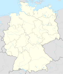
434:
433:
426:
420:
419:
412:
241:
240:
238:
237:
236:
231:
227:
224:
223:
222:
219:
183:Landkreis Goslar
156:
155:
149:
131:
124:
114:
107:
103:
100:
94:
92:
51:
27:
19:
564:
563:
559:
558:
557:
555:
554:
553:
529:
528:
527:
526:
517:
516:
512:
503:
502:
498:
489:
487:
483:
482:
478:
469:
467:
463:
459:
458:
454:
445:
444:
437:
428:
427:
423:
414:
413:
406:
401:
366:flatrod systems
328:hammer and pick
324:
234:
232:
228:
225:
221:010°30′12.024″E
220:
217:
215:
213:
212:
170:
169:
168:
167:
164:
163:
162:
161:
157:
115:
104:
98:
95:
52:
50:
40:
28:
17:
12:
11:
5:
562:
560:
552:
551:
546:
541:
531:
530:
525:
524:
510:
496:
476:
452:
435:
421:
403:
402:
400:
397:
362:Spötterstollen
323:
320:
286:Harz mountains
256:
255:
252:
248:
247:
243:
242:
218:51°42′20.394″N
210:
206:
205:
200:
196:
195:
190:
186:
185:
176:
172:
171:
165:
159:
158:
151:
150:
144:
143:
142:
141:
138:
137:
133:
132:
117:
116:
31:
29:
22:
15:
13:
10:
9:
6:
4:
3:
2:
561:
550:
547:
545:
542:
540:
537:
536:
534:
520:
514:
511:
506:
500:
497:
486:
480:
477:
462:
456:
453:
448:
442:
440:
436:
431:
425:
422:
417:
411:
409:
405:
398:
396:
394:
390:
386:
382:
381:Grüner Hirsch
377:
374:
369:
367:
363:
359:
355:
354:Sieberstollen
351:
346:
344:
340:
339:Sankt Andreas
336:
331:
329:
321:
319:
317:
314:
310:
305:
303:
299:
295:
294:Grüner Hirsch
291:
287:
283:
279:
275:
271:
267:
263:
253:
249:
244:
239:
211:
207:
204:
201:
197:
194:
191:
187:
184:
180:
177:
173:
148:
139:
134:
130:
125:
113:
110:
102:
91:
88:
84:
81:
77:
74:
70:
67:
63:
60: –
59:
55:
54:Find sources:
48:
44:
38:
37:
32:This article
30:
26:
21:
20:
518:
513:
504:
499:
488:. Retrieved
479:
468:. Retrieved
455:
446:
429:
424:
415:
380:
378:
370:
361:
357:
349:
347:
343:König Ludwig
342:
338:
334:
332:
325:
306:
297:
293:
277:
269:
265:
261:
259:
193:Lower Saxony
105:
99:January 2016
96:
86:
79:
72:
65:
53:
41:Please help
36:verification
33:
393:Sperrlutter
335:Wennsglückt
233: /
209:Coordinates
533:Categories
490:2015-12-11
470:2015-12-02
399:References
302:Samson Pit
298:Green Stag
69:newspapers
389:Oderteich
296:(German:
284:, in the
276:(German:
360:and the
175:Location
136:Location
322:History
246:History
203:Germany
199:Country
83:scholar
373:drifts
313:UNESCO
264:(also
251:Opened
85:
78:
71:
64:
56:
464:(PDF)
189:State
90:JSTOR
76:books
341:and
274:adit
260:The
254:1691
62:news
268:or
45:by
535::
438:^
407:^
395:.
330:.
318:.
181:,
493:.
473:.
112:)
106:(
101:)
97:(
87:·
80:·
73:·
66:·
39:.
Text is available under the Creative Commons Attribution-ShareAlike License. Additional terms may apply.