20:
160:
275:
290:
There is some debate over whether the
Chinese and other Asians knew the world to be spherical prior to Western contact, but most maps appear to assume regions as flat. Although Chinese maps do not portray any concept of latitude and longitude, cartesian grids appear on some maps dating back to the
266:
that were much more useful for sea navigation than latitude and longitude. At the same time, however, the rediscovery of
Ptolemy and other classical knowledge of the shape and size of the Earth led to the recreation of some of the ancient maps with their graticules; the earliest extant copies of
97:
Some cartographers have used the term "graticule" to refer not only to the visual lines, but to the system of latitude and longitude reference itself; however, in the era of
236:
271:
with his maps date to the 14th and 15th centuries. Starting in the 16th
Century, the graticule has been ubiquitous on global and continental scale maps.
441:
Cordell, D.K. Yee (1994). "Taking the World's
Measure: Chinese Maps between Observation and Text". In Harley, J.B.; Woodward, David (eds.).
19:
240:
206:
Book 3 (3rd
Century BC, now lost) contained lines "drawn from west to east, parallel to the equatorial line" (thus the term
98:
91:
132:
102:
75:
300:
147:
These are usually secondary to the main purpose of the map, so graticules are often drawn to be relatively low in the
87:
83:
52:
181:
48:
335:
320:
Robinson, Arthur H.; Morrison, Joel L.; Muehrcke, Phillip C.; Kimerling, A. Jon; Guptill, Stephen C. (1995).
462:
225:
136:
71:
243:, further developed these works, including creating maps on a graticule of latitude and longitude.
221:
216:
207:
165:
67:
124:
56:
405:
159:
148:
128:
372:
Kimerling, A. Jon; Buckley, Aileen R.; Muehrcke, Philip C.; Muehrcke, Juliana O. (2012).
235:
The works of
Ptolemy and other classical geographers were available to the scientists of
409:
259:
229:
185:
32:
456:
127:, especially on map projections in which these directions vary across the map (e.g.
38:
199:
140:
60:
251:
247:
194:
274:
63:, and is commonly found on maps of many kinds, at scales from local to global.
263:
176:
The graticule is of ancient origin, being almost as old as the concept of the
255:
426:
Ptolemy, Claudius (2000). Berggren, J. Lennart; Jones, Alexander (eds.).
177:
386:
Slocum, Terry A., Robert B. McMaster, Fritz C. Kessler, Hugh H. Howard,
211:
170:
189:
273:
158:
262:
of the 13th to 15th centuries were much more accurate, but used
250:, graticules disappeared from the few maps that were produced;
44:
120:
Aid map users in identifying locations with known coordinates
66:
The term is almost always used to specifically refer to the
94:– usually the coordinate system in which the map is drawn.
430:. Vol. 1. Princeton University Press. pp. 83–93.
358:
Dent, Borden D., Jeffrey S. Torguson, Thomas W. Hodler,
220:(ca 150 AD) gives detailed instructions for drawing the
117:
Aid map users in estimating the coordinates of locations
404:. Vol. 2. Harvard University Press. p. 253.
113:The graticule may serve several purposes on a map:
78:. In modern usage, graticules are contrasted with
390:, 3rd Edition, Pearson-Prentice Hall, 2009, p.201
336:"Grids and graticules—ArcGIS Pro | Documentation"
254:in particular were more concerned with religious
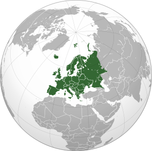
23:Map of Europe with a 30° graticule in dark gray
258:than accurate representation of location. The
74:of latitude and longitude respectively in the
8:
400:Strabo (1917). Jones, Horace Leonard (ed.).
184:for measuring geographic locations, and the
55:of lines, each line representing a constant
16:Grid on a map, depicting a coordinate system
376:(7th ed.). Esri Press. pp. 13–16.
374:Map Use: Reading, Analysis, Interpretation
163:1482 reproduction of the world map in the
421:
419:
101:, it is far more ______ to call this the
18:
312:
388:Thematic Cartography and Visualization
362:, 6th Edition, McGraw-Hill, 2009, p.27
7:
198:(ca 20 AD), states that the maps in
410:10.4159/DLCL.strabo-geography.1917
324:(6th ed.). Wiley. p. 48.
14:
360:Cartography: Thematic Map Design
282:map, based on a grid with a 100
278:The Song Dynasty (12th Century)
47:, is a graphical depiction of a
445:. University of Chicago Press.
99:geographic information systems
1:
92:Universal Transverse Mercator
43: 'grill/grating'), on a
103:geographic coordinate system
76:geographic coordinate system
59:value. It is thus a form of
301:Projected coordinate system
88:coordinate reference system
481:
443:The History of Cartography
139:) where a north arrow or
286:(about 30 mile) spacing.
143:would not be appropriate
322:Elements of Cartography
287:
173:
84:eastings and northings
37:
24:
277:
162:
22:
246:During the European
82:, which display the
125:cardinal directions
288:
174:
25:
182:coordinate system
133:pseudocylindrical
49:coordinate system
470:
447:
446:
438:
432:
431:
423:
414:
413:
397:
391:
384:
378:
377:
369:
363:
356:
350:
349:
347:
346:
332:
326:
325:
317:
239:. Some, such as
171:Claudius Ptolemy
149:visual hierarchy
480:
479:
473:
472:
471:
469:
468:
467:
453:
452:
451:
450:
440:
439:
435:
425:
424:
417:
399:
398:
394:
385:
381:
371:
370:
366:
357:
353:
344:
342:
334:
333:
329:
319:
318:
314:
309:
297:
260:portolan charts
178:spherical Earth
157:
111:
109:Uses and design
17:
12:
11:
5:
478:
477:
474:
466:
465:
455:
454:
449:
448:
433:
415:
392:
379:
364:
351:
340:pro.arcgis.com
327:
311:
310:
308:
305:
304:
303:
296:
293:
291:11th century.
237:medieval Islam
186:map projection
156:
153:
145:
144:
121:
118:
110:
107:
15:
13:
10:
9:
6:
4:
3:
2:
476:
475:
464:
461:
460:
458:
444:
437:
434:
429:
422:
420:
416:
411:
407:
403:
396:
393:
389:
383:
380:
375:
368:
365:
361:
355:
352:
341:
337:
331:
328:
323:
316:
313:
306:
302:
299:
298:
294:
292:
285:
281:
276:
272:
270:
265:
261:
257:
253:
249:
244:
242:
238:
233:
231:
227:
223:
219:
218:
213:
209:
205:
201:
197:
196:
191:
187:
183:
179:
172:
168:
167:
161:
154:
152:
150:
142:
138:
134:
130:
126:
123:Indicate the
122:
119:
116:
115:
114:
108:
106:
104:
100:
95:
93:
89:
85:
81:
77:
73:
69:
64:
62:
58:
54:
50:
46:
42:
41:
40:
34:
30:
21:
442:
436:
427:
401:
395:
387:
382:
373:
367:
359:
354:
343:. Retrieved
339:
330:
321:
315:
289:
283:
279:
268:
252:T and O maps
245:
241:al-Khwarizmi
234:
228:for his two
215:
203:
200:Eratosthenes
193:
175:
164:
146:
141:compass rose
112:
96:
79:
65:
36:
28:
26:
463:Cartography
402:Geographica
264:rhumb lines
248:Middle Ages
230:projections
86:of another
345:2024-01-27
307:References
267:Ptolemy's
90:, such as
57:coordinate
31:(from
428:Geography
269:Geography
256:cosmology
226:meridians
222:parallels
217:Geography
204:Geography
195:Geography
192:, in his
166:Geography
137:azimuthal
72:meridians
68:parallels
39:crāticula
29:graticule
457:Category
295:See also
280:Yu Ji Tu
208:parallel
212:Ptolemy
155:History
61:isoline
190:Strabo
129:conic
80:grids
51:as a
35:
33:Latin
224:and
70:and
53:grid
406:doi
214:'s
202:'s
169:of
45:map
459::
418:^
338:.
284:li
232:.
210:)
188:.
180:,
151:.
135:,
131:,
105:.
27:A
412:.
408::
348:.
Text is available under the Creative Commons Attribution-ShareAlike License. Additional terms may apply.