56:
306:
632:
560:
There were 2,021 households, out of which 33.2% had children under the age of 18 living with them, 56.2% were married couples living together, 10.3% had a female householder with no husband present, and 30.0% were non-families. 24.6% of all households were made up of individuals, and 8.8% had someone
564:
In the CDP, the age distribution of the population shows 26.8% under the age of 18, 6.5% from 18 to 24, 28.9% from 25 to 44, 24.6% from 45 to 64, and 13.1% who were 65 years of age or older. The median age was 38 years. For every 100 females, there were 97.9 males. For every 100 females age 18 and
524:
of 2000, there were 5,158 people, 2,021 households, and 1,414 families residing in the CDP. The population density was 1,554.7 per square mile (600.3/km). There were 2,126 housing units at an average density of 640.8 per square mile (247.4/km). The racial makeup of the CDP was 95.17%
55:
744:
568:
The median income for a household in the CDP was $ 36,290, and the median income for a family was $ 38,839. Males had a median income of $ 32,488 versus $ 22,361 for females. The
382:, the CDP had a total area of 3.4 square miles (8.8 km), of which, 3.3 square miles (8.5 km) was land and 0.1 square miles (0.26 km) of it (1.78%) was water.
739:
332:
The majority of the CDP became part of the city of
Spokane Valley upon its incorporation in 2003. An additional section of the CDP became part of the city of
305:
69:
241:
749:
347:
251:
542:
530:
294:
121:
682:
534:
229:
561:
living alone who was 65 years of age or older. The average household size was 2.55 and the average family size was 3.04.
636:
28:
708:
686:
597:
546:
379:
322:
275:
271:
126:
476:
461:
446:
431:
416:
318:
333:
283:
620:
657:
314:
267:
550:
329:
has been classified as an "official common name for a populated location within an incorporated place".
554:
202:
538:
526:
279:
114:
712:
569:
192:
661:
572:
for the CDP was $ 15,494. About 7.0% of families and 10.5% of the population were below the
17:
733:
234:
573:
621:
U.S. Geological Survey
Geographic Names Information System: Greenacres, Washington
287:
109:
362:
349:
84:
71:
183:
297:
named after it; Greenacres Middle School and
Greenacres Elementary School.
576:, including 14.4% of those under age 18 and 2.5% of those age 65 or over.
274:, United States. The locale is almost entirely split between the city of
217:
27:
This article is about the place in
Washington state. For other uses, see
321:
with the spelling "Green Acres". The community largely became part of
282:
Spokane County, with a small portion being located within the city of
521:
304:
209:
188:
60:
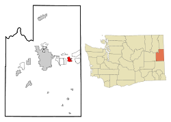
Location of the CDP of
Greenacres, Washington at the 2000 Census
325:
when that city incorporated in March 2003. Since then the name
593:
336:
in 2006. The population was 5,158 at the 2000 census.
745:
Former census-designated places in
Washington (state)
250:
240:
228:
216:
199:
182:
174:
166:
161:
153:
145:
137:
132:
120:
108:
100:
39:
8:
683:"US Gazetteer files: 2010, 2000, and 1990"
557:of any race were 2.46% of the population.
389:
36:
740:Geography of Spokane County, Washington
585:
239:
215:
181:
160:
131:
99:
64:
52:
616:
614:
409:
249:
227:
198:
173:
165:
152:
144:
136:
119:
107:
7:
549:, and 2.29% from two or more races.
34:Locale in Washington, United States
713:"Census of Population and Housing"
399:
293:Greenacres has two schools in the
25:
157:0.1 sq mi (0.1 km)
149:3.3 sq mi (8.6 km)
141:3.4 sq mi (8.7 km)
54:
295:Central Valley School District
1:
658:"Liberty Lake gets 644 acres"
565:over, there were 93.6 males.
286:. Greenacres retains its own
178:1,554.7/sq mi (600.3/km)
637:United States Postal Service
29:Green Acres (disambiguation)
709:United States Census Bureau
687:United States Census Bureau
598:United States Census Bureau
380:United States Census Bureau
313:Greenacres was listed as a
766:
750:Spokane Valley, Washington
375:(47.663450, -117.156537).
272:Spokane County, Washington
26:
502:
490:
475:
460:
445:
430:
415:
408:
403:
398:
395:
344:Greenacres is located at
65:
53:
46:
315:census-designated place
268:census-designated place
266:is a locale and former
18:Green Acres, Washington
363:47.66333°N 117.15667°W
310:
85:47.66333°N 117.15667°W
41:Greenacres, Washington
594:"U.S. Census website"
503:U.S. Decennial Census
391:Historical population
308:
201: • Summer (
368:47.66333; -117.15667
175: • Density
90:47.66333; -117.15667
689:. February 12, 2011
506:6,913 population in
392:
359: /
309:Greenacres ca. 1910
81: /
390:
311:
167: • Total
154: • Water
138: • Total
570:per capita income
518:
517:
514:
508:the 2010 Estimate
378:According to the
261:
260:
146: • Land
16:(Redirected from
757:
724:
723:
721:
719:
705:
699:
698:
696:
694:
679:
673:
672:
670:
668:
662:Spokesman Review
654:
648:
647:
645:
643:
629:
623:
618:
609:
608:
606:
604:
590:
543:Pacific Islander
531:African American
513:
510:
411:
406:
401:
393:
374:
373:
371:
370:
369:
364:
360:
357:
356:
355:
352:
206:
96:
95:
93:
92:
91:
86:
82:
79:
78:
77:
74:
58:
37:
21:
765:
764:
760:
759:
758:
756:
755:
754:
730:
729:
728:
727:
717:
715:
707:
706:
702:
692:
690:
681:
680:
676:
666:
664:
656:
655:
651:
641:
639:
631:
630:
626:
619:
612:
602:
600:
592:
591:
587:
582:
535:Native American
511:
509:
507:
505:
504:
404:
388:
367:
365:
361:
358:
353:
350:
348:
346:
345:
342:
303:
224:
200:
89:
87:
83:
80:
75:
72:
70:
68:
67:
61:
49:
42:
35:
32:
23:
22:
15:
12:
11:
5:
763:
761:
753:
752:
747:
742:
732:
731:
726:
725:
700:
674:
649:
624:
610:
584:
583:
581:
578:
516:
515:
500:
499:
497:
495:
492:
488:
487:
484:
482:
479:
473:
472:
469:
467:
464:
458:
457:
454:
452:
449:
443:
442:
439:
437:
434:
428:
427:
424:
422:
419:
413:
412:
407:
402:
397:
387:
384:
341:
338:
323:Spokane Valley
302:
299:
280:unincorporated
276:Spokane Valley
259:
258:
255:
248:
247:
244:
238:
237:
232:
226:
225:
222:
220:
214:
213:
207:
197:
196:
186:
180:
179:
176:
172:
171:
168:
164:
163:
159:
158:
155:
151:
150:
147:
143:
142:
139:
135:
134:
130:
129:
124:
118:
117:
112:
106:
105:
102:
98:
97:
63:
62:
59:
51:
50:
47:
44:
43:
40:
33:
24:
14:
13:
10:
9:
6:
4:
3:
2:
762:
751:
748:
746:
743:
741:
738:
737:
735:
714:
710:
704:
701:
688:
684:
678:
675:
663:
659:
653:
650:
638:
634:
628:
625:
622:
617:
615:
611:
599:
595:
589:
586:
579:
577:
575:
571:
566:
562:
558:
556:
552:
548:
545:, 0.33% from
544:
540:
536:
532:
528:
523:
501:
498:
496:
493:
489:
485:
483:
480:
478:
474:
470:
468:
465:
463:
459:
455:
453:
450:
448:
444:
440:
438:
435:
433:
429:
425:
423:
420:
418:
414:
394:
385:
383:
381:
376:
372:
339:
337:
335:
330:
328:
324:
320:
317:(CDP) in the
316:
307:
300:
298:
296:
291:
289:
285:
281:
277:
273:
269:
265:
256:
253:
245:
243:
236:
233:
231:
221:
219:
211:
208:
204:
194:
193:Pacific (PST)
190:
187:
185:
177:
169:
156:
148:
140:
128:
125:
123:
116:
113:
111:
104:United States
103:
94:
66:Coordinates:
57:
45:
38:
30:
19:
716:. Retrieved
703:
691:. Retrieved
677:
665:. Retrieved
652:
640:. Retrieved
633:"Greenacres"
627:
601:. Retrieved
588:
574:poverty line
567:
563:
559:
519:
386:Demographics
377:
343:
334:Liberty Lake
331:
326:
312:
292:
284:Liberty Lake
263:
262:
667:December 3,
603:January 31,
547:other races
491:2007 (est.)
366: /
319:2000 census
288:post office
88: /
734:Categories
580:References
520:As of the
354:117°9′24″W
351:47°39′48″N
327:Greenacres
264:Greenacres
254:feature ID
162:Population
115:Washington
76:117°9′24″W
73:47°39′48″N
718:August 3,
693:April 23,
512:unsourced
340:Geography
270:(CDP) in
242:FIPS code
230:Area code
184:Time zone
551:Hispanic
541:, 0.02%
537:, 0.72%
533:, 1.01%
529:, 0.47%
246:53-28520
218:ZIP code
642:June 6,
301:History
257:1505280
127:Spokane
101:Country
555:Latino
522:census
396:Census
122:County
48:Locale
539:Asian
527:White
494:5,618
486:11.5%
481:5,158
466:4,626
456:12.1%
451:2,324
441:61.1%
436:2,074
421:1,287
223:99016
212:(PDT)
210:UTC-7
189:UTC-8
170:5,158
110:State
720:2013
695:2011
669:2018
644:2019
605:2008
477:2000
462:1990
447:1970
432:1960
417:1950
405:Note
400:Pop.
278:and
252:GNIS
133:Area
553:or
235:509
203:DST
736::
711:.
685:.
660:.
635:.
613:^
596:.
410:%±
290:.
722:.
697:.
671:.
646:.
607:.
471:—
426:—
205:)
195:)
191:(
31:.
20:)
Text is available under the Creative Commons Attribution-ShareAlike License. Additional terms may apply.