79:
622:
1775:
1990:
3118:
3130:
86:
57:
839:) was proclaimed on 31 December 1878. It covers an area of 300 square kilometres (117 sq mi) and its name is reported as being derived from the aboriginal words “waural” which means ‘bandicoot’ and “tee” which means ‘island island (sic).’!! The first local government body within the hundred was the
380:
Sixteen hundreds were proclaimed within the county from 1869 to 1878: Carribie and
Coonarie in 1878, Cunningham in 1873, Curramulka in 1874, Dalrymple and Kilkerran in 1872, Koolywurtie in 1874, Maitland in 1872, Melville in 1869, Minlacowie in 1874, Moorowie in 1869, Muloowurtie in 1874, Para Wurlie
1295:) was proclaimed on 18 February 1869. It covers an area of 330 square kilometres (126 sq mi) and its name is reported as being derived from the aboriginal words “Para” which means ‘water’ and “Wurlie” which means ‘hut’. The first local government body within the hundred was the
423:
Until 1888 the remaining residents of Yorke
Peninsula, scattered across 14 hundred divisions, strongly resisted the establishment of local government. This allowed them to escape being subject to the expense of council rates until 1888 when the promulgation of the
1351:) was proclaimed on 18 February 1869. It covers an area of 280 square kilometres (110 sq mi) and its name is reported as being derived from an aboriginal word meaning “a sandy or dusty water.” The first local government body within the hundred was the
673:) was proclaimed on 20 June 1872. It covers an area of 320 square kilometres (123 sq mi) and was named after Julia Maitland who is considered to be a relative of Governor Fergusson., The first local government bodies within the hundred were the
1511:) was proclaimed on 24 January 1878. It covers an area of 429 square kilometres (165.5 sq mi) and its name is reported as being derived from an aboriginal word meaning “a waterhole.” The first local government body within the hundred was the
910:) was proclaimed on 31 December 1874. It covers an area of 280 square kilometres (107 sq mi) and its name is reported as being derived from an aboriginal word meaning “a rat burrow.” The first local government body within the hundred was the
1455:) was proclaimed on 24 January 1878. It covers an area of 270 square kilometres (104 sq mi) and its name is reported as being derived from an aboriginal word meaning “Hollow Tree.” The first local government body within the hundred was the
1090:) was proclaimed on 26 March 1874. It covers an area of 280 square kilometres (110 sq mi) and its name is reported as being derived from an aboriginal word meaning “sweet water.” The first local government body within the hundred was the
590:) was proclaimed on 20 June 1872. It covers an area of 320 square kilometres (123 sq mi) and its name is derived from “Governor Fergusson's estate in Scotland.” The first local government body within the hundred was the
1011:) was proclaimed on 31 December 1874. It covers an area of 270 square kilometres (105 sq mi) and its name is reported as being derived from the aboriginal words "curra" which means
377:
on 18 February 1869 along with three of its constituent hundreds, Melville, Moorowie and Para Wurlie. The county was named after
Governor Fergusson, who held office from 1869 to 1873.
1744:
2290:
2778:
1598:
911:
840:
757:
674:
591:
449:
2299:
1524:
1258:
873:
1053:
703:
1474:
553:
974:
636:
1314:
802:
78:
1418:
1198:
1124:
188:
1235:) was proclaimed on 24 January 1878. It covers an area of 350 square kilometres (137 sq mi) and its name is reported as being derived from an
2814:
2583:
2283:
159:
2796:
2340:
322:
111:
2370:
2360:
3161:
2355:
2276:
1751:
2520:
1689:
209:
2154:"Search result for " Hundred of Para Wurlie (HD)" (Record no SA0053257) with the following layers selected - "Counties" and "Hundreds""
2004:"Search result for " Hundred of Muloowurtie (HD)" (Record no SA0047616) with the following layers selected - "Counties" and "Hundreds""
3013:
2949:
2931:
2922:
2480:
2064:"Search result for " Hundred of Minlacowie (HD)" (Record no SA0045169) with the following layers selected - "Counties" and "Hundreds""
2034:"Search result for " Hundred of Curramulka (HD)" (Record no SA0017408) with the following layers selected - "Counties" and "Hundreds""
1932:"Search result for " Hundred of Cunningham (HD)" (Record no SA0017333) with the following layers selected - "Counties" and "Hundreds""
1656:
2244:"Search result for " Hundred of Warrenben (HD)" (Record no SA0018206) with the following layers selected - "Counties" and "Hundreds""
2124:"Search result for " Hundred of Carribie (HD)" (Record no SA0062029) with the following layers selected - "Counties" and "Hundreds""
1962:"Search result for " Hundred of Wauraltee (HD)" (Record no SA0020015) with the following layers selected - "Counties" and "Hundreds""
1846:"Search result for " Hundred of Kilkerran (HD)" (Record no SA0036575) with the following layers selected - "Counties" and "Hundreds""
1591:"Search result for "County of Fergusson (CNTY)" (Record no SA0023746) with the following layers selected - "Counties" and "Hundreds""
520:(from south to north) - Warrenben, Carribie, Para Wurlie, northern end of Moorowie, Minlacowie, Koolywurtie, Wauraltee and Kilkerran.
2983:
2380:
2214:"Search result for " Hundred of Coonarie (HD)" (Record no SA0015674) with the following layers selected - "Counties" and "Hundreds""
2184:"Search result for " Hundred of Moorowie (HD)" (Record no SA0046245) with the following layers selected - "Counties" and "Hundreds""
1876:"Search result for " Hundred of Maitland (HD)" (Record no SA0042118) with the following layers selected - "Counties" and "Hundreds""
2094:"Search result for " Hundred of Ramsay (HD)" (Record no SA0057759) with the following layers selected - "Counties" and "Hundreds""
1628:
2832:
2545:
606:
370:
338:
3047:
2645:
3057:
3037:
2957:
2857:
2804:
2746:
2731:
2721:
1106:
847:
753:
3003:
2973:
2862:
2726:
2711:
2706:
2576:
1698:
1602:
1177:
1035:
926:
772:
602:
2978:
2716:
2686:
1816:
1166:
1161:) was proclaimed on 20 June 1872. It covers an area of 280 square kilometres (110 sq mi) and was named after
1091:
1016:
956:
934:
468:
171:
104:
3093:
2998:
2912:
2701:
2640:
1027:
1023:
938:
930:
922:
918:
768:
374:
280:
3134:
3098:
3088:
2962:
2741:
2655:
2610:
1370:
1181:
1170:
1102:
855:
764:
741:
425:
413:
61:
1512:
1456:
1400:
1392:
1352:
1296:
1240:
1031:
776:
495:
401:
385:
3019:
2967:
2761:
2650:
2630:
2625:
1396:
1098:
685:
610:
598:
397:
678:
405:
3156:
3122:
2993:
2988:
2756:
2751:
2676:
2569:
784:
740:) was proclaimed on 19 June 1873. It covers an area of 350 square kilometres (134 sq mi) around the
621:
851:
2822:
2635:
2620:
349:
The County of
Fergusson covers the part of Yorke Peninsula "lying to the south of the south boundary of the
164:
27:
This article is about the cadastral unit in South
Australia. For the cadastral division in Queensland, see
2736:
2671:
2450:
950:
780:
745:
487:
460:
445:
358:
334:
307:
749:
2615:
2243:
2213:
2183:
2153:
2123:
2093:
2063:
2033:
2003:
1961:
1931:
1875:
1845:
1590:
1236:
464:
456:
433:
302:
65:
3042:
2827:
2490:
2485:
1364:
1015:
and "mulka" which means ‘deep waterhole.’ The first local government body within the hundred was the
491:
441:
437:
417:
1165:, a South Australian parliamentarian. The first local government bodies within the hundred were the
297:
2939:
2500:
2460:
2440:
2415:
2335:
2330:
2325:
1382:
1162:
524:
483:
479:
409:
393:
389:
248:
241:
176:
428:
forced the incorporation of the entire peninsula into district councils. Thus, from
January 1888:
2535:
2510:
2495:
2470:
2445:
2400:
2385:
2310:
756:
and “a friend of
Governor Fergusson.” The first local government body within the hundred was the
28:
1369:
Proclaimed in 1872 on the southern Yorke
Peninsula and first governed at the local level by the
3103:
2902:
2530:
2515:
2465:
2455:
2435:
2365:
472:
2897:
2786:
2430:
2425:
2410:
2350:
2320:
2315:
1681:
1548:
534:(from south to north) - Melville, Dalrymple, Ramsay, Curramulka, Muloowurtie and Cunningham.
226:
955:
Proclaimed in 1874 on central Yorke
Peninsula and first governed at the local level by the
2892:
2596:
2592:
2550:
2525:
2475:
2405:
2345:
1792:
1721:
1388:
537:
Boundary with the County of Daly (from west to east) - Kilkerran, Maitland and
Cunningham.
531:
330:
326:
47:
1905:
1832:
3073:
3052:
2907:
2877:
2505:
2420:
2390:
2375:
354:
350:
204:
1662:. Department of Environment and Heritage, Government of South Australia. December 2008
3150:
2887:
2867:
2540:
17:
1239:
word meaning “Emu Flat.” The first local government body within the hundred was the
2882:
2561:
517:
292:
234:
217:
198:
688:
boundary including the township, Yorke Valley and the western area of Cunningham.
2872:
2852:
1750:. Local Government Association of South Australia. pp. 5–6. Archived from
512:
The hundreds located within the County of Fergusson are laid out as follows:
2696:
2691:
2268:
1490:
1476:
1434:
1420:
1330:
1316:
1274:
1260:
1214:
1200:
1140:
1126:
1069:
1055:
990:
976:
889:
875:
818:
804:
719:
705:
652:
638:
569:
555:
126:
113:
452:, along with a previously unincorporated portion of the Hundred of Maitland;
384:
The earliest local government bodies established within the county were the
498:
along with a previously unincorporated portion of the Hundred of Moorowie.
3083:
2681:
56:
620:
381:
in 1869, Ramsay in 1872, Warrenben in 1878 and Wauraltee in 1874.
527:(from west to east) - Warrenben, Coonarie, Moorowie and Melville.
2565:
2272:
1012:
2251:
2221:
2191:
2161:
2131:
2101:
2071:
2041:
2011:
1969:
1939:
1883:
1853:
1812:
1810:
1606:
471:, along with a previously unincorporated portion of the
1827:
1825:
1562:. Government of South Australia: 248. 18 February 1869
748:
areas and its name is reported as being derived from
1599:
Department of Planning, Transport and Infrastructure
3066:
3030:
3012:
2948:
2930:
2921:
2845:
2813:
2795:
2777:
2770:
2664:
2603:
357:", the county boundary approximately aligning with
263:
170:
158:
150:
142:
103:
41:
1387:Proclaimed in 1869 at the south-eastern corner of
1525:Lands administrative divisions of South Australia
1786:
1784:
1745:"A History of South Australian Councils to 1936"
183:
2250:. Government of South Australia. Archived from
2220:. Government of South Australia. Archived from
2190:. Government of South Australia. Archived from
2160:. Government of South Australia. Archived from
2130:. Government of South Australia. Archived from
2100:. Government of South Australia. Archived from
2070:. Government of South Australia. Archived from
2040:. Government of South Australia. Archived from
2010:. Government of South Australia. Archived from
1968:. Government of South Australia. Archived from
1938:. Government of South Australia. Archived from
1882:. Government of South Australia. Archived from
1852:. Government of South Australia. Archived from
154:4,830 square kilometres (1,864 sq mi)
1651:
1649:
2577:
2284:
1391:and first governed at the local level by the
8:
1722:"Counties & Hundreds of South Australia"
1629:"Yorke and Mid North SA Government region"
2927:
2774:
2584:
2570:
2562:
2291:
2277:
2269:
523:South coast of the peninsula overlooking
369:The County of Fergusson was proclaimed by
55:
38:
1793:"Counties and Hundreds – South Australia"
404:which seceded from the same in 1882, the
400:which seceded from Melville in 1879, the
1817:Counties and hundreds of South Australia
516:West coast of the peninsula overlooking
1556:The South Australian Government Gazette
1543:
1541:
1539:
1535:
1833:Counties and Hundreds, South Australia
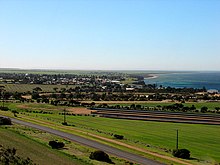
1791:Leadbeater, Maureen M (5 June 2016).
1585:
1583:
1581:
1579:
1577:
752:which was the founder of what is now
508:Description of layout of the hundreds
231:
214:
195:
185:
7:
3129:
416:, formed in 1877 and comprising the
388:, formed in 1875 and comprising the
1778:, State Library of South Australia.
1690:South Australian Government Gazette
1634:. The Government of South Australia
912:District Council of Yorke Peninsula
841:District Council of Yorke Peninsula
758:District Council of Yorke Peninsula
675:District Council of Yorke Peninsula
592:District Council of Yorke Peninsula
450:District Council of Yorke Peninsula
325:located in the Australian state of
1912:. State Library of South Australia
25:
341:after whom the county was named.
85:
3128:
3117:
3116:
2833:District Council of Barunga West
1105:, Parsons Beach and part of the
337:. It was proclaimed in 1869 by
84:
77:
684:Localities include most of the
1910:Place Names of South Australia
1657:"HUNDRED MAP Series Index Map"
189:Lands administrative divisions
1:
1699:Government of South Australia
1603:Government of South Australia
1371:District Council of Dalrymple
1171:District Council of Dalrymple
467:were incorporated as the new
448:were incorporated as the new
414:District Council of Dalrymple
1720:Leadbeater, Maureen (2014).
1513:District Council of Melville
1457:District Council of Melville
1401:Corporate Town of Edithburgh
1393:District Council of Melville
1353:District Council of Melville
1297:District Council of Melville
1241:District Council of Melville
1167:District Council of Minlaton
1092:District Council of Minlaton
1017:District Council of Minlaton
957:District Council of Minlaton
937:, and a northern section of
763:The localities included are
503:List of constituent hundreds
496:District Council of Melville
469:District Council of Minlaton
408:, formed in 1883 within the
402:Corporate Town of Edithburgh
386:District Council of Melville
36:Cadastral in South Australia
3162:Counties of South Australia
2300:Counties of South Australia
1701:: 249–250. 18 February 1869
1397:Corporate Town of Yorketown
1176:Localities include Ramsay,
494:were incorporated into the
398:Corporate Town of Yorketown
375:Governor of South Australia
308:GPX (secondary coordinates)
3178:
3099:Yorke Peninsula Field Days
3089:The Peninsulas zone (wine)
1993:, South Australian Museum.
1380:
1362:
948:
679:Corporate Town of Maitland
426:District Councils Act 1887
406:Corporate Town of Maitland
26:
3112:
3067:Related and uncategorised
2797:State electoral districts
2306:
2248:Property Location Browser
2218:Property Location Browser
2188:Property Location Browser
2158:Property Location Browser
2128:Property Location Browser
2098:Property Location Browser
2068:Property Location Browser
2038:Property Location Browser
2008:Property Location Browser
1966:Property Location Browser
1936:Property Location Browser
1880:Property Location Browser
1850:Property Location Browser
1595:Property Location Browser
625:Hundred of Maitland, 1894
303:GPX (primary coordinates)
278:Map all coordinates using
255:
186:
182:
72:
54:
1906:"Maitland, Nomenclature"
1776:The Hundred of Kilkerran
1491:35.159640°S 137.029660°E
1275:34.986790°S 137.276570°E
1141:34.821840°S 137.743360°E
1070:34.821950°S 137.557210°E
1038:are within the hundred.
941:are within the hundred.
890:34.553590°S 137.792490°E
720:34.359620°S 137.890150°E
653:34.373930°S 137.717120°E
570:34.379050°S 137.553820°E
286:Download coordinates as:
2823:Yorke Peninsula Council
1743:Marsden, Susan (2012).
1331:35.000160°S 137.47076°E
530:East coast overlooking
165:Yorke Peninsula Council
1795:. FamilyHistorySA.info
1496:-35.159640; 137.029660
1435:35.110590°S 137.2806°E
1286:Hundred of Para Wurlie
1280:-34.986790; 137.276570
1253:Hundred of Para Wurlie
1247:Hundred of Para Wurlie
1215:35.0004°S 137.066220°E
1146:-34.821840; 137.743360
1075:-34.821950; 137.557210
991:34.6896°S 137.770750°E
951:Hundred of Koolywurtie
945:Hundred of Koolywurtie
901:Hundred of Muloowurtie
895:-34.553590; 137.792490
868:Hundred of Muloowurtie
862:Hundred of Muloowurtie
819:34.547450°S 137.5992°E
725:-34.359620; 137.890150
658:-34.373930; 137.717120
626:
575:-34.379050; 137.553820
1831:Maureen M Leadbeater
1336:-35.000160; 137.47076
1081:Hundred of Minlacowie
1048:Hundred of Minlacowie
1042:Hundred of Minlacowie
1002:Hundred of Curramulka
969:Hundred of Curramulka
963:Hundred of Curramulka
731:Hundred of Cunningham
698:Hundred of Cunningham
692:Hundred of Cunningham
624:
298:GPX (all coordinates)
66:Hundred of Cunningham
18:Hundred of Curramulka
2828:Copper Coast Council
1502:Hundred of Warrenben
1469:Hundred of Warrenben
1463:Hundred of Warrenben
1440:-35.110590; 137.2806
1365:Hundred of Dalrymple
1359:Hundred of Dalrymple
1220:-35.0004; 137.066220
996:-34.6896; 137.770750
830:Hundred of Wauraltee
824:-34.547450; 137.5992
797:Hundred of Wauraltee
791:Hundred of Wauraltee
581:Hundred of Kilkerran
548:Hundred of Kilkerran
542:Hundred of Kilkerran
418:Hundred of Dalrymple
3079:County of Fergusson
1486: /
1446:Hundred of Coonarie
1430: /
1413:Hundred of Coonarie
1407:Hundred of Coonarie
1383:Hundred of Melville
1377:Hundred of Melville
1342:Hundred of Moorowie
1326: /
1309:Hundred of Moorowie
1303:Hundred of Moorowie
1270: /
1226:Hundred of Carribie
1210: /
1193:Hundred of Carribie
1187:Hundred of Carribie
1136: /
1097:Localities include
1065: /
986: /
885: /
846:Localities include
814: /
750:Hastings Cunningham
715: /
664:Hundred of Maitland
648: /
631:Hundred of Maitland
617:Hundred of Maitland
597:Localities include
565: /
525:Investigator Strait
410:Hundred of Maitland
394:Hundred of Moorowie
390:Hundred of Melville
371:Sir James Fergusson
319:County of Fergusson
249:Investigator Strait
242:Investigator Strait
177:Yorke and Mid North
123: /
2950:Conservation parks
2254:on 7 December 2015
2224:on 7 December 2015
2194:on 7 December 2015
2164:on 7 December 2015
2134:on 7 December 2015
2104:on 7 December 2015
2074:on 7 December 2015
2044:on 7 December 2015
2014:on 7 December 2015
1972:on 7 December 2015
1942:on 7 December 2015
1886:on 7 December 2015
1856:on 7 December 2015
1609:on 7 December 2015
1022:The localities of
917:The localities of
627:
339:Governor Fergusson
269:Adjoining counties
127:34.706°S 137.656°E
29:County of Ferguson
3144:
3143:
3104:Kernewek Lowender
3026:
3025:
2903:Troubridge Shoals
2841:
2840:
2559:
2558:
1724:. FamilyHistorySA
1597:. Land Services,
1152:Hundred of Ramsay
1119:Hundred of Ramsay
1113:Hundred of Ramsay
787:(southern part).
473:Hundred of Ramsay
273:
272:
259:
258:
191:around Fergusson:
16:(Redirected from
3169:
3132:
3131:
3120:
3119:
3031:Adjacent islands
3014:Aquatic reserves
2928:
2898:Troubridge Point
2846:Coastal features
2815:Local Government
2779:Federal division
2775:
2586:
2579:
2572:
2563:
2293:
2286:
2279:
2270:
2264:
2263:
2261:
2259:
2240:
2234:
2233:
2231:
2229:
2210:
2204:
2203:
2201:
2199:
2180:
2174:
2173:
2171:
2169:
2150:
2144:
2143:
2141:
2139:
2120:
2114:
2113:
2111:
2109:
2090:
2084:
2083:
2081:
2079:
2060:
2054:
2053:
2051:
2049:
2030:
2024:
2023:
2021:
2019:
2000:
1994:
1988:
1982:
1981:
1979:
1977:
1958:
1952:
1951:
1949:
1947:
1928:
1922:
1921:
1919:
1917:
1902:
1896:
1895:
1893:
1891:
1872:
1866:
1865:
1863:
1861:
1842:
1836:
1829:
1820:
1814:
1805:
1804:
1802:
1800:
1788:
1779:
1773:
1767:
1766:
1764:
1762:
1757:on 17 March 2016
1756:
1749:
1740:
1734:
1733:
1731:
1729:
1717:
1711:
1710:
1708:
1706:
1686:
1678:
1672:
1671:
1669:
1667:
1661:
1653:
1644:
1643:
1641:
1639:
1633:
1625:
1619:
1618:
1616:
1614:
1605:. Archived from
1587:
1572:
1571:
1569:
1567:
1553:
1545:
1510:
1509:
1507:
1506:
1505:
1503:
1498:
1497:
1492:
1487:
1484:
1483:
1482:
1479:
1454:
1453:
1451:
1450:
1449:
1447:
1442:
1441:
1436:
1431:
1428:
1427:
1426:
1423:
1350:
1349:
1347:
1346:
1345:
1343:
1338:
1337:
1332:
1327:
1324:
1323:
1322:
1319:
1294:
1293:
1291:
1290:
1289:
1287:
1282:
1281:
1276:
1271:
1268:
1267:
1266:
1263:
1234:
1233:
1231:
1230:
1229:
1227:
1222:
1221:
1216:
1211:
1208:
1207:
1206:
1203:
1160:
1159:
1157:
1156:
1155:
1153:
1148:
1147:
1142:
1137:
1134:
1133:
1132:
1129:
1089:
1088:
1086:
1085:
1084:
1082:
1077:
1076:
1071:
1066:
1063:
1062:
1061:
1058:
1034:and part of the
1010:
1009:
1007:
1006:
1005:
1003:
998:
997:
992:
987:
984:
983:
982:
979:
909:
908:
906:
905:
904:
902:
897:
896:
891:
886:
883:
882:
881:
878:
838:
837:
835:
834:
833:
831:
826:
825:
820:
815:
812:
811:
810:
807:
771:(eastern part),
739:
738:
736:
735:
734:
732:
727:
726:
721:
716:
713:
712:
711:
708:
672:
671:
669:
668:
667:
665:
660:
659:
654:
649:
646:
645:
644:
641:
609:and part of the
589:
588:
586:
585:
584:
582:
577:
576:
571:
566:
563:
562:
561:
558:
478:The hundreds of
455:The hundreds of
432:The hundreds of
392:and part of the
355:Wauraltee Island
184:
138:
137:
135:
134:
133:
132:-34.706; 137.656
128:
124:
121:
120:
119:
116:
88:
87:
81:
59:
50:
44:
39:
21:
3177:
3176:
3172:
3171:
3170:
3168:
3167:
3166:
3157:Yorke Peninsula
3147:
3146:
3145:
3140:
3108:
3084:Narungga people
3062:
3022:
3008:
2984:Point Davenport
2944:
2923:Protected areas
2917:
2893:Troubridge Hill
2837:
2809:
2791:
2766:
2665:Minor Townships
2660:
2604:Major Townships
2599:
2597:South Australia
2593:Yorke Peninsula
2590:
2560:
2555:
2302:
2297:
2267:
2257:
2255:
2242:
2241:
2237:
2227:
2225:
2212:
2211:
2207:
2197:
2195:
2182:
2181:
2177:
2167:
2165:
2152:
2151:
2147:
2137:
2135:
2122:
2121:
2117:
2107:
2105:
2092:
2091:
2087:
2077:
2075:
2062:
2061:
2057:
2047:
2045:
2032:
2031:
2027:
2017:
2015:
2002:
2001:
1997:
1989:
1985:
1975:
1973:
1960:
1959:
1955:
1945:
1943:
1930:
1929:
1925:
1915:
1913:
1904:
1903:
1899:
1889:
1887:
1874:
1873:
1869:
1859:
1857:
1844:
1843:
1839:
1830:
1823:
1815:
1808:
1798:
1796:
1790:
1789:
1782:
1774:
1770:
1760:
1758:
1754:
1747:
1742:
1741:
1737:
1727:
1725:
1719:
1718:
1714:
1704:
1702:
1684:
1680:
1679:
1675:
1665:
1663:
1659:
1655:
1654:
1647:
1637:
1635:
1631:
1627:
1626:
1622:
1612:
1610:
1589:
1588:
1575:
1565:
1563:
1551:
1547:
1546:
1537:
1533:
1521:
1501:
1499:
1495:
1493:
1489:
1488:
1485:
1480:
1477:
1475:
1473:
1472:
1465:
1445:
1443:
1439:
1437:
1433:
1432:
1429:
1424:
1421:
1419:
1417:
1416:
1409:
1389:Yorke Peninsula
1385:
1379:
1367:
1361:
1341:
1339:
1335:
1333:
1329:
1328:
1325:
1320:
1317:
1315:
1313:
1312:
1305:
1285:
1283:
1279:
1277:
1273:
1272:
1269:
1264:
1261:
1259:
1257:
1256:
1249:
1225:
1223:
1219:
1217:
1213:
1212:
1209:
1204:
1201:
1199:
1197:
1196:
1189:
1151:
1149:
1145:
1143:
1139:
1138:
1135:
1130:
1127:
1125:
1123:
1122:
1115:
1080:
1078:
1074:
1072:
1068:
1067:
1064:
1059:
1056:
1054:
1052:
1051:
1044:
1001:
999:
995:
993:
989:
988:
985:
980:
977:
975:
973:
972:
965:
953:
947:
900:
898:
894:
892:
888:
887:
884:
879:
876:
874:
872:
871:
864:
829:
827:
823:
821:
817:
816:
813:
808:
805:
803:
801:
800:
793:
730:
728:
724:
722:
718:
717:
714:
709:
706:
704:
702:
701:
694:
663:
661:
657:
655:
651:
650:
647:
642:
639:
637:
635:
634:
619:
607:South Kilkerran
580:
578:
574:
572:
568:
567:
564:
559:
556:
554:
552:
551:
544:
532:Gulf St Vincent
510:
505:
367:
347:
331:Yorke Peninsula
327:South Australia
316:
315:
314:
313:
312:
268:
131:
129:
125:
122:
117:
114:
112:
110:
109:
99:
98:
97:
96:
95:
94:
93:
89:
68:
48:South Australia
46:
45:
42:
37:
32:
23:
22:
15:
12:
11:
5:
3175:
3173:
3165:
3164:
3159:
3149:
3148:
3142:
3141:
3139:
3138:
3126:
3113:
3110:
3109:
3107:
3106:
3101:
3096:
3091:
3086:
3081:
3076:
3074:County of Daly
3070:
3068:
3064:
3063:
3061:
3060:
3055:
3050:
3045:
3040:
3034:
3032:
3028:
3027:
3024:
3023:
3018:
3016:
3010:
3009:
3007:
3006:
3001:
2996:
2991:
2986:
2981:
2976:
2971:
2965:
2960:
2954:
2952:
2946:
2945:
2943:
2942:
2936:
2934:
2932:National parks
2925:
2919:
2918:
2916:
2915:
2910:
2908:Warburto Point
2905:
2900:
2895:
2890:
2885:
2880:
2878:Pondalowie Bay
2875:
2870:
2865:
2860:
2855:
2849:
2847:
2843:
2842:
2839:
2838:
2836:
2835:
2830:
2825:
2819:
2817:
2811:
2810:
2808:
2807:
2801:
2799:
2793:
2792:
2790:
2789:
2783:
2781:
2772:
2768:
2767:
2765:
2764:
2759:
2754:
2749:
2744:
2739:
2734:
2729:
2724:
2719:
2714:
2709:
2704:
2699:
2694:
2689:
2684:
2679:
2674:
2668:
2666:
2662:
2661:
2659:
2658:
2653:
2648:
2646:Port Broughton
2643:
2638:
2633:
2628:
2623:
2618:
2613:
2607:
2605:
2601:
2600:
2591:
2589:
2588:
2581:
2574:
2566:
2557:
2556:
2554:
2553:
2548:
2543:
2538:
2533:
2528:
2523:
2518:
2513:
2508:
2503:
2498:
2493:
2488:
2483:
2478:
2473:
2468:
2463:
2458:
2453:
2448:
2443:
2438:
2433:
2428:
2423:
2418:
2413:
2408:
2403:
2398:
2393:
2388:
2383:
2378:
2373:
2368:
2363:
2358:
2353:
2348:
2343:
2338:
2333:
2328:
2323:
2318:
2313:
2307:
2304:
2303:
2298:
2296:
2295:
2288:
2281:
2273:
2266:
2265:
2235:
2205:
2175:
2145:
2115:
2085:
2055:
2025:
1995:
1983:
1953:
1923:
1897:
1867:
1837:
1821:
1806:
1780:
1768:
1735:
1712:
1682:"New Hundreds"
1673:
1645:
1620:
1573:
1549:"New Counties"
1534:
1532:
1529:
1528:
1527:
1520:
1517:
1464:
1461:
1408:
1405:
1381:Main article:
1378:
1375:
1363:Main article:
1360:
1357:
1304:
1301:
1248:
1245:
1188:
1185:
1114:
1111:
1043:
1040:
964:
961:
949:Main article:
946:
943:
863:
860:
792:
789:
693:
690:
618:
615:
543:
540:
539:
538:
535:
528:
521:
509:
506:
504:
501:
500:
499:
476:
453:
366:
363:
351:County of Daly
346:
343:
323:cadastral unit
311:
310:
305:
300:
295:
289:
283:
276:
275:
274:
271:
270:
265:
261:
260:
257:
256:
253:
252:
245:
238:
230:
229:
224:
221:
213:
212:
207:
202:
194:
193:
180:
179:
174:
168:
167:
162:
156:
155:
152:
148:
147:
144:
140:
139:
107:
101:
100:
91:
90:
83:
82:
76:
75:
74:
73:
70:
69:
60:
52:
51:
35:
24:
14:
13:
10:
9:
6:
4:
3:
2:
3174:
3163:
3160:
3158:
3155:
3154:
3152:
3137:
3136:
3127:
3125:
3124:
3115:
3114:
3111:
3105:
3102:
3100:
3097:
3095:
3092:
3090:
3087:
3085:
3082:
3080:
3077:
3075:
3072:
3071:
3069:
3065:
3059:
3056:
3054:
3051:
3049:
3046:
3044:
3043:Chinamans Hat
3041:
3039:
3036:
3035:
3033:
3029:
3021:
3017:
3015:
3011:
3005:
3002:
3000:
2997:
2995:
2992:
2990:
2987:
2985:
2982:
2980:
2977:
2975:
2972:
2969:
2966:
2964:
2961:
2959:
2956:
2955:
2953:
2951:
2947:
2941:
2938:
2937:
2935:
2933:
2929:
2926:
2924:
2920:
2914:
2911:
2909:
2906:
2904:
2901:
2899:
2896:
2894:
2891:
2889:
2888:Sultana Point
2886:
2884:
2881:
2879:
2876:
2874:
2871:
2869:
2868:Hardwicke Bay
2866:
2864:
2861:
2859:
2856:
2854:
2851:
2850:
2848:
2844:
2834:
2831:
2829:
2826:
2824:
2821:
2820:
2818:
2816:
2812:
2806:
2803:
2802:
2800:
2798:
2794:
2788:
2785:
2784:
2782:
2780:
2776:
2773:
2769:
2763:
2760:
2758:
2755:
2753:
2750:
2748:
2747:Stenhouse Bay
2745:
2743:
2740:
2738:
2735:
2733:
2732:Port Victoria
2730:
2728:
2725:
2723:
2722:Port Moorowie
2720:
2718:
2715:
2713:
2710:
2708:
2705:
2703:
2700:
2698:
2695:
2693:
2690:
2688:
2685:
2683:
2680:
2678:
2675:
2673:
2670:
2669:
2667:
2663:
2657:
2654:
2652:
2649:
2647:
2644:
2642:
2639:
2637:
2634:
2632:
2629:
2627:
2624:
2622:
2619:
2617:
2614:
2612:
2609:
2608:
2606:
2602:
2598:
2594:
2587:
2582:
2580:
2575:
2573:
2568:
2567:
2564:
2552:
2549:
2547:
2544:
2542:
2539:
2537:
2534:
2532:
2529:
2527:
2524:
2522:
2519:
2517:
2514:
2512:
2509:
2507:
2504:
2502:
2499:
2497:
2494:
2492:
2489:
2487:
2484:
2482:
2479:
2477:
2474:
2472:
2469:
2467:
2464:
2462:
2459:
2457:
2454:
2452:
2449:
2447:
2444:
2442:
2439:
2437:
2434:
2432:
2429:
2427:
2424:
2422:
2419:
2417:
2414:
2412:
2409:
2407:
2404:
2402:
2399:
2397:
2394:
2392:
2389:
2387:
2384:
2382:
2379:
2377:
2374:
2372:
2369:
2367:
2364:
2362:
2359:
2357:
2354:
2352:
2349:
2347:
2344:
2342:
2339:
2337:
2334:
2332:
2329:
2327:
2324:
2322:
2319:
2317:
2314:
2312:
2309:
2308:
2305:
2301:
2294:
2289:
2287:
2282:
2280:
2275:
2274:
2271:
2253:
2249:
2245:
2239:
2236:
2223:
2219:
2215:
2209:
2206:
2193:
2189:
2185:
2179:
2176:
2163:
2159:
2155:
2149:
2146:
2133:
2129:
2125:
2119:
2116:
2103:
2099:
2095:
2089:
2086:
2073:
2069:
2065:
2059:
2056:
2043:
2039:
2035:
2029:
2026:
2013:
2009:
2005:
1999:
1996:
1992:
1987:
1984:
1971:
1967:
1963:
1957:
1954:
1941:
1937:
1933:
1927:
1924:
1911:
1907:
1901:
1898:
1885:
1881:
1877:
1871:
1868:
1855:
1851:
1847:
1841:
1838:
1834:
1828:
1826:
1822:
1818:
1813:
1811:
1807:
1794:
1787:
1785:
1781:
1777:
1772:
1769:
1753:
1746:
1739:
1736:
1723:
1716:
1713:
1700:
1696:
1692:
1691:
1683:
1677:
1674:
1658:
1652:
1650:
1646:
1630:
1624:
1621:
1608:
1604:
1600:
1596:
1592:
1586:
1584:
1582:
1580:
1578:
1574:
1561:
1557:
1550:
1544:
1542:
1540:
1536:
1530:
1526:
1523:
1522:
1518:
1516:
1514:
1508:
1470:
1462:
1460:
1458:
1452:
1414:
1406:
1404:
1402:
1398:
1394:
1390:
1384:
1376:
1374:
1372:
1366:
1358:
1356:
1354:
1348:
1310:
1302:
1300:
1298:
1292:
1254:
1246:
1244:
1242:
1238:
1232:
1194:
1186:
1184:
1183:
1179:
1174:
1172:
1168:
1164:
1158:
1120:
1112:
1110:
1108:
1107:Hardwicke Bay
1104:
1100:
1095:
1093:
1087:
1049:
1041:
1039:
1037:
1033:
1029:
1025:
1020:
1018:
1014:
1008:
970:
962:
960:
958:
952:
944:
942:
940:
936:
932:
928:
924:
920:
915:
913:
907:
869:
861:
859:
857:
853:
849:
848:Port Victoria
844:
842:
836:
798:
790:
788:
786:
782:
778:
774:
770:
766:
761:
759:
755:
754:Mount Gambier
751:
747:
743:
737:
699:
691:
689:
687:
682:
680:
676:
670:
632:
623:
616:
614:
612:
608:
604:
600:
595:
593:
587:
549:
541:
536:
533:
529:
526:
522:
519:
515:
514:
513:
507:
502:
497:
493:
489:
485:
481:
477:
474:
470:
466:
462:
458:
454:
451:
447:
443:
439:
435:
431:
430:
429:
427:
421:
419:
415:
411:
407:
403:
399:
395:
391:
387:
382:
378:
376:
373:, the eighth
372:
364:
362:
361:town centre.
360:
356:
352:
344:
342:
340:
336:
332:
328:
324:
320:
309:
306:
304:
301:
299:
296:
294:
291:
290:
288:
287:
282:
281:OpenStreetMap
279:
266:
262:
254:
251:
250:
246:
244:
243:
239:
237:
236:
232:
228:
225:
222:
220:
219:
215:
211:
208:
206:
203:
201:
200:
196:
192:
190:
181:
178:
175:
173:
169:
166:
163:
161:
157:
153:
149:
145:
141:
136:
108:
106:
102:
80:
71:
67:
63:
58:
53:
49:
40:
34:
30:
19:
3133:
3121:
3078:
2958:Bird Islands
2883:Royston Head
2858:Cape Spencer
2727:Port Rickaby
2712:Point Turton
2707:Point Pearce
2451:Hore-Ruthven
2395:
2256:. Retrieved
2252:the original
2247:
2238:
2226:. Retrieved
2222:the original
2217:
2208:
2196:. Retrieved
2192:the original
2187:
2178:
2166:. Retrieved
2162:the original
2157:
2148:
2136:. Retrieved
2132:the original
2127:
2118:
2106:. Retrieved
2102:the original
2097:
2088:
2076:. Retrieved
2072:the original
2067:
2058:
2046:. Retrieved
2042:the original
2037:
2028:
2016:. Retrieved
2012:the original
2007:
1998:
1986:
1974:. Retrieved
1970:the original
1965:
1956:
1944:. Retrieved
1940:the original
1935:
1926:
1914:. Retrieved
1909:
1900:
1888:. Retrieved
1884:the original
1879:
1870:
1858:. Retrieved
1854:the original
1849:
1840:
1797:. Retrieved
1771:
1759:. Retrieved
1752:the original
1738:
1726:. Retrieved
1715:
1703:. Retrieved
1694:
1688:
1676:
1664:. Retrieved
1636:. Retrieved
1623:
1611:. Retrieved
1607:the original
1594:
1564:. Retrieved
1559:
1555:
1468:
1466:
1412:
1410:
1386:
1368:
1308:
1306:
1252:
1250:
1192:
1190:
1180:and part of
1178:Port Vincent
1175:
1118:
1116:
1096:
1047:
1045:
1036:Port Vincent
1021:
968:
966:
954:
927:Rogues Point
916:
867:
865:
845:
796:
794:
773:Dowlingville
762:
697:
695:
683:
630:
628:
603:Point Pearce
596:
547:
545:
518:Spencer Gulf
511:
422:
383:
379:
368:
353:, including
348:
329:which spans
318:
317:
285:
284:
277:
247:
240:
235:Spencer Gulf
233:
218:Spencer Gulf
216:
199:Spencer Gulf
197:
187:
33:
3004:Wills Creek
2974:Leven Beach
2873:Klein Point
2863:Corny Point
2853:Brown Point
2717:Port Hughes
2687:Corny Point
1666:16 November
1494: /
1481:137°01′47″E
1438: /
1425:137°16′50″E
1334: /
1321:137°28′15″E
1278: /
1265:137°16′36″E
1218: /
1205:137°03′58″E
1144: /
1131:137°44′36″E
1073: /
1060:137°33′26″E
1032:Sheoak Flat
994: /
981:137°46′15″E
935:Black Point
893: /
880:137°47′33″E
822: /
809:137°35′57″E
777:Petersville
723: /
710:137°53′25″E
656: /
643:137°43′02″E
573: /
560:137°33′14″E
488:Para Wurlie
461:Koolywurtie
446:Muloowurtie
345:Description
267:Coordinates
143:Established
130: /
118:137°39′22″E
105:Coordinates
3151:Categories
3094:Port Giles
2979:Minlacowie
2771:Governance
2702:Marion Bay
2697:Edithburgh
2692:Curramulka
2641:Paskeville
2491:Manchester
2486:MacDonnell
2341:Buckingham
1531:References
1500: (
1478:35°09′35″S
1444: (
1422:35°06′38″S
1340: (
1318:35°00′01″S
1284: (
1262:34°59′12″S
1237:Aboriginal
1224: (
1202:35°00′01″S
1163:J G Ramsay
1150: (
1128:34°49′19″S
1109:boundary.
1079: (
1057:34°49′19″S
1024:Curramulka
1000: (
978:34°41′23″S
939:Curramulka
931:Pine Point
923:James Well
919:Sandilands
899: (
877:34°33′13″S
828: (
806:34°32′51″S
769:Cunningham
729: (
707:34°21′35″S
662: (
640:34°22′26″S
613:boundary.
579: (
557:34°22′45″S
465:Minlacowie
457:Curramulka
434:Cunningham
412:, and the
115:34°42′22″S
2999:Warrenben
2913:West Cape
2742:Stansbury
2656:Yorketown
2611:Ardrossan
2501:Newcastle
2461:Kimberley
2441:Hindmarsh
2416:Granville
2396:Fergusson
2371:Dalhousie
2361:Carnarvon
2336:Buccleuch
2331:Bosanquet
2326:Blachford
1991:Wauraltee
1761:4 October
1182:Stansbury
1103:Brentwood
1028:PortJulia
856:Wauraltee
765:Ardrossan
742:Ardrossan
492:Warrenben
442:Wauraltee
438:Kilkerran
333:south of
264:Footnotes
223:Fergusson
92:Fergusson
62:Ardrossan
43:Fergusson
3123:Category
3020:Coobowie
2963:Carribie
2805:Narungga
2762:Wool Bay
2682:Coobowie
2651:Wallaroo
2631:Minlaton
2626:Maitland
2536:Victoria
2511:Robinson
2496:Musgrave
2471:Le Hunte
2446:Hopetoun
2401:Flinders
2386:Dufferin
2356:Cardwell
2311:Adelaide
1519:See also
1399:and the
1169:and the
1099:Minlaton
686:Maitland
677:and the
611:Maitland
599:Balgowan
484:Coonarie
480:Carribie
3135:Commons
3053:Royston
2968:Clinton
2757:Warooka
2752:Tickera
2677:Clinton
2531:Taunton
2521:Stanley
2516:Russell
2466:Kintore
2456:Jervois
2436:Herbert
2366:Chandos
2258:20 July
2228:20 July
2198:20 July
2168:20 July
2138:20 July
2108:20 July
2078:20 July
2048:20 July
2018:20 July
1976:20 July
1946:20 July
1916:20 July
1890:20 July
1860:20 July
1799:19 July
1728:20 July
1705:20 July
1638:20 July
1613:20 July
1566:20 July
785:Winulta
365:History
210:Stanley
64:in the
3048:Middle
2994:Thidna
2989:Ramsay
2970:(part)
2636:Moonta
2621:Kadina
2481:Lytton
2431:Hanson
2426:Hamley
2411:Gawler
2351:Buxton
2321:Alfred
2316:Albert
1697:(10).
1395:, the
852:Urania
396:, the
227:Gawler
172:Region
160:LGA(s)
3058:South
2940:Innes
2737:Price
2672:Agery
2551:Young
2526:Sturt
2476:Light
2406:Frome
2381:Derby
2346:Burra
1755:(PDF)
1748:(PDF)
1685:(PDF)
1660:(PDF)
1632:(PDF)
1552:(PDF)
781:Price
746:Price
475:; and
359:Price
335:Price
321:is a
3038:Bird
2787:Grey
2616:Bute
2546:York
2506:Robe
2421:Grey
2391:Eyre
2376:Daly
2260:2016
2230:2016
2200:2016
2170:2016
2140:2016
2110:2016
2080:2016
2050:2016
2020:2016
1978:2016
1948:2016
1918:2016
1892:2016
1862:2016
1801:2016
1763:2017
1730:2016
1707:2016
1695:1869
1668:2015
1640:2016
1615:2016
1568:2016
1560:1869
1467:The
1411:The
1307:The
1251:The
1191:The
1117:The
1046:The
967:The
933:and
866:The
854:and
795:The
744:and
696:The
629:The
546:The
490:and
463:and
444:and
205:Daly
151:Area
146:1869
2541:Way
1013:emu
767:,
293:KML
3153::
2595:,
2246:.
2216:.
2186:.
2156:.
2126:.
2096:.
2066:.
2036:.
2006:.
1964:.
1934:.
1908:.
1878:.
1848:.
1824:^
1809:^
1783:^
1693:.
1687:.
1648:^
1601:,
1593:.
1576:^
1558:.
1554:.
1538:^
1515:.
1459:.
1403:.
1373:.
1355:.
1299:.
1243:.
1173:.
1101:,
1094:.
1030:,
1026:,
1019:.
959:.
929:,
925:,
921:,
914:.
858:.
850:,
843:.
783:,
779:,
775:,
760:.
681:.
605:,
601:,
594:.
486:,
482:,
459:,
440:,
436:,
420:.
2585:e
2578:t
2571:v
2292:e
2285:t
2278:v
2262:.
2232:.
2202:.
2172:.
2142:.
2112:.
2082:.
2052:.
2022:.
1980:.
1950:.
1920:.
1894:.
1864:.
1835:.
1819:.
1803:.
1765:.
1732:.
1709:.
1670:.
1642:.
1617:.
1570:.
1504:)
1471:(
1448:)
1415:(
1344:)
1311:(
1288:)
1255:(
1228:)
1195:(
1154:)
1121:(
1083:)
1050:(
1004:)
971:(
903:)
870:(
832:)
799:(
733:)
700:(
666:)
633:(
583:)
550:(
31:.
20:)
Text is available under the Creative Commons Attribution-ShareAlike License. Additional terms may apply.