914:
429:
45:
618:
590:
566:
613:
595:
585:
561:
537:
600:
580:
556:
542:
640:
532:
484:
In the CDP, the population was spread out, with 19.3% under the age of 18, 8.0% from 18 to 24, 28.7% from 25 to 44, 27.3% from 45 to 64, and 16.7% who were 65 years of age or older. The median age was 41 years. For every 100 females, there were 90.0 males. For every 100 females age 18 and over, there
480:
living together, 10.7% had a female householder with no husband present, and 28.7% were non-families. 25.5% of all households were made up of individuals, and 10.9% had someone living alone who was 65 years of age or older. The average household size was 2.27 and the average family size was 2.71.
54:
444:
of 2000, there were 1,566 people, 689 households, and 491 families residing in the CDP. The population density was 254.9 inhabitants per square mile (98.4/km). There were 729 housing units at an average density of 118.6 per square mile (45.8/km). The racial makeup of the CDP was 99.17%
309:
1071:
362:, the CDP has a total area of 6.411 square miles (16.60 km), of which 6.386 square miles (16.54 km) of it is land and 0.025 square miles (0.065 km) of it (0.39%) is water.
488:
The median income for a household in the CDP was $ 30,968, and the median income for a family was $ 37,981. Males had a median income of $ 25,000 versus $ 20,668 for females. The
662:
1081:
840:
1076:
247:
833:
67:
988:
257:
826:
519:
327:
200:
716:
450:
305:
818:
763:
454:
121:
53:
1008:
767:
742:
691:
462:
359:
407:
301:
1041:
963:
850:
621:
603:
569:
293:
289:
281:
237:
126:
99:
813:
1018:
1013:
998:
968:
924:
896:
891:
872:
573:
549:
476:
There were 689 households, out of which 27.7% had children under the age of 18 living with them, 57.9% were
277:
35:
1003:
466:
993:
958:
313:
1048:
470:
210:
978:
932:
458:
446:
948:
943:
902:
937:
489:
370:
492:
for the CDP was $ 15,590. About 5.6% of families and 8.7% of the population were below the
428:
44:
617:
1065:
545:
433:
366:
297:
493:
285:
865:
789:
109:
342:
329:
82:
69:
191:
114:
589:
565:
432:
Whitewater rafters floating downstream by the Hunter Bridge put-in on the
1032:‡This populated place also has portions in an adjacent county or counties
496:, including 9.7% of those under age 18 and 8.5% of those age 65 or over.
477:
225:
504:
Schools in Hunter/Stoney Creek are operated by Carter County
Schools:
606:
441:
612:
594:
584:
560:
536:
599:
579:
555:
427:
217:
196:
883:
541:
822:
531:
310:
Johnson City-Kingsport-Bristol, TN-VA Combined
Statistical Area
369:
forms a southern boundary for the Hunter community, while the
814:
Tennessee
Technology Center, Elizabethton Tennessee Home Page
912:
712:
738:
687:
1072:
Census-designated places in Carter County, Tennessee
1027:
977:
923:
882:
256:
246:
236:
224:
207:
190:
182:
174:
169:
161:
153:
145:
137:
132:
120:
108:
98:
23:
526:Connection with U.S. Interstate Highway System
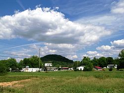
316:" region. Hunter is a suburb of Elizabethton.
834:
8:
841:
827:
819:
764:"US Gazetteer files: 2010, 2000, and 1990"
473:of any race were 1.15% of the population.
380:
306:Johnson City Metropolitan Statistical Area
20:
1082:Johnson City metropolitan area, Tennessee
632:
245:
223:
189:
168:
160:
131:
97:
62:
50:
41:
400:
1077:Census-designated places in Tennessee
682:
680:
300:. Its population was 1,854 as of the
255:
235:
206:
181:
173:
152:
144:
136:
119:
107:
7:
465:, and 0.45% from two or more races.
149:6.40 sq mi (16.57 km)
141:6.42 sq mi (16.64 km)
157:0.03 sq mi (0.07 km)
849:Municipalities and communities of
790:"Census of Population and Housing"
390:
14:
520:Northeast State Community College
641:"ArcGIS REST Services Directory"
616:
611:
598:
593:
588:
583:
578:
564:
559:
554:
540:
535:
530:
52:
43:
717:United States Geological Survey
508:Hunter Elementary – Grades PK–8
312:– commonly known as the "
18:CDP in Tennessee, United States
713:"US Board on Geographic Names"
511:Unaka Elementary – Grades PK–8
308:, which is a component of the
1:
665:. United States Census Bureau
643:. United States Census Bureau
624:Stoney Creek Exit to Hunter.
186:281.85/sq mi (108.83/km)
58:Location of Hunter, Tennessee
768:United States Census Bureau
743:United States Census Bureau
692:United States Census Bureau
518:The Elizabethton campus of
373:forms a northern boundary.
360:United States Census Bureau
1098:
165:1,568 ft (478 m)
1037:
910:
863:
421:
406:
399:
394:
389:
386:
355:(36.376630, -82.155032).
63:
51:
42:
33:
852:Carter County, Tennessee
622:Tennessee State Route 91
604:Tennessee State Route 67
570:Tennessee State Route 67
522:is located near Hunter.
514:Unaka High - Grades 9–12
294:Tennessee State Route 91
290:Carter County, Tennessee
282:unincorporated community
663:"Census Population API"
278:census-designated place
917:
437:
916:
739:"U.S. Census website"
688:"U.S. Census website"
431:
422:U.S. Decennial Census
382:Historical population
343:36.37667°N 82.15500°W
324:Hunter is located at
284:located northeast of
209: • Summer (
83:36.37667°N 82.15500°W
1050:United States portal
304:. It is part of the
183: • Density
770:. February 12, 2011
383:
348:36.37667; -82.15500
339: /
88:36.37667; -82.15500
79: /
918:
719:. October 25, 2007
438:
381:
175: • Total
154: • Water
138: • Total
1059:
1058:
490:per capita income
485:were 88.5 males.
426:
425:
358:According to the
267:
266:
146: • Land
1089:
1051:
1044:
1043:Tennessee portal
1009:Milligan College
915:
875:
868:
858:
853:
843:
836:
829:
820:
802:
801:
799:
797:
786:
780:
779:
777:
775:
760:
754:
753:
751:
749:
735:
729:
728:
726:
724:
709:
703:
702:
700:
698:
684:
675:
674:
672:
670:
659:
653:
652:
650:
648:
637:
620:
615:
602:
597:
592:
587:
582:
568:
563:
558:
544:
539:
534:
451:African American
402:
397:
392:
384:
371:Holston Mountain
354:
353:
351:
350:
349:
344:
340:
337:
336:
335:
332:
214:
94:
93:
91:
90:
89:
84:
80:
77:
76:
75:
72:
56:
47:
21:
1097:
1096:
1092:
1091:
1090:
1088:
1087:
1086:
1062:
1061:
1060:
1055:
1049:
1042:
1033:
1023:
980:
973:
919:
913:
908:
878:
873:
866:
859:
856:
851:
847:
810:
805:
795:
793:
788:
787:
783:
773:
771:
762:
761:
757:
747:
745:
737:
736:
732:
722:
720:
711:
710:
706:
696:
694:
686:
685:
678:
668:
666:
661:
660:
656:
646:
644:
639:
638:
634:
630:
610:
577:
576:, then left on
553:
528:
502:
478:married couples
455:Native American
395:
379:
347:
345:
341:
338:
333:
330:
328:
326:
325:
322:
232:
208:
87:
85:
81:
78:
73:
70:
68:
66:
65:
59:
38:
29:
26:
19:
12:
11:
5:
1095:
1093:
1085:
1084:
1079:
1074:
1064:
1063:
1057:
1056:
1054:
1053:
1046:
1038:
1035:
1034:
1031:
1029:
1025:
1024:
1022:
1021:
1016:
1011:
1006:
1001:
996:
991:
985:
983:
979:Unincorporated
975:
974:
972:
971:
966:
961:
956:
951:
946:
941:
935:
929:
927:
921:
920:
911:
909:
907:
906:
900:
894:
888:
886:
880:
879:
864:
861:
860:
848:
846:
845:
838:
831:
823:
817:
816:
809:
808:External links
806:
804:
803:
781:
755:
730:
704:
676:
654:
631:
629:
626:
527:
524:
516:
515:
512:
509:
501:
498:
424:
423:
419:
418:
415:
413:
410:
404:
403:
398:
393:
388:
378:
375:
321:
318:
265:
264:
261:
254:
253:
250:
244:
243:
240:
234:
233:
230:
228:
222:
221:
215:
205:
204:
194:
188:
187:
184:
180:
179:
176:
172:
171:
167:
166:
163:
159:
158:
155:
151:
150:
147:
143:
142:
139:
135:
134:
130:
129:
124:
118:
117:
112:
106:
105:
102:
96:
95:
61:
60:
57:
49:
48:
40:
39:
34:
31:
30:
27:
24:
17:
13:
10:
9:
6:
4:
3:
2:
1094:
1083:
1080:
1078:
1075:
1073:
1070:
1069:
1067:
1052:
1047:
1045:
1040:
1039:
1036:
1030:
1026:
1020:
1017:
1015:
1012:
1010:
1007:
1005:
1002:
1000:
997:
995:
992:
990:
987:
986:
984:
982:
976:
970:
967:
965:
964:Roan Mountain
962:
960:
957:
955:
952:
950:
947:
945:
942:
939:
936:
934:
931:
930:
928:
926:
922:
904:
901:
898:
895:
893:
890:
889:
887:
885:
881:
877:
876:
869:
862:
857:United States
854:
844:
839:
837:
832:
830:
825:
824:
821:
815:
812:
811:
807:
791:
785:
782:
769:
765:
759:
756:
744:
740:
734:
731:
718:
714:
708:
705:
693:
689:
683:
681:
677:
664:
658:
655:
642:
636:
633:
627:
625:
623:
619:
614:
609:then right on
608:
605:
601:
596:
591:
586:
581:
575:
571:
567:
562:
557:
552:then east on
551:
547:
546:Interstate 26
543:
538:
533:
525:
523:
521:
513:
510:
507:
506:
505:
499:
497:
495:
491:
486:
482:
479:
474:
472:
468:
464:
461:, 0.06% from
460:
456:
452:
448:
443:
435:
434:Watauga River
430:
420:
416:
414:
411:
409:
405:
385:
376:
374:
372:
368:
367:Watauga River
363:
361:
356:
352:
319:
317:
315:
311:
307:
303:
299:
298:Watauga River
295:
291:
287:
283:
279:
275:
272:(also called
271:
262:
259:
251:
249:
241:
239:
229:
227:
219:
216:
212:
202:
201:Eastern (EST)
198:
195:
193:
185:
177:
164:
156:
148:
140:
128:
125:
123:
116:
113:
111:
104:United States
103:
101:
92:
64:Coordinates:
55:
46:
37:
32:
22:
16:
1019:Tiger Valley
1014:Stoney Creek
999:Fish Springs
969:Valley Forge
953:
897:Johnson City
892:Elizabethton
874:Elizabethton
871:
794:. Retrieved
792:. Census.gov
784:
772:. Retrieved
758:
746:. Retrieved
733:
721:. Retrieved
707:
695:. Retrieved
667:. Retrieved
657:
645:. Retrieved
635:
574:Elizabethton
550:Johnson City
529:
517:
503:
494:poverty line
487:
483:
475:
439:
377:Demographics
364:
357:
323:
286:Elizabethton
274:Stoney Creek
273:
269:
268:
28:Stoney Creek
15:
1004:Laurel Fork
981:communities
867:County seat
723:January 31,
697:January 31,
669:October 15,
647:October 15,
548:Exit 24 at
463:other races
346: /
302:2010 census
86: /
1066:Categories
994:Bitter End
989:Big Spring
959:Pine Crest
628:References
440:As of the
331:36°22′36″N
314:Tri-Cities
280:(CDP) and
260:feature ID
170:Population
71:36°22′36″N
1028:Footnotes
774:April 23,
500:Education
334:82°9′18″W
320:Geography
248:FIPS code
238:Area code
192:Time zone
162:Elevation
115:Tennessee
74:82°9′18″W
933:Biltmore
467:Hispanic
457:, 0.13%
453:, 0.06%
449:, 0.13%
296:and the
292:, along
252:47-36500
226:ZIP code
949:Hampton
944:Central
903:Watauga
796:June 4,
748:May 14,
607:/US 19E
276:) is a
263:1328513
100:Country
954:Hunter
938:Butler
884:Cities
471:Latino
442:census
387:Census
270:Hunter
127:Carter
122:County
25:Hunter
459:Asian
447:White
412:1,803
231:37643
220:(EDT)
218:UTC-4
197:UTC-5
178:1,803
110:State
925:CDPs
798:2016
776:2011
750:2011
725:2008
699:2008
671:2022
649:2022
408:2020
396:Note
391:Pop.
365:The
258:GNIS
133:Area
572:to
469:or
288:in
242:423
211:DST
36:CDP
1068::
870::
855:,
766:.
741:.
715:.
690:.
679:^
401:%±
940:‡
905:‡
899:‡
842:e
835:t
828:v
800:.
778:.
752:.
727:.
701:.
673:.
651:.
436:.
417:—
213:)
203:)
199:(
Text is available under the Creative Commons Attribution-ShareAlike License. Additional terms may apply.