756:
42:
56:
86:
975:
93:
63:
1054:
1039:
369:, which forms the southern border of the community. It is served by Exit 85 of Interstate 90, which leads southeast 20 miles (32 km) to Missoula and northwest 38 miles (61 km) to
1020:
694:
1049:
1044:
357:
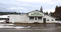
Huson was established as a railroad station in about 1894. The post office opened as Glaude in about 1897, but was changed to Huson around a year later.
561:
118:
1013:
687:
648:
552:
300:
1006:
680:
85:
1059:
478:
380:, the Huson CDP has an area of 0.78 square miles (2.02 km), of which 0.01 square miles (0.03 km), or 1.54%, are water.
557:
55:
775:
672:
503:
921:
579:
172:
870:
429:
414:
346:
342:
982:
704:
334:
288:
177:
150:
547:
455:
767:
326:
41:
32:
945:
820:
795:
952:
845:
835:
261:
860:
825:
805:
330:
913:
903:
655:
377:
251:
880:
745:
726:
370:
990:
875:
830:
785:
780:
366:
898:
790:
526:
840:
800:
1033:
815:
293:
850:
719:
626:
974:
890:
160:
133:
120:
311:
242:
936:‡This populated place also has portions in an adjacent county or counties
276:
504:"P1. Race – Huson CDP, Montana: 2020 DEC Redistricting Data (PL 94-171)"
986:
338:
165:
649:"2020 CENSUS - SCHOOL DISTRICT REFERENCE MAP: Missoula County, MT"
268:
247:
737:
676:
365:
Huson is in northwestern
Missoula County, in the valley of the
754:
600:
575:
458:, a unified K-12 school district, covers all of the CDP,
994:
1055:
Unincorporated communities in
Missoula County, Montana
473:
471:
1040:
Census-designated places in
Missoula County, Montana
931:
912:
889:
859:
766:
736:
310:
299:
287:
275:
258:
241:
233:
225:
220:
212:
204:
196:
188:
183:
171:
159:
149:
23:
341:, United States. Its population was 256 as of the
18:Census-designated place in Montana, United States
1014:
688:
498:
496:
8:
755:
1021:
1007:
695:
681:
673:
387:
20:
562:United States Department of the Interior
467:
298:
274:
240:
219:
211:
182:
148:
113:
47:
38:
407:
1050:Unincorporated communities in Montana
525:United States Postal Service (2012).
309:
286:
257:
232:
224:
203:
195:
187:
170:
158:
7:
971:
969:
479:"2023 U.S. Gazetteer Files: Montana"
1045:Census-designated places in Montana
553:Geographic Names Information System
208:0.01 sq mi (0.03 km)
200:0.77 sq mi (1.98 km)
192:0.78 sq mi (2.01 km)
993:. You can help Knowledge (XXG) by
703:Municipalities and communities of
627:"Census of Population and Housing"
397:
14:
973:
91:
84:
61:
54:
40:
558:United States Geological Survey
1:
605:Montana Place Names Companion
481:. United States Census Bureau
237:334.64/sq mi (129.21/km)
105:Show map of the United States
92:
62:
989:state location article is a
607:. Montana Historical Society
922:Flathead Indian Reservation
580:United States Census Bureau
527:"USPS - Look Up a ZIP Code"
1076:
968:
216:3,012 ft (918 m)
941:
752:
717:
456:Frenchtown Public Schools
443:
428:
413:
406:
401:
396:
393:
114:
48:
39:
30:
706:Missoula County, Montana
331:unincorporated community
1060:Montana geography stubs
327:census-designated place
33:Census-designated place
760:
134:47.03139°N 114.32722°W
776:Bonner-West Riverside
758:
576:"U.S. Census website"
444:U.S. Decennial Census
389:Historical population
260: • Summer (
954:United States portal
506:. U.S. Census Bureau
234: • Density
139:47.03139; -114.32722
759:Missoula County map
390:
130: /
75:Show map of Montana
914:Indian reservation
761:
656:U.S. Census Bureau
388:
378:U.S. Census Bureau
226: • Total
205: • Water
189: • Total
1002:
1001:
963:
962:
448:
447:
376:According to the
345:, up from 210 in
320:
319:
197: • Land
1067:
1023:
1016:
1009:
977:
970:
955:
948:
871:Lolo Hot Springs
757:
729:
722:
712:
707:
697:
690:
683:
674:
667:
666:
664:
662:
653:
645:
639:
638:
636:
634:
623:
617:
616:
614:
612:
597:
591:
590:
588:
586:
572:
566:
565:
544:
538:
537:
535:
533:
522:
516:
515:
513:
511:
500:
491:
490:
488:
486:
475:
409:
404:
399:
391:
367:Clark Fork River
265:
145:
144:
142:
141:
140:
135:
131:
128:
127:
126:
123:
106:
95:
94:
88:
76:
65:
64:
58:
44:
21:
1075:
1074:
1070:
1069:
1068:
1066:
1065:
1064:
1030:
1029:
1028:
1027:
983:Missoula County
966:
964:
959:
953:
946:
937:
927:
908:
885:
862:
855:
762:
750:
732:
727:
720:
713:
710:
705:
701:
671:
670:
660:
658:
651:
647:
646:
642:
632:
630:
625:
624:
620:
610:
608:
599:
598:
594:
584:
582:
574:
573:
569:
546:
545:
541:
531:
529:
524:
523:
519:
509:
507:
502:
501:
494:
484:
482:
477:
476:
469:
464:
453:
402:
386:
363:
355:
335:Missoula County
283:
259:
138:
136:
132:
129:
124:
121:
119:
117:
116:
110:
109:
108:
107:
104:
103:
102:
101:
100:
96:
79:
78:
77:
74:
73:
72:
71:
70:
66:
35:
26:
19:
12:
11:
5:
1073:
1071:
1063:
1062:
1057:
1052:
1047:
1042:
1032:
1031:
1026:
1025:
1018:
1011:
1003:
1000:
999:
978:
961:
960:
958:
957:
950:
947:Montana portal
942:
939:
938:
935:
933:
929:
928:
926:
925:
918:
916:
910:
909:
907:
906:
901:
895:
893:
887:
886:
884:
883:
878:
873:
867:
865:
857:
856:
854:
853:
848:
843:
838:
833:
828:
823:
818:
813:
808:
803:
798:
793:
788:
783:
778:
772:
770:
764:
763:
753:
751:
749:
748:
742:
740:
734:
733:
718:
715:
714:
702:
700:
699:
692:
685:
677:
669:
668:
640:
618:
592:
567:
539:
517:
492:
466:
465:
463:
460:
452:
449:
446:
445:
441:
440:
437:
435:
432:
426:
425:
422:
420:
417:
411:
410:
405:
400:
395:
385:
382:
362:
359:
354:
351:
318:
317:
314:
308:
307:
304:
297:
296:
291:
285:
284:
281:
279:
273:
272:
266:
256:
255:
252:Mountain (MST)
245:
239:
238:
235:
231:
230:
227:
223:
222:
218:
217:
214:
210:
209:
206:
202:
201:
198:
194:
193:
190:
186:
185:
181:
180:
175:
169:
168:
163:
157:
156:
153:
147:
146:
112:
111:
98:
97:
90:
89:
83:
82:
81:
80:
68:
67:
60:
59:
53:
52:
51:
50:
49:
46:
45:
37:
36:
31:
28:
27:
25:Huson, Montana
24:
17:
13:
10:
9:
6:
4:
3:
2:
1072:
1061:
1058:
1056:
1053:
1051:
1048:
1046:
1043:
1041:
1038:
1037:
1035:
1024:
1019:
1017:
1012:
1010:
1005:
1004:
998:
996:
992:
988:
984:
979:
976:
972:
967:
956:
951:
949:
944:
943:
940:
934:
930:
923:
920:
919:
917:
915:
911:
905:
902:
900:
897:
896:
894:
892:
888:
882:
879:
877:
874:
872:
869:
868:
866:
864:
858:
852:
849:
847:
844:
842:
839:
837:
834:
832:
829:
827:
824:
822:
821:Orchard Homes
819:
817:
814:
812:
809:
807:
804:
802:
799:
797:
796:East Missoula
794:
792:
789:
787:
784:
782:
779:
777:
774:
773:
771:
769:
765:
747:
744:
743:
741:
739:
735:
731:
730:
723:
716:
711:United States
708:
698:
693:
691:
686:
684:
679:
678:
675:
657:
650:
644:
641:
628:
622:
619:
606:
602:
596:
593:
581:
577:
571:
568:
563:
559:
555:
554:
549:
543:
540:
528:
521:
518:
505:
499:
497:
493:
480:
474:
472:
468:
461:
459:
457:
450:
442:
438:
436:
433:
431:
427:
423:
421:
418:
416:
412:
392:
383:
381:
379:
374:
372:
368:
360:
358:
352:
350:
348:
344:
340:
336:
332:
328:
324:
315:
313:
305:
302:
295:
292:
290:
280:
278:
270:
267:
263:
253:
249:
246:
244:
236:
228:
215:
207:
199:
191:
179:
176:
174:
167:
164:
162:
155:United States
154:
152:
143:
115:Coordinates:
87:
57:
43:
34:
29:
22:
16:
995:expanding it
980:
965:
810:
725:
659:. Retrieved
643:
631:. Retrieved
629:. Census.gov
621:
609:. Retrieved
604:
595:
583:. Retrieved
570:
551:
542:
532:February 15,
530:. Retrieved
520:
508:. Retrieved
483:. Retrieved
454:
384:Demographics
375:
364:
356:
322:
321:
15:
891:Ghost towns
863:communities
846:Twin Creeks
836:Seeley Lake
721:County seat
343:2020 census
137: /
125:114°19′38″W
1034:Categories
826:Piltzville
806:Frenchtown
462:References
303:feature ID
221:Population
122:47°01′53″N
932:Footnotes
904:Hell Gate
661:March 13,
451:Education
361:Geography
312:FIPS code
289:Area code
243:Time zone
213:Elevation
881:Milltown
746:Missoula
728:Missoula
611:April 5,
371:Superior
316:30-38275
277:ZIP code
178:Missoula
987:Montana
876:Lothrop
831:Potomac
786:Clinton
781:Carlton
633:June 4,
585:May 14,
548:"Huson"
510:June 4,
485:June 4,
353:History
339:Montana
166:Montana
151:Country
899:Coloma
791:Condon
601:"Hall"
394:Census
306:785180
173:County
981:This
861:Other
841:Turah
811:Huson
801:Evaro
652:(PDF)
439:21.9%
325:is a
323:Huson
282:59846
271:(MDT)
269:UTC-6
248:UTC-7
161:State
99:Huson
69:Huson
991:stub
816:Lolo
768:CDPs
738:City
663:2024
635:2016
613:2021
587:2011
534:2012
512:2024
487:2024
430:2020
415:2010
403:Note
398:Pop.
347:2010
329:and
301:GNIS
184:Area
851:Wye
434:256
419:210
373:.
333:in
294:406
262:DST
229:256
1036::
985:,
724::
709:,
654:.
603:.
578:.
560:,
556:.
550:.
495:^
470:^
408:%±
349:.
337:,
1022:e
1015:t
1008:v
997:.
924:‡
696:e
689:t
682:v
665:.
637:.
615:.
589:.
564:.
536:.
514:.
489:.
424:—
264:)
254:)
250:(
Text is available under the Creative Commons Attribution-ShareAlike License. Additional terms may apply.