60:
795:
85:
118:
45:
125:
92:
528:
In the township the population was spread out, with 23.8% under the age of 18, 8.1% from 18 to 24, 30.4% from 25 to 44, 25.2% from 45 to 64, and 12.6% who were 65 years of age or older. The median age was 38 years. For every 100 females, there were 97.5 males. For every 100 females age 18 and over,
488:
of 2000, there were 3,964 people, 1,639 households, and 1,085 families residing in the township. The population density was 213.4 inhabitants per square mile (82.4/km). There were 2,122 housing units at an average density of 114.2 per square mile (44.1/km). The racial makeup of the township was
524:
living together, 8.8% had a female householder with no husband present, and 33.8% were non-families. 27.5% of all households were made up of individuals, and 9.0% had someone living alone who was 65 years of age or older. The average household size was 2.41 and the average family size was 2.94.
59:
532:
The median income for a household in the township was $ 38,614, and the median income for a family was $ 47,768. Males had a median income of $ 34,890 versus $ 23,924 for females. The
455:, the township has a total area of 18.7 square miles (48.4 km), of which 18.4 square miles (47.6 km) is land and 0.31 square miles (0.8 km), or 1.76%, is water.
697:
1118:
1108:
1088:
1038:
1191:
153:
641:
1196:
335:
690:
902:
117:
84:
345:
1139:
1098:
897:
887:
620:
44:
877:
872:
683:
416:
408:
892:
596:
286:
882:
1201:
965:
494:
675:
1018:
985:
925:
907:
498:
428:
412:
69:
970:
950:
207:
1113:
1073:
975:
945:
940:
564:
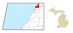
506:
452:
645:
1068:
935:
404:
1083:
990:
955:
930:
819:
462:
443:
in 1839 to become the first
European-American settlers. The township was officially organized on March 25, 1846.
400:
389:
1008:
980:
707:
628:
377:
323:
212:
185:
65:
584:
520:
There were 1,639 households, out of which 29.1% had children under the age of 18 living with them, 53.5% were
427:
There are no incorporated municipalities within the township. The unincorporated communities of
Riverside and
1161:
1000:
806:
748:
466:
1033:
849:
510:
834:
768:
642:"Geographic Identifiers: 2010 Demographic Profile Data (G001): Hagar township, Berrien County, Michigan"
1168:
1123:
1013:
854:
824:
784:
779:
729:
514:
296:
1063:
1048:
502:
490:
1133:
1093:
1078:
1028:
1023:
844:
839:
758:
753:
536:
for the township was $ 19,710. About 6.5% of families and 8.0% of the population were below the
617:
533:
864:
829:
814:
763:
1058:
773:
624:
917:
458:
373:
32:
1185:
473:
396:
328:
585:
U.S. Geological Survey
Geographic Names Information System: Hagar Township, Michigan
537:
722:
381:
195:
168:
155:
277:
1152:‡This populated place also has portions in an adjacent county or counties
540:, including 6.1% of those under age 18 and 4.6% of those age 65 or over.
521:
385:
311:
200:
440:
485:
794:
597:"Hagar township, Berrien County, Michigan - Census Bureau Profile"
303:
282:
740:
670:
360:
679:
469:
passes through the township along the shore of Lake
Michigan.
793:
644:. U.S. Census Bureau, American Factfinder. Archived from
560:
431:(also known as "Hagar Shores") are within the township.
1147:
1132:
1047:
999:
916:
863:
805:
739:
355:
344:
334:
322:
310:
293:
276:
268:
263:
255:
247:
239:
231:
226:
218:
206:
194:
184:
23:
439:Charles Lamb and his wife came to the area from
395:The township is in the north of the county with
465:serves the township with two interchanges, and
631:Community Development Department, August 2008.
691:
476:flows to the southwest through the township.
8:
798:Map of Michigan highlighting Berrien County
698:
684:
676:
517:of any race were 2.14% of the population.
20:
18:Civil township in Michigan, United States
68:(red) and the administered community of
549:
354:
333:
309:
275:
262:
254:
225:
217:
183:
148:
76:
56:
38:
124:
91:
1192:Townships in Berrien County, Michigan
555:
553:
392:, the township population was 3,243.
343:
321:
292:
267:
246:
238:
230:
205:
193:
104:Location within the state of Michigan
7:
509:, and 0.83% from two or more races.
243:18.4 sq mi (47.6 km)
235:18.7 sq mi (48.4 km)
1140:Pokagon Band of Potawatomi Indians
706:Municipalities and communities of
137:Hagar Township (the United States)
14:
251:0.3 sq mi (0.8 km)
123:
116:
90:
83:
58:
43:
1197:1846 establishments in Michigan
671:Hagar Township official website
1:
1039:Shorewood–Tower Hills–Harbert
599:. United States Census Bureau
140:Show map of the United States
565:United States Census Bureau
453:United States Census Bureau
1218:
1157:
791:
720:
149:
77:
57:
39:
30:
709:Berrien County, Michigan
259:653 ft (199 m)
25:Hagar Township, Michigan
529:there were 97.1 males.
417:Benton Charter Township
409:Coloma Charter Township
799:
415:to the southeast, and
1202:Townships in Michigan
797:
561:"U.S. Census website"
295: • Summer (
169:42.20472°N 86.38111°W
1170:United States portal
648:on February 12, 2020
107:Show map of Michigan
1019:Lake Michigan Beach
429:Lake Michigan Beach
413:Bainbridge Township
317:49022, 49038, 49084
174:42.20472; -86.38111
165: /
70:Lake Michigan Beach
1134:Indian reservation
800:
623:2010-06-13 at the
399:to the northwest,
269: • Total
248: • Water
232: • Total
1179:
1178:
865:Charter townships
534:per capita income
451:According to the
367:
366:
240: • Land
1209:
1171:
1164:
796:
732:
725:
715:
710:
700:
693:
686:
677:
658:
657:
655:
653:
638:
632:
615:
609:
608:
606:
604:
593:
587:
582:
576:
575:
573:
571:
557:
495:African American
405:Van Buren County
363:
361:Official website
300:
180:
179:
177:
176:
175:
170:
166:
163:
162:
161:
158:
141:
127:
126:
120:
108:
94:
93:
87:
64:Location within
62:
47:
21:
1217:
1216:
1212:
1211:
1210:
1208:
1207:
1206:
1182:
1181:
1180:
1175:
1169:
1163:Michigan portal
1162:
1153:
1143:
1128:
1119:Shorewood Hills
1050:
1043:
995:
918:Civil townships
912:
859:
820:Berrien Springs
801:
789:
735:
730:
723:
716:
713:
708:
704:
667:
662:
661:
651:
649:
640:
639:
635:
625:Wayback Machine
616:
612:
602:
600:
595:
594:
590:
583:
579:
569:
567:
559:
558:
551:
546:
522:married couples
499:Native American
482:
449:
437:
425:
401:Covert Township
359:
318:
294:
173:
171:
167:
164:
159:
156:
154:
152:
151:
145:
144:
143:
142:
139:
138:
135:
134:
133:
132:
128:
111:
110:
109:
106:
105:
102:
101:
100:
99:
95:
73:
53:
52:
51:
50:
35:
26:
19:
12:
11:
5:
1215:
1213:
1205:
1204:
1199:
1194:
1184:
1183:
1177:
1176:
1174:
1173:
1166:
1158:
1155:
1154:
1151:
1149:
1145:
1144:
1138:
1136:
1130:
1129:
1127:
1126:
1121:
1116:
1111:
1106:
1101:
1096:
1091:
1086:
1081:
1076:
1071:
1069:Berrien Center
1066:
1061:
1055:
1053:
1045:
1044:
1042:
1041:
1036:
1031:
1026:
1021:
1016:
1011:
1009:Benton Heights
1005:
1003:
997:
996:
994:
993:
988:
983:
978:
973:
968:
963:
958:
953:
948:
943:
938:
933:
928:
922:
920:
914:
913:
911:
910:
905:
900:
895:
890:
885:
880:
875:
869:
867:
861:
860:
858:
857:
852:
847:
842:
837:
832:
827:
822:
817:
811:
809:
803:
802:
792:
790:
788:
787:
782:
777:
771:
766:
761:
756:
751:
745:
743:
737:
736:
721:
718:
717:
705:
703:
702:
695:
688:
680:
674:
673:
666:
665:External links
663:
660:
659:
633:
629:Berrien County
618:Hagar Township
610:
588:
577:
548:
547:
545:
542:
481:
478:
459:Interstate 196
448:
445:
436:
433:
424:
421:
419:to the south.
407:to the north,
378:Berrien County
374:civil township
370:Hagar Township
365:
364:
357:
353:
352:
349:
342:
341:
338:
332:
331:
326:
320:
319:
316:
314:
308:
307:
301:
291:
290:
280:
274:
273:
270:
266:
265:
261:
260:
257:
253:
252:
249:
245:
244:
241:
237:
236:
233:
229:
228:
224:
223:
220:
216:
215:
210:
204:
203:
198:
192:
191:
188:
182:
181:
147:
146:
136:
131:Hagar Township
130:
129:
122:
121:
115:
114:
113:
112:
103:
98:Hagar Township
97:
96:
89:
88:
82:
81:
80:
79:
78:
75:
74:
66:Berrien County
63:
55:
54:
48:
42:
41:
40:
37:
36:
33:Civil township
31:
28:
27:
24:
17:
13:
10:
9:
6:
4:
3:
2:
1214:
1203:
1200:
1198:
1195:
1193:
1190:
1189:
1187:
1172:
1167:
1165:
1160:
1159:
1156:
1150:
1146:
1141:
1137:
1135:
1131:
1125:
1122:
1120:
1117:
1115:
1112:
1110:
1107:
1105:
1102:
1100:
1097:
1095:
1092:
1090:
1087:
1085:
1082:
1080:
1077:
1075:
1072:
1070:
1067:
1065:
1062:
1060:
1057:
1056:
1054:
1052:
1046:
1040:
1037:
1035:
1032:
1030:
1027:
1025:
1022:
1020:
1017:
1015:
1012:
1010:
1007:
1006:
1004:
1002:
998:
992:
989:
987:
984:
982:
979:
977:
974:
972:
969:
967:
964:
962:
959:
957:
954:
952:
949:
947:
944:
942:
939:
937:
934:
932:
929:
927:
924:
923:
921:
919:
915:
909:
906:
904:
901:
899:
896:
894:
891:
889:
886:
884:
881:
879:
876:
874:
871:
870:
868:
866:
862:
856:
853:
851:
848:
846:
843:
841:
838:
836:
833:
831:
828:
826:
823:
821:
818:
816:
813:
812:
810:
808:
804:
786:
783:
781:
778:
775:
772:
770:
767:
765:
762:
760:
757:
755:
752:
750:
749:Benton Harbor
747:
746:
744:
742:
738:
734:
733:
726:
719:
714:United States
711:
701:
696:
694:
689:
687:
682:
681:
678:
672:
669:
668:
664:
647:
643:
637:
634:
630:
626:
622:
619:
614:
611:
598:
592:
589:
586:
581:
578:
566:
562:
556:
554:
550:
543:
541:
539:
535:
530:
526:
523:
518:
516:
512:
508:
505:, 0.83% from
504:
500:
496:
492:
487:
479:
477:
475:
474:Paw Paw River
470:
468:
464:
460:
456:
454:
446:
444:
442:
434:
432:
430:
422:
420:
418:
414:
411:to the east,
410:
406:
402:
398:
397:Lake Michigan
393:
391:
387:
383:
379:
375:
371:
362:
358:
350:
347:
339:
337:
330:
327:
325:
315:
313:
305:
302:
298:
288:
287:Eastern (EST)
284:
281:
279:
271:
258:
250:
242:
234:
221:
214:
211:
209:
202:
199:
197:
190:United States
189:
187:
178:
150:Coordinates:
119:
86:
71:
67:
61:
46:
34:
29:
22:
16:
1103:
1034:Paw Paw Lake
960:
850:Stevensville
728:
650:. Retrieved
646:the original
636:
613:
601:. Retrieved
591:
580:
568:. Retrieved
538:poverty line
531:
527:
519:
483:
480:Demographics
471:
457:
450:
438:
426:
394:
388:. As of the
369:
368:
15:
1051:communities
966:New Buffalo
835:Grand Beach
769:New Buffalo
724:County seat
652:January 10,
570:January 31,
507:other races
423:Communities
390:2020 census
312:ZIP code(s)
172: /
1186:Categories
1124:Union Pier
1014:Fair Plain
986:Three Oaks
926:Bainbridge
908:Watervliet
903:St. Joseph
855:Three Oaks
825:Eau Claire
785:Watervliet
780:St. Joseph
731:St. Joseph
544:References
484:As of the
463:US 31
382:U.S. state
348:feature ID
264:Population
160:86°22′52″W
157:42°12′17″N
1148:Footnotes
1114:Scottdale
1104:Riverside
1064:Bakertown
971:Pipestone
951:Chikaming
603:March 18,
447:Geography
336:FIPS code
324:Area code
278:Time zone
256:Elevation
219:Organized
1099:Lakeside
1094:Hinchman
1084:Glendora
1079:Buckhorn
1029:New Troy
1024:Millburg
976:Royalton
946:Buchanan
941:Bertrand
845:Shoreham
840:Michiana
807:Villages
759:Buchanan
754:Bridgman
621:Archived
511:Hispanic
501:, 0.30%
497:, 0.71%
493:, 1.74%
386:Michigan
340:26-35860
201:Michigan
1089:Harbert
936:Berrien
898:Oronoko
888:Lincoln
489:95.59%
441:Vermont
435:History
380:in the
356:Website
351:1626418
213:Berrien
186:Country
1109:Sawyer
1074:Dayton
991:Weesaw
956:Galien
931:Baroda
878:Coloma
873:Benton
830:Galien
815:Baroda
764:Coloma
741:Cities
515:Latino
486:census
208:County
72:(pink)
1059:Avery
1049:Other
981:Sodus
961:Hagar
893:Niles
774:Niles
503:Asian
491:White
372:is a
306:(EDT)
304:UTC-4
283:UTC-5
272:3,243
196:State
1001:CDPs
883:Lake
654:2014
605:2024
572:2008
472:The
467:M-63
346:GNIS
227:Area
222:1846
49:Seal
513:or
403:in
384:of
376:of
329:269
297:DST
1188::
727::
712:,
627:,
563:.
552:^
1142:‡
776:‡
699:e
692:t
685:v
656:.
607:.
574:.
461:/
299:)
289:)
285:(
Text is available under the Creative Commons Attribution-ShareAlike License. Additional terms may apply.