56:
72:
405:
141:
42:
802:
161:
719:
736:
711:
306:
694:
612:
79:
383:
446:
Colonized in the middle of the 19th century, the township of Ham-Sud, established in 1851, takes its name from a village in the county of Essex in
England. One of its first inhabitants, Joseph Dion, would eventually see his first name honoured through attribution to the mission in 1869. The parish
543:
904:
909:
768:
447:
was established both canonically and civilly in 1877. The parish municipality, installed two years later, would also take this denomination, Saint-Joseph-de-Ham-Sud.
249:
652:
244:
55:
919:
231:
516:
790:
71:
914:
807:
190:
103:
955:
899:
894:
323:
499:
153:
645:
950:
852:
681:
358:
783:
638:
424:
185:
776:
366:
236:
725:
582:
556:
455:
On 22 Oct. 2011, the parish municipality of Saint-Joseph-de-Ham-Sud changed its name and status to simply
873:
745:
344:
41:
32:
568:
847:
672:
352:
333:
487:
616:
589:
821:
750:
677:
440:
386:
842:
826:
173:
404:
857:
755:
703:
436:
432:
944:
371:
929:
630:
593:
467:
The 2021 census counted 214 inhabitants, which is a 8.9% decrease from 2016.
340:
319:
118:
105:
588:(in French). Institut de la statistique du Québec. October 2011. p. 3.
314:
611:
210:
205:
46:
557:
http://www.stat.gouv.qc.ca/publications/referenc/pdf2011/modif_oct11.pdf
888:
801:
417:
178:
166:
146:
544:"Census Profile, 2021 Census, Statistics Canada - Validation Error"
527:(in French). Ministère des Affaires municipales et de l'Habitation.
772:
634:
622:
435:
and about 50 kilometres (31 mi) to the southwest of
397:
431:. It lies 20 kilometres (12 mi) to the east of
866:
835:
814:
392:
377:
365:
351:
330:
313:
297:
289:
281:
276:
268:
260:
255:
242:
229:
221:
216:
204:
196:
184:
172:
152:
134:
23:
784:
646:
8:
583:"Modifications aux municipalités du Québec"
482:
480:
791:
777:
769:
653:
639:
631:
569:"Toponymie : Saint-Joseph-de-Ham-Sud"
403:
20:
808:Les Sources Regional County Municipality
538:
536:
534:
511:
509:
476:
391:
376:
350:
312:
275:
254:
215:
133:
98:
64:
52:
38:
272:151.21 km (58.38 sq mi)
264:152.40 km (58.84 sq mi)
364:
329:
296:
288:
280:
267:
259:
241:
228:
220:
203:
195:
183:
171:
151:
7:
668:
423:Prior to October 22, 2011 it was a
887:Regional County Municipalities in
14:
500:Commission de toponymie du Québec
490:Banque de noms de lieux du Québec
800:
734:
717:
709:
692:
610:
381:
305:
304:
159:
139:
77:
70:
54:
40:
78:
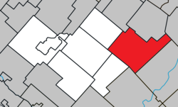
60:Location within Les Sources RCM
18:Municipality in Quebec, Canada
1:
956:Incorporated places in Estrie
735:
693:
718:
710:
519:Répertoire des municipalités
443:passes through the region.
91:Location in southern Quebec
972:
661:Places adjacent to Ham-Sud
492:: Reference number 359444"
882:
666:
99:
65:
53:
39:
30:
951:Municipalities in Quebec
853:Saint-Georges-de-Windsor
682:Saints-Martyrs-Canadiens
521:: Geographic code 40005"
457:Municipality of Ham-Sud
429:Saint-Joseph-de-Ham-Sud
905:Le Haut-Saint-François
806: Subdivisions of
298: • Pop
910:Le Val-Saint-François
416:is a municipality in
332: • Summer (
293:1.4/km (4/sq mi)
619:at Wikimedia Commons
496:toponymie.gouv.qc.ca
290: • Density
927:Independent Cities:
525:www.mamh.gouv.qc.ca
425:parish municipality
237:Richmond—Arthabaska
115: /
282: • Total
261: • Total
222: • Mayor
938:
937:
766:
765:
761:
760:
615:Media related to
427:and its name was
411:
410:
301:
269: • Land
119:45.761°N 71.602°W
963:
805:
804:
793:
786:
779:
770:
738:
737:
721:
720:
713:
712:
696:
695:
669:
655:
648:
641:
632:
627:
623:Official website
614:
598:
597:
587:
579:
573:
572:
565:
559:
554:
548:
547:
540:
529:
528:
513:
504:
503:
484:
441:Quebec Route 257
407:
402:
399:
385:
384:
337:
308:
307:
299:
165:
163:
162:
145:
143:
142:
130:
129:
127:
126:
125:
120:
116:
113:
112:
111:
108:
81:
80:
74:
58:
44:
21:
971:
970:
966:
965:
964:
962:
961:
960:
941:
940:
939:
934:
893:
878:
862:
831:
827:Val-des-Sources
810:
799:
797:
767:
762:
726:Beaulac-Garthby
722:
662:
659:
625:
607:
602:
601:
585:
581:
580:
576:
567:
566:
562:
555:
551:
542:
541:
532:
515:
514:
507:
486:
485:
478:
473:
465:
453:
396:
382:
361:
331:
225:Langevin Gagnon
200:January 1, 1879
160:
158:
140:
138:
124:45.761; -71.602
123:
121:
117:
114:
109:
106:
104:
102:
101:
95:
94:
93:
92:
89:
88:
87:
86:
82:
61:
49:
35:
26:
19:
12:
11:
5:
969:
967:
959:
958:
953:
943:
942:
936:
935:
933:
932:
923:
922:
917:
912:
907:
902:
897:
883:
880:
879:
877:
876:
870:
868:
864:
863:
861:
860:
855:
850:
845:
839:
837:
836:Municipalities
833:
832:
830:
829:
824:
818:
816:
812:
811:
798:
796:
795:
788:
781:
773:
764:
763:
759:
758:
753:
748:
742:
741:
739:
732:
729:
728:
723:
708:
706:
700:
699:
697:
690:
687:
686:
684:
675:
667:
664:
663:
660:
658:
657:
650:
643:
635:
629:
628:
620:
606:
605:External links
603:
600:
599:
574:
560:
549:
530:
505:
475:
474:
472:
469:
464:
461:
452:
449:
437:Thetford Mines
409:
408:
394:
390:
389:
379:
375:
374:
369:
363:
362:
357:
355:
353:Postal code(s)
349:
348:
338:
328:
327:
317:
311:
310:
302:
295:
294:
291:
287:
286:
283:
279:
278:
274:
273:
270:
266:
265:
262:
258:
257:
253:
252:
247:
240:
239:
234:
232:Federal riding
227:
226:
223:
219:
218:
214:
213:
208:
202:
201:
198:
194:
193:
188:
182:
181:
176:
170:
169:
156:
150:
149:
136:
132:
131:
97:
96:
90:
84:
83:
76:
75:
69:
68:
67:
66:
63:
62:
59:
51:
50:
45:
37:
36:
31:
28:
27:
24:
17:
13:
10:
9:
6:
4:
3:
2:
968:
957:
954:
952:
949:
948:
946:
931:
928:
925:
924:
921:
918:
916:
913:
911:
908:
906:
903:
901:
898:
896:
892:
890:
885:
884:
881:
875:
874:Saint-Camille
872:
871:
869:
865:
859:
856:
854:
851:
849:
846:
844:
841:
840:
838:
834:
828:
825:
823:
820:
819:
817:
813:
809:
803:
794:
789:
787:
782:
780:
775:
774:
771:
757:
754:
752:
749:
747:
746:Saint-Camille
744:
743:
740:
733:
731:
730:
727:
724:
716:
707:
705:
702:
701:
698:
691:
689:
688:
685:
683:
679:
676:
674:
671:
670:
665:
656:
651:
649:
644:
642:
637:
636:
633:
624:
621:
618:
613:
609:
608:
604:
595:
591:
584:
578:
575:
570:
564:
561:
558:
553:
550:
545:
539:
537:
535:
531:
526:
522:
520:
512:
510:
506:
501:
498:(in French).
497:
493:
491:
483:
481:
477:
470:
468:
462:
460:
458:
450:
448:
444:
442:
438:
434:
430:
426:
421:
419:
415:
406:
401:
395:
388:
380:
373:
370:
368:
360:
356:
354:
346:
342:
339:
335:
325:
321:
318:
316:
303:
292:
284:
271:
263:
251:
248:
246:
243: •
238:
235:
233:
230: •
224:
212:
209:
207:
199:
192:
189:
187:
180:
177:
175:
168:
157:
155:
148:
137:
128:
100:Coordinates:
73:
57:
48:
43:
34:
29:
22:
16:
926:
920:Memphrémagog
886:
848:Saint-Adrien
714:
673:Saint-Adrien
577:
571:(in French).
563:
552:
524:
518:
495:
489:
466:
456:
454:
445:
428:
422:
413:
412:
245:Prov. riding
33:Municipality
15:
915:Les Sources
626:(in French)
197:Constituted
191:Les Sources
122: /
945:Categories
930:Sherbrooke
471:References
463:Demography
420:, Canada.
277:Population
217:Government
110:71°36′07″W
107:45°45′40″N
900:Le Granit
895:Coaticook
867:Townships
594:1715-6408
367:Area code
315:Time zone
300:2016-2021
206:Named for
822:Danville
751:Dudswell
678:Ham-Nord
378:Highways
250:Richmond
211:West Ham
154:Province
47:Mont Ham
843:Ham-Sud
715:Ham-Sud
617:Ham-Sud
451:History
414:Ham-Sud
398:ham-sud
393:Website
359:J0B 3J0
135:Country
85:Ham-Sud
25:Ham-Sud
889:Estrie
858:Wotton
815:Cities
756:Weedon
704:Wotton
592:
433:Wotton
418:Quebec
179:Estrie
174:Region
167:Quebec
164:
147:Canada
144:
586:(PDF)
387:R-257
341:UTC−4
320:UTC−5
590:ISSN
309:8.9%
256:Area
400:.ca
372:819
345:EDT
334:DST
324:EST
285:214
186:RCM
947::
680:/
533:^
523:.
508:^
494:.
479:^
459:.
439:.
891::
792:e
785:t
778:v
654:e
647:t
640:v
596:.
546:.
517:"
502:.
488:"
347:)
343:(
336:)
326:)
322:(
Text is available under the Creative Commons Attribution-ShareAlike License. Additional terms may apply.