101:
67:
57:
528:
108:
82:
437:
The name "Hamakita" is often mistaken to come from "North of the city of
Hamamatsu" (浜松市の北). However, when the town of Hamakita was formed, the town took one letter each from the component villages of Hamana Village and Kitahama Village to form the name "Hamakita".
495:
Tenryu-shi, Hamakita-shi, Haruno-cho, Tatsuyama-mura, Sakuma-cho, Misakubo-cho, Maisaka-cho, Yuto-cho, Hosoe-cho, Inasa-cho,and
Mikkabi-cho were incorporated into Hamamatsu-shi as of July 1, 2005.
368:
100:
584:
66:
565:
132:
56:
81:
589:
558:
456:
383:
551:
427:
21:
415:
399:
172:
307:
364:
207:
16:
This article is about the former municipality. For the ward of
Hamamatsu of which it became a part, see
510:
423:
189:
527:
431:
411:
375:
345:
262:
211:
194:
87:
407:
360:
286:
419:
395:
535:
403:
379:
391:
387:
341:
181:
177:
472:平成17年7月1日、浜松市、浜北市、天竜市、舞阪町、雄踏町、細江町、引佐町、三ヶ日町、春野町、佐久間町、水窪町及び龍山村の12市町村が合併して、新しい浜松市が誕生しました。
578:
17:
296:
484:
363:
of 1,300.00 persons per km. The total area was 66.64 km. It is now part of
356:
258:
147:
134:
253:
491:
Annual Report on
Population Movement in the Basic Resident Register
349:
539:
302:
292:
282:
252:
244:
236:
231:
223:
218:
200:
188:
171:
163:
32:
374:On July 1, 2005, Hamakita, along with the city of
493:] (in Japanese). 総務庁統計局. 2005. p. 142.
534:This Shizuoka Prefecture location article is a
331:
325:
559:
8:
355:On April 1, 2005, the city had an estimated
566:
552:
29:
430:), was merged into the expanded city of
447:
277:
251:
230:
217:
162:
127:
93:
78:
50:
585:Dissolved municipalities of Hamamatsu
301:
291:
281:
243:
235:
227:66.64 km (25.73 sq mi)
222:
199:
187:
170:
7:
524:
522:
367:when the city of Hamamatsu became a
27:Former municipality in Chūbu, Japan
538:. You can help Knowledge (XXG) by
14:
526:
107:
106:
99:
80:
65:
55:
1:
332:
248:1,300/km (3,000/sq mi)
606:
521:
15:
326:
314:
278:
273:
269:
128:
94:
79:
51:
44:
22:Hamakita (disambiguation)
590:Shizuoka geography stubs
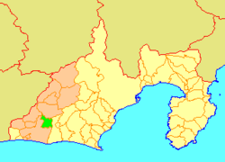
86:Location of Hamakita in
36:
308:Podocarpus macrophyllus
148:34.79306°N 137.79000°E
20:. For other uses, see
418:), and the towns of
245: • Density
346:Shizuoka Prefecture
344:located in western
195:Shizuoka Prefecture
153:34.79306; 137.79000
144: /
88:Shizuoka Prefecture
46:Former municipality
371:on April 1, 2007.
287:Japanese white-eye
237: • Total
224: • Total
547:
546:
410:, the village of
318:
317:
120:Location in Japan
597:
568:
561:
554:
530:
523:
515:
498:
497:
481:
475:
474:
469:
468:
452:
402:), the towns of
386:), the towns of
365:ward of Hamakita
359:of 86,653 and a
339:
338:
335:
329:
328:
159:
158:
156:
155:
154:
149:
145:
142:
141:
140:
137:
110:
109:
103:
84:
69:
59:
39:
30:
605:
604:
600:
599:
598:
596:
595:
594:
575:
574:
573:
572:
519:
513:
507:
502:
501:
483:
482:
478:
466:
464:
454:
453:
449:
444:
428:Hamana District
384:Shūchi District
369:designated city
336:
323:
205:
152:
150:
146:
143:
138:
135:
133:
131:
130:
124:
123:
122:
121:
118:
117:
116:
115:
111:
90:
75:
74:
73:
72:
63:
62:
47:
40:
37:
35:
28:
25:
12:
11:
5:
603:
601:
593:
592:
587:
577:
576:
571:
570:
563:
556:
548:
545:
544:
531:
517:
516:
506:
505:External links
503:
500:
499:
486:住民基本台帳人口移動報告年報
476:
446:
445:
443:
440:
416:Iwata District
400:Inasa District
378:, the town of
316:
315:
312:
311:
304:
300:
299:
294:
290:
289:
284:
280:
279:
276:
275:
271:
270:
267:
266:
256:
250:
249:
246:
242:
241:
238:
234:
233:
229:
228:
225:
221:
220:
216:
215:
202:
198:
197:
192:
186:
185:
175:
169:
168:
165:
161:
160:
126:
125:
119:
113:
112:
105:
104:
98:
97:
96:
95:
92:
91:
85:
77:
76:
70:
64:
60:
54:
53:
52:
49:
48:
45:
42:
41:
33:
26:
13:
10:
9:
6:
4:
3:
2:
602:
591:
588:
586:
583:
582:
580:
569:
564:
562:
557:
555:
550:
549:
543:
541:
537:
532:
529:
525:
520:
514:(in Japanese)
512:
509:
508:
504:
496:
492:
488:
487:
480:
477:
473:
463:(in Japanese)
462:
458:
451:
448:
441:
439:
435:
433:
429:
425:
421:
417:
413:
409:
405:
401:
397:
393:
389:
385:
381:
377:
372:
370:
366:
362:
358:
353:
351:
347:
343:
334:
322:
313:
310:
309:
305:
298:
295:
288:
285:
272:
268:
264:
260:
257:
255:
247:
239:
226:
213:
209:
206:(now part of
203:
196:
193:
191:
183:
179:
176:
174:
166:
157:
129:Coordinates:
102:
89:
83:
68:
58:
43:
31:
23:
19:
18:Hamakita Ward
540:expanding it
533:
518:
511:天竜浜名湖地域合併評議会
494:
490:
485:
479:
471:
465:. Retrieved
460:
450:
436:
373:
354:
333:Hamakita-shi
320:
319:
306:
297:Rhododendron
204:July 1, 2005
461:浜松市公式ホームページ
426:(both from
208:Hamakita-ku
151: /
139:137°47′24″E
579:Categories
467:2024-02-07
442:References
414:(all from
398:(all from
357:population
232:Population
190:Prefecture
136:34°47′35″N
432:Hamamatsu
412:Tatsuyama
259:UTC+09:00
254:Time zone
212:Hamamatsu
408:Misakubo
321:Hamakita
114:Hamakita
34:Hamakita
457:"合併の経緯"
420:Maisaka
396:Mikkabi
361:density
274:Symbols
164:Country
404:Sakuma
382:(from
380:Haruno
376:Tenryū
340:was a
293:Flower
240:86,653
201:Merged
173:Region
71:Emblem
489:[
455:浜松市.
392:Inasa
388:Hosoe
350:Japan
182:Tōkai
178:Chūbu
167:Japan
536:stub
424:Yūtō
422:and
406:and
394:and
342:city
303:Tree
283:Bird
219:Area
61:Flag
327:浜北市
263:JST
38:浜北市
581::
470:.
459:.
434:.
390:,
352:.
348:,
330:,
210:,
567:e
560:t
553:v
542:.
337:)
324:(
265:)
261:(
214:)
184:)
180:(
24:.
Text is available under the Creative Commons Attribution-ShareAlike License. Additional terms may apply.