42:
757:
442:
360:
There were 5 households, out of which 20.0% had children under the age of 18 living with them, 40.0% were married couples living together, and 40.0% were non-families. 40.0% of all households were made up of individuals, and 20.0% had someone living alone who was 65 years of age or older. The average
364:
In Hamill, the population was spread out, with 18.2% under the age of 18, 27.3% from 25 to 44, 9.1% from 45 to 64, and 45.5% who were 65 years of age or older. The median age was 62 years. For every 100 females, there were 83.3 males. For every 100 females age 18 and over, there were 80.0 males.
368:
The median income for a household in Hamill was $ 42,500, and the median income for a family was $ 42,500. Males had a median income of $ 15,000 versus $ 16,250 for females. The per capita income for Hamill was $ 11,833. None of the population or families were below the poverty line.
352:
As of the census of 2000, there were 11 people, 5 households, and 3 families residing in Hamill. The population density was 9.0 people per square mile (3.5/km). There were 7 housing units at an average density of 5.7/sq mi (2.2/km). The racial makeup of the CDP was 100.00%
554:
41:
926:
690:
478:
921:
425:, this CDP has a total area of 1.2 square miles (3.1 km), of which 1.2 square miles (3.1 km) is land and 0.04 square miles (0.10 km) (2.40%) is water.
62:
683:
242:
294:
676:
252:
193:
114:
668:
659:
829:
891:
507:
422:
397:
612:
867:
700:
275:
119:
47:
286:. There is a post office at Hamill, also two churches and a community hall; otherwise, no businesses or services.
331:
283:
824:
776:
230:
644:
466:
786:
616:
418:
32:
839:
834:
421:(CDP) was established in 1980 to include Hamill, from which the CDP derived its name. According to the
381:, Hamill was renamed for Gail Hamill the pioneer merchant, postmaster and banker in town. In 1909 the
898:
849:
844:
819:
746:
741:
722:
403:
386:
203:
809:
799:
411:
354:
859:
290:
528:
377:
The town was started in April 1909 on the east side of No
Moccasin Lake. Originally named
392:
382:
271:
915:
235:
279:
107:
51:
715:
579:
467:
U.S. Geological Survey
Geographic Names Information System: Hamill, South Dakota
102:
77:
64:
184:
882:‡This populated place also has portions in an adjacent county or counties
218:
600:
268:
210:
189:
768:
733:
672:
361:
household size was 2.20 and the average family size was 3.00.
755:
389:
through
Roseland and beyond but the line was never built.
503:
927:
Census-designated places in Tripp County, South Dakota
650:
on
Keystone Area Historical Society Official Homepage
877:
858:
808:
785:
767:
732:
251:
241:
229:
217:
200:
183:
175:
167:
162:
154:
146:
138:
130:
125:
113:
101:
93:
23:
631:Linnaus, Dr. Vernon F and Bartels, Michael M..
529:"U.S. Census Bureau: Hamill CDP, South Dakota"
282:, United States. The population was 14 at the
684:
8:
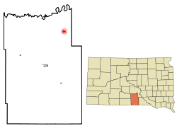
289:Hamill lies about 1.9 miles (3 km) south of
691:
677:
669:
406:) was transferred to the local newspaper;
304:
20:
621:. University of South Dakota. p. 40.
922:Census-designated places in South Dakota
756:
434:
240:
216:
182:
161:
153:
124:
92:
57:
38:
462:
460:
324:
662:on littlehousediscussion.blogspot.com
498:
496:
250:
228:
199:
174:
166:
145:
137:
129:
112:
100:
7:
150:0.03 sq mi (0.08 km)
142:1.22 sq mi (3.16 km)
134:1.25 sq mi (3.25 km)
699:Municipalities and communities of
635:. South Platte Press, 2008, p. 41.
580:"Census of Population and Housing"
555:"No Moccasin Creek · South Dakota"
314:
18:CDP in South Dakota, United States
14:
559:No Moccasin Creek · South Dakota
443:"ArcGIS REST Services Directory"
40:
618:South Dakota place-names, v.1–3
1:
535:. United States Census Bureau
481:. United States Census Bureau
445:. United States Census Bureau
508:United States Census Bureau
423:United States Census Bureau
398:Little House on the Prairie
943:
868:Rosebud Indian Reservation
702:Tripp County, South Dakota
179:11.46/sq mi (4.42/km)
158:1,798 ft (548 m)
887:
753:
713:
345:
330:
323:
318:
313:
310:
58:
39:
30:
613:Federal Writers' Project
479:"Census Population API"
419:census-designated place
761:
385:surveyed a route from
759:
504:"U.S. Census website"
346:U.S. Decennial Census
306:Historical population
293:, a tributary of the
202: • Summer (
78:43.59389°N 99.69056°W
900:United States portal
633:Rails to the Rosebud
601:Hamill, Tripp County
404:Laura Ingalls Wilder
387:Oacoma, South Dakota
176: • Density
25:Hamill, South Dakota
893:South Dakota portal
412:Pedro, South Dakota
307:
83:43.59389; -99.69056
74: /
860:Indian reservation
762:
305:
168: • Total
147: • Water
131: • Total
909:
908:
350:
349:
291:No Moccasin Creek
262:
261:
139: • Land
50:and the state of
934:
901:
894:
760:Tripp County map
758:
725:
718:
708:
703:
693:
686:
679:
670:
663:
657:
651:
642:
636:
629:
623:
622:
609:
603:
598:
592:
591:
589:
587:
576:
570:
569:
567:
565:
551:
545:
544:
542:
540:
525:
519:
518:
516:
514:
500:
491:
490:
488:
486:
475:
469:
464:
455:
454:
452:
450:
439:
326:
321:
316:
308:
207:
89:
88:
86:
85:
84:
79:
75:
72:
71:
70:
67:
44:
21:
942:
941:
937:
936:
935:
933:
932:
931:
912:
911:
910:
905:
899:
892:
883:
873:
854:
830:Jordan Junction
811:
804:
781:
763:
751:
728:
723:
716:
709:
706:
701:
697:
667:
666:
658:
654:
643:
639:
630:
626:
611:
610:
606:
599:
595:
585:
583:
578:
577:
573:
563:
561:
553:
552:
548:
538:
536:
527:
526:
522:
512:
510:
502:
501:
494:
484:
482:
477:
476:
472:
465:
458:
448:
446:
441:
440:
436:
431:
408:Roseland Review
375:
319:
303:
225:
201:
82:
80:
76:
73:
68:
65:
63:
61:
60:
54:
35:
26:
19:
12:
11:
5:
940:
938:
930:
929:
924:
914:
913:
907:
906:
904:
903:
896:
888:
885:
884:
881:
879:
875:
874:
872:
871:
864:
862:
856:
855:
853:
852:
847:
842:
837:
832:
827:
822:
816:
814:
806:
805:
803:
802:
797:
791:
789:
783:
782:
780:
779:
773:
771:
765:
764:
754:
752:
750:
749:
744:
738:
736:
730:
729:
714:
711:
710:
698:
696:
695:
688:
681:
673:
665:
664:
660:Carrie Ingalls
652:
646:Carrie Ingalls
637:
624:
604:
593:
571:
546:
533:www.census.gov
520:
492:
470:
456:
433:
432:
430:
427:
410:in 1910, from
393:Carrie Ingalls
383:Milwaukee Road
374:
371:
348:
347:
343:
342:
339:
337:
334:
328:
327:
322:
317:
312:
302:
299:
260:
259:
256:
249:
248:
245:
239:
238:
233:
227:
226:
223:
221:
215:
214:
208:
198:
197:
187:
181:
180:
177:
173:
172:
169:
165:
164:
160:
159:
156:
152:
151:
148:
144:
143:
140:
136:
135:
132:
128:
127:
123:
122:
117:
111:
110:
105:
99:
98:
95:
91:
90:
56:
55:
45:
37:
36:
31:
28:
27:
24:
17:
13:
10:
9:
6:
4:
3:
2:
939:
928:
925:
923:
920:
919:
917:
902:
897:
895:
890:
889:
886:
880:
876:
869:
866:
865:
863:
861:
857:
851:
848:
846:
843:
841:
838:
836:
833:
831:
828:
826:
823:
821:
818:
817:
815:
813:
807:
801:
798:
796:
793:
792:
790:
788:
784:
778:
775:
774:
772:
770:
766:
748:
745:
743:
740:
739:
737:
735:
731:
727:
726:
719:
712:
707:United States
704:
694:
689:
687:
682:
680:
675:
674:
671:
661:
656:
653:
649:
647:
641:
638:
634:
628:
625:
620:
619:
614:
608:
605:
602:
597:
594:
581:
575:
572:
560:
556:
550:
547:
534:
530:
524:
521:
509:
505:
499:
497:
493:
480:
474:
471:
468:
463:
461:
457:
444:
438:
435:
428:
426:
424:
420:
415:
413:
409:
405:
401:
399:
394:
390:
388:
384:
380:
372:
370:
366:
362:
358:
356:
344:
340:
338:
335:
333:
329:
309:
300:
298:
296:
292:
287:
285:
281:
277:
273:
270:
266:
257:
254:
246:
244:
237:
234:
232:
222:
220:
212:
209:
205:
195:
194:Central (CST)
191:
188:
186:
178:
170:
157:
149:
141:
133:
121:
118:
116:
109:
106:
104:
97:United States
96:
87:
59:Coordinates:
53:
49:
43:
34:
29:
22:
16:
794:
721:
655:
645:
640:
632:
627:
617:
607:
596:
584:. Retrieved
582:. Census.gov
574:
562:. Retrieved
558:
549:
539:December 23,
537:. Retrieved
532:
523:
511:. Retrieved
483:. Retrieved
473:
447:. Retrieved
437:
416:
407:
396:
391:
378:
376:
367:
363:
359:
351:
301:Demographics
288:
280:South Dakota
276:Tripp County
264:
263:
108:South Dakota
52:South Dakota
48:Tripp County
46:Location in
15:
812:communities
717:County seat
513:January 31,
485:October 15,
449:October 15,
395:(sister of
295:White River
284:2020 census
81: /
916:Categories
825:Clearfield
777:New Witten
429:References
255:feature ID
163:Population
69:99°41′26″W
66:43°35′38″N
878:Footnotes
243:FIPS code
231:Area code
185:Time zone
155:Elevation
840:Millboro
835:Keyapaha
615:(1940).
564:July 18,
379:Roseland
247:46-26660
219:ZIP code
648:profile
586:June 4,
373:History
258:2393037
94:Country
850:Witten
845:Wewela
820:Carter
795:Hamill
747:Winner
742:Colome
734:Cities
724:Winner
311:Census
272:hamlet
265:Hamill
115:County
810:Other
800:Ideal
355:White
269:rural
267:is a
224:57534
213:(CDT)
211:UTC-5
190:UTC-6
120:Tripp
103:State
769:Town
588:2016
566:2024
541:2021
515:2008
487:2022
451:2022
332:2020
320:Note
315:Pop.
253:GNIS
126:Area
787:CDP
274:in
236:605
204:DST
33:CDP
918::
720::
705:,
557:.
531:.
506:.
495:^
459:^
417:A
414:.
402:s
357:.
336:14
325:%±
297:.
278:,
171:14
870:‡
692:e
685:t
678:v
590:.
568:.
543:.
517:.
489:.
453:.
400:'
341:—
206:)
196:)
192:(
Text is available under the Creative Commons Attribution-ShareAlike License. Additional terms may apply.