509:
501:
17:
255:
92:
641:, were employed for the construction of the canal and the oil harbour as well. It was expected that the first ships would be able to use the harbour in spring 1942. The later expansion of the harbour, which was due to take place after the end of the war, was to fit out the harbour with a total of seven basins, the first of which was to be used during the transport of
765:. On 12 July 1949, the city senate decreed a temporary ban on construction in the areas around the natural landing sites on the Danube, the Danube Canal, the quay in the first and second districts, the harbours in Albern and Lobau and for the regulation of the Schwechat River in connection with the Donau-Oder-Kanal and the Donau-Adria-Kanal in Vienna.
484:, the head of the harbour administration, described the state of Vienna's harbour facilities (the unenclosed river harbour and the winter harbour) and their qualities, projects (the harbour in Simmering) and works that had actually been realised (the harbours in Albern and Lobau), as well as the plans to expand them following victory in the war (
238:(Commission for Transport Facilities) in December 1896 with the design of the quays. In line with his plans, the 15-metre wide quays were built with sites for a fish market, a berth for passenger ships and loading bays for freight. Wager also designed the Nußdorf and Kaiserbadwehr locks and weirs and the attached houses.
472:, the winter harbour in Freudenau, which until then had been the property of the state, came into the possession of the City of Vienna. The city, which was already suffering from a shortage of funds, was not able to invest anything in the city's harbours, which only cost money and did not directly generate any income.
568:
from the Danube Canal from flowing into the harbour, the authorities considered directing the water used to cool the power plant in
Simmering into the basin. It was hoped that this water, which would be warm, would furthermore help to prevent the harbour from icing over, thus allowing it to stay open
262:
The harbour in
Freudenau, which was designed as a winter harbour, had been envisaged in an arm of the Danube between the Danube and the Danube Canal as part of the regulation of the river in the 19th century. A lack of funding had however prevented the construction of the harbour and only preparatory
241:
Although there was no money to finance the running of the facilities in Nußdorf, they were necessary to protect against flooding and were kept in operation. Because the income required was too great to be obtained through charging a usage fee for the locks, the construction of a hydroelectric plant
853:
The automobile terminal in the winter harbour boasts a carwash capable of washing 12 cars per hour, an unpacking facility with a capacity of 20 cars per hour and space for around 5000 vehicles. In 2005, approximately 77,000 personal cars were imported via the harbour in
Freudenau, or around one in
723:
The river bank at the mouth of the Fischa is however steep and can be as much as 30 metres tall, which made the site inappropriate for a freight harbour. Nonetheless, Broschek records that an unnamed section of the army was looking for a site for a storage facility, for which the Fischa might have
676:
In his document, harbourmaster
Broschek detailed not only the start of work on the Donau-Oder-Kanal and the beginnings of both of the new harbours on the Danube in Vienna, which were limited to an absolute minimum because of the war and which were due to be expanded after the final victory, but he
560:
As another two basins were only meant to be built after the end of the war and would not have been used for loading and unloading grain, Otto
Broschek felt that the notion "grain harbour" was an exaggeration. According to the thinking at the time, the lack of available space on land only made it
791:
In 1962/63, the Wiener
Hafenbetriebsgesellschaft m.b.H., a private company, was founded to operate the harbours in Freudenau, Albern and Lobau. In 1978/79, the company merged with the Wiener Städtischen Lager- und Kühlhausgesellschaft m.b.H., which ran the city's warehouse and refrigeration
491:
Broschek's report was intended as a summary of the plans for the time after the final victory, when Vienna was to have an important role for shipping on the Danube, but it also highlights the difficulties that were being experienced in the immediate realisation of this goal due to the war.
572:
The creation of the harbour at Albern changed the current flows in this section of the Danube. As a result, the bodies of people who had drowned in the river were rarely swept ashore here, as had been the case in the past. The remains of such individuals had previously been buried in the
532:
Work began on 13 March 1939, and on 2 October 1941, the first tugboat entered the completed first harbour basin. The harbour was equipped with five granaries, as a result of which the harbour was given the nickname "grain harbour". As such, it was to serve as a logistic node of a future
32:. It was only when steamships began to arrive in great numbers that a harbour offering safe berths became essential. Even then however, goods were for the most part loaded and unloaded at an unenclosed river harbour that was established at the end of the 19th century.
204:
The authorities did not have the money to build both the rail network and to carry out the envisaged work on the Danube Canal at the same time. The army also lobbied for the rail network, which connected the various military installations in Vienna. As a result, the
584:
began dropping on the Danube from 1944, a de-magnetisation device was built in the harbour at Albern. All ships on the Danube had to make use of this device in regular intervals. Tugboats could be de-magnetised for around two months, motorboats around one month.
181:
were also planned to ensure the necessary water depth for passing ships. Another flood control structure near the point where the Danube Canal joined the Danube was to be considered in order to prevent floodwater from the river washing back into the canal.
320:
The harbour in
Kuchelau was created between 1901 and 1903 by building a harbour wall that separated it from the Danube. It was intended to serve as a holding point for ships waiting to pass the lock near Nußdorf on their way towards the Danube Canal.
122:. After this time, the shipping companies of other states on the Danube had berths with warehouses, storerooms, and sheds as well as the necessary equipment to load and unload ships. The City of Vienna also owned refrigerated warehouses here.
516:
The construction of a freight harbour near Albern, the plans for which engineer Ludwig Brandl had described in 1923 as one of several possibilities for the expansion of Vienna's harbour facilities, was selected for realisation by the
396:
The lower reaches of the Danube Canal were to be widened, so that ships could moor there without blocking the path of other ships passing through. The additional harbour basin that the plan envisaged would have been in the area of the
760:
The town planning authority's general plan for the development of Vienna's harbour facilities was approved on 1 March 1949 by the city senate. The first stage of this plan was the upgrading of the winter harbour in
Freudenau to a
266:
When part of the preparatory works was destroyed in a flood and ships that had been moored here for the winter were later damaged by ice on the river, it became necessary to increase the level of protection that the site offered.
64:
At first, ships could land in Vienna at the naturally occurring landing points on the Danube. These were flat sections of river bank with a surface of sand or gravel, onto which ships could be dragged to be loaded or unloaded.
441:
Furthermore, the plan envisaged dividing the sluice into three sections by means of two weirs, and using it in addition to its role as a canal for ships and as a harbour to generate electricity, which would have made it more
333:, thought was still put into the possibility of constructing further harbour facilities. Only plans that had already existed during the Monarchy were finally realised, adapted as and where necessary to meet new demands.
615:. This the plans for this long-discussed project were already drawn up for large sections of the proposed route; only the question of where in Vienna the canal should empty into the Danube river could not be answered.
133:
The river harbour occupied a stretch of river bank some 12 kilometres long. It offered ships no protection whatsoever when the river flooded or froze over. The harbour was connected to the surrounding area by the
125:
Farthest upstream was an oil and petrol storage facility. This stood on a section of the river bank that was approximately three kilometres long and was the site of 50 tanks belonging to the oil companies Vacuum,
768:
On 27 October 1953, the Vienna City
Council resolved to restore the last remaining 300 metres of the heavily damaged embankment in front of the harbour in Freudenau. This was expected to cost some 450.000
629:
The
Reichsverkehrsministerium resolved that the Oder-Donau-Kanal should empty in Lobau at river kilometre 1916.4, and commissioned the construction of the first harbour basin at the mouth of the canal.
154:
into a freight and passenger harbour offering protection from flooding and winter weather was enacted in an 1892 law concerning Vienna's transport facilities. The law also called for the building of a
304:
oil fields to the oil refinery in Lobau and are supposed to have sunk as many as 300 tankers. The harbour in Freudenau was furthermore used as a stop-over point for flying boats en route between the
633:
Work on the harbour basin and the entrance to the harbour - which was intended to form the mouth of the canal - began on 19 December 1939. It is to be assumed that forced laboureres, presumably
453:(Danube Regulation Commission) also reported on the proposal to dig an overflow canal through the flood plain and then to turn the canal into a harbour in 1920, although not in as much detail.
114:
essentially commanded a monopoly over cargo and passenger transport on the Danube at the time, it seems likely that the company was the sole owner of almost the entire harbour until the end of
270:
Construction began on 8 August 1899 and the harbour was opened on 10 October 1902. Even before it had been finished, it was being used during the winter months by ships seeking a safe haven.
720:
as a harbour; the company had even been against the construction of a winter harbour at first, but later changed its position and lobbied for the construction of the harbour in Freudenau.
691:
in the area from kilometre 8 to kilometre 10 of the Donau-Oder-Kanal. This would have made it possible to settle industries that required a connection to the canal network in the area.
417:. In his article, Brandl describes the state of the plan in 1923, but the basic idea of digging an overflow canal to protect the city of Vienna from floods had been around since 1911.
201:, an area 95 by 200 metres was dug out to create a basin in which ships could turn around. This was however later filled in again and the Hermannpark was established in its stead.
246:
was proposed. According to the proposal, the electricity that the plant produced could have been sold to generate the finances necessary to operate the flood control mechanisms.
618:
Different suggestions were broached, including a canal that would run parallel to the Danube, with which the Donau-Oder-Kanal would connect, or connecting the canal with the
554:
933:
825:
in its business dealings. This is an honour that the Austrian minister for the economy can award companies that have made exceptional contributions to the Austrian economy.
661:
in Austria. The oil storage facility was not relocated from the unenclosed river harbour to this new harbour because it would have created longer transport routes on land.
68:
Such landing sites required access to the adjoining ground further inland so that the goods delivered by boat could be transported further afield using horses and carts.
694:
It was estimated that 3 million square metres of land were available for this project, but these plans were dependent on the flight paths for the proposed airport near
599:
for one of the granaries, reflecting on the overdue historical and social commemoration of the harbour's construction history and the forced labourers who built it.
835:
On 21 September 2006, the BioDiesel Vienna GmbH opened one of Europe's largest and most modern biodiesel-facilities in the harbour in Lobau. 95,000 tonnes of
1097:
727:
Probably as a result of the later course of the war, the unnamed section of the army lost interest in the plans and they were thus not pursued further.
788:
on 13 December 1938. This bridge shortened the land route to the harbour in Albern, which until then had only been accessible via the Rotundenbrücke.
1112:
296:. Their task was to eliminate mines that had been dropped on the river by Allied aircraft; the mines were intended to prevent the transport of
359:. The new harbour, which would have boasted three basins and the necessary rail connections, would have been accessible from the Danube Canal.
224:(which had been built between 1894 and 1898), the Kaiserbadwehr (a weir and lock built between 1904 and 1908) and the quays downstream of the
384:
This plan also envisaged the construction of a basin alongside the Danube Canal with five subsidiary basins and a range of rail connections.
456:
It is not known why none of these projects was realised, but it can be assumed that they were victims of a lack of funding and/or of the
677:
also listed two further possible projects. These were still quite vague and only preliminary deliberations about them had taken place.
282:
75:
in Heiligenstadt, Nußdorf, Roßauer and Brigittenau. The Salzgries was also used as a landing site, primarily for ships carrying salt (
1009:
709:
111:
426:. It would have made its way through the flood plain and would have joined the river again some 12 kilometres downstream of Vienna.
930:
1058:
884:
142:, which ran parallel to the Danube, thereby limiting the space available to the harbour to a thin strip some 75 metres across.
634:
1024:
611:
The construction of the harbour in Lobau (today known as the "Oil harbour") was closely linked to the construction of the
436:
The banks of the river which would have been raised could have been used as loading bays and for industrial installations.
1102:
1047:
228:
had been completed, but the money required to turn the Danube Canal into a proper harbour had not been made available.
518:
340:("Plans for harbour facilities in Vienna"), in which he presented the different possibilities. These were as follows:
664:
Besides oil and oil-based products, it was expected that the harbour in Lobau would also serve as a loading bay for
1107:
622:. Connecting the canal directly with the Danube would only have been possible in Langenzersdorf or Mannswörth near
212:
By 1923, when the project manager, engineer Ludwig Brandl, reported on progress in number 13 of the trade magazine
931:
Stadt am Fluss: Wiener Häfen als sozio-naturale Schauplätze von der Frühen Neuzeit bis nach dem Zweiten Weltkrieg.
626:, because these were the only points where the riverbed was dredged on the left-hand (eastern) side of the river.
988:
Stadt am Fluss: Wiener Häfen als sozio-naturale Schauplätze von der Frühen Neuzeit bis nach dem Zweiten Weltkrieg
1035:
398:
103:
221:
781:
574:
822:
422:
In the plan, the approximately 80-metre wide overflow sluice would have branched away from the Danube near
135:
431:
In the case of a flood, the sluice was meant to be able to draw in 2,400 cubic metres of water per second.
178:
45:
541:
order, designated for the transshipment of grain from the annexed or economically colonized regions of
750:
546:
376:
44:, it was possible to berth at the natural landing points along the Danube, and at the harbour in the
958:
Der Freudenauer Hafen in Wien - Denkschrift zur Eröffnung des Freudenauer Hafens am 28. Oktober 1902
508:
194:
481:
166:
53:
286:
843:
770:
762:
757:
and the construction of a city museum in their stead. A harbour was also envisaged in this area.
688:
619:
162:
139:
49:
1005:
305:
225:
190:
127:
41:
173:, which entered service in 1873, did not provide sufficient protection. Three, possibly four
743:
612:
561:
possible to erect processing plants; there was not enough space for industrial enterprises.
457:
372:
352:
206:
155:
28:, because the existing natural landing points were sufficient for the level of trade on the
784:, which crosses both the Danube Canal and the entrance to the harbour, was opened by mayor
375:
and the Donauuferbahn. It would have stood to the rear of the former artillery barracks in
1039:
937:
888:
581:
564:
In order to ensure that the water in the harbour was regularly exchanged so as to prevent
522:
469:
356:
330:
119:
80:
992:
Orte der Stadt im Wandel vom Mittelalter zur Gegenwart: Treffpunkte, Verkehr und Fürsorge
603:
was destroyed in autumn 2013 in the course of renovation works on the granary's facade.
994:(= Beiträge zur Geschichte der Städte Mitteleuropas 24). Innsbrucker Studienverlag 2013
542:
423:
355:
between the Danube Canal, the Donauuferbahn and the right-hand flood barrier along the
1091:
881:
654:
589:
447:
325:
Plans to expand Vienna's harbours during the Habsburg monarchy and the First Republic
742:
Because the area along the Danube Canal had been particularly badly damaged in the
736:
600:
592:
550:
538:
534:
500:
293:
16:
806:
WHV (Wiener Hafen und Lager Ausbau- und Vermögensverwaltungsgesellschaft m.b.H.) (
978:Österr.Monatsschrift für den öffentlichen Baudienst und das Berg- und Hüttenwesen
908:
785:
746:
in 1945, a town planning competition was organised in 1946 to reshape the area.
650:
646:
638:
274:
231:
115:
336:
In 1923 the project manager, engineer Ludwig Brandl, wrote an article entitled
717:
414:
254:
198:
170:
151:
1073:
1060:
808:"Vienna Harbour and Warehouse Expansion and Financial Administration Society"
847:
836:
829:
642:
623:
329:
Although Vienna was no longer the centre of an empire after the collapse of
324:
297:
278:
243:
91:
99:
Not a lot is known about the construction of the unenclosed river harbour.
980:.“ Jg. 1923,11.12., Artikel: „Die Ausgestaltung der Hafenanlagen in Wien“
739:, the harbours in Albern and Lobau became property of the City of Vienna.
754:
695:
161:
The works were to include the creation of a flood control structure near
966:
Baudirektion der niederösterreichischen Donau-Regulierungs-Kommission: „
371:
The industrial and freight harbour in Simmering was planned between the
485:
309:
301:
753:'s proposal envisaged the removal of the partly destroyed barracks in
1032:
832:
in 1965; in 1977, plans were drawn up to expand the harbour further.
713:
565:
250:
The harbour in Freudenau (the winter harbour, river kilometre 1920.1)
107:
29:
52:
train station now stands; in 1847, it was moved to the site of the
596:
507:
499:
253:
90:
15:
774:
665:
273:
In 1925, the winter harbour was also home to a landing site for
186:
174:
795:
In 1979, a new legal arrangement created the following bodies:
580:
In order to protect ships against the magnetic mines that the
553:. For the construction of the harbour basin and the granaries
990:. In: Lukas Morscher, Martin Scheutz, Walter Schuster (Hg.):
909:
Braune Donau. Transportweg nationalsozialistischer Biopolitik
880:, Verlag für moderne Kunst, Nuremberg 2014, p 208; see also
529:) from amongst several available options on 2 January 1939.
813:
WHL (Wiener Hafen Lager- und Umschlagsbetriebe Ges.m.b.H) (
351:
This plan envisaged the creation of a freight harbour near
197:
on both sides of the Danube Canal. Near the mouth of the
512:
Blu's mural on the harbour's northern granary, 2010-2013
413:
The plan for an overflow sluice was a precursor to the
956:
Donau-Regulierungs-Kommission in Wien (Herausgeber): „
110:
in 1875 on the right-hand bank of the Danube. As the
48:. This harbour was originally located near where the
815:"Vienna Harbour Warehouse and Loading Businesses"
24:For a long time, it was not necessary to build a
968:Die Schiffahrtsstraßen und Hafenanlagen bei Wien
496:The harbour near Albern (River kilometre 1918.3)
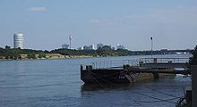
20:A view of the Danube from the harbour in Nußdorf
821:In 1983, the WHL received the right to use the
102:The harbour was established sometime after the
878:Kör vie 07-10: Public Art in Vienna, 2007-2010
365:An industrial and freight harbour in Simmering
902:
900:
687:There were proposals to build a harbour near
607:The harbour in Lobau (River kilometre 1916.4)
8:
1002:Die Stadt und der Strom - Wien und die Donau
960:“, k.k. Hof- und Staatsdruckerei, Wien 1902
338:"Die Ausgestaltung der Hafenanlagen in Wien"
185:The law envisaged the creation of temporary
941:(Manuscript), University Klagenfurt, p 25f
916:, Springer, Vienna/New York, 2008, p 240 f
854:three of all new vehicles sold in Austria.
912:, in: Christian Reder, Erich Klein (Hg.):
876:, in: Maria Taig, Barbara Horvath (Hg.):
712:had already made use of the mouth of the
657:) was to continue being processed by the
281:, which was used by the Austrian airline
799:WHG (Wiener Hafen Gesellschaft m.b.H.) (
379:where the waste processing plant now is.
862:
828:The harbour in Freudenau was decreed a
868:
866:
292:Seaplanes were stationed here during
7:
645:from Romania to the north. Oil from
1000:Christine Klusacek, Kurt Stimmer: „
1098:Buildings and structures in Vienna
1004:“, DACHS Verlagsges.m.b.H., Wien,
839:are expected to be produced here.
390:An industrial harbour in Freudenau
14:
846:is for its part provisioned with
710:Donaudampfschiffahrtsgesellschaft
130:, Nova, Fanto AG and Redeventza.
112:Donaudampfschiffahrtsgesellschaft
283:Österreichische Luftverkehrs AG
258:The winter harbour in Freudenau
118:and the subsequent collapse of
236:Kommission für Verkehrsanlagen
1:
1113:Ports and harbours of Austria
659:Ostmärkischen Mineralölwerken
451:Donau-Regulierungs-Kommission
345:A freight harbour near Albern
914:Graue Donau – Schwarzes Meer
874:BLU - Untitled/it is obvious
682:A harbour in Groß-Enzersdorf
577:(Cemetery of the Nameless).
95:A crane at the river harbour
87:The unenclosed river harbour
71:Landing points were located
36:During the Habsburg monarchy
970:“, Selbstverlag, Wien 1920
850:via the harbour in Albern.
519:Reich Ministry of Transport
446:The project manager of the
1129:
468:Following the collapse of
285:and the Hungarian company
263:works could be completed.
1074:48.1600167°N 16.4939972°E
842:A biomass power plant in
527:Reichsverkehrsministerium
480:In a document from 1942,
464:During the First Republic
399:Galopprennplatz Freudenau
169:'s floating barrier, the
1033:Yachthafen Wien-Kuchelau
801:"Vienna Harbour Society"
595:was invited to create a
220:), the flood barrier in
882:Mural am Alberner Hafen
782:Freudenauer Hafenbrücke
703:A harbour in Fischamend
575:Friedhof der Namenlosen
316:The harbour in Kuchelau
1079:48.1600167; 16.4939972
672:Projects (1938 – 1945)
526:
513:
505:
259:
96:
60:Natural landing points
21:
906:Ortrun Veichtlbauer:
823:Austrian coat of arms
549:to the heartlands of
511:
503:
257:
150:The expansion of the
94:
46:Wiener Neustadt Canal
19:
588:In 2010 the Italian
547:south-eastern Europe
214:Die Wasserwirtschaft
1103:Transport in Vienna
1070: /
891:, koer.or.at, 2010
504:Harbour near Albern
167:Wilhelm von Engerth
40:At the time of the
1038:2009-06-28 at the
936:2016-06-09 at the
887:2015-06-02 at the
763:container terminal
724:been appropriate.
514:
506:
407:An overflow sluice
260:
234:was tasked by the
156:local rail network
97:
22:
1108:History of Vienna
635:Jewish Hungarians
306:Mediterranean Sea
209:was built first.
42:Habsburg monarchy
26:Harbour in Vienna
1120:
1085:
1084:
1082:
1081:
1080:
1075:
1071:
1068:
1067:
1066:
1063:
1052:
1044:
1029:
1014:
997:
983:
976:Ludwig Brandl: „
973:
963:
945:
944:
926:
920:
919:
904:
895:
894:
872:Roman Tschiedl:
870:
744:Vienna Offensive
613:Donau-Oder-Kanal
458:Great Depression
218:Water management
207:Wiener Stadtbahn
146:The Danube Canal
1128:
1127:
1123:
1122:
1121:
1119:
1118:
1117:
1088:
1087:
1078:
1076:
1072:
1069:
1064:
1061:
1059:
1057:
1056:
1050:
1042:
1040:Wayback Machine
1027:
1021:
1012:
995:
986:Martin Schmid:
981:
971:
961:
953:
948:
942:
938:Wayback Machine
928:Martin Schmid:
927:
923:
917:
905:
898:
892:
889:Wayback Machine
871:
864:
860:
773:(around 32.700
751:Egon Friedinger
733:
731:Second Republic
689:Groß-Enzersdorf
674:
609:
582:Royal Air Force
569:during winter.
498:
478:
470:Austria-Hungary
466:
377:Kaiserebersdorf
357:Schwechat River
331:Austria-Hungary
327:
318:
252:
148:
120:Austria-Hungary
89:
62:
38:
12:
11:
5:
1126:
1124:
1116:
1115:
1110:
1105:
1100:
1090:
1089:
1054:
1053:
1048:Alberner Hafen
1045:
1030:
1020:
1019:External links
1017:
1016:
1015:
998:
984:
974:
964:
952:
949:
947:
946:
921:
896:
861:
859:
856:
819:
818:
811:
804:
732:
729:
706:
705:
685:
684:
673:
670:
608:
605:
557:was employed.
497:
494:
477:
474:
465:
462:
448:Lower Austrian
444:
443:
438:
437:
433:
432:
428:
427:
424:Langenzersdorf
419:
418:
410:
409:
403:
402:
393:
392:
386:
385:
381:
380:
368:
367:
361:
360:
348:
347:
326:
323:
317:
314:
251:
248:
226:Augartenbrücke
195:Franzensbrücke
191:Augartenbrücke
147:
144:
88:
85:
61:
58:
37:
34:
13:
10:
9:
6:
4:
3:
2:
1125:
1114:
1111:
1109:
1106:
1104:
1101:
1099:
1096:
1095:
1093:
1086:
1083:
1065:16°29′38.39″E
1049:
1046:
1041:
1037:
1034:
1031:
1026:
1023:
1022:
1018:
1011:
1010:3-85058-113-6
1007:
1003:
999:
993:
989:
985:
979:
975:
969:
965:
959:
955:
954:
950:
940:
939:
935:
932:
925:
922:
915:
911:
910:
903:
901:
897:
890:
886:
883:
879:
875:
869:
867:
863:
857:
855:
851:
849:
845:
840:
838:
833:
831:
826:
824:
816:
812:
809:
805:
802:
798:
797:
796:
793:
789:
787:
783:
778:
776:
772:
766:
764:
758:
756:
752:
747:
745:
740:
738:
730:
728:
725:
721:
719:
715:
711:
704:
701:
700:
699:
697:
692:
690:
683:
680:
679:
678:
671:
669:
667:
662:
660:
656:
655:Lower Austria
652:
648:
644:
640:
636:
631:
627:
625:
621:
616:
614:
606:
604:
602:
598:
594:
591:
590:street artist
586:
583:
578:
576:
570:
567:
562:
558:
556:
555:forced labour
552:
548:
544:
540:
536:
530:
528:
524:
520:
510:
502:
495:
493:
489:
487:
483:
482:Otto Broschek
475:
473:
471:
463:
461:
459:
454:
452:
449:
440:
439:
435:
434:
430:
429:
425:
421:
420:
416:
412:
411:
408:
405:
404:
400:
395:
394:
391:
388:
387:
383:
382:
378:
374:
373:Ostbahnbrücke
370:
369:
366:
363:
362:
358:
354:
350:
349:
346:
343:
342:
341:
339:
334:
332:
322:
315:
313:
311:
308:and northern
307:
303:
299:
295:
290:
288:
284:
280:
276:
271:
268:
264:
256:
249:
247:
245:
239:
237:
233:
229:
227:
223:
219:
215:
210:
208:
202:
200:
196:
192:
188:
183:
180:
176:
172:
168:
164:
159:
157:
153:
145:
143:
141:
137:
136:Donauuferbahn
131:
129:
123:
121:
117:
113:
109:
105:
100:
93:
86:
84:
82:
78:
74:
69:
66:
59:
57:
55:
54:Aspangbahnhof
51:
47:
43:
35:
33:
31:
27:
18:
1062:48°9′36.06″N
1055:
1025:Wiener Hafen
1001:
991:
987:
977:
967:
957:
929:
924:
913:
907:
877:
873:
852:
841:
834:
827:
820:
814:
807:
800:
794:
792:facilities.
790:
779:
767:
759:
748:
741:
737:World War II
734:
726:
722:
707:
702:
693:
686:
681:
675:
663:
658:
632:
628:
617:
610:
587:
579:
571:
563:
559:
551:Nazi Germany
539:biopolitical
531:
515:
490:
479:
467:
455:
450:
445:
406:
389:
364:
344:
337:
335:
328:
319:
294:World War II
291:
287:Aero-Express
275:flying boats
272:
269:
265:
261:
240:
235:
230:
217:
213:
211:
203:
189:between the
184:
160:
152:Danube Canal
149:
132:
124:
101:
98:
76:
72:
70:
67:
63:
39:
25:
23:
1077: /
1051:(in German)
1043:(in German)
1028:(in German)
1013:(in German)
996:(in German)
982:(in German)
972:(in German)
962:(in German)
943:(in German)
918:(in German)
893:(in German)
786:Franz Jonas
716:River near
651:Weinviertel
647:Zistersdorf
476:1938 – 1945
442:profitable.
232:Otto Wagner
116:World War I
1092:Categories
951:Literature
858:References
749:Architect
718:Fischamend
639:Ukrainians
620:Alte Donau
415:Donauinsel
199:Wien River
171:Schwimmtor
140:Handelskai
104:regulation
73:inter alia
50:Wien Mitte
848:woodchips
844:Simmering
837:biodiesel
830:free port
771:Schilling
643:crude oil
624:Schwechat
601:The piece
279:seaplanes
244:Simmering
1036:Archived
934:Archived
885:Archived
696:Aderklaa
302:Romanian
193:and the
138:and the
649:in the
543:eastern
486:Endsieg
310:Germany
222:Nußdorf
163:Nußdorf
106:of the
1008:
735:After
714:Fischa
566:faeces
537:- and
523:German
353:Albern
108:Danube
81:German
30:Danube
755:Roßau
597:mural
300:from
242:near
187:quays
179:locks
177:with
175:weirs
128:Shell
1006:ISBN
780:The
775:Euro
708:The
666:coal
637:and
545:and
277:and
77:Salz
777:).
593:BLU
535:geo
488:).
298:oil
83:).
79:in
1094::
899:^
865:^
698:.
668:.
525::
460:.
312:.
289:.
165:.
158:.
56:.
817:)
810:)
803:)
653:(
521:(
401:.
216:(
Text is available under the Creative Commons Attribution-ShareAlike License. Additional terms may apply.