487:
Shoal, Halcyon, Harts, Leet, Rector, Sand Creek, Shively, Spottswood, Toney, Warren, and
Whirlwind. The larger community includes the following watersheds: Big Harts Creek (Lincoln and Logan counties), Big Ugly Creek, Fourteen Mile Creek, a portion of Kiahs Creek, Little Harts Creek, Little Ugly Creek, Sand Creek, Dry Branch, Browns Branch, Swift Shoals Branch, Walker Branch, Fowler Branch, Douglas Branch, Green Shoal Creek, and Abbotts Branch. These various locations were populated by numerous families prior to 1840: Brumfield, Elkins, Gore, Adkins, Fry, Brown, Lucas, Spurlock, Toney, Vance, Workman, Conley, Rowe, Adams, Browning, Collins, Dingess, Dolen, Heart, Johnson, Lambert, Lilly, Perry, Tomblin, Hensley, Butcher, White, Mullins, Dalton, Thompson, Dempsey, Abbott, Blankenship, Butcher, Estep, Farley, Ferrell, Nester, Richards, Spears, Dial, Carter, and Farmer. Most early settlers were of English origin.
761:
42:
482:
passed through town. In 1910, Hart PO was discontinued. In 1916, Lewis
Dempsey established Harts Post Office, which continues today. Prominent merchants during this time and in subsequent decades included F.E. Adkins, Herb Adkins, P.B. "Fed" Adkins, Hollena Brumfield, Fisher B. Adkins, Watson Adkins,
473:
In 1869, the area became part of
Lincoln County. In November or December 1870, Henry S. Godby established Hearts Creek Post Office. The Hearts Creek PO was discontinued in 1872. In 1877, merchant William T. "Bill" Fowler established Hart's Creek Post Office. This post office was discontinued in 1880.
486:
The Harts Creek community includes the Harts Creek
District of Lincoln County and a portion of Chapmanville District in Logan County. It includes the following communities, many of which once had post offices which are now closed: Atenville, Bulwark, Enzelo, Ferrellsburg, Fourteen, Fry, Gill, Green
425:
In the CDP, the population was spread out, with 24.6% under the age of 18, 10.3% from 18 to 24, 29.6% from 25 to 44, 25.2% from 45 to 64, and 10.3% who were 65 years of age or older. The median age was 36 years. For every 100 females, there were 102.8 males. For every 100 females age 18 and over,
421:
living together, 10.4% had a female householder with no husband present, and 18.3% were non-families. 17.0% of all households were made up of individuals, and 7.1% had someone living alone who was 65 years of age or older. The average household size was 2.75 and the average family size was 3.07.
445:
Harts (town), situated at the mouth of Big Harts Creek, is named for
Stephen Hart (Heart), an early settler who once lived in the area, or his father, the latter killed by Native Americans in the vicinity. Richard Elkins was the first permanent settler, arriving in 1807 or 1815. At the time of
54:
462:, Isaac Adkins (who lived at the present-day site of the Harts Fire Department) operated a large farm at "Harts Bottom." He was one of the area's most prominent landowners; Isaac Adkins Shoals are named for him. In the 1840s, James Toney, a native of present-day
377:
The census area includes both Big Harts Creek and Little Harts Creek. The West Fork of Big Harts Creek is often misidentified as "East Fork" on maps and in deeds. However, the West Fork was named for a man by the name of West, not the direction of the creek.
1079:
301:
694:
429:
The median income for a household in the CDP was $ 21,703, and the median income for a family was $ 24,886. Males had a median income of $ 31,250 versus $ 20,357 for females. The
466:, acquired land from the Elkins settlers at the mouth of Big Harts Creek, just across the Guyandotte from Harts Bottom. During the Civil War, nearly all local men served in the
374:, the Harts CDP has a total area of 9.3 square miles (24.1 km), of which 9.2 square miles (23.8 km) are land and 0.1 square miles (0.3 km), or 1.44%, are water.
478:
occurred in Harts and garnered headlines in newspapers across the United States. During the 1890s, Al and
Hollena Brumfield were the most prominent residents. In 1904, the
1084:
1089:
394:
was 78.9 people per square mile (30.5/km). There were 1,004 housing units at an average density of 33.5/sq mi (13.0/km). The racial makeup of the CDP was 99.36%
454:. Prominent early families who settled in the present-day town of Harts included the Elkins, Adkins, and Toney families. After 1824, the area became a part of
951:
687:
251:
680:
635:
359:
passes through the center of the community, following the
Guyandotte River. The highway leads northwest (downstream) 44 miles (71 km) to
67:
261:
327:
123:
672:
508:
202:
591:
886:
704:
447:
399:
285:
128:
53:
1049:
996:
876:
451:
956:
861:
661:
566:
533:
463:
455:
371:
364:
313:
750:
831:
826:
780:
360:
297:
41:
1021:
1006:
961:
856:
816:
309:
239:
99:
976:
866:
772:
663:
West
Virginia Place Names: Their Origin and Meaning, Including the Nomenclature of the Streams and Mountains
467:
417:
There were 858 households, out of which 36.2% had children under the age of 18 living with them, 66.2% were
277:
32:
1016:
1001:
986:
971:
946:
931:
926:
896:
407:
356:
1026:
966:
916:
911:
846:
841:
836:
821:
745:
726:
1056:
1011:
906:
901:
891:
811:
806:
737:
411:
212:
981:
941:
921:
881:
851:
796:
475:
403:
395:
305:
991:
936:
871:
459:
391:
430:
433:
for the CDP was $ 10,697. About 22.9% of families and 26.2% of the population were below the
390:
of 2000, there were 2,361 people, 858 households, and 700 families residing in the CDP. The
293:
446:
Elkins' settlement, depending on which year is accurate, the present-day town was part of
281:
479:
1073:
289:
244:
116:
104:
474:
In 1881, Andrew D. Robinson established the Hart Post Office. During the 1880s, the
434:
534:"Total Population: 2010 Census DEC Summary File 1 (P1), Harts CDP, West Virginia"
719:
111:
636:"U.S. Geological Survey 7.5-minute topographic map series: Ranger quadrangle"
342:
329:
82:
69:
613:
193:
437:, including 31.7% of those under age 18 and 17.3% of those age 65 or over.
1040:‡This populated place also has portions in an adjacent county or counties
418:
227:
387:
219:
198:
676:
759:
587:
302:
Huntington-Ashland, WV-KY-OH, Metropolitan
Statistical Area
1080:
Census-designated places in
Lincoln County, West Virginia
562:
18:
Census-designated place in West Virginia, United States
503:
501:
499:
1035:
795:
771:
736:
260:
250:
238:
226:
209:
192:
184:
176:
171:
163:
155:
147:
139:
134:
122:
110:
98:
23:
666:. Piedmont, WV: The Place Name Press. p. 666.
363:and southeast (upstream) 10 miles (16 km) to
300:, its population was 656. Harts is a part of the
324:Harts is located in southern Lincoln County at
688:
528:
526:
8:
509:"2020 U.S. Gazetteer Files – West Virginia"
760:
695:
681:
673:
414:of any race were 0.21% of the population.
20:
1085:Census-designated places in West Virginia
1090:Populated places on the Guyandotte River
616:. Geography Division, U.S. Census Bureau
495:
249:
225:
191:
170:
162:
133:
97:
62:
50:
38:
557:
555:
259:
237:
208:
183:
175:
154:
146:
138:
121:
109:
7:
614:"TIGERweb: Harts CDP, West Virginia"
406:, and 0.42% from two or more races.
292:, United States, situated along the
151:9.18 sq mi (23.77 km)
143:9.31 sq mi (24.12 km)
159:0.14 sq mi (0.35 km)
703:Municipalities and communities of
304:(MSA). The Harts CDP includes the
14:
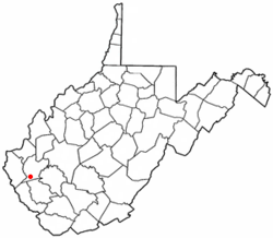
58:Location of Harts, West Virginia
52:
40:
592:United States Geological Survey
588:"US Board on Geographic Names"
1:
706:Lincoln County, West Virginia
511:. United States Census Bureau
567:United States Census Bureau
372:United States Census Bureau
1106:
1045:
757:
717:
355:(38.030643, -82.128147).
63:
51:
39:
30:
167:630 ft (192 m)
468:Confederate States Army
426:there were 99.1 males.
278:census-designated place
188:71/sq mi (27.6/km)
33:Census-designated place
765:
660:Kenny, Hamill (1945).
357:West Virginia Route 10
308:communities of Harts,
280:(CDP) at the mouth of
763:
563:"U.S. Census website"
343:38.03056°N 82.12806°W
211: • Summer (
83:38.03056°N 82.12806°W
1058:United States portal
1051:West Virginia portal
540:. U.S. Census Bureau
185: • Density
46:Harts Baptist Church
25:Harts, West Virginia
476:Lincoln County Feud
348:38.03056; -82.12806
339: /
88:38.03056; -82.12806
79: /
766:
764:Lincoln County map
594:. October 25, 2007
392:population density
316:, and Sand Creek.
177: • Total
156: • Water
140: • Total
1067:
1066:
431:per capita income
370:According to the
271:
270:
148: • Land
1097:
1059:
1052:
762:
729:
722:
712:
707:
697:
690:
683:
674:
668:
667:
657:
651:
650:
648:
646:
632:
626:
625:
623:
621:
610:
604:
603:
601:
599:
584:
578:
577:
575:
573:
559:
550:
549:
547:
545:
530:
521:
520:
518:
516:
505:
483:and L.T. Jones.
480:C&O Railroad
354:
353:
351:
350:
349:
344:
340:
337:
336:
335:
332:
294:Guyandotte River
216:
94:
93:
91:
90:
89:
84:
80:
77:
76:
75:
72:
56:
44:
21:
1105:
1104:
1100:
1099:
1098:
1096:
1095:
1094:
1070:
1069:
1068:
1063:
1057:
1050:
1041:
1031:
798:
791:
767:
755:
732:
727:
720:
713:
710:
705:
701:
671:
659:
658:
654:
644:
642:
634:
633:
629:
619:
617:
612:
611:
607:
597:
595:
586:
585:
581:
571:
569:
561:
560:
553:
543:
541:
538:data.census.gov
532:
531:
524:
514:
512:
507:
506:
497:
493:
458:. Prior to the
443:
419:married couples
400:Native American
384:
347:
345:
341:
338:
333:
330:
328:
326:
325:
322:
282:Big Harts Creek
234:
210:
87:
85:
81:
78:
73:
70:
68:
66:
65:
59:
47:
35:
26:
19:
12:
11:
5:
1103:
1101:
1093:
1092:
1087:
1082:
1072:
1071:
1065:
1064:
1062:
1061:
1054:
1046:
1043:
1042:
1039:
1037:
1033:
1032:
1030:
1029:
1024:
1019:
1014:
1009:
1004:
999:
994:
989:
984:
979:
974:
969:
964:
959:
954:
949:
944:
939:
934:
929:
924:
919:
914:
909:
904:
899:
894:
889:
887:Griffithsville
884:
879:
874:
869:
864:
859:
854:
849:
844:
839:
834:
829:
824:
819:
814:
809:
803:
801:
797:Unincorporated
793:
792:
790:
789:
784:
777:
775:
769:
768:
758:
756:
754:
753:
748:
742:
740:
734:
733:
718:
715:
714:
702:
700:
699:
692:
685:
677:
670:
669:
652:
627:
605:
579:
551:
522:
494:
492:
489:
448:Kanawha County
442:
439:
383:
380:
321:
318:
306:unincorporated
286:Lincoln County
269:
268:
265:
258:
257:
254:
248:
247:
242:
236:
235:
232:
230:
224:
223:
217:
207:
206:
196:
190:
189:
186:
182:
181:
178:
174:
173:
169:
168:
165:
161:
160:
157:
153:
152:
149:
145:
144:
141:
137:
136:
132:
131:
126:
120:
119:
114:
108:
107:
102:
96:
95:
61:
60:
57:
49:
48:
45:
37:
36:
31:
28:
27:
24:
17:
13:
10:
9:
6:
4:
3:
2:
1102:
1091:
1088:
1086:
1083:
1081:
1078:
1077:
1075:
1060:
1055:
1053:
1048:
1047:
1044:
1038:
1034:
1028:
1025:
1023:
1020:
1018:
1015:
1013:
1010:
1008:
1005:
1003:
1000:
998:
997:Spurlockville
995:
993:
990:
988:
985:
983:
980:
978:
975:
973:
970:
968:
965:
963:
960:
958:
955:
953:
952:Pleasant View
950:
948:
945:
943:
940:
938:
935:
933:
930:
928:
925:
923:
920:
918:
915:
913:
910:
908:
905:
903:
900:
898:
895:
893:
890:
888:
885:
883:
880:
878:
877:Garretts Bend
875:
873:
870:
868:
865:
863:
860:
858:
855:
853:
850:
848:
845:
843:
840:
838:
835:
833:
830:
828:
825:
823:
820:
818:
815:
813:
810:
808:
805:
804:
802:
800:
794:
788:
785:
782:
779:
778:
776:
774:
770:
752:
749:
747:
744:
743:
741:
739:
735:
731:
730:
723:
716:
711:United States
708:
698:
693:
691:
686:
684:
679:
678:
675:
665:
664:
656:
653:
641:
637:
631:
628:
615:
609:
606:
593:
589:
583:
580:
568:
564:
558:
556:
552:
539:
535:
529:
527:
523:
510:
504:
502:
500:
496:
490:
488:
484:
481:
477:
471:
469:
465:
461:
457:
453:
452:Cabell County
449:
440:
438:
436:
432:
427:
423:
420:
415:
413:
409:
405:
401:
397:
393:
389:
381:
379:
375:
373:
368:
366:
362:
358:
352:
319:
317:
315:
311:
307:
303:
299:
295:
291:
290:West Virginia
287:
283:
279:
275:
266:
263:
255:
253:
246:
243:
241:
231:
229:
221:
218:
214:
204:
203:Eastern (EST)
200:
197:
195:
187:
179:
166:
158:
150:
142:
130:
127:
125:
118:
117:West Virginia
115:
113:
106:
105:United States
103:
101:
92:
64:Coordinates:
55:
43:
34:
29:
22:
16:
957:Portersville
862:Ferrellsburg
786:
725:
662:
655:
643:. Retrieved
639:
630:
618:. Retrieved
608:
596:. Retrieved
582:
570:. Retrieved
542:. Retrieved
537:
513:. Retrieved
485:
472:
464:Boone County
456:Logan County
444:
435:poverty line
428:
424:
416:
385:
382:Demographics
376:
369:
365:Chapmanville
323:
314:Ferrellsburg
296:. As of the
273:
272:
15:
799:communities
751:West Hamlin
721:County seat
640:ACME Mapper
598:January 31,
572:January 31,
346: /
298:2010 census
86: /
1074:Categories
832:Branchland
827:Bradyville
781:Alum Creek
491:References
386:As of the
361:Huntington
264:feature ID
172:Population
1036:Footnotes
1022:Woodville
1007:Sweetland
962:Priestley
857:Eden Park
817:Atenville
460:Civil War
334:82°7′41″W
331:38°1′50″N
320:Geography
310:Atenville
252:FIPS code
240:Area code
194:Time zone
164:Elevation
74:82°7′41″W
71:38°1′50″N
977:Sheridan
867:Fourteen
645:March 9,
620:March 9,
544:March 9,
515:March 9,
408:Hispanic
402:, 0.17%
398:, 0.04%
256:54-35596
228:ZIP code
1017:Wewanta
1002:Sumerco
987:Snowden
972:Redwing
947:Palermo
932:Minerva
927:Midkiff
897:Hubball
441:History
267:1540035
129:Lincoln
100:Country
1027:Yawkey
967:Ranger
917:Lattin
912:Kinder
847:Dollie
842:Cuzzie
837:Bulger
822:Bernie
746:Hamlin
728:Hamlin
412:Latino
388:census
124:County
1012:Toney
907:Jenks
902:Irene
892:Hager
812:Allen
807:Alkol
787:Harts
738:Towns
404:Asian
396:White
276:is a
274:Harts
233:25524
222:(EDT)
220:UTC-4
199:UTC-5
112:State
982:Sias
942:Myra
922:Leet
882:Gill
852:East
773:CDPs
647:2021
622:2021
600:2008
574:2008
546:2021
517:2021
262:GNIS
135:Area
992:Sod
937:Mud
872:Fry
450:or
410:or
284:in
245:304
213:DST
180:656
1076::
724::
709:,
638:.
590:.
565:.
554:^
536:.
525:^
498:^
470:.
367:.
312:,
288:,
783:‡
696:e
689:t
682:v
649:.
624:.
602:.
576:.
548:.
519:.
215:)
205:)
201:(
Text is available under the Creative Commons Attribution-ShareAlike License. Additional terms may apply.