79:
51:
86:
58:
34:
479:
331:, but is extremely rare among local temples, and shows the strong connection between this temple and the Yamato government. Heat marks can be seen on the surface of the foundation stone, and it is presumed that the pagoda was destroyed by fire.
326:
was found around the site of the pagoda, and it is presumed that it had a tuff platform with a masonry foundation similar to the Shōda temple ruins. This type of foundation is found in major temples in the central part of the
318:
and is the largest in
Okayama Prefecture, with a major axis of about 2.6 meters and a minor axis of about 2.1 meters with a hexagonal shallow depression in the center, where the central pillar of a
307:. The name of the temple is unknown as there are no historical records. It is presumed to be a temple associated with the Kibi-no-Kamimichi clan, a powerful family in the ancient
78:
541:
531:
135:
395:
273:. The temple no longer exists, but the foundation stone of the pagoda which once existed in the temple grounds was designated as a
50:
516:
456:
347:
339:
368:, and is thought to have been abandoned by the 11th century in the late Heian period. In addition, ceramics such as Nara
419:
483:
335:
250:
352:(approximately 110 meters square), but the exact scale and layout of the temple remains uncertain. Fragments of
338:
from 1972 to 1973 of the whole area centering on this foundation stone, the remains of the foundations of the
526:
274:
364:
have been unearthed. These indicate that this temple was built in the late Hakuho period, prospered in the
383:
536:
346:, South gate, and North gate were discovered, and it was estimated that the temple area was roughly one
294:
33:
243:
266:
123:
262:
213:
452:
376:
490:
521:
254:
247:
109:
415:
319:
308:
304:
286:
510:
357:
498:
361:
328:
191:
365:
315:
290:
150:
137:
353:
478:
343:
380:
258:
369:
299:
270:
113:
323:
372:, round inkstones, and earthenware have also been excavated.
285:
The Hata temple ruins are located in the middle of an
202:
197:
187:
179:
174:
166:
129:
119:
105:
253:located in the Akoda neighbourhood of what is now
235:
229:
449:(国指定史跡事典) National Historic Site Encyclopedia
8:
356:with double petaled lotus patterns from the
293:, about two kilometers south of the site of
19:
375:The site is about ten minutes on foot from
16:Asuka period temple ruins in Okayama, Japan
32:
18:
442:
440:
438:
436:
396:List of Historic Sites of Japan (Okayama)
85:
57:
297:, and near the presumed location of the
407:
314:The base of the pagoda is exposed in a
542:Buddhist archaeological sites in Japan
447:Isomura, Yukio; Sakai, Hideya (2012).
7:
532:7th-century establishments in Japan
14:
477:
84:
77:
56:
49:
214:National Historic Site of Japan
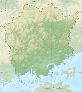
68:Show map of Okayama Prefecture
1:
360:and flat roof tiles from the
420:Agency for Cultural Affairs
236:
558:
336:archaeological excavation
230:
210:
93:Hata temple ruins (Japan)
43:
31:
24:
491:Okayama Prefectural site
289:on the left bank of the
151:34.681028°N 133.961639°E
517:Historic Sites of Japan
275:National Historic Site
486:at Wikimedia Commons
156:34.681028; 133.961639
246:with the ruins of a
244:archaeological site
147: /
21:
295:Shōda temple ruins
263:Okayama Prefecture
203:Public access
499:Okayama City site
482:Media related to
377:Takashima Station
225:Hata temple ruins
221:
220:
96:Show map of Japan
65:Hata temple ruins
38:Hata temple ruins
20:Hata temple ruins
549:
503:
495:
481:
466:
465:
462:
444:
431:
430:
428:
426:
412:
384:San'yō Main Line
241:
239:
233:
232:
162:
161:
159:
158:
157:
152:
148:
145:
144:
143:
140:
110:Naka-ku, Okayama
97:
88:
87:
81:
69:
60:
59:
53:
36:
22:
557:
556:
552:
551:
550:
548:
547:
546:
507:
506:
501:
493:
484:Hatahaiji Ruins
475:
470:
469:
463:
459:
446:
445:
434:
424:
422:
418:(in Japanese).
414:
413:
409:
404:
392:
342:, Middle gate,
320:Japanese pagoda
309:Kingdom of Kibi
283:
257:in the city of
251:Buddhist temple
227:
217:
216:
155:
153:
149:
146:
141:
138:
136:
134:
133:
101:
100:
99:
98:
95:
94:
91:
90:
89:
72:
71:
70:
67:
66:
63:
62:
61:
39:
27:
17:
12:
11:
5:
555:
553:
545:
544:
539:
534:
529:
527:Bizen Province
524:
519:
509:
508:
505:
504:
496:
474:
473:External links
471:
468:
467:
457:
432:
406:
405:
403:
400:
399:
398:
391:
388:
305:Bizen Province
287:alluvial plain
282:
279:
237:Hata Haiji ato
219:
218:
212:
211:
208:
207:
204:
200:
199:
195:
194:
189:
185:
184:
181:
177:
176:
172:
171:
168:
164:
163:
131:
127:
126:
121:
117:
116:
107:
103:
102:
92:
83:
82:
76:
75:
74:
73:
64:
55:
54:
48:
47:
46:
45:
44:
41:
40:
37:
29:
28:
25:
15:
13:
10:
9:
6:
4:
3:
2:
554:
543:
540:
538:
535:
533:
530:
528:
525:
523:
520:
518:
515:
514:
512:
502:(in Japanese)
500:
497:
494:(in Japanese)
492:
489:
488:
487:
485:
480:
472:
464:(in Japanese)
460:
454:
450:
443:
441:
439:
437:
433:
421:
417:
411:
408:
401:
397:
394:
393:
389:
387:
385:
382:
378:
373:
371:
367:
363:
359:
358:Hakuho period
355:
351:
350:
345:
341:
337:
332:
330:
325:
322:was erected.
321:
317:
312:
310:
306:
302:
301:
296:
292:
288:
280:
278:
276:
272:
268:
267:San'yō region
264:
260:
256:
252:
249:
248:Hakuhō period
245:
238:
226:
215:
209:
205:
201:
196:
193:
190:
186:
183:c.7th century
182:
178:
173:
169:
165:
160:
142:133°57′41.9″E
132:
128:
125:
124:San'yō region
122:
118:
115:
111:
108:
104:
80:
52:
42:
35:
30:
23:
537:Asuka period
476:
448:
423:. Retrieved
410:
374:
362:Heian period
348:
333:
329:Kinai region
313:
298:
284:
224:
222:
192:Asuka period
139:34°40′51.7″N
366:Nara period
334:During the
316:paddy field
291:Asahi River
170:temple ruin
154: /
130:Coordinates
511:Categories
458:4311750404
425:August 20,
402:References
354:roof tiles
198:Site notes
277:in 1944.
265:, in the
416:"幡多廃寺塔跡"
390:See also
344:cloister
106:Location
522:Okayama
451:. 学生社.
381:JR West
379:on the
281:History
259:Okayama
255:Naka-ku
188:Periods
180:Founded
175:History
455:
370:Sancai
300:Kokufu
242:is an
120:Region
340:Kondō
271:Japan
231:幡多廃寺跡
114:Japan
26:幡多廃寺跡
453:ISBN
427:2020
324:Tuff
223:The
167:Type
349:chō
303:of
269:of
206:Yes
513::
435:^
386:.
311:.
261:,
234:,
112:,
461:.
429:.
240:)
228:(
Text is available under the Creative Commons Attribution-ShareAlike License. Additional terms may apply.