180:
346:
192:
289:
17:
41:
88:
56:. The parks board developed a portion of the land in 1973 for public use, but the majority of the land remains in its original condition to be preserved for the future. Although the entire park is open to the public, the nature reserve area is to always kept free of development to continue Hays' dream of natural preservation of the land.
99:
The park has a paved looped hiking trail along the north part of the park. There is a large playground on the western side, a fishing lake near the creek, primitive restrooms, and picnic areas. The
Doolittle section of the Indian Creek Trail passes through the park and features a walking bridge over
95:
This park preserve covers 311 acres (1.26 km) and includes the Pilot Knob, the surrounding forest, and several rock outcrops overlooking Indian Creek that runs along the eastern side of the park. The forest consists largely of oak-hickory forest with beech-maple forest closer to the creek.
179:
431:
273:
406:
330:
421:
387:
71:, whose family operated the mill until the advent of electricity in the 1920s. The same mill was one of many threatened with burning by Confederate General
436:
191:
266:
416:
323:
426:
259:
411:
204:
316:
345:
380:
128:
353:
373:
288:
296:
53:
29:
60:
162:
59:
The park property has a history as interesting as its nature. The property was previously owned by
68:
16:
76:
357:
300:
243:
109:
72:
67:
in the curve of Indian Creek. He later sold the mill to John Peter Mauck, the founder of
49:
400:
64:
219:
206:
40:
87:
185:
Downtown
Corydon viewed from the Pilot Knob in the Hayswood Nature Reserve
151:
48:
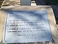
The preserve was donated to the citizens of
Harrison County in 1969 by
86:
39:
15:
136:
52:, A Corydon native and Professor Emeritus of History at the
91:
Big Indian Creek flows along the southern edge of the park
242:
This article related to a protected area in
Indiana is a
147:
145:
361:
304:
247:
432:
Louisville metropolitan area, Indiana geography stubs
129:Samuel P. Hays on National Forests and Ecology
381:
324:
267:
8:
407:Protected areas of Harrison County, Indiana
388:
374:
331:
317:
274:
260:
175:
121:
7:
342:
340:
285:
283:
239:
237:
422:Protected areas established in 1969
437:Louisville metropolitan area stubs
360:. You can help Knowledge (XXG) by
303:. You can help Knowledge (XXG) by
246:. You can help Knowledge (XXG) by
14:
344:
287:
190:
178:
417:1969 establishments in Indiana
28:is a county park owned by the
1:
427:Indiana protected area stubs
197:Reserve's dedication marker
63:. In 1820 he constructed a
36:The Samuel P. Hays donation
32:Park and Recreation Board.
453:
412:Nature reserves in Indiana
339:
282:
236:
297:Harrison County, Indiana
163:Hayswood Nature Preserve
54:University of Pittsburgh
30:Harrison County, Indiana
26:Hayswood Nature Preserve
152:Hayswood Nature Reserve
356:-related article is a
299:location article is a
133:History for the Future
92:
45:
21:
354:Louisville metro area
90:
43:
19:
216: /
93:
46:
22:
369:
368:
312:
311:
255:
254:
220:38.208°N 86.143°W
77:Battle of Corydon
61:Henry L. Fabrique
444:
390:
383:
376:
348:
341:
333:
326:
319:
291:
284:
276:
269:
262:
238:
231:
230:
228:
227:
226:
221:
217:
214:
213:
212:
209:
194:
182:
165:
160:
154:
149:
140:
126:
110:Corydon, Indiana
73:John Hunt Morgan
452:
451:
447:
446:
445:
443:
442:
441:
397:
396:
395:
394:
338:
337:
281:
280:
234:
225:38.208; -86.143
224:
222:
218:
215:
210:
207:
205:
203:
202:
198:
195:
186:
183:
174:
169:
168:
161:
157:
150:
143:
127:
123:
118:
106:
85:
38:
12:
11:
5:
450:
448:
440:
439:
434:
429:
424:
419:
414:
409:
399:
398:
393:
392:
385:
378:
370:
367:
366:
349:
336:
335:
328:
321:
313:
310:
309:
292:
279:
278:
271:
264:
256:
253:
252:
200:
199:
196:
189:
187:
184:
177:
173:
170:
167:
166:
155:
141:
120:
119:
117:
114:
113:
112:
105:
102:
84:
81:
50:Samuel P. Hays
37:
34:
20:Park Entrances
13:
10:
9:
6:
4:
3:
2:
449:
438:
435:
433:
430:
428:
425:
423:
420:
418:
415:
413:
410:
408:
405:
404:
402:
391:
386:
384:
379:
377:
372:
371:
365:
363:
359:
355:
350:
347:
343:
334:
329:
327:
322:
320:
315:
314:
308:
306:
302:
298:
293:
290:
286:
277:
272:
270:
265:
263:
258:
257:
251:
249:
245:
240:
235:
232:
229:
193:
188:
181:
176:
171:
164:
159:
156:
153:
148:
146:
142:
138:
134:
130:
125:
122:
115:
111:
108:
107:
103:
101:
97:
89:
82:
80:
78:
74:
70:
66:
62:
57:
55:
51:
42:
35:
33:
31:
27:
18:
362:expanding it
351:
305:expanding it
294:
248:expanding it
241:
233:
201:
158:
139:, Pittsburgh
132:
124:
98:
94:
58:
47:
25:
23:
223: /
100:the creek.
401:Categories
211:86°08′35″W
208:38°12′29″N
116:References
75:after the
65:water mill
83:Park area
69:Mauckport
44:Duck Pond
104:See also
172:Gallery
352:This
295:This
358:stub
301:stub
244:stub
137:WRCT
24:The
403::
144:^
135:,
131:,
79:.
389:e
382:t
375:v
364:.
332:e
325:t
318:v
307:.
275:e
268:t
261:v
250:.
Text is available under the Creative Commons Attribution-ShareAlike License. Additional terms may apply.