49:
923:
756:
451:
living together, 4.9% had a female householder with no husband present, and 24.5% were non-families. 19.4% of all households were made up of individuals, and 4.4% had someone living alone who was 65 years of age or older. The average household size was 2.56 and the average family size was 2.96.
455:
Age distribution was 20.2% under the age of 18, 10.1% from 18 to 24, 28.5% from 25 to 44, 32.3% from 45 to 64, and 8.9% who were 65 years of age or older. The median age was 41 years. For every 100 females, there were 98.9 males. For every 100 females age 18 and over, there were 96.7 males.
424:, there were 1,104 people, 432 households and 326 families residing in the city. The population density was 1,872.9 inhabitants per square mile (723.1/km). There were 442 housing units at an average density of 749.9 per square mile (289.5/km). The racial makeup of the city was 97.83%
48:
964:
659:
1008:
998:
62:
983:
459:
The median household income $ 51,146, and the median family income was $ 59,732. Males had a median income of $ 40,511 versus $ 26,875 for females. The
569:
1003:
252:
957:
652:
993:
855:
820:
805:
860:
262:
950:
810:
645:
483:
203:
429:
637:
433:
795:
116:
988:
621:
441:
317:
922:
735:
730:
740:
573:
399:
384:
369:
354:
294:
290:
930:
745:
725:
691:
669:
282:
240:
121:
94:
507:
893:
767:
278:
39:
835:
815:
447:
There were 432 households, of which 27.8% had children under the age of 18 living with them, 68.1% were
900:
850:
800:
541:
306:
213:
875:
785:
710:
437:
425:
865:
825:
720:
463:
for the city was $ 22,748. None of the families and 2.0% of the population were living below the
595:
880:
460:
310:
934:
570:"Geographic Identifiers: 2010 Demographic Profile Data (G001): Hebron Estates city, Kentucky"
305:
Hebron
Estates is located in northern Bullitt County 17 miles (27 km) south of downtown
870:
775:
17:
845:
840:
830:
977:
245:
508:
U.S. Geological Survey
Geographic Names Information System: Hebron Estates, Kentucky
464:
684:
104:
77:
64:
194:
542:"Summary and Reference Guide to House Bill 331 City Classification Reform"
320:, the city has a total area of 0.62 square miles (1.6 km), all land.
448:
286:
228:
109:
421:
519:
313:(North Preston Highway) forms the western border of the community.
220:
199:
702:
641:
755:
754:
289:, in the United States. The population was 1,014 as of the
467:, including no under eighteens and 5.7% of those over 64.
617:
572:. U.S. Census Bureau, American Factfinder. Archived from
16:
Not to be confused with the unincorporated community of
938:
53:
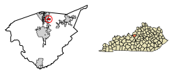
Location of Hebron
Estates in Bullitt County, Kentucky.
784:
766:
701:
261:
251:
239:
227:
210:
193:
185:
177:
172:
164:
156:
148:
140:
135:
127:
115:
103:
93:
30:
958:
653:
564:
562:
8:
965:
951:
660:
646:
638:
327:
27:
1009:Bullitt County, Kentucky geography stubs
475:
250:
226:
192:
171:
163:
134:
126:
92:
57:
45:
503:
501:
347:
293:, a small decrease from 1,087 in the
260:
238:
209:
184:
176:
155:
147:
139:
114:
102:
7:
999:Populated places established in 1984
919:
917:
759:Location of Bullitt County, Kentucky
444:, and 1.09% from two or more races.
160:0.00 sq mi (0.00 km)
152:0.59 sq mi (1.53 km)
144:0.59 sq mi (1.53 km)
984:Cities in Bullitt County, Kentucky
937:. You can help Knowledge (XXG) by
668:Municipalities and communities of
596:"Census of Population and Housing"
337:
14:
921:
47:
1004:1984 establishments in Kentucky
189:1,715.74/sq mi (662.91/km)
25:City in Kentucky, United States
1:
486:. United States Census Bureau
994:Louisville metropolitan area
933:state location article is a
520:"Hebron Estates KY ZIP Code"
622:United States Census Bureau
547:. Kentucky League of Cities
484:"2020 U.S. Gazetteer Files"
318:United States Census Bureau
1025:
916:
15:
889:
752:
682:
413:
398:
383:
368:
353:
346:
341:
336:
333:
58:
46:
37:
931:Bullitt County, Kentucky
671:Bullitt County, Kentucky
168:538 ft (164 m)
32:Hebron Estates, Kentucky
522:. zipdatamaps.com. 2023
760:
758:
618:"U.S. Census website"
414:U.S. Decennial Census
329:Historical population
212: • Summer (
78:38.05000°N 85.66806°W
902:United States portal
576:on February 12, 2020
279:home rule-class city
186: • Density
330:
83:38.05000; -85.66806
74: /
989:Cities in Kentucky
796:Bardstown Junction
761:
328:
178: • Total
157: • Water
141: • Total
20:, in Boone County.
946:
945:
911:
910:
461:per capita income
418:
417:
316:According to the
311:Kentucky Route 61
272:
271:
149: • Land
1016:
967:
960:
953:
925:
918:
903:
896:
757:
736:Mount Washington
731:Lebanon Junction
694:
687:
677:
672:
662:
655:
648:
639:
633:
632:
630:
628:
614:
608:
607:
605:
603:
592:
586:
585:
583:
581:
566:
557:
556:
554:
552:
546:
538:
532:
531:
529:
527:
516:
510:
505:
496:
495:
493:
491:
480:
430:African American
349:
344:
339:
331:
217:
89:
88:
86:
85:
84:
79:
75:
72:
71:
70:
67:
51:
28:
18:Hebron, Kentucky
1024:
1023:
1019:
1018:
1017:
1015:
1014:
1013:
974:
973:
972:
971:
914:
912:
907:
901:
895:Kentucky portal
894:
885:
787:
780:
762:
750:
741:Pioneer Village
697:
692:
685:
678:
675:
670:
666:
636:
626:
624:
616:
615:
611:
601:
599:
594:
593:
589:
579:
577:
568:
567:
560:
550:
548:
544:
540:
539:
535:
525:
523:
518:
517:
513:
506:
499:
489:
487:
482:
481:
477:
473:
449:married couples
434:Native American
342:
326:
303:
235:
211:
82:
80:
76:
73:
68:
65:
63:
61:
60:
54:
42:
33:
26:
21:
12:
11:
5:
1022:
1020:
1012:
1011:
1006:
1001:
996:
991:
986:
976:
975:
970:
969:
962:
955:
947:
944:
943:
926:
909:
908:
906:
905:
898:
890:
887:
886:
884:
883:
878:
873:
868:
863:
858:
853:
848:
843:
838:
833:
828:
823:
818:
813:
808:
803:
798:
792:
790:
786:Unincorporated
782:
781:
779:
778:
772:
770:
764:
763:
753:
751:
749:
748:
746:Shepherdsville
743:
738:
733:
728:
726:Hunters Hollow
723:
718:
716:Hebron Estates
713:
707:
705:
699:
698:
693:Shepherdsville
683:
680:
679:
667:
665:
664:
657:
650:
642:
635:
634:
609:
587:
558:
533:
511:
497:
474:
472:
469:
416:
415:
411:
410:
407:
405:
402:
396:
395:
392:
390:
387:
381:
380:
377:
375:
372:
366:
365:
362:
360:
357:
351:
350:
345:
340:
335:
325:
322:
302:
299:
283:Bullitt County
275:Hebron Estates
270:
269:
266:
259:
258:
255:
249:
248:
243:
237:
236:
233:
231:
225:
224:
218:
208:
207:
197:
191:
190:
187:
183:
182:
179:
175:
174:
170:
169:
166:
162:
161:
158:
154:
153:
150:
146:
145:
142:
138:
137:
133:
132:
129:
125:
124:
119:
113:
112:
107:
101:
100:
97:
91:
90:
56:
55:
52:
44:
43:
38:
35:
34:
31:
24:
13:
10:
9:
6:
4:
3:
2:
1021:
1010:
1007:
1005:
1002:
1000:
997:
995:
992:
990:
987:
985:
982:
981:
979:
968:
963:
961:
956:
954:
949:
948:
942:
940:
936:
932:
927:
924:
920:
915:
904:
899:
897:
892:
891:
888:
882:
879:
877:
874:
872:
869:
867:
864:
862:
859:
857:
854:
852:
849:
847:
844:
842:
839:
837:
834:
832:
829:
827:
824:
822:
819:
817:
814:
812:
809:
807:
804:
802:
799:
797:
794:
793:
791:
789:
783:
777:
774:
773:
771:
769:
765:
747:
744:
742:
739:
737:
734:
732:
729:
727:
724:
722:
719:
717:
714:
712:
709:
708:
706:
704:
700:
696:
695:
688:
681:
676:United States
673:
663:
658:
656:
651:
649:
644:
643:
640:
623:
619:
613:
610:
597:
591:
588:
575:
571:
565:
563:
559:
543:
537:
534:
521:
515:
512:
509:
504:
502:
498:
485:
479:
476:
470:
468:
466:
462:
457:
453:
450:
445:
443:
440:, 0.18% from
439:
435:
431:
427:
423:
412:
408:
406:
403:
401:
397:
393:
391:
388:
386:
382:
378:
376:
373:
371:
367:
363:
361:
358:
356:
352:
332:
323:
321:
319:
314:
312:
308:
300:
298:
296:
292:
288:
284:
280:
276:
267:
264:
256:
254:
247:
244:
242:
232:
230:
222:
219:
215:
205:
204:Eastern (EST)
201:
198:
196:
188:
180:
167:
159:
151:
143:
130:
123:
120:
118:
111:
108:
106:
99:United States
98:
96:
87:
59:Coordinates:
50:
41:
36:
29:
23:
19:
939:expanding it
928:
913:
715:
690:
625:. Retrieved
612:
600:. Retrieved
598:. Census.gov
590:
580:November 25,
578:. Retrieved
574:the original
551:December 30,
549:. Retrieved
536:
524:. Retrieved
514:
488:. Retrieved
478:
465:poverty line
458:
454:
446:
420:At the 2000
419:
324:Demographics
315:
304:
274:
273:
128:Incorporated
22:
856:Scuffletown
836:Gap in Knob
821:Cedar Grove
816:Brownington
806:Beech Grove
788:communities
686:County seat
627:January 31,
442:other races
295:2010 census
291:2020 census
81: /
978:Categories
861:Smithville
851:Salt River
801:Barrallton
471:References
307:Louisville
265:feature ID
173:Population
69:85°40′05″W
66:38°03′00″N
876:Whitfield
711:Fox Chase
490:March 18,
301:Geography
253:FIPS code
241:Area code
195:Time zone
165:Elevation
866:Solitude
826:Clermont
721:Hillview
526:June 16,
436:, 0.54%
432:, 0.18%
428:, 0.18%
287:Kentucky
257:21-35545
229:ZIP code
110:Kentucky
881:Zoneton
811:Belmont
602:June 4,
268:2404674
122:Bullitt
95:Country
871:Stites
776:Brooks
703:Cities
422:census
334:Census
117:County
929:This
846:Lotus
841:Hobbs
831:Cupio
545:(PDF)
438:Asian
426:White
409:−6.7%
404:1,014
394:−1.5%
389:1,087
379:18.7%
374:1,104
277:is a
234:40165
223:(EDT)
221:UTC-4
200:UTC-5
181:1,014
105:State
935:stub
629:2008
604:2015
582:2013
553:2014
528:2023
492:2022
400:2020
385:2010
370:2000
355:1990
343:Note
338:Pop.
263:GNIS
136:Area
131:1984
40:City
768:CDP
359:930
281:in
246:502
214:DST
980::
689::
674:,
620:.
561:^
500:^
348:%±
309:.
297:.
285:,
966:e
959:t
952:v
941:.
661:e
654:t
647:v
631:.
606:.
584:.
555:.
530:.
494:.
364:—
216:)
206:)
202:(
Text is available under the Creative Commons Attribution-ShareAlike License. Additional terms may apply.