42:
1064:
54:
74:
107:
448:. A post office named "Portage" opened on May 21, 1838, with John Davidson as the first postmaster. The name changed to "West Portage" on December 14, 1838, and then to "Henrietta" on May 13, 1840. The post office was discontinued on December 14, 1903. Another post office, named "South Henrietta", opened on September 5, 1851, with Henry Hurd as the first postmaster, and was succeeded by William D. Martin on May 10, 1853. The office continued until December 21, 1866.
114:
81:
622:, Roots was a station on the Western Jackson branch of the Grand Trunk Western Railroad. A post office named "Tanner" was established there on April 14, 1884. The name changed to "Roots" on September 11, 1885, then to "Valley Villa" on December 20, 1885, and the name of Roots was restored on March 1, 1890. The office was discontinued on November 14, 1904.
709:
In the township the population was spread out, with 27.3% under the age of 18, 7.7% from 18 to 24, 31.3% from 25 to 44, 24.1% from 45 to 64, and 9.5% who were 65 years of age or older. The median age was 36 years. For every 100 females, there were 103.7 males. For every 100 females age 18 and over,
665:
of 2000, there were 4,483 people, 1,614 households, and 1,276 families residing in the township. The population density was 123.7 inhabitants per square mile (47.8/km). There were 1,753 housing units at an average density of 48.4 per square mile (18.7/km). The racial makeup of the township was
705:
living together, 8.1% had a female householder with no husband present, and 20.9% were non-families. 16.3% of all households were made up of individuals, and 5.4% had someone living alone who was 65 years of age or older. The average household size was 2.76 and the average family size was 3.07.
443:
Jean
Baptiste Berard (also spelled Boreaux by descendants) claimed to have settled here in 1816 and had established a trading post in 1831. Nearby Batteese Lake and Batteese Creek were named after him, as his name was also commonly written as "Battise" by other early settlers. The township was
41:
463:
552:, just south of the lake of the same name. The lake was known as Spring Lake until John Wenstren purchased 1,800 acres (7.3 km) of land adjoining the lake in 1836. A village named Pleasant Lake was
515:
585:
713:
The median income for a household in the township was $ 48,517, and the median income for a family was $ 55,265. Males had a median income of $ 38,454 versus $ 26,079 for females. The
635:, the township has a total area of 37.05 square miles (95.96 km), of which 35.98 square miles (93.19 km) is land and 1.07 square miles (2.77 km) (2.89%) is water.
1002:
1411:
142:
1421:
1160:
1185:
1170:
1225:
1426:
639:
378:
106:
995:
1137:
73:
1142:
53:
1132:
388:
777:
988:
840:
307:
1215:
556:
in 1868, but never incorporated. A post office opened on
October 13, 1961, with Leo E. Osterberg as the first postmaster. The
1416:
947:
683:
671:
444:
organized in 1837 with the name "West
Portage". In 1839, Henry Hurd had the town renamed "Henrietta", after his home town of
980:
1220:
675:
650:
501:
196:
1235:
1230:
1190:
943:
745:
687:
632:
573:
891:
1205:
1195:
1165:
1268:
1253:
938:
432:
1343:
1210:
1200:
1180:
1012:
576:
and
Henrietta townships. The Munith post office with ZIP code 49259 also serves portions of Henrietta Township.
569:
420:
366:
201:
174:
59:
918:
907:
855:
765:
701:
There were 1,614 households, out of which 37.2% had children under the age of 18 living with them, 66.5% were
877:
866:
812:
801:
1381:
1333:
1308:
1273:
1245:
1075:
508:
351:
1298:
1263:
691:
643:
1088:
357:
1388:
1114:
1099:
695:
317:
856:
U.S. Geological Survey
Geographic Names Information System: South Henrietta Post Office (historical)
1348:
1293:
1283:
679:
667:
445:
1358:
1353:
1258:
1083:
717:
for the township was $ 19,904. About 1.3% of families and 3.3% of the population were below the
1338:
1328:
1318:
1104:
1094:
1053:
1034:
836:
714:
339:
1323:
1303:
1124:
564:
460:
is a mostly historical locale in the southeastern part of the township on Coon Hill Road at
345:
1313:
1109:
919:
U.S. Geological Survey
Geographic Names Information System: Roots Post Office (historical)
895:
230:
931:"Michigan: 2010 Population and Housing Unit Counts 2010 Census of Population and Housing"
766:
U.S. Geological Survey
Geographic Names Information System: Henrietta Township, Michigan
582:
is an unincorporated community on Root
Station Road between Jordon and Wooster roads at
512:
is an unincorporated community at the junction of N. Meridian Road and E. Berry Road at
1152:
867:
U.S. Geological Survey
Geographic Names Information System: Henrietta Station, Michigan
416:
32:
1405:
371:
930:
878:
U.S. Geological Survey
Geographic Names Information System: Pleasant Lake, Michigan
718:
1027:
424:
184:
601:
587:
531:
517:
479:
465:
157:
144:
298:
908:
U.S. Geological Survey Geographic Names Information System: Roots, Michigan
813:
U.S. Geological Survey Geographic Names Information System: Batteese Creek
1372:‡This populated place also has portions in an adjacent county or counties
888:
802:
U.S. Geological Survey Geographic Names Information System: Batteese Lake
721:, including 3.2% of those under age 18 and none of those age 65 or over.
702:
557:
428:
332:
189:
642:, which runs along the township's southern boundary and is part of the
662:
403:
324:
303:
1045:
975:
553:
984:
46:
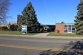
Henrietta Township Office and Eldon E. Katz Elementary School
1062:
741:
500:. It was a stop on the Western Jackson branch of the
1367:
1282:
1244:
1151:
1123:
1074:
1044:
835:. Detroit, Michigan: Wayne State University Press.
398:
387:
377:
365:
331:
314:
297:
289:
281:
276:
268:
260:
252:
244:
239:
228:
220:
215:
207:
195:
183:
173:
23:
996:
8:
1003:
989:
981:
698:of any race were 1.85% of the population.
113:
80:
20:
18:Civil township in Michigan, United States
1063:
946:. September 2012. p. 26 Michigan.
826:
824:
822:
820:
730:
568:is a small unincorporated community on
397:
376:
330:
296:
275:
267:
238:
214:
206:
172:
137:
65:
50:
38:
653:is located within Henrietta Township.
126:Henrietta Township (the United States)
1412:Townships in Jackson County, Michigan
953:from the original on October 19, 2012
736:
734:
386:
364:
313:
288:
280:
259:
251:
243:
227:
219:
194:
182:
93:Location within the state of Michigan
7:
1422:Populated places established in 1837
690:, and 0.67% from two or more races.
638:It is drained by tributaries of the
256:35.98 sq mi (93.2 km)
248:37.05 sq mi (96.0 km)
976:Henrietta Township official website
1011:Municipalities and communities of
431:. The population was 4,673 at the
264:1.07 sq mi (2.8 km)
14:
112:
105:
79:
72:
52:
40:
1427:1837 establishments in Michigan
898:, United States Postal Service
1:
560:for the post office in 49272.
129:Show map of the United States
651:Meridian-Baseline State Park
502:Grand Trunk Western Railroad
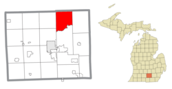
25:Henrietta Township, Michigan
944:United States Census Bureau
746:United States Census Bureau
633:United States Census Bureau
1443:
1377:
1060:
1025:
939:2010 United States Census
138:
66:
51:
39:
30:
1014:Jackson County, Michigan
710:there were 103.3 males.
572:on the boundary between
272:938 ft (286 m)
831:Romig, Walter (1986) .
221: • Supervisor
1068:
293:130/sq mi (49/km)
1417:Townships in Michigan
1066:
778:"Explore Census Data"
742:"U.S. Census website"
602:42.33556°N 84.32222°W
532:42.38000°N 84.34917°W
480:42.36333°N 84.28611°W
316: • Summer (
158:42.38333°N 84.31444°W
1390:United States portal
833:Michigan Place Names
290: • Density
96:Show map of Michigan
607:42.33556; -84.32222
597: /
537:42.38000; -84.34917
527: /
485:42.36333; -84.28611
475: /
446:Henrietta, New York
163:42.38333; -84.31444
154: /
1069:
894:2010-11-22 at the
413:Henrietta Township
282: • Total
261: • Water
245: • Total
120:Henrietta Township
87:Henrietta Township
1399:
1398:
1125:Charter townships
715:per capita income
631:According to the
491:Henrietta Station
458:Henrietta Station
410:
409:
253: • Land
1434:
1391:
1384:
1065:
1037:
1030:
1020:
1015:
1005:
998:
991:
982:
963:
962:
960:
958:
952:
935:
927:
921:
916:
910:
905:
899:
886:
880:
875:
869:
864:
858:
853:
847:
846:
828:
815:
810:
804:
799:
793:
792:
790:
788:
774:
768:
763:
757:
756:
754:
752:
738:
684:Pacific Islander
672:African American
621:
620:
618:
617:
616:
614:
609:
608:
603:
598:
595:
594:
593:
590:
551:
550:
548:
547:
546:
544:
539:
538:
533:
528:
525:
524:
523:
520:
499:
498:
496:
495:
494:
492:
487:
486:
481:
476:
473:
472:
471:
468:
406:
404:Official website
321:
169:
168:
166:
165:
164:
159:
155:
152:
151:
150:
147:
130:
116:
115:
109:
97:
83:
82:
76:
58:Location within
56:
44:
21:
1442:
1441:
1437:
1436:
1435:
1433:
1432:
1431:
1402:
1401:
1400:
1395:
1389:
1383:Michigan portal
1382:
1373:
1363:
1285:
1278:
1269:Vandercook Lake
1254:Michigan Center
1240:
1153:Civil townships
1147:
1119:
1070:
1067:Map of Michigan
1058:
1040:
1035:
1028:
1021:
1018:
1013:
1009:
972:
967:
966:
956:
954:
950:
933:
929:
928:
924:
917:
913:
906:
902:
896:Wayback Machine
889:ZIP Code Lookup
887:
883:
876:
872:
865:
861:
854:
850:
843:
830:
829:
818:
811:
807:
800:
796:
786:
784:
782:data.census.gov
776:
775:
771:
764:
760:
750:
748:
740:
739:
732:
727:
703:married couples
676:Native American
659:
629:
612:
610:
606:
604:
600:
599:
596:
591:
588:
586:
584:
583:
542:
540:
536:
534:
530:
529:
526:
521:
518:
516:
514:
513:
490:
488:
484:
482:
478:
477:
474:
469:
466:
464:
462:
461:
454:
441:
402:
361:
355:
349:
343:
315:
162:
160:
156:
153:
148:
145:
143:
141:
140:
134:
133:
132:
131:
128:
127:
124:
123:
122:
121:
117:
100:
99:
98:
95:
94:
91:
90:
89:
88:
84:
62:
47:
35:
26:
19:
12:
11:
5:
1440:
1438:
1430:
1429:
1424:
1419:
1414:
1404:
1403:
1397:
1396:
1394:
1393:
1386:
1378:
1375:
1374:
1371:
1369:
1365:
1364:
1362:
1361:
1356:
1351:
1346:
1344:Rives Junction
1341:
1336:
1331:
1326:
1321:
1316:
1311:
1306:
1301:
1296:
1290:
1288:
1280:
1279:
1277:
1276:
1271:
1266:
1261:
1256:
1250:
1248:
1242:
1241:
1239:
1238:
1233:
1228:
1223:
1218:
1213:
1208:
1203:
1198:
1193:
1188:
1183:
1178:
1173:
1168:
1163:
1157:
1155:
1149:
1148:
1146:
1145:
1140:
1135:
1129:
1127:
1121:
1120:
1118:
1117:
1112:
1107:
1102:
1097:
1092:
1086:
1080:
1078:
1072:
1071:
1061:
1059:
1057:
1056:
1050:
1048:
1042:
1041:
1026:
1023:
1022:
1010:
1008:
1007:
1000:
993:
985:
979:
978:
971:
970:External links
968:
965:
964:
922:
911:
900:
881:
870:
859:
848:
841:
816:
805:
794:
769:
758:
729:
728:
726:
723:
658:
655:
628:
625:
624:
623:
577:
561:
505:
453:
450:
440:
437:
421:Jackson County
417:civil township
408:
407:
400:
396:
395:
392:
385:
384:
381:
375:
374:
369:
363:
362:
337:
335:
329:
328:
322:
312:
311:
301:
295:
294:
291:
287:
286:
283:
279:
278:
274:
273:
270:
266:
265:
262:
258:
257:
254:
250:
249:
246:
242:
241:
237:
236:
233:
226:
225:
222:
218:
217:
213:
212:
209:
205:
204:
199:
193:
192:
187:
181:
180:
177:
171:
170:
136:
135:
125:
119:
118:
111:
110:
104:
103:
102:
101:
92:
86:
85:
78:
77:
71:
70:
69:
68:
67:
64:
63:
60:Jackson County
57:
49:
48:
45:
37:
36:
33:Civil township
31:
28:
27:
24:
17:
13:
10:
9:
6:
4:
3:
2:
1439:
1428:
1425:
1423:
1420:
1418:
1415:
1413:
1410:
1409:
1407:
1392:
1387:
1385:
1380:
1379:
1376:
1370:
1366:
1360:
1357:
1355:
1352:
1350:
1347:
1345:
1342:
1340:
1337:
1335:
1334:Pleasant Lake
1332:
1330:
1327:
1325:
1322:
1320:
1317:
1315:
1312:
1310:
1309:Lake Columbia
1307:
1305:
1302:
1300:
1297:
1295:
1292:
1291:
1289:
1287:
1281:
1275:
1274:Vineyard Lake
1272:
1270:
1267:
1265:
1262:
1260:
1257:
1255:
1252:
1251:
1249:
1247:
1243:
1237:
1234:
1232:
1229:
1227:
1224:
1222:
1219:
1217:
1214:
1212:
1209:
1207:
1204:
1202:
1199:
1197:
1194:
1192:
1189:
1187:
1184:
1182:
1179:
1177:
1174:
1172:
1169:
1167:
1164:
1162:
1159:
1158:
1156:
1154:
1150:
1144:
1141:
1139:
1136:
1134:
1131:
1130:
1128:
1126:
1122:
1116:
1113:
1111:
1108:
1106:
1103:
1101:
1098:
1096:
1093:
1090:
1087:
1085:
1082:
1081:
1079:
1077:
1073:
1055:
1052:
1051:
1049:
1047:
1043:
1039:
1038:
1031:
1024:
1019:United States
1016:
1006:
1001:
999:
994:
992:
987:
986:
983:
977:
974:
973:
969:
949:
945:
941:
940:
932:
926:
923:
920:
915:
912:
909:
904:
901:
897:
893:
890:
885:
882:
879:
874:
871:
868:
863:
860:
857:
852:
849:
844:
842:0-8143-1838-X
838:
834:
827:
825:
823:
821:
817:
814:
809:
806:
803:
798:
795:
783:
779:
773:
770:
767:
762:
759:
747:
743:
737:
735:
731:
724:
722:
720:
716:
711:
707:
704:
699:
697:
693:
689:
686:, 0.76% from
685:
681:
677:
673:
669:
664:
656:
654:
652:
649:A portion of
647:
645:
641:
640:Portage River
636:
634:
626:
619:
581:
578:
575:
571:
567:
566:
562:
559:
555:
549:
543:Pleasant Lake
511:
510:
509:Pleasant Lake
506:
503:
497:
459:
456:
455:
451:
449:
447:
438:
436:
434:
430:
426:
422:
418:
414:
405:
401:
393:
390:
382:
380:
373:
370:
368:
359:
353:
352:Pleasant Lake
347:
341:
336:
334:
326:
323:
319:
309:
308:Eastern (EST)
305:
302:
300:
292:
284:
271:
263:
255:
247:
234:
232:
229: •
223:
210:
203:
200:
198:
191:
188:
186:
179:United States
178:
176:
167:
139:Coordinates:
108:
75:
61:
55:
43:
34:
29:
22:
16:
1299:Farwell Lake
1264:Spring Arbor
1216:Spring Arbor
1175:
1033:
955:. Retrieved
937:
925:
914:
903:
884:
873:
862:
851:
832:
808:
797:
785:. Retrieved
781:
772:
761:
749:. Retrieved
719:poverty line
712:
708:
700:
660:
657:Demographics
648:
637:
630:
579:
563:
507:
457:
442:
412:
411:
15:
1286:communities
1089:Cement City
1029:County seat
751:January 31,
688:other races
646:watershed.
644:Grand River
605: /
535: /
483: /
452:Communities
433:2020 census
358:Stockbridge
333:ZIP code(s)
235:Sally Keene
224:Andy Grimes
208:Established
161: /
1406:Categories
1221:Springport
1138:Grass Lake
1115:Springport
1100:Grass Lake
725:References
661:As of the
611: (
592:84°19′20″W
589:42°20′08″N
541: (
522:84°20′57″W
519:42°22′48″N
489: (
470:84°17′10″W
467:42°21′48″N
425:U.S. state
391:feature ID
277:Population
216:Government
149:84°18′52″W
146:42°23′00″N
1368:Footnotes
1349:Sandstone
1294:Clarklake
1176:Henrietta
1143:Sandstone
787:April 27,
627:Geography
379:FIPS code
367:Area code
299:Time zone
269:Elevation
1359:Waterloo
1354:Tompkins
1259:Napoleon
1236:Waterloo
1231:Tompkins
1191:Napoleon
1161:Columbia
1133:Blackman
1084:Brooklyn
1076:Villages
948:Archived
892:Archived
692:Hispanic
682:, 0.07%
678:, 0.09%
674:, 0.49%
670:, 0.42%
574:Waterloo
558:ZIP code
429:Michigan
383:26-37700
190:Michigan
1339:Pulaski
1329:Norvell
1319:Liberty
1206:Pulaski
1196:Norvell
1186:Liberty
1171:Hanover
1166:Concord
1105:Hanover
1095:Concord
1054:Jackson
1036:Jackson
666:97.50%
554:platted
439:History
423:in the
399:Website
394:1626465
356:49285 (
350:49272 (
344:49259 (
340:Jackson
338:49201 (
202:Jackson
175:Country
1324:Munith
1304:Horton
1226:Summit
957:May 1,
839:
696:Latino
663:census
565:Munith
346:Munith
197:County
1314:Leoni
1284:Other
1211:Rives
1201:Parma
1181:Leoni
1110:Parma
951:(PDF)
934:(PDF)
680:Asian
668:White
613:Roots
580:Roots
570:M-106
415:is a
327:(EDT)
325:UTC-4
304:UTC-5
285:4,673
231:Clerk
185:State
1246:CDPs
1046:City
959:2020
837:ISBN
789:2024
753:2008
389:GNIS
240:Area
211:1837
694:or
427:of
419:of
372:517
318:DST
1408::
1032::
1017:,
942:.
936:.
819:^
780:.
744:.
733:^
435:.
1091:‡
1004:e
997:t
990:v
961:.
845:.
791:.
755:.
615:)
545:)
504:.
493:)
360:)
354:)
348:)
342:)
320:)
310:)
306:(
Text is available under the Creative Commons Attribution-ShareAlike License. Additional terms may apply.