67:
39:
74:
46:
288:
with footprints preserved, and the foundations of timber-framed buildings were discovered. Further in the hills, a cemetery was also discovered. The site covers an area of 6.3 hectares. The settlement was surrounded by ring moat measuring 130 meters from east-to-west by 110 meters from
66:
328:
440:
430:
385:
38:
123:
445:
352:
305:
435:
276:
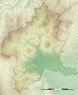
The Hidaka site is located in the southern end of the
Somagahara fluvial fan on the southeastern foothills of
281:
425:
309:
241:
265:
209:
381:
253:
249:
97:
407:
257:
111:
419:
294:
290:
277:
245:
179:
348:
316:
298:
285:
280:. It was discovered in 1977 during preliminary survey work for the route of the
138:
125:
301:, which provides a precise dating to the latter half of the 3rd century AD.
293:. The village site is preserved in good condition as it was covered with a
248:
settlement located in what is now the Hidaka neighborhood of the city of
313:
268:
in 1989, with the area designated expanded in 1998 and again in 2000.
304:
The site, which is now a grassy field, having been backfilled after
261:
101:
16:
Ruins of a Yayoi period settlement in
Takasaki, Japan
198:
190:
185:
175:
167:
162:
154:
117:
107:
93:
308:, is located about 20 minutes on foot from the
231:
225:
378:(国指定史跡事典) National Historic Site Encyclopedia
8:
19:
289:north-to-south. Within were a total of 17
18:
371:
369:
340:
329:List of Historic Sites of Japan (Gunma)
376:Isomura, Yukio; Sakai, Hideya (2012).
7:
73:
45:
14:
72:
65:
44:
37:
266:National Historic Site of Japan
210:National Historic Site of Japan
1:
441:Archaeological sites in Japan
264:. The site was designated a
56:Show map of Gunma Prefecture
431:History of Gunma Prefecture
408:Takasaki City official site
353:Agency for Cultural Affairs
232:
462:
297:layer from an eruption of
244:containing the ruins of a
202:Yes (No public facilities)
226:
206:
31:
24:
446:Historic Sites of Japan
139:36.36806°N 139.03194°E
282:Kan'etsu Expressway
242:archaeological site
144:36.36806; 139.03194
135: /
81:Hidaka Site (Japan)
21:
199:Public access
284:. Traces of rice
217:
216:
84:Show map of Japan
453:
412:
395:
394:
391:
373:
364:
363:
361:
359:
345:
256:in the northern
254:Gunma Prefecture
239:
238:
235:
229:
228:
150:
149:
147:
146:
145:
140:
136:
133:
132:
131:
128:
85:
76:
75:
69:
57:
48:
47:
41:
22:
461:
460:
456:
455:
454:
452:
451:
450:
436:Takasaki, Gunma
416:
415:
410:
404:
399:
398:
392:
388:
375:
374:
367:
357:
355:
351:(in Japanese).
347:
346:
342:
337:
325:
274:
236:
223:
213:
212:
143:
141:
137:
134:
129:
126:
124:
122:
121:
98:Takasaki, Gunma
89:
88:
87:
86:
83:
82:
79:
78:
77:
60:
59:
58:
55:
54:
51:
50:
49:
27:
17:
12:
11:
5:
459:
457:
449:
448:
443:
438:
433:
428:
418:
417:
414:
413:
403:
402:External links
400:
397:
396:
387:978-4311750403
386:
365:
339:
338:
336:
333:
332:
331:
324:
321:
273:
270:
215:
214:
208:
207:
204:
203:
200:
196:
195:
192:
188:
187:
183:
182:
177:
173:
172:
171:3rd century AD
169:
165:
164:
160:
159:
156:
152:
151:
119:
115:
114:
109:
105:
104:
95:
91:
90:
80:
71:
70:
64:
63:
62:
61:
52:
43:
42:
36:
35:
34:
33:
32:
29:
28:
25:
15:
13:
10:
9:
6:
4:
3:
2:
458:
447:
444:
442:
439:
437:
434:
432:
429:
427:
424:
423:
421:
411:(in Japanese)
409:
406:
405:
401:
393:(in Japanese)
389:
383:
379:
372:
370:
366:
354:
350:
344:
341:
334:
330:
327:
326:
322:
320:
318:
315:
311:
307:
302:
300:
296:
292:
291:pit dwellings
287:
283:
279:
271:
269:
267:
263:
259:
255:
251:
247:
243:
234:
222:
211:
205:
201:
197:
193:
189:
184:
181:
178:
174:
170:
166:
161:
157:
153:
148:
120:
116:
113:
110:
106:
103:
99:
96:
92:
68:
40:
30:
23:
426:Yayoi period
377:
356:. Retrieved
343:
303:
295:volcanic ash
286:paddy fields
278:Mount Haruna
275:
258:Kantō region
246:Yayoi period
233:Hidaka iseki
221:Hidaka ruins
220:
218:
180:Yayoi period
112:Kantō region
317:Joetsu Line
310:Ino Station
299:Mount Asama
142: /
130:139°01′55″E
118:Coordinates
53:Hidaka Site
20:Hidaka Site
420:Categories
358:August 20,
335:References
306:excavation
191:Discovered
186:Site notes
158:settlement
127:36°22′05″N
168:Abandoned
323:See also
272:Overview
250:Takasaki
94:Location
380:. 学生社.
314:JR East
312:on the
176:Periods
163:History
384:
349:"日高遺跡"
240:is an
108:Region
262:Japan
102:Japan
382:ISBN
360:2020
227:日高遺跡
219:The
194:1977
155:Type
26:日高遺跡
260:of
422::
368:^
319:.
252:,
230:,
100:,
390:.
362:.
237:)
224:(
Text is available under the Creative Commons Attribution-ShareAlike License. Additional terms may apply.