119:
259:
126:
186:
29:
240:
75:
239:
258:
118:
328:
308:
221:, is the highest point in the Dransfeld region by a long way. It lies within the Dransfeld Municipal Forest, a hill massif in the
365:
370:
68:
198:
202:
159:
222:
206:
171:
304:
283:
185:
38:
28:
325:
332:
230:
359:
279:
301:
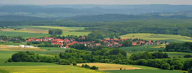
Stadt
Dransfeld. Ein geschichtlicher Rückblick vom 19. Jahrhundert bis zur Frühzeit
138:
246:
226:
59:
90:
77:
218:
265:
303:. Vol. 1. Horb am Neckar: Geiger-Verlag, 1999. S.196-200,352-360,387-397.
338:
School hall of residence and educational establishment on the Hoher Hagen
164:
142:
34:
176:
52:
184:
347:
337:
250:
197:
is a volcanic hill that is still 480 m high today, in the
342:
170:
158:
153:
106:
67:
51:
46:
21:
343:Information on the Gauss Tower on the Hoher Hagen
245:View from Hoher Hagen looking northeast over
8:
189:View into the basalt quarry in January 2007
18:
326:Further information about the Hoher Hagen
235:
268:from the Gauß Tower on the Hoher Hagen
278:On top of the Hoher Hagen stands the
7:
217:The hill, which is located south of
125:
14:
257:
238:
124:
117:
27:
225:that is about halfway between
1:
288:478 m above NN
201:, in the German district of
58:480 m above
387:
199:Dransfeld Municipal Forest
111:
33:The Hohe Hagen seen from
26:
282:, a 51 metre high
190:
366:Hills of Lower Saxony
229:to the northeast and
188:
41:is in the foreground.
371:Volcanoes of Germany
91:51.47389°N 9.76583°E
348:Information on the
87: /
16:Mountain in Germany
331:2007-12-14 at the
233:to the southwest.
223:Münden Nature Park
207:South Lower Saxony
191:
47:Highest point
299:Rehkop, Friedel:
284:observation tower
183:
182:
96:51.47389; 9.76583
378:
289:
261:
242:
128:
127:
121:
102:
101:
99:
98:
97:
92:
88:
85:
84:
83:
80:
62:
31:
19:
386:
385:
381:
380:
379:
377:
376:
375:
356:
355:
350:Hasenmelkerlauf
333:Wayback Machine
322:
317:
296:
287:
276:
269:
262:
253:
243:
215:
149:
148:
147:
146:
145:
136:
135:
134:
133:
129:
95:
93:
89:
86:
81:
78:
76:
74:
73:
63:(1,570 ft)
57:
42:
17:
12:
11:
5:
384:
382:
374:
373:
368:
358:
357:
354:
353:
345:
340:
335:
321:
320:External links
318:
316:
313:
312:
311:
295:
292:
275:
272:
271:
270:
263:
256:
254:
244:
237:
214:
211:
181:
180:
174:
168:
167:
162:
156:
155:
151:
150:
137:
131:
130:
123:
122:
116:
115:
114:
113:
112:
109:
108:
104:
103:
71:
65:
64:
60:sea level (NN)
55:
49:
48:
44:
43:
32:
24:
23:
15:
13:
10:
9:
6:
4:
3:
2:
383:
372:
369:
367:
364:
363:
361:
352:
351:
346:
344:
341:
339:
336:
334:
330:
327:
324:
323:
319:
314:
310:
309:3-89570-561-6
306:
302:
298:
297:
293:
291:
285:
281:
273:
267:
260:
255:
252:
248:
241:
236:
234:
232:
228:
224:
220:
212:
210:
208:
204:
200:
196:
187:
178:
175:
173:
169:
166:
163:
161:
160:Mountain type
157:
152:
144:
140:
120:
110:
105:
100:
72:
70:
66:
61:
56:
54:
50:
45:
40:
36:
30:
25:
20:
349:
300:
277:
231:Hann. Münden
216:
194:
192:
172:Type of rock
139:Lower Saxony
195:Hoher Hagen
132:Hoher Hagen
94: /
69:Coordinates
22:Hoher Hagen
360:Categories
315:References
280:Gauß Tower
274:Gauß Tower
79:51°28′26″N
247:Göttingen
227:Göttingen
219:Dransfeld
213:Geography
203:Göttingen
179:extrusion
107:Geography
82:9°45′57″E
53:Elevation
329:Archived
264:View of
294:Sources
249:to the
165:volcano
154:Geology
143:Germany
35:Scheden
307:
266:Jühnde
177:basalt
37:. The
305:ISBN
251:Harz
193:The
290:.
286:at
205:in
39:B 3
362::
209:.
141:,
Text is available under the Creative Commons Attribution-ShareAlike License. Additional terms may apply.