363:
configuration, with a main mall and two side buildings to the east and two side buildings to the west, forming a central courtyard. The building pillars were originally set directly into the ground. Phase II is estimated to be from the first half of the 9th century to the first half of the 10th century. The number of side buildings was reduced to one on each side, but a gate was added to the south of the complex. Phase III is estimated to be from the first half of the 10th century to the second half of the 10th century. During this phase, the buildings had transitioned to using foundation stones. Phase IV is from the latter half of the 10th century to the middle of the 11th century. The complex was in decline and consisted only of the main hall and the eastern side building.
76:
83:
55:
48:
31:
338:
highway a short distance to the south. The actual location had bene lost for several centuries. Despite the perseverance of place names such as "Fuchu" and "Kokufu Minato" indicating that the site was in this general vicinity, few Nara period or Heian period artifacts had been found.. The ruins were
362:
The archaeology of the site is complex, as the buildings on this site have been rebuilt on four separate occasions. Phase 1 is estimated to be from the end of the 8th century to the first half of the 9th century. During this time, he complex consisted of wooden buildings arranged in a "U"
319:, the official sent from the central government as provincial governor, along with buildings housing offices concerned with general administration, farming, finance, police and military. In the periphery there was a provincial school (
339:
rediscovered only in 1988 in conjunction with field improvement works. The site measures 200 meters from east-to-west by 150 meters from north-to-south, based on height differences from surrounding
75:
619:
132:
483:
604:
390:
584:
466:
609:
536:
47:
461:(in German). Vol. Band 2: Kulturlandschaft, Wirtschaftsgroßmacht auf engem Raum. Berlin: de Gruyter. pp. 69–70.
343:. This enclosed area is divided into squares measuring 40 meters on each side, surrounded by a narrow ditch. Numerous
482:
Atsuru Yagi (March 1986), "国府の成立と構造 -文献史料からみた-" [Formation and
Structure of Kokufu (Provincial Capitals)],
441:
558:
505:
274:
614:
594:
589:
335:
236:
315:
306:
296:
206:
599:
532:
497:
462:
456:
334:. The site is adjacent to the confluence of the three rivers, with the route of the ancient
378:
327:
247:
government administrative complex located in the
Sakanoshita neighborhood of the city of
371:
252:
30:
578:
256:
120:
356:
352:
270:
244:
184:
410:
367:
340:
291:
286:
240:
180:
331:
566:
501:
347:
pottery shards with ink inscriptions confirmed that this was the site of the
147:
134:
344:
248:
106:
351:. These shards also indicate that the complex was in use from the late
375:
309:, known as (郡, gun, kōri), composed of 2–20 townships in 715 AD. The
301:
265:
260:
110:
305:(provincial capital), and each province was divided into smaller
289:, after the establishment of a centralized government under the
313:
complex contained the official residence and offices of the
355:
at the end of the 8th century, and was abandoned in the
366:
The site is now backfilled and has mostly reverted to
326:
The Iga
Provincial Capital ruins are located on the
490:
Bulletin of the
National Museum of Japanese History
436:Shively, Donald H.; McCullough, William H. (1999).
195:
190:
176:
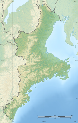
171:
163:
126:
116:
102:
228:
222:
529:(国指定史跡事典) National Historic Site Encyclopedia
8:
16:
438:Cambridge History of Japan vol. II (p.31f.)
323:), the garrison and storehouses for taxes.
417:(in Japanese). Agency for Cultural Affairs
29:
15:
522:
520:
518:
82:
54:
330:of the Tsuge River, a tributary of the
402:
527:Isomura, Yukio; Sakai, Hideya (2012).
370:. It is about a five-minute walk from
391:List of Historic Sites of Japan (Mie)
7:
620:8th-century establishments in Japan
359:in the middle of the 11th century.
273:, the site has been protected as a
14:
263:. Identified as the ruins of the
81:
74:
53:
46:
207:National Historic Site of Japan
1:
605:Archaeological sites in Japan
496:(in Japanese), p. 343,
295:system, local rule over the
218:Iga Provincial Capital ruins
62:Iga Provincial Capital ruins
35:Iga Provincial Capital ruins
17:Iga Provincial Capital ruins
229:
636:
442:Cambridge University Press
199:Yes (no public facilities)
65:Show map of Mie Prefecture
585:History of Mie Prefecture
458:Das Japanische Inselreich
299:was standardized under a
223:
203:
90:Iga Kokuchō ruins (Japan)
40:
28:
21:
559:Mie Prefecture home page
484:
415:Cultural Heritage Online
307:administrative districts
269:(provincial capital) of
610:Historic Sites of Japan
455:Martin Schwind (1981).
167:30,586.17 square meters
275:National Historic Site
148:34.80250°N 136.15778°E
239:with the ruins of a
237:archaeological site
153:34.80250; 136.15778
144: /
18:
567:Iga City home page
196:Public access
214:
213:
93:Show map of Japan
627:
571:
563:
546:
545:
542:
524:
513:
512:
510:
504:, archived from
495:
479:
473:
472:
452:
446:
445:
433:
427:
426:
424:
422:
407:
379:Kansai Main Line
234:
232:
226:
225:
159:
158:
156:
155:
154:
149:
145:
142:
141:
140:
137:
94:
85:
84:
78:
66:
57:
56:
50:
33:
19:
635:
634:
630:
629:
628:
626:
625:
624:
575:
574:
569:
561:
555:
550:
549:
543:
539:
526:
525:
516:
508:
493:
486:
481:
480:
476:
469:
454:
453:
449:
435:
434:
430:
420:
418:
409:
408:
404:
399:
387:
328:fluvial terrace
283:
230:Iga kokuchō ato
220:
210:
209:
152:
150:
146:
143:
138:
135:
133:
131:
130:
98:
97:
96:
95:
92:
91:
88:
87:
86:
69:
68:
67:
64:
63:
60:
59:
58:
36:
24:
12:
11:
5:
633:
631:
623:
622:
617:
612:
607:
602:
597:
592:
587:
577:
576:
573:
572:
564:
554:
553:External links
551:
548:
547:
537:
514:
474:
467:
447:
428:
401:
400:
398:
395:
394:
393:
386:
383:
372:Sanagu Station
282:
279:
253:Mie prefecture
212:
211:
205:
204:
201:
200:
197:
193:
192:
188:
187:
178:
174:
173:
169:
168:
165:
161:
160:
128:
124:
123:
118:
114:
113:
104:
100:
99:
89:
80:
79:
73:
72:
71:
70:
61:
52:
51:
45:
44:
43:
42:
41:
38:
37:
34:
26:
25:
22:
13:
10:
9:
6:
4:
3:
2:
632:
621:
618:
616:
613:
611:
608:
606:
603:
601:
598:
596:
593:
591:
588:
586:
583:
582:
580:
570:(in Japanese)
568:
565:
562:(in Japanese)
560:
557:
556:
552:
544:(in Japanese)
540:
534:
530:
523:
521:
519:
515:
511:on 2013-10-29
507:
503:
499:
491:
487:
485:国立歴史民俗博物館研究報告
478:
475:
470:
468:3-11-008319-1
464:
460:
459:
451:
448:
443:
439:
432:
429:
416:
412:
406:
403:
396:
392:
389:
388:
384:
382:
380:
377:
373:
369:
364:
360:
358:
354:
350:
346:
342:
337:
333:
329:
324:
322:
318:
317:
312:
308:
304:
303:
298:
294:
293:
288:
280:
278:
276:
272:
268:
267:
262:
258:
257:Kansai region
254:
250:
246:
242:
238:
231:
219:
208:
202:
198:
194:
189:
186:
182:
179:
175:
170:
166:
162:
157:
129:
125:
122:
121:Kansai region
119:
115:
112:
108:
105:
101:
77:
49:
39:
32:
27:
20:
615:Iga Province
595:Heian period
528:
506:the original
489:
477:
457:
450:
437:
431:
419:. Retrieved
414:
405:
365:
361:
357:Heian period
353:Asuka period
348:
341:paddy fields
325:
320:
314:
310:
300:
290:
285:In the late
284:
271:Iga Province
264:
245:Heian period
217:
215:
185:Heian period
590:Nara period
287:Nara period
277:from 2009.
151: /
139:136°09′28″E
127:Coordinates
579:Categories
538:4311750404
397:References
368:rice paddy
332:Kizu River
191:Site notes
136:34°48′09″N
502:0286-7400
297:provinces
600:Iga, Mie
385:See also
345:Sue ware
321:kokugaku
292:Ritsuryō
281:Overview
107:Iga, Mie
103:Location
531:. 学生社.
411:"伊賀国庁跡"
376:JR West
374:on the
336:Tōkaidō
316:kokushi
255:in the
177:Periods
172:History
535:
500:
492:]
465:
421:25 May
349:kokufu
311:kokufu
302:kokufu
266:kokufu
235:is an
117:Region
509:(PDF)
494:(PDF)
488:[
261:Japan
224:伊賀国庁跡
111:Japan
23:伊賀国庁跡
533:ISBN
498:ISSN
463:ISBN
423:2020
241:Nara
216:The
181:Nara
164:Area
259:of
249:Iga
243:to
581::
517:^
440:.
413:.
381:.
251:,
227:,
183:-
109:,
541:.
471:.
444:.
425:.
233:)
221:(
Text is available under the Creative Commons Attribution-ShareAlike License. Additional terms may apply.