58:
991:
42:
631:
In the city, the population was spread out, with 22.9% under the age of 18, 7.6% from 18 to 24, 29.0% from 25 to 44, 28.4% from 45 to 64, and 12.2% who were 65 years of age or older. The median age was 39 years. For every 100 females, there were 97.6 males. For every 100 females age 18 and over,
627:
living together, 6.6% had a female householder with no husband present, and 37.2% were non-families. 29.9% of all households were made up of individuals, and 13.9% had someone living alone who was 65 years of age or older. The average household size was 2.39 and the average family size was 3.03.
603:
of 2000, there were 328 people, 137 households, and 86 families residing in the city. The population density was 403.2 inhabitants per square mile (155.7/km). There were 143 housing units at an average density of 175.8 per square mile (67.9/km). The racial makeup of the city was 97.26%
57:
301:
Ila was first settled in the mid-1800s by farmers from North
Carolina and Virginia. The community became an agricultural one and growing corn, cotton, soybeans, wheat, and other crops.
1108:
635:
The median income for a household in the city was $ 41,250, and the median income for a family was $ 44,583. Males had a median income of $ 31,875 versus $ 24,167 for females. The
386:, Ila has a total area of 0.8 square miles (2.1 km), of which 0.001 square miles (0.6 acres), or 0.13%, are water. Ila sits on a ridge between the South Fork of the
898:
1113:
1103:
132:
1098:
260:
891:
270:
78:
816:
884:
663:
211:
1045:
742:
323:
609:
688:
876:
832:
836:
717:
383:
1002:
578:
563:
548:
533:
518:
503:
488:
473:
458:
443:
428:
305:
248:
110:
908:
623:
There were 137 households, out of which 27.0% had children under the age of 18 living with them, 49.6% were
356:
286:
137:
63:
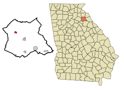
47:
1068:
613:
352:
41:
964:
930:
387:
372:
1015:
1075:
617:
364:
290:
221:
125:
67:
1040:
1020:
605:
858:
639:
for the city was $ 16,890. About 11.6% of families and 14.6% of the population were below the
812:
786:
636:
368:
1035:
979:
954:
949:
309:
360:
390:
to the south and its tributary, Furnace Creek, to the northeast. The city is part of the
1030:
1010:
959:
391:
1092:
969:
253:
1025:
640:
765:
923:
376:
120:
351:(34.173692, -83.292706). The city is concentrated around the intersection of
338:
325:
93:
80:
202:
643:, including 22.2% of those under age 18 and 15.2% of those age 65 or over.
1059:‡This populated place also has portions in an adjacent county or counties
624:
236:
689:"P1. Race – Ila city, Georgia: 2020 DEC Redistricting Data (PL 94-171)"
803:
600:
308:
incorporated the Town of Ila in 1910. Ila is a name derived from the
788:
Acts and
Resolutions of the General Assembly of the State of Georgia
990:
228:
207:
941:
32:
880:
989:
738:
367:, while SR 98 leads west-northwest 10 miles (16 km) to
293:, United States. The population was 350 at the 2020 census.
713:
359:. SR 106 leads south-southwest 16 miles (26 km) to
791:. Clark & Hines, State Printers. 1910. p. 771.
658:
656:
1054:
1001:
940:
269:
259:
247:
235:
218:
201:
193:
185:
180:
172:
164:
156:
148:
143:
131:
119:
109:
23:
320:Ila is located in northwestern Madison County at
805:Georgia Place-Names: Their History and Origins
892:
683:
681:
363:and north-northeast 15 miles (24 km) to
8:
994:Map of Georgia highlighting Madison County
899:
885:
877:
833:"US Gazetteer files: 2010, 2000, and 1990"
620:of any race were 0.30% of the population.
401:
20:
811:. Macon, GA: Winship Press. p. 115.
1109:Athens – Clarke County metropolitan area
766:"Ila, Georgia – Top Schools in the USA"
652:
258:
234:
200:
179:
171:
142:
108:
73:
54:
38:
421:
708:
706:
371:and southeast 5 miles (8 km) to
268:
246:
217:
192:
184:
163:
155:
147:
130:
118:
7:
1114:Populated places established in 1910
664:"2022 U.S. Gazetteer Files: Georgia"
612:, and 0.61% from two or more races.
168:0.00 sq mi (0.00 km)
160:0.77 sq mi (1.99 km)
152:0.77 sq mi (2.00 km)
907:Municipalities and communities of
859:"Census of Population and Housing"
411:
14:
1104:Cities in Madison County, Georgia
56:
40:
743:United States Geological Survey
1099:Cities in Georgia (U.S. state)
739:"US Board on Geographic Names"
18:City in Georgia, United States
1:
666:. United States Census Bureau
197:454.55/sq mi (175.49/km)
837:United States Census Bureau
802:Krakow, Kenneth K. (1975).
718:United States Census Bureau
384:United States Census Bureau
1130:
1003:Unincorporated communities
1064:
987:
921:
592:
577:
562:
547:
532:
517:
502:
487:
472:
457:
442:
427:
420:
415:
410:
407:
74:
55:
39:
30:
306:Georgia General Assembly
176:801 ft (244 m)
910:Madison County, Georgia
632:there were 94.6 males.
357:Georgia State Route 106
995:
353:Georgia State Route 98
993:
714:"U.S. Census website"
593:U.S. Decennial Census
403:Historical population
339:34.17361°N 83.29278°W
220: • Summer (
94:34.17361°N 83.29278°W
1077:United States portal
764:topschoolsintheusa.
691:. U.S. Census Bureau
194: • Density
839:. February 12, 2011
404:
344:34.17361; -83.29278
335: /
99:34.17361; -83.29278
90: /
996:
745:. October 25, 2007
402:
186: • Total
165: • Water
149: • Total
1086:
1085:
637:per capita income
597:
596:
382:According to the
280:
279:
157: • Land
66:and the state of
1121:
1078:
1071:
992:
933:
926:
916:
911:
901:
894:
887:
878:
871:
870:
868:
866:
855:
849:
848:
846:
844:
829:
823:
822:
810:
799:
793:
792:
783:
777:
776:
774:
772:
761:
755:
754:
752:
750:
735:
729:
728:
726:
724:
710:
701:
700:
698:
696:
685:
676:
675:
673:
671:
660:
610:African American
423:
418:
413:
405:
350:
349:
347:
346:
345:
340:
336:
333:
332:
331:
328:
312:meaning "dead".
310:Choctaw language
225:
105:
104:
102:
101:
100:
95:
91:
88:
87:
86:
83:
60:
44:
21:
1129:
1128:
1124:
1123:
1122:
1120:
1119:
1118:
1089:
1088:
1087:
1082:
1076:
1069:
1060:
1050:
997:
985:
936:
931:
924:
917:
914:
909:
905:
875:
874:
864:
862:
857:
856:
852:
842:
840:
831:
830:
826:
819:
808:
801:
800:
796:
785:
784:
780:
770:
768:
763:
762:
758:
748:
746:
737:
736:
732:
722:
720:
712:
711:
704:
694:
692:
687:
686:
679:
669:
667:
662:
661:
654:
649:
625:married couples
416:
400:
343:
341:
337:
334:
329:
326:
324:
322:
321:
318:
299:
243:
219:
98:
96:
92:
89:
84:
81:
79:
77:
76:
70:
51:
35:
26:
19:
12:
11:
5:
1127:
1125:
1117:
1116:
1111:
1106:
1101:
1091:
1090:
1084:
1083:
1081:
1080:
1073:
1070:Georgia portal
1065:
1062:
1061:
1058:
1056:
1052:
1051:
1049:
1048:
1043:
1038:
1033:
1028:
1023:
1018:
1013:
1007:
1005:
999:
998:
988:
986:
984:
983:
977:
972:
967:
962:
957:
952:
946:
944:
938:
937:
922:
919:
918:
906:
904:
903:
896:
889:
881:
873:
872:
850:
824:
817:
794:
778:
756:
730:
702:
677:
651:
650:
648:
645:
595:
594:
590:
589:
586:
584:
581:
575:
574:
571:
569:
566:
560:
559:
556:
554:
551:
545:
544:
541:
539:
536:
530:
529:
526:
524:
521:
515:
514:
511:
509:
506:
500:
499:
496:
494:
491:
485:
484:
481:
479:
476:
470:
469:
466:
464:
461:
455:
454:
451:
449:
446:
440:
439:
436:
434:
431:
425:
424:
419:
414:
409:
399:
396:
392:Savannah River
375:, the Madison
317:
314:
298:
295:
287:Madison County
278:
277:
274:
267:
266:
263:
257:
256:
251:
245:
244:
241:
239:
233:
232:
226:
216:
215:
205:
199:
198:
195:
191:
190:
187:
183:
182:
178:
177:
174:
170:
169:
166:
162:
161:
158:
154:
153:
150:
146:
145:
141:
140:
135:
129:
128:
123:
117:
116:
113:
107:
106:
72:
71:
64:Madison County
61:
53:
52:
45:
37:
36:
31:
28:
27:
24:
17:
13:
10:
9:
6:
4:
3:
2:
1126:
1115:
1112:
1110:
1107:
1105:
1102:
1100:
1097:
1096:
1094:
1079:
1074:
1072:
1067:
1066:
1063:
1057:
1053:
1047:
1044:
1042:
1039:
1037:
1034:
1032:
1029:
1027:
1024:
1022:
1019:
1017:
1014:
1012:
1009:
1008:
1006:
1004:
1000:
981:
978:
976:
973:
971:
968:
966:
963:
961:
958:
956:
953:
951:
948:
947:
945:
943:
939:
935:
934:
927:
920:
915:United States
912:
902:
897:
895:
890:
888:
883:
882:
879:
860:
854:
851:
838:
834:
828:
825:
820:
818:0-915430-00-2
814:
807:
806:
798:
795:
790:
789:
782:
779:
767:
760:
757:
744:
740:
734:
731:
719:
715:
709:
707:
703:
690:
684:
682:
678:
665:
659:
657:
653:
646:
644:
642:
638:
633:
629:
626:
621:
619:
615:
611:
607:
602:
591:
587:
585:
582:
580:
576:
572:
570:
567:
565:
561:
557:
555:
552:
550:
546:
542:
540:
537:
535:
531:
527:
525:
522:
520:
516:
512:
510:
507:
505:
501:
497:
495:
492:
490:
486:
482:
480:
477:
475:
471:
467:
465:
462:
460:
456:
452:
450:
447:
445:
441:
437:
435:
432:
430:
426:
406:
397:
395:
393:
389:
385:
380:
378:
374:
370:
366:
362:
358:
354:
348:
315:
313:
311:
307:
302:
296:
294:
292:
288:
285:is a city in
284:
275:
272:
264:
262:
255:
252:
250:
240:
238:
230:
227:
223:
213:
212:Eastern (EST)
209:
206:
204:
196:
188:
175:
167:
159:
151:
139:
136:
134:
127:
124:
122:
115:United States
114:
112:
103:
75:Coordinates:
69:
65:
59:
49:
46:Main Street (
43:
34:
29:
22:
16:
974:
965:Danielsville
932:Danielsville
929:
863:. Retrieved
861:. Census.gov
853:
841:. Retrieved
827:
804:
797:
787:
781:
769:. Retrieved
759:
747:. Retrieved
733:
721:. Retrieved
693:. Retrieved
668:. Retrieved
641:poverty line
634:
630:
622:
598:
398:Demographics
381:
373:Danielsville
319:
303:
300:
282:
281:
62:Location in
25:Ila, Georgia
15:
925:County seat
771:November 9,
749:January 31,
723:January 31,
695:January 23,
670:January 23,
394:watershed.
388:Broad River
377:county seat
365:Carnesville
342: /
97: /
1093:Categories
1041:Pocataligo
1021:Fort Lamar
647:References
599:As of the
330:83°17′34″W
327:34°10′25″N
273:feature ID
181:Population
85:83°17′34″W
82:34°10′25″N
1055:Footnotes
843:April 23,
316:Geography
261:FIPS code
249:Area code
203:Time zone
173:Elevation
1016:Dogsboro
614:Hispanic
608:, 2.13%
369:Commerce
265:13-40840
237:ZIP code
1036:Planter
980:Royston
955:Colbert
950:Carlton
865:June 4,
297:History
291:Georgia
276:0315877
138:Madison
126:Georgia
111:Country
68:Georgia
1046:Shiloh
942:Cities
815:
618:Latino
601:census
408:Census
361:Athens
133:County
48:SR 106
1031:Paoli
1011:Alvin
960:Comer
809:(PDF)
606:White
558:10.4%
528:42.1%
513:−6.5%
498:−4.0%
468:−3.9%
242:30647
231:(EDT)
229:UTC-4
208:UTC-5
121:State
970:Hull
867:2015
845:2011
813:ISBN
773:2023
751:2008
725:2008
697:2023
672:2023
588:3.9%
579:2020
573:2.7%
564:2010
549:2000
543:3.5%
534:1990
519:1980
504:1970
489:1960
483:0.4%
474:1950
459:1940
453:0.4%
444:1930
429:1920
417:Note
412:Pop.
355:and
304:The
271:GNIS
144:Area
33:City
1026:Hix
975:Ila
616:or
583:350
568:337
553:328
538:297
523:287
508:202
493:216
478:225
463:224
448:233
433:232
283:Ila
254:706
222:DST
189:350
1095::
928::
913:,
835:.
741:.
716:.
705:^
680:^
655:^
422:%±
379:.
289:,
982:‡
900:e
893:t
886:v
869:.
847:.
821:.
775:.
753:.
727:.
699:.
674:.
438:—
224:)
214:)
210:(
50:)
Text is available under the Creative Commons Attribution-ShareAlike License. Additional terms may apply.