54:
421:, son of mortuary founders John and Emma Olinger, became interested in the area in 1918, and purchased the Eden property in 1921. Olinger planned a development to be called "Indian Hills," and built a golf course on part of Eden's land. The first filing was recorded at Jefferson County in June 1923, making Indian Hills the community's official name. Filings were named to recall the association with original inhabitants: Arrowhead Park, Ute & Cherokee Village, and Shawnee Village. "Eden Park" became the fifth filing of Olinger's development, and was platted in 1926. Models of summer cabins were built of logs, and small lots were sold to Denver residents seeking summer homes in the mountains.
1176:
602:
76:
42:
616:
164:
630:
184:
83:
588:
406:
In 1885, Parmalee sold his interest in the toll road to
Benjamin F. Eden (1848–1932), who became tollgate keeper from 1877 to 1883. In 1886, Eden sold the road to Jefferson County. Eden bought properties in the northern end of Parmalee Gulch, which became known as
53:
403:; the Denver and Turkey Creek Toll Road opened in 1870. Parmalee also operated sawmills and shingle mills in the area. He was later commissioned to build a road from Turkey Creek to Bergen Park, along what is known as Parmalee Gulch.
376:
1439:
115:
704:
1081:
699:
415:
and crash in silver prices, the development foundered and Eden recovered the property. He continued to farm the area, raising cattle, horses, hay, and potatoes.
1444:
544:
348:
1074:
895:
684:
395:
John D. Parmalee (1813–1885) came to
Colorado in 1860 and settled in Mount Vernon. In 1866, he was granted a charter for a toll road between
1381:
1251:
75:
1067:
343:
648:
1449:
694:
665:
841:
767:
1059:
733:
867:
763:
1308:
1268:
820:
196:
1358:
998:
969:
940:
737:
530:
453:
41:
1091:
689:
677:
438:
372:
201:
60:
660:
516:
503:
490:
462:
430:
384:
792:
444:
The Indian Hills CDP has an area of 3,474 acres (14.060 km), including 2.2 acres (0.009 km) of water.
331:
156:
1409:
1353:
1328:
1227:
1211:
368:
32:
411:. In time he acquired more than 1,000 acres (4.0 km), attracting the interest of developers. With the
1386:
1263:
1245:
336:
311:
290:
885:
Indian Hills
History Calendar, 2008, "The People." Published by the Indian Hills Improvement Association.
1165:
1159:
985:
956:
927:
418:
1416:
1240:
621:
607:
300:
981:
952:
923:
1318:
1303:
1298:
1278:
1273:
1257:
1235:
1153:
1138:
643:
557:
434:
360:
216:
1363:
1288:
1216:
1206:
1201:
1148:
902:
396:
1037:
1010:
1333:
1283:
1195:
861:
672:
655:
400:
1343:
1338:
1143:
1132:
1113:
593:
1032:
635:
1348:
568:
The sign at the Indian Hills
Community Center features a changing display of humorous
1433:
573:
412:
169:
99:
734:"State of Colorado Census Designated Places - BAS20 - Data as of January 1, 2020"
1106:
364:
1373:
583:
176:
131:
117:
429:
Indian Hills extends along the
Parmalee Gulch and Myers Gulch Roads between
281:
1400:‡This populated place also has portions in an adjacent county or counties
569:
380:
319:
189:
816:
1175:
307:
286:
1187:
1124:
1049:
483:
1063:
1174:
1027:
478:
705:
Denver-Aurora-Broomfield, CO Metropolitan
Statistical Area
1054:
1044:
377:
Denver–Aurora–Lakewood, CO Metropolitan
Statistical Area
1440:
Census-designated places in
Jefferson County, Colorado
387:, the population of the Indian Hills CDP was 1,474.
1395:
1372:
1317:
1226:
1186:
1123:
700:
342:
330:
318:
297:
280:
272:
264:
259:
251:
243:
235:
227:
222:
212:
207:
195:
175:
155:
23:
18:Census Designated Place in Colorado, United States
764:"U.S. Board on Geographic Names: Domestic Names"
848:. Archived from the original on March 22, 2012
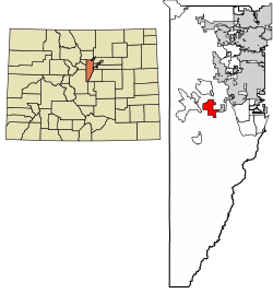
1179:Map of Colorado highlighting Jefferson County
1075:
786:
784:
728:
726:
724:
8:
469:
1082:
1068:
1060:
1038:The Indian Hills Community Center and Sign
881:
879:
877:
468:
375:, United States. The CDP is a part of the
20:
811:
809:
1011:"Indian Hills Community Center and Sign"
547:. Schools serving Indian Hills include:
97:Location of the Indian Hills CDP in the
720:
379:. The Indian Hills post office has the
341:
317:
279:
258:
250:
221:
206:
154:
110:
68:
50:
38:
859:
239:5.425 sq mi (14.051 km)
231:5.429 sq mi (14.060 km)
1045:Indian Hills Fire Protection District
758:
756:
754:
685:List of statistical areas in Colorado
329:
296:
271:
263:
247:0.003 sq mi (0.009 km)
242:
234:
226:
211:
194:
174:
7:
1445:Census-designated places in Colorado
1028:Indian Hills Improvement Association
82:
58:Location of the Indian Hills CDP in
1090:Municipalities and communities of
649:Index of Colorado-related articles
14:
695:North Central Colorado Urban Area
666:Colorado census designated places
628:
614:
600:
586:
182:
162:
81:
74:
52:
40:
842:"Brief History of Indian Hills"
768:United States Geological Survey
545:Jefferson County Public Schools
543:Indian Hills is served by the
1:
791:United States Census Bureau.
369:census-designated place (CDP)
821:United States Postal Service
793:"Indian Hills CDP, Colorado"
554:West Jefferson Middle School
255:7,211 ft (2,198 m)
1050:Indian Hills Water District
738:United States Census Bureau
531:United States Census Bureau
454:United States Census Bureau
401:Bradford Junction (Conifer)
371:located in and governed by
1466:
1093:Jefferson County, Colorado
690:Front Range Urban Corridor
678:Jefferson County, Colorado
551:Parmalee Elementary School
470:Indian Hills CDP, Colorado
373:Jefferson County, Colorado
143:Indian Hills CDP, Colorado
132:39.6294448°N 105.2508700°W
61:Jefferson County, Colorado
1405:
1172:
1104:
866:: CS1 maint: unfit URL (
661:Colorado cities and towns
528:
498:—
463:United States Census 2000
385:United States Census 2020
111:
69:
51:
39:
30:
1450:Denver metropolitan area
1055:Jefferson County website
217:unincorporated community
137:39.6294448; -105.2508700
1033:History of Indian Hills
276:270/sq mi (100/km)
33:Census Designated Place
1180:
846:Indian Hills, Colorado
456:initially defined the
25:Indian Hills, Colorado
1178:
986:Jeffco Public Schools
957:Jeffco Public Schools
928:Jeffco Public Schools
299: • Summer (
46:Indian Hills in 2014.
1418:United States portal
924:"Elementary Schools"
817:"Look Up a ZIP Code"
622:United States portal
608:North America portal
273: • Density
644:Outline of Colorado
558:Conifer High School
471:
435:Kittredge, Colorado
361:unincorporated town
127: /
1309:West Pleasant View
1269:East Pleasant View
1181:
903:U.S. Census Bureau
896:"Indian Hills Map"
572:, and has its own
265: • Total
244: • Water
228: • Total
100:United States
1427:
1426:
1359:Shaffers Crossing
673:Colorado counties
656:State of Colorado
536:
535:
441:at Turkey Creek.
419:George W. Olinger
354:
353:
236: • Land
213: • Type
1457:
1419:
1412:
1177:
1116:
1109:
1099:
1094:
1084:
1077:
1070:
1061:
1015:
1014:
1007:
1001:
996:
994:
992:
978:
972:
967:
965:
963:
953:"Middle Schools"
949:
943:
938:
936:
934:
920:
914:
913:
911:
909:
900:
892:
886:
883:
872:
871:
865:
857:
855:
853:
838:
832:
831:
829:
827:
813:
804:
803:
801:
799:
788:
779:
778:
776:
774:
760:
749:
748:
746:
744:
730:
638:
633:
632:
631:
624:
619:
618:
617:
610:
605:
604:
603:
596:
594:Geography portal
591:
590:
589:
485:
480:
472:
466:
459:
458:Indian Hills CDP
439:U.S. Highway 285
431:State Highway 74
349:Indian Hills CDP
304:
202:Jefferson County
188:
186:
185:
168:
166:
165:
151:
150:
148:
147:
146:
144:
139:
138:
133:
128:
125:
124:
123:
120:
103:
91:
85:
84:
78:
64:
56:
44:
21:
1465:
1464:
1460:
1459:
1458:
1456:
1455:
1454:
1430:
1429:
1428:
1423:
1417:
1411:Colorado portal
1410:
1401:
1391:
1368:
1320:
1313:
1222:
1182:
1170:
1119:
1114:
1107:
1100:
1097:
1092:
1088:
1024:
1019:
1018:
1009:
1008:
1004:
990:
988:
980:
979:
975:
961:
959:
951:
950:
946:
932:
930:
922:
921:
917:
907:
905:
898:
894:
893:
889:
884:
875:
858:
851:
849:
840:
839:
835:
825:
823:
815:
814:
807:
797:
795:
790:
789:
782:
772:
770:
762:
761:
752:
742:
740:
732:
731:
722:
717:
636:Colorado portal
634:
629:
627:
620:
615:
613:
606:
601:
599:
592:
587:
585:
582:
566:
541:
461:
457:
450:
427:
393:
326:
298:
183:
181:
163:
161:
142:
140:
136:
134:
130:
129:
126:
121:
118:
116:
114:
113:
107:
106:
105:
104:
98:
95:
94:
93:
92:
89:
86:
65:
59:
47:
35:
26:
19:
12:
11:
5:
1463:
1461:
1453:
1452:
1447:
1442:
1432:
1431:
1425:
1424:
1422:
1421:
1414:
1406:
1403:
1402:
1399:
1397:
1393:
1392:
1390:
1389:
1384:
1378:
1376:
1370:
1369:
1367:
1366:
1361:
1356:
1351:
1346:
1341:
1336:
1331:
1325:
1323:
1319:Unincorporated
1315:
1314:
1312:
1311:
1306:
1301:
1296:
1291:
1286:
1281:
1276:
1271:
1266:
1261:
1255:
1249:
1243:
1238:
1232:
1230:
1224:
1223:
1221:
1220:
1214:
1209:
1204:
1199:
1192:
1190:
1184:
1183:
1173:
1171:
1169:
1168:
1163:
1157:
1151:
1146:
1141:
1136:
1129:
1127:
1121:
1120:
1105:
1102:
1101:
1089:
1087:
1086:
1079:
1072:
1064:
1058:
1057:
1052:
1047:
1042:
1041:
1040:
1035:
1023:
1022:External links
1020:
1017:
1016:
1002:
982:"High Schools"
973:
944:
915:
887:
873:
833:
805:
780:
750:
719:
718:
716:
713:
712:
711:
710:
709:
708:
707:
702:
697:
692:
682:
681:
680:
670:
669:
668:
653:
652:
651:
640:
639:
625:
611:
597:
581:
578:
565:
562:
561:
560:
555:
552:
540:
537:
534:
533:
526:
525:
522:
519:
513:
512:
509:
506:
500:
499:
496:
493:
487:
486:
481:
476:
449:
446:
426:
423:
392:
389:
383:80454. At the
352:
351:
346:
340:
339:
334:
328:
327:
324:
322:
316:
315:
305:
295:
294:
284:
278:
277:
274:
270:
269:
266:
262:
261:
257:
256:
253:
249:
248:
245:
241:
240:
237:
233:
232:
229:
225:
224:
220:
219:
214:
210:
209:
205:
204:
199:
193:
192:
179:
173:
172:
159:
153:
152:
109:
108:
96:
88:
87:
80:
79:
73:
72:
71:
70:
67:
66:
57:
49:
48:
45:
37:
36:
31:
28:
27:
24:
17:
13:
10:
9:
6:
4:
3:
2:
1462:
1451:
1448:
1446:
1443:
1441:
1438:
1437:
1435:
1420:
1415:
1413:
1408:
1407:
1404:
1398:
1394:
1388:
1385:
1383:
1380:
1379:
1377:
1375:
1371:
1365:
1362:
1360:
1357:
1355:
1354:Pine Junction
1352:
1350:
1347:
1345:
1342:
1340:
1337:
1335:
1332:
1330:
1329:Buffalo Creek
1327:
1326:
1324:
1322:
1316:
1310:
1307:
1305:
1302:
1300:
1297:
1295:
1292:
1290:
1287:
1285:
1282:
1280:
1277:
1275:
1272:
1270:
1267:
1265:
1262:
1259:
1256:
1253:
1250:
1247:
1244:
1242:
1239:
1237:
1234:
1233:
1231:
1229:
1225:
1218:
1215:
1213:
1212:Mountain View
1210:
1208:
1205:
1203:
1200:
1197:
1194:
1193:
1191:
1189:
1185:
1167:
1164:
1161:
1158:
1155:
1152:
1150:
1147:
1145:
1142:
1140:
1137:
1134:
1131:
1130:
1128:
1126:
1122:
1118:
1117:
1110:
1103:
1098:United States
1095:
1085:
1080:
1078:
1073:
1071:
1066:
1065:
1062:
1056:
1053:
1051:
1048:
1046:
1043:
1039:
1036:
1034:
1031:
1030:
1029:
1026:
1025:
1021:
1012:
1006:
1003:
1000:
987:
983:
977:
974:
971:
958:
954:
948:
945:
942:
929:
925:
919:
916:
904:
897:
891:
888:
882:
880:
878:
874:
869:
863:
847:
843:
837:
834:
822:
818:
812:
810:
806:
794:
787:
785:
781:
769:
765:
759:
757:
755:
751:
739:
735:
729:
727:
725:
721:
714:
706:
703:
701:
698:
696:
693:
691:
688:
687:
686:
683:
679:
676:
675:
674:
671:
667:
664:
663:
662:
659:
658:
657:
654:
650:
647:
646:
645:
642:
641:
637:
626:
623:
612:
609:
598:
595:
584:
579:
577:
575:
574:Facebook page
571:
564:Humorous sign
563:
559:
556:
553:
550:
549:
548:
546:
538:
532:
527:
523:
520:
518:
515:
514:
510:
507:
505:
502:
501:
497:
494:
492:
489:
488:
482:
477:
474:
473:
467:
464:
455:
447:
445:
442:
440:
436:
432:
424:
422:
420:
416:
414:
413:Panic of 1893
410:
404:
402:
398:
390:
388:
386:
382:
378:
374:
370:
366:
362:
358:
350:
347:
345:
338:
337:303 & 720
335:
333:
323:
321:
313:
309:
306:
302:
292:
288:
285:
283:
275:
267:
254:
246:
238:
230:
218:
215:
203:
200:
198:
191:
180:
178:
171:
170:United States
160:
158:
149:
112:Coordinates:
101:
77:
62:
55:
43:
34:
29:
22:
16:
1387:Mount Vernon
1294:Indian Hills
1293:
1264:Dakota Ridge
1246:Brook Forest
1112:
1005:
989:. Retrieved
976:
960:. Retrieved
947:
931:. Retrieved
918:
906:. Retrieved
890:
850:. Retrieved
845:
836:
826:December 18,
824:. Retrieved
796:. Retrieved
773:December 18,
771:. Retrieved
743:December 18,
741:. Retrieved
567:
542:
451:
448:Demographics
443:
428:
417:
408:
405:
394:
357:Indian Hills
356:
355:
344:GNIS feature
90:Indian Hills
15:
1374:Ghost towns
1321:communities
1166:Wheat Ridge
1160:Westminster
1108:County seat
1013:. Facebook.
852:October 27,
365:post office
135: /
122:105°15′03″W
1434:Categories
1252:Coal Creek
1241:Aspen Park
999:Detail map
970:Detail map
941:Detail map
715:References
332:Area codes
260:Population
208:Government
141: (
119:39°37′46″N
1396:Footnotes
1304:Kittredge
1299:Ken Caryl
1279:Fairmount
1274:Evergreen
1258:Columbine
1236:Applewood
1154:Littleton
1139:Edgewater
991:March 28,
962:March 28,
933:March 28,
908:March 29,
798:April 15,
570:wordplays
539:Education
425:Geography
409:Eden Park
282:Time zone
252:Elevation
1382:Arapahoe
1364:Waterton
1289:Idledale
1217:Superior
1207:Morrison
1202:Lakeside
1149:Lakewood
862:cite web
580:See also
529:Source:
460:for the
397:Morrison
381:ZIP code
367:, and a
320:ZIP Code
190:Colorado
1334:Conifer
1284:Genesee
1196:Bow Mar
391:History
157:Country
1344:Leyden
1339:Foxton
1144:Golden
1133:Arvada
1125:Cities
1115:Golden
524:+15.2%
437:, and
359:is an
197:County
187:
167:
1188:Towns
899:(PDF)
521:1,474
511:+6.9%
508:1,280
495:1,197
325:80454
308:UTC-6
287:UTC-7
268:1,474
177:State
1349:Pine
1228:CDPs
993:2020
964:2020
935:2020
910:2020
868:link
854:2011
828:2020
800:2023
775:2020
745:2020
517:2020
504:2010
491:2000
479:Pop.
475:Year
452:The
399:and
363:, a
223:Area
433:at
312:MDT
301:DST
291:MST
1436::
1111::
1096:,
997:-
984:.
968:-
955:.
939:-
926:.
901:.
876:^
864:}}
860:{{
844:.
819:.
808:^
783:^
766:.
753:^
736:.
723:^
576:.
484:±%
1260:‡
1254:‡
1248:‡
1219:‡
1198:‡
1162:‡
1156:‡
1135:‡
1083:e
1076:t
1069:v
995:.
966:.
937:.
912:.
870:)
856:.
830:.
802:.
777:.
747:.
465:.
314:)
310:(
303:)
293:)
289:(
145:)
102:.
63:.
Text is available under the Creative Commons Attribution-ShareAlike License. Additional terms may apply.