31:
232:
side. There are remnants of an outer platform, up to 2m wide. The grave's upper surface is composed of turf. The mound covers an intact burial chamber with an entrance at the eastern side of the mound. The entrance is covered by a large stone slab. The rectangular chamber is 4.6m long and approximately 1.5m wide and 1.2m high. The chamber walls are lined with large slabs. Along the north-northeast wall, are coursed smaller slabs and rubble. The west-northwest end of the chamber is blocked by a large edge-set slab. Five large slabs make up the roof of the burial chamber. The roof slabs are slightly exposed in the grassy surface of the mound.
224:
106:
248:, circa 2500 BC. Burial monuments on the islands range in date from the later Neolithic period to the Middle Bronze Age (c.2500-1000 BC). Entrance graves are distinguished by their burial chamber, typically constructed with edge-set slabs, coursed rubble walling or both, and roofed by large covering slabs. The chamber is usually accessible through an opening in the mound's stone outer edge. Excavations of entrance graves have generally uncovered cremation urns, pottery fragments and cremated and unburnt human bones.
450:
113:
215:
lined with coursed rubble. There is a large stone positioned at the northern end of the chamber and large slabs edge the central and northern parts of the east wall. Two capstones provide a roof to the central and southern parts of the chamber. During an unauthorized excavation in 1950, the chamber was emptied of its existing earth and rubble.
214:
of rock. This entrance grave consists of a circular mound of earth and rubble, 8.5m in diameter and 1.7m in height. Inside the mound is a central chamber, 5.4m long 1.3m wide, and 1m high. The entrance to the chamber is on the south side of the mound and faces north. The walls of the burial space are
231:
Upper
Innisidgen, also known as "The Giant's Grave", is one of the best preserved entrance graves on Scilly. The entrance grave consists of a slightly oblong mound of earth and rubble measuring 9m by 8m, and is 1.8m in height. The mound's surrounding kerb is approximately 1 metres high on its north
251:
The two entrance graves at
Innisidgen Hill were built during the Bronze Age. At the time of construction, the burial chambers overlooked a coastal inlet, later known as Crow Sound. During the prehistoric era, this site would have encompassed a wide valley of fields enclosed by stone walls. The
252:
remains of a prehistoric field system are located on the northern slope of
Innisidgen hill next to the entrance graves, discernible as earth and piles of rubble. No artefacts or human remains were found when both graves were first excavated in 1854.
190:. The larger burial chamber, generally referred to as "Upper Innisidgen", is perched on top of Innisidgen Hill. The smaller grave, "Lower Inisigen", is located on the lower northern slope of the hill. The burial monument also includes an
992:
206:
Lower
Innisidgen lies near the bottom of the northern slope of Innisidgen Hill. This grave is more damaged than the upper grave and has only two of its original
902:
30:
416:
997:
977:
105:
982:
162:. The two burial monuments, (Upper and Lower Innisidgen) lie on a steep slope of Innisidgen Hill overlooking Crow Sound with a view towards the
1007:
987:
354:"Two entrance graves, a prehistoric field system, and Civil War fieldworks and blockhouse on Innisidgen Hill and Helvear Down, St Mary's"
383:
56:
955:
675:
438:
182:, the largest village on the Island of St. Mary's. It is the site of two Bronze Age entrance graves that overlook Crow Sound and the
860:
854:
942:
492:
455:
223:
1002:
155:
44:
912:
932:
885:
890:
833:
187:
895:
907:
207:
431:
692:
865:
937:
927:
747:
560:
353:
948:
880:
875:
870:
850:
782:
650:
640:
535:
175:
272:
210:. Parts of the surrounding kerb of the mound remain, while the mound itself incorporates small
917:
797:
635:
424:
195:
922:
802:
792:
600:
487:
134:
630:
472:
241:
159:
772:
297:
151:
971:
827:
742:
712:
245:
191:
183:
163:
807:
777:
767:
757:
752:
732:
727:
702:
822:
817:
812:
737:
722:
707:
697:
575:
411:
762:
667:
620:
610:
520:
148:
71:
58:
787:
717:
625:
555:
530:
179:
655:
605:
580:
565:
525:
461:
449:
645:
615:
595:
590:
550:
211:
585:
510:
186:
in Scilly. Innisidgen Hill is located near the small settlement of
661:
545:
540:
325:
222:
570:
515:
420:
412:
Innisidgen walking tour — Isles of Scilly
Wildlife Trust
384:"History of Innisidgen Lower and Upper Burial Chambers"
843:
685:
501:
480:
87:
50:
40:
23:
378:
376:
374:
348:
346:
267:
265:
993:English Heritage sites in the Isles of Scilly
432:
8:
16:Two entrances graves in the Isles of Scilly
439:
425:
417:
320:
318:
29:
20:
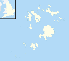
120:Location of Innisidgen in Isles of Scilly
261:
178:on the Isles of Scilly, north east of
7:
244:were originally settled during the
956:Index of Cornwall-related articles
676:List of civil parishes in Cornwall
112:
14:
227:Upper entrance grave at Innisdgen
35:Lower entrance Grave at Inisidgen
448:
111:
104:
998:Tourist attractions in Cornwall
978:Megalithic monuments in England
903:Population of major settlements
983:History of the Isles of Scilly
493:Council of the Isles of Scilly
1:
988:Ruins in the Isles of Scilly
273:"Innisidgen Burial Chambers"
1024:
1008:St Mary's, Isles of Scilly
45:St Mary's, Isles of Scilly
469:
99:
95:
28:
228:
138:
226:
174:Innisidgen Hill is a
147:) is the site of two
1003:Religion in Cornwall
949:Outline of Cornwall
504:(cities in italics)
481:Unitary authorities
194:site dating to the
68: /
943:Places of interest
641:St Just in Penwith
298:"Innisidgen Upper"
229:
176:scheduled monument
72:49.9349°N 6.2917°W
965:
964:
502:Major settlements
456:Ceremonial county
196:English Civil War
154:on the island of
128:
127:
1015:
488:Cornwall Council
464:
458:
453:
452:
441:
434:
427:
418:
399:
398:
396:
394:
388:English Heritage
380:
369:
368:
366:
364:
358:Historic England
350:
341:
340:
338:
336:
322:
313:
312:
310:
308:
294:
288:
287:
285:
283:
269:
219:Upper Innisidgen
202:Lower Innisidgen
115:
114:
108:
83:
82:
80:
79:
78:
77:49.9349; -6.2917
73:
69:
66:
65:
64:
61:
33:
21:
1023:
1022:
1018:
1017:
1016:
1014:
1013:
1012:
968:
967:
966:
961:
938:Hundreds/shires
886:Flora and fauna
839:
681:
670:
631:St Columb Major
503:
497:
476:
473:Cornwall Portal
465:
460:
454:
447:
445:
408:
403:
402:
392:
390:
382:
381:
372:
362:
360:
352:
351:
344:
334:
332:
324:
323:
316:
306:
304:
296:
295:
291:
281:
279:
271:
270:
263:
258:
242:Isles of Scilly
238:
221:
204:
172:
170:Innisidgen Hill
160:Isles of Scilly
152:entrance graves
124:
123:
122:
121:
118:
117:
116:
76:
74:
70:
67:
62:
59:
57:
55:
54:
36:
17:
12:
11:
5:
1021:
1019:
1011:
1010:
1005:
1000:
995:
990:
985:
980:
970:
969:
963:
962:
960:
959:
952:
945:
940:
935:
930:
925:
920:
915:
913:Notable people
910:
905:
900:
899:
898:
888:
883:
878:
873:
868:
863:
858:
847:
845:
841:
840:
838:
837:
830:
825:
820:
815:
810:
805:
800:
795:
790:
785:
780:
775:
770:
765:
760:
755:
750:
745:
740:
735:
730:
725:
720:
715:
710:
705:
700:
695:
689:
687:
683:
682:
680:
679:
665:
658:
653:
648:
643:
638:
633:
628:
623:
618:
613:
608:
603:
598:
593:
588:
583:
578:
573:
568:
563:
558:
553:
548:
543:
538:
533:
528:
523:
518:
513:
507:
505:
499:
498:
496:
495:
490:
484:
482:
478:
477:
470:
467:
466:
446:
444:
443:
436:
429:
421:
415:
414:
407:
406:External links
404:
401:
400:
370:
342:
314:
289:
260:
259:
257:
254:
237:
234:
220:
217:
203:
200:
171:
168:
126:
125:
119:
110:
109:
103:
102:
101:
100:
97:
96:
93:
92:
89:
85:
84:
52:
48:
47:
42:
38:
37:
34:
26:
25:
15:
13:
10:
9:
6:
4:
3:
2:
1020:
1009:
1006:
1004:
1001:
999:
996:
994:
991:
989:
986:
984:
981:
979:
976:
975:
973:
958:
957:
953:
951:
950:
946:
944:
941:
939:
936:
934:
931:
929:
926:
924:
921:
919:
916:
914:
911:
909:
906:
904:
901:
897:
896:List of farms
894:
893:
892:
889:
887:
884:
882:
879:
877:
874:
872:
869:
867:
864:
862:
861:Status debate
859:
856:
852:
849:
848:
846:
842:
836:
835:
831:
829:
826:
824:
821:
819:
816:
814:
811:
809:
806:
804:
801:
799:
796:
794:
791:
789:
786:
784:
781:
779:
776:
774:
771:
769:
766:
764:
761:
759:
756:
754:
751:
749:
746:
744:
741:
739:
736:
734:
731:
729:
726:
724:
721:
719:
716:
714:
711:
709:
706:
704:
701:
699:
696:
694:
691:
690:
688:
684:
678:
677:
673:
669:
666:
664:
663:
659:
657:
654:
652:
649:
647:
644:
642:
639:
637:
634:
632:
629:
627:
624:
622:
619:
617:
614:
612:
609:
607:
604:
602:
599:
597:
594:
592:
589:
587:
584:
582:
579:
577:
574:
572:
569:
567:
564:
562:
559:
557:
554:
552:
549:
547:
544:
542:
539:
537:
534:
532:
529:
527:
524:
522:
519:
517:
514:
512:
509:
508:
506:
500:
494:
491:
489:
486:
485:
483:
479:
475:
474:
468:
463:
457:
451:
442:
437:
435:
430:
428:
423:
422:
419:
413:
410:
409:
405:
389:
385:
379:
377:
375:
371:
359:
355:
349:
347:
343:
331:
327:
321:
319:
315:
303:
302:Megalithic.co
299:
293:
290:
278:
277:Cornwall Tour
274:
268:
266:
262:
255:
253:
249:
247:
246:Neolithic era
243:
235:
233:
225:
218:
216:
213:
209:
201:
199:
197:
193:
192:archeological
189:
185:
184:Eastern Isles
181:
177:
169:
167:
165:
164:Eastern Isles
161:
157:
153:
150:
146:
142:
141:
136:
132:
107:
98:
94:
90:
86:
81:
53:
49:
46:
43:
39:
32:
27:
22:
19:
954:
947:
834:full list...
832:
674:
671:
660:
471:
391:. Retrieved
387:
361:. Retrieved
357:
333:. Retrieved
329:
326:"Innisidgen"
305:. Retrieved
301:
292:
280:. Retrieved
276:
250:
239:
230:
212:outcroppings
205:
173:
144:
139:
130:
129:
18:
576:Lostwithiel
75: /
51:Coordinates
972:Categories
908:Demography
803:St Austell
793:Port Navas
668:Wadebridge
621:St Austell
611:Porthleven
561:Launceston
521:Callington
256:References
149:Bronze Age
143:, meaning
140:Enys Ojyon
131:Innisidgen
91:Bronze Age
60:49°56′06″N
24:Innisidgen
918:The Duchy
855:Civil War
788:Pont Pill
672:See also:
626:St Blazey
556:Hugh Town
531:Camelford
208:capstones
188:Trenowieh
180:Hugh Town
156:St Mary's
145:Ox Island
63:6°17′30″W
928:Politics
773:Menalhyl
656:Torpoint
651:Stratton
606:Penzance
581:Marazion
566:Liskeard
536:Falmouth
526:Camborne
462:Cornwall
330:Mapcarta
41:Location
933:Schools
923:Diocese
881:Fishing
876:Economy
871:Culture
851:History
828:Valency
743:Helford
713:De Lank
646:Saltash
636:St Ives
616:Redruth
596:Padstow
591:Newquay
551:Helston
393:16 July
363:16 July
335:17 July
307:17 July
282:17 July
236:History
158:in the
135:Cornish
891:Places
844:Topics
808:Seaton
778:Ottery
768:Lynher
758:Lerryn
753:Kensey
728:Gannel
703:Carnon
686:Rivers
601:Penryn
586:Newlyn
511:Bodmin
823:Truro
818:Tiddy
813:Tamar
738:Hayle
733:Gover
723:Fowey
708:Cober
698:Camel
693:Allen
662:Truro
546:Hayle
541:Fowey
88:Built
866:Flag
763:Looe
748:Inny
571:Looe
516:Bude
395:2020
365:2020
337:2020
309:2020
284:2020
240:The
798:Red
783:Par
718:Fal
459:of
974::
386:.
373:^
356:.
345:^
328:.
317:^
300:.
275:.
264:^
198:.
166:.
137::
857:)
853:(
440:e
433:t
426:v
397:.
367:.
339:.
311:.
286:.
133:(
Text is available under the Creative Commons Attribution-ShareAlike License. Additional terms may apply.