54:
420:
workers at a time, accompanied with their herds of horses (sometimes over 100 horses), their sleights, all required rigging and provisions for the use of forest sites in Middle or Upper
Batiscanie Batiscanie. These men and their horses coming back down in the spring by the same ice roads before the great debacle. These ice roads should avoid areas where the ice was weak (especially in the rapids or falls) by clearing the pathways on the mainland. The construction of the railway along the
345:) with a length of one kilometre and a maximum width of 300 metres (980 ft). The altitude of the water upstream of the island is 246 m and 244 m downstream. "Island of the Cross" is the main island of a small archipelago that can be designated "archipelago Miguick" with 11 other islands including nine upstream. The last small island (altitude: 244 m) is located further downstream in front of the outlet of Lac de la Daraise (west side of the
288:(Geographical Names Board of Quebec). Formerly, a cross was planted on the island as protection for travellers on the river regularly surreptitiously caused the drowning. The rapids upstream and downstream of the island are deemed dangerous for boats river. The cross also protect residents and seasonal workers fast river (upstream and downstream) and sometimes considerable floods accentuated the risk of injury or drowning.
460:
61:
407:
to visit the area of the island, there were fur traders who practiced trade, Catholic evangelists and explorers designated by the civil and religious authorities. Annually, at the end of spring, loggers went around the banks of the river, including the island to the Cross to return to the water the
419:
In the 19th century, the government was granting logging on public lands more distant from the Lower
Batiscanie. Prior to the 1888-1889 construction of the railway to Upper Batiscanie, every winter, ice roads were constructed on the Batiscan River by forest contractors to bring hundreds forest
424:
and roads (public or private), have reduced the need to use these long ice roads. However, the ice roads continued to be appointed at various places for local needs to cross the river.
334:
The island is 1.5 kilometres (0.93 mi) from
Miguick hamlet, 4.5 kilometres (2.8 mi) and from Linton 7 kilometres (4.3 mi), which is downstream from the mouth of the
432:
The Island of the Cross is known for wild camping and various outdoor activities. The island turns to be a breakpoint or starting point for raids by boat down the river to
416:. After the season of logs driving many workers became "cageux" (cage workers) for sawmills, others often went to work on farms in the Lower or Middle-Batiscanie.
620:
356:
crosses the northern part of the island in the east-west direction to connect the two main sections of this provincial park, which is divided in two by the
53:
99:
258:
210:
276:, a quarry of granite began to be exploited, through the construction of the railway connecting the Lower Batiscanie and Upper Batiscanie.
285:
292:
409:
615:
433:
324:
308:
311:". Fifty kilometres (following the route of the river) separate the mouth of the lake and the island at the cross.
493:
441:
361:
353:
250:
566:
284:
The French toponym "Ïle-à-la-Croix" was officially recorded
December 5, 1968 in the bank of place names at the
304:
254:
220:
328:
488:
445:
393:
381:
342:
320:
296:
273:
594:
524:
546:
Research conducted by historian Gaétan
Veillette referring to the Google Maps website, in March 2013
341:
The island is shaped like a foot (toes pointing to the southwest and the heel to the mouth of the
266:
262:
555:
This designation of the archipelago was proposed by historian Gaétan
Veillette in October 2014
396:
mouth is very quiet and winding; it was particularly favorable for hunting moose and beavers.
17:
483:
404:
335:
36:
319:
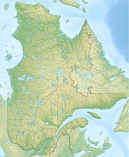
The "Island of the Cross" (Île à la Croix) is located 63 km south of the village of
478:
465:
437:
421:
413:
389:
385:
365:
357:
346:
300:
246:
136:
87:
291:
In Judeo-Christian origin place name "Island of the Cross" is akin to the place name "
609:
565:
Société d’aménagement et de mise en valeur du bassin de la
Batiscan (SAMBBA) (2007).
403:, also served as a landmark on expeditions on the river. Among the early explorers
537:
Geographical audit performed by the historian Gaétan
Veillette (Saint-Hubert, QC)
568:
Plan directeur de l’eau : Portrait du bassin versant de la rivière
Batiscan
473:
455:
400:
114:
101:
459:
512:
525:"Commission de toponymie du Québec - Bank of place names - Île à la Croix"
369:
323:
in Upper-Batiscanie, 26 kilometres (16 mi) north of the village of
360:. This "Miguick-Île à la Croix" area comprises a small hamlet near the
599:
Commission de toponymie du Québec (Geographical Names Board of Québec)
253:, in the area designated "Miguick-Île à la Croix", the unincorporated
200:
573:
Master plan for water: Portrait of the
Batiscan River watershed
436:. Many canoeists begin their expedition down the rapids of the
295:" which is located at 9.3 kilometres (5.8 mi) southern of
392:
during the Amerindian prehistory. In front of the island, the
327:
and 27 kilometres (17 mi) (direct line) of the church of
408:
logs coming down the river to sawmills downstream, including
380:
Its strategic geographic position in front of the mouth of
231:
226:
216:
206:
196:
182:
174:
166:
158:
150:
142:
130:
93:
83:
78:
34:
249:, at the northern edge of the eastern part of the
245:(Île à la Croix) is located in the middle of the
388:), ¨Île à la Croix served as resting place of
8:
29:
60:
28:
444:iron bridge that spans the mouth of the
505:
448:, located just in front of the island.
621:Portneuf Regional County Municipality
259:Portneuf Regional County Municipality
7:
261:, in the administrative area of the
25:
372:passenger train stops if needed.
286:Commission de toponymie du Québec
601:. Bank of place names in Quebec.
458:
59:
52:
412:. Log drives ended in 1963 on
1:
513:Hamlet Miguick Cross - island
207:Regional County Municipality
18:Island of the Cross (Quebec)
637:
162:0.3 km (0.19 mi)
494:Portneuf Wildlife Reserve
442:Canadian National Railway
399:This legendary island of
362:Canadian National Railway
354:Portneuf Wildlife Reserve
251:Portneuf Wildlife Reserve
187:
47:
579:(in French). p. 32.
170:244 m (801 ft)
40:
616:River islands of Quebec
434:Notre-Dame-de-Montauban
325:Notre-Dame-de-Montauban
154:1 km (0.6 mi)
489:Miguick River (Quebec)
446:Miguick River (Quebec)
394:Miguick River (Quebec)
382:Miguick River (Quebec)
364:, on the east side of
343:Miguick River (Quebec)
167:Highest elevation
255:Lac-Lapeyrère, Quebec
217:Unorganized territory
115:47.22222°N 72.25972°W
243:Island of the Cross
120:47.22222; -72.25972
111: /
67:Island of the Cross
31:
30:Island of the Cross
272:By 1888, near the
267:province of Quebec
263:Capitale-Nationale
175:Highest point
352:Highway 2 to the
303:, which rises in
239:
238:
16:(Redirected from
628:
602:
595:"Île à la croix"
581:
580:
578:
562:
556:
553:
547:
544:
538:
535:
529:
528:
521:
515:
510:
468:
463:
462:
329:Rivière-à-Pierre
307:flows into the "
133:
126:
125:
123:
122:
121:
116:
112:
109:
108:
107:
104:
63:
62:
56:
32:
21:
636:
635:
631:
630:
629:
627:
626:
625:
606:
605:
593:
590:
585:
584:
576:
564:
563:
559:
554:
550:
545:
541:
536:
532:
523:
522:
518:
511:
507:
502:
484:Jeannotte River
464:
457:
454:
430:
410:Saint-Stanislas
405:French Canadian
378:
336:Jeannotte River
317:
282:
192:
131:
119:
117:
113:
110:
105:
102:
100:
98:
97:
74:
73:
72:
71:
70:
69:
68:
64:
43:
42:
23:
22:
15:
12:
11:
5:
634:
632:
624:
623:
618:
608:
607:
604:
603:
589:
588:External links
586:
583:
582:
557:
548:
539:
530:
516:
504:
503:
501:
498:
497:
496:
491:
486:
481:
479:Batiscan River
476:
470:
469:
466:Islands portal
453:
450:
438:Batiscan River
429:
426:
422:Batiscan River
414:Batiscan River
390:Batiscan River
386:Batiscan River
384:(east side of
377:
374:
366:Batiscan River
358:Batiscan River
347:Batiscan River
316:
313:
309:Lac à la croix
301:Batiscan River
293:Lac à la Croix
281:
278:
247:Batiscan River
237:
236:
233:
229:
228:
224:
223:
218:
214:
213:
208:
204:
203:
198:
194:
193:
188:
185:
184:
183:Administration
180:
179:
176:
172:
171:
168:
164:
163:
160:
156:
155:
152:
148:
147:
144:
140:
139:
137:Batiscan River
134:
128:
127:
95:
91:
90:
88:Batiscan River
85:
81:
80:
76:
75:
66:
65:
58:
57:
51:
50:
49:
48:
45:
44:
41:Île à la Croix
35:
24:
14:
13:
10:
9:
6:
4:
3:
2:
633:
622:
619:
617:
614:
613:
611:
600:
596:
592:
591:
587:
574:
570:
569:
561:
558:
552:
549:
543:
540:
534:
531:
526:
520:
517:
514:
509:
506:
499:
495:
492:
490:
487:
485:
482:
480:
477:
475:
472:
471:
467:
461:
456:
451:
449:
447:
443:
439:
435:
427:
425:
423:
417:
415:
411:
406:
402:
397:
395:
391:
387:
383:
375:
373:
371:
367:
363:
359:
355:
350:
348:
344:
339:
337:
332:
330:
326:
322:
314:
312:
310:
306:
302:
298:
294:
289:
287:
279:
277:
275:
274:Miguick River
270:
268:
264:
260:
256:
252:
248:
244:
234:
230:
225:
222:
221:Lac-Lapeyrère
219:
215:
212:
209:
205:
202:
199:
195:
191:
186:
181:
177:
173:
169:
165:
161:
157:
153:
149:
145:
143:Total islands
141:
138:
135:
129:
124:
96:
92:
89:
86:
82:
77:
55:
46:
38:
33:
27:
19:
598:
572:
567:
560:
551:
542:
533:
519:
508:
431:
418:
398:
379:
351:
340:
333:
318:
305:Lake Édouard
290:
283:
271:
242:
240:
227:Demographics
189:
26:
321:Lac-Édouard
297:Lac-Édouard
257:territory,
132:Adjacent to
118: /
94:Coordinates
37:Native name
610:Categories
500:References
474:Batiscanie
401:Batiscanie
269:, Canada.
232:Population
106:72°15′35″W
103:47°13′20″N
440:from the
315:Geography
265:, in the
79:Geography
452:See also
370:Via Rail
280:Toponymy
235:0 (2011)
211:Portneuf
197:Province
84:Location
428:Leisure
376:History
575:]
368:. The
299:. The
201:Quebec
190:Canada
151:Length
577:(PDF)
571:[
159:Width
241:The
349:).
178:258
612::
597:.
338:.
331:.
39::
527:.
146:1
20:)
Text is available under the Creative Commons Attribution-ShareAlike License. Additional terms may apply.