105:
45:
803:
92:
918:
70:
1027:
414:
60:
445:
336:
694:
776:
875:
112:
475:) characterized by warm summers and cool winters with light to no snowfall. The average annual temperature in Kasagi is 13.7 °C. The average annual rainfall is 1439 mm with September as the wettest month. The temperatures are highest on average in August, at around 25.7 °C, and lowest in January, at around 2.1 °C.
377:. As of 1 April 2024, it has a population of 1,108 in 579 households and a population density of 47 persons per km. The total area of the town is 23.52 square kilometres (9.08 sq mi). It has the smallest population of any municipality in Kyoto.
664:
town council of eight members. Kasagi, collectively with the other municipalities of Sōraku
District and the city of Kizugawa, contributes two members to the Kyoto Prefectural Assembly. In terms of national politics, the town is part of the
389:
flowing through the center of the town, the Nunome River and the
Uchitaki River flowing from the south, and the Yokogawa River from the north. The town also enclaves scattered in the eastern part of the
616:. The Kasagi-cho area developed as a key hub for water transportation from ancient times, as wood was cut and transported using the Kizugawa waterway for the construction of
648:. The village of Kasagi was established on April 1, 1889 with the creation of the modern municipalities system. Kasagi was raised to town status on January 1, 1934.
104:
734:
in Nara. It is an important temple in the history of
Buddhism in Japan, and many eminent monks have served as abbot. According to legend, the annual
44:
136:
1225:
399:
1244:
670:
907:
1026:
91:
69:
779:
1158:
935:
468:
366:
205:
879:
806:
176:
59:
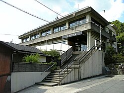
1185:
1146:
1168:
435:
362:
1122:
967:
839:
301:
1002:
992:
917:
312:
1202:
1134:
1091:
987:
188:
1151:
1066:
1012:
900:
385:
Kasagi is located in far southern Kyoto
Prefecture. Forests occupy 80% of the total area, with the
255:
645:
1046:
666:
613:
200:
1127:
997:
1051:
1007:
962:
982:
921:
783:
719:
629:
418:
413:
370:
193:
1139:
1061:
757:
Kasagi has one public elementary school and one public junior high school operated by the
633:
449:
444:
425:
395:
335:
1056:
977:
954:
893:
789:
35:
1238:
1212:
1096:
1081:
972:
723:
674:
657:
430:
181:
850:
693:
1173:
1041:
702:
625:
483:
Per
Japanese census data, the population of Kasagi has declined in recent decades.
323:
731:
621:
1071:
727:
617:
391:
1207:
1190:
661:
641:
637:
456:
386:
251:
151:
138:
1195:
775:
736:
685:
Kasagi is a rural area, with an economy based on agriculture and forestry.
246:
885:
741:
874:
745:
1086:
1076:
715:
1178:
1106:
744:
after he discovered a passage here that led to the heavenly home of
266:
90-1 Kasagi Nishi-dori, Kasagi-machi, Soraku-gun, Kyoto-fu 619-1303
945:
930:
692:
374:
334:
865:
826:
500:
276:
889:
1101:
495:
660:
form of government with a directly elected mayor and a
398:
city. Parts of the town are within the borders of the
840:
1115:
1034:
953:
944:
640:, the area north of the Kizugawa River was part of
319:
307:
297:
270:
262:
245:
237:
229:
224:
216:
211:
199:
187:
175:
167:
21:
718:sect Buddhist temple said to have been founded by
726:. Historically it has had close relations with
354:
707:
348:
901:
8:
486:
740:ceremony at Tōdai-ji was begun by the monk
950:
908:
894:
886:
774:
644:, whereas the area south of the river was
485:
18:
761:. The town does not have a high school
818:
612:The area of Kasagi was part of ancient
292:
269:
261:
244:
223:
210:
166:
131:
97:
81:
53:
41:
84:Location of Kasagi in Kyoto Prefecture
318:
306:
296:
236:
228:
215:
198:
186:
174:
88:
7:
220:23.52 km (9.08 sq mi)
1226:List of mergers in Kyoto Prefecture
400:Kasagiyama Prefectural Natural Park
14:
827:"Kasagi Town official statistics"
1025:
916:
873:
801:
443:
412:
110:
103:
90:
68:
58:
43:
628:became the temporary palace of
339:Kizugawa River and Mount Kasagi
111:
1:
851:Kasagi population statistics
355:
1261:
406:Neighboring municipalities
1245:Towns in Kyoto Prefecture
1223:
1023:
928:
708:
513:—
469:humid subtropical climate
349:
329:
293:
288:
284:
132:
98:
89:
82:
54:
42:
33:
25:
866:Kasagi official website
807:National Route 163
759:Sōraku Tōbu kōiki rengō
698:
340:
241:47/km (120/sq mi)
152:34.76056°N 135.93944°E
829:(in Japanese). Japan.
696:
487:Historical population
338:
302:Japanese bush warbler
16:Town in Kansai, Japan
882:at Wikimedia Commons
620:in Nara. During the
238: • Density
488:
157:34.76056; 135.93944
148: /
699:
697:Gate of Kasagidera
667:Kyoto 6th district
614:Yamashiro Province
341:
313:Prunus × yedoensis
230: • Total
217: • Total
1232:
1231:
1021:
1020:
939:
878:Media related to
689:Local attractions
605:
604:
333:
332:
263:City hall address
124:Location in Japan
1252:
1186:Tsuzuki District
1147:Otokuni District
1029:
951:
933:
922:Kyoto Prefecture
920:
910:
903:
896:
887:
877:
870:
853:
848:
842:
837:
831:
830:
823:
805:
804:
784:Kansai Main Line
778:
713:
711:
710:
630:Emperor Go-Daigo
502:
497:
489:
448:
447:
419:Kyoto Prefecture
417:
416:
371:Kyoto Prefecture
360:
358:
352:
351:
280:
279:
277:Official website
163:
162:
160:
159:
158:
153:
149:
146:
145:
144:
141:
114:
113:
107:
94:
72:
62:
49:Kasagi Town Hall
47:
28:
19:
1260:
1259:
1255:
1254:
1253:
1251:
1250:
1249:
1235:
1234:
1233:
1228:
1219:
1169:Minamiyamashiro
1159:Sōraku District
1111:
1030:
1017:
940:
924:
914:
868:
862:
857:
856:
849:
845:
838:
834:
825:
824:
820:
815:
802:
798:
772:
767:
755:
705:
691:
683:
654:
634:Siege of Kasagi
610:
481:
465:
450:Nara Prefecture
442:
436:Minamiyamashiro
411:
408:
383:
367:Sōraku District
346:
275:
274:
156:
154:
150:
147:
142:
139:
137:
135:
134:
128:
127:
126:
125:
122:
121:
120:
119:
115:
85:
78:
77:
76:
75:
66:
65:
50:
38:
29:
26:
24:
17:
12:
11:
5:
1258:
1256:
1248:
1247:
1237:
1236:
1230:
1229:
1224:
1221:
1220:
1218:
1217:
1216:
1215:
1210:
1200:
1199:
1198:
1193:
1183:
1182:
1181:
1176:
1171:
1166:
1156:
1155:
1154:
1144:
1143:
1142:
1132:
1131:
1130:
1123:Funai District
1119:
1117:
1113:
1112:
1110:
1109:
1104:
1099:
1094:
1089:
1084:
1079:
1074:
1069:
1064:
1059:
1054:
1049:
1044:
1038:
1036:
1032:
1031:
1024:
1022:
1019:
1018:
1016:
1015:
1010:
1005:
1000:
995:
990:
985:
980:
975:
970:
965:
959:
957:
948:
942:
941:
929:
926:
925:
915:
913:
912:
905:
898:
890:
884:
883:
871:
861:
860:External links
858:
855:
854:
843:
832:
817:
816:
814:
811:
810:
809:
797:
794:
793:
792:
771:
768:
766:
765:Transportation
763:
754:
751:
750:
749:
690:
687:
682:
679:
653:
650:
609:
606:
603:
602:
599:
596:
592:
591:
588:
585:
581:
580:
577:
574:
570:
569:
566:
563:
559:
558:
555:
552:
548:
547:
544:
541:
537:
536:
533:
530:
526:
525:
522:
519:
515:
514:
511:
508:
504:
503:
498:
493:
480:
477:
464:
461:
460:
459:
453:
452:
439:
438:
433:
428:
422:
421:
407:
404:
387:Kizugawa River
382:
379:
331:
330:
327:
326:
321:
317:
316:
309:
305:
304:
299:
295:
294:
291:
290:
286:
285:
282:
281:
272:
268:
267:
264:
260:
259:
249:
243:
242:
239:
235:
234:
231:
227:
226:
222:
221:
218:
214:
213:
209:
208:
203:
197:
196:
191:
185:
184:
179:
173:
172:
169:
165:
164:
130:
129:
123:
117:
116:
109:
108:
102:
101:
100:
99:
96:
95:
87:
86:
83:
80:
79:
73:
67:
63:
57:
56:
55:
52:
51:
48:
40:
39:
34:
31:
30:
22:
15:
13:
10:
9:
6:
4:
3:
2:
1257:
1246:
1243:
1242:
1240:
1227:
1222:
1214:
1211:
1209:
1206:
1205:
1204:
1203:Yosa District
1201:
1197:
1194:
1192:
1189:
1188:
1187:
1184:
1180:
1177:
1175:
1172:
1170:
1167:
1165:
1162:
1161:
1160:
1157:
1153:
1150:
1149:
1148:
1145:
1141:
1138:
1137:
1136:
1135:Kuse District
1133:
1129:
1126:
1125:
1124:
1121:
1120:
1118:
1114:
1108:
1105:
1103:
1100:
1098:
1095:
1093:
1090:
1088:
1085:
1083:
1080:
1078:
1075:
1073:
1070:
1068:
1065:
1063:
1060:
1058:
1055:
1053:
1050:
1048:
1045:
1043:
1040:
1039:
1037:
1033:
1028:
1014:
1011:
1009:
1006:
1004:
1001:
999:
996:
994:
991:
989:
986:
984:
981:
979:
976:
974:
971:
969:
966:
964:
961:
960:
958:
956:
952:
949:
947:
943:
937:
932:
927:
923:
919:
911:
906:
904:
899:
897:
892:
891:
888:
881:
880:Kasagi, Kyoto
876:
872:
869:(in Japanese)
867:
864:
863:
859:
852:
847:
844:
841:
836:
833:
828:
822:
819:
812:
808:
800:
799:
795:
791:
788:
787:
786:
785:
781:
777:
769:
764:
762:
760:
752:
747:
743:
739:
738:
733:
729:
725:
724:Emperor Tenmu
721:
720:Emperor Kōbun
717:
704:
701:
700:
695:
688:
686:
680:
678:
676:
675:Diet of Japan
672:
668:
663:
659:
658:mayor-council
656:Kasagi has a
651:
649:
647:
643:
639:
636:. During the
635:
631:
627:
623:
619:
615:
607:
600:
597:
594:
593:
589:
586:
583:
582:
578:
575:
572:
571:
567:
564:
561:
560:
556:
553:
550:
549:
545:
542:
539:
538:
534:
531:
528:
527:
523:
520:
517:
516:
512:
509:
506:
505:
499:
494:
491:
490:
484:
478:
476:
474:
470:
467:Kasagi has a
462:
458:
455:
454:
451:
446:
441:
440:
437:
434:
432:
429:
427:
424:
423:
420:
415:
410:
409:
405:
403:
401:
397:
393:
388:
380:
378:
376:
372:
368:
364:
357:
345:
337:
328:
325:
322:
315:
314:
310:
303:
300:
287:
283:
278:
273:
265:
257:
253:
250:
248:
240:
232:
219:
207:
204:
202:
195:
192:
190:
183:
180:
178:
170:
161:
133:Coordinates:
106:
93:
71:
61:
46:
37:
32:
20:
1163:
846:
835:
821:
773:
758:
756:
735:
684:
655:
646:Yagyū Domain
611:
482:
479:Demographics
472:
466:
394:district of
384:
343:
342:
324:Rhododendron
311:
1047:Fukuchiyama
968:Higashiyama
703:Kasagi-dera
671:lower house
632:during the
626:Kasagi-dera
155: /
143:135°56′22″E
1092:Nagaokakyō
813:References
662:unicameral
652:Government
642:Tsu Domain
638:Edo Period
356:Kasagi-chō
225:Population
189:Prefecture
140:34°45′38″N
1196:Ujitawara
1152:Ōyamazaki
1116:Districts
1067:Kyōtanabe
1013:Yamashina
753:Education
737:Omizutori
732:Kōfuku-ji
624:of 1331,
622:Genkō War
381:Geography
252:UTC+09:00
247:Time zone
1239:Category
1140:Kumiyama
1128:Kyōtamba
1072:Kyōtango
1062:Kizugawa
1003:Shimogyō
993:Nishikyō
796:Highways
746:Maitreya
728:Tōdai-ji
618:Tōdai-ji
471:(Köppen
426:Kizugawa
396:Kizugawa
201:District
1077:Maizuru
1057:Kameoka
988:Nakagyō
973:Kamigyō
963:Fushimi
936:capital
780:JR West
770:Railway
716:Shingon
681:Economy
673:of the
669:of the
608:History
463:Climate
289:Symbols
271:Website
168:Country
74:Chapter
1213:Yosano
1179:Wazuka
1164:Kasagi
1107:Yawata
1097:Nantan
1082:Miyazu
1035:Cities
983:Minami
790:Kasagi
742:Jitchū
714:was a
601:−29.6%
590:−20.9%
579:−11.0%
546:−10.7%
524:+28.1%
431:Wazuka
363:a town
344:Kasagi
308:Flower
206:Sōraku
182:Kansai
177:Region
118:Kasagi
23:Kasagi
1174:Seika
1042:Ayabe
998:Sakyō
955:Wards
946:Kyoto
931:Kyoto
598:1,144
595:2020
587:1,626
584:2010
576:2,056
573:2000
568:−7.8%
565:2,311
562:1990
557:−7.9%
554:2,506
551:1980
543:2,721
540:1970
535:−8.3%
532:3,048
529:1960
521:3,323
518:1950
510:2,595
507:1940
375:Japan
233:1,108
194:Kyoto
171:Japan
1087:Mukō
1052:Jōyō
1008:Ukyō
978:Kita
730:and
496:Pop.
492:Year
457:Nara
392:Kamo
320:Tree
298:Bird
212:Area
64:Flag
36:Town
1208:Ine
1191:Ide
1102:Uji
722:or
709:笠置寺
473:Cfa
365:in
361:is
350:笠置町
256:JST
27:笠置町
1241::
782:-
677:.
501:±%
402:.
373:,
369:,
353:,
938:)
934:(
909:e
902:t
895:v
748:.
712:)
706:(
359:)
347:(
258:)
254:(
Text is available under the Creative Commons Attribution-ShareAlike License. Additional terms may apply.