340:
105:
89:
859:
706:
74:
64:
905:
49:
662:
641:
803:
112:
609:. The modern town of Kasamatsu was formed on July 1, 1889. In expanded by annexing the neighbouring village of Matsueda on August 1, 1950 and the village of Shimoharugi on April 1, 1955. Plans to merge with the neighbouring city of Gifu were rejected by a referendum in June 2004.
416:). The average annual temperature in Kasamatsu is 15.5 °C. The average annual rainfall is 1915 mm with September as the wettest month. The temperatures are highest on average in August, at around 28.0 °C, and lowest in January, at around 4.1 °C.
409:
flows through the town, which is located in marshy flatlands and was often subject to flooding. The town has a climate characterized by characterized by hot and humid summers, and mild winters (
625:
Kasamatsu has three public elementary schools and two public middle schools operated by the town government, and one public high school operated by the Gifu
Prefectural Board of Education.
104:
617:
The mainstay of the local economy is agriculture (rice, vegetables, dairy, poultry), and light industry (computer related products, dairy products, chemicals).
339:
136:
88:
858:
731:
1204:
1228:
410:
73:
848:
389:
of 2200 persons per km, in 8944 households. The total area of the town was 10.30 square kilometres (3.98 sq mi).
904:
699:
605:
cadastral reforms, the area was organised into Haguri
District, Gifu Prefecture, which was subsequently transferred to
826:
807:
63:
48:
1179:
876:
648:
1186:
1223:
674:
653:
180:
168:
709:
678:
1133:
1118:
1069:
1030:
669:
606:
370:
366:
209:
1162:
1174:
886:
192:
1150:
1108:
1052:
272:
468:
Per
Japanese census data, the population of Kasamatsu has remained steady over the past 50 years.
1086:
841:
591:
455:
386:
204:
740:
602:
430:
1113:
1057:
425:
402:
1191:
862:
374:
197:
185:
1167:
1128:
1045:
1014:
1004:
974:
964:
565:
301:
39:
1217:
1040:
1035:
934:
929:
834:
569:
450:
398:
568:
until the course of the Kiso River shifted in 1586, after which time it was part of
1155:
1143:
1138:
1123:
979:
969:
949:
788:
661:
640:
1101:
1096:
1074:
1062:
984:
445:
777:
1009:
994:
959:
954:
939:
924:
581:
577:
440:
406:
382:
151:
138:
919:
263:
586:
802:
572:. It was an ancient settlement on the important river crossing connecting
989:
665:
644:
596:
1091:
999:
816:
573:
329:
268:
763:
944:
378:
173:
894:
871:
485:
291:
830:
319:
Tsukasa-machi 1, Kasamatsu-chō, Hashima-gun, Gifu-ken 501-6181
381:. As of 31 October 2018, the town had an estimated
480:
1023:
912:
885:
739:(in Japanese). Kasamatsu. June 2010. Archived from
323:
315:
307:
297:
287:
279:
262:
254:
246:
241:
233:
228:
220:
215:
203:
191:
179:
167:
21:
564:The area around Kasamatsu was part of traditional
358:
352:
27:
842:
8:
471:
726:
724:
849:
835:
827:
470:
401:in southern Gifu Prefecture, bordering on
18:
338:
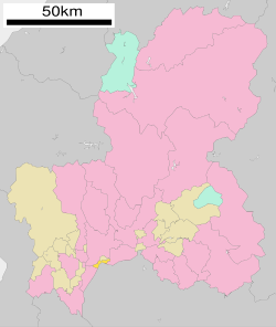
93:Location of Kasamatsu in Gifu Prefecture
720:
322:
306:
278:
261:
240:
227:
214:
166:
131:
97:
85:
57:
45:
314:
296:
286:
253:
245:
232:
219:
202:
190:
178:
7:
1205:List of mergers in Gifu Prefecture
764:Kasamatsu town official statistics
237:10.3 km (4.0 sq mi)
14:
111:
903:
857:
801:
704:
660:
639:
110:
103:
87:
72:
62:
47:
789:Kasamatsu population statistics
1:
411:Köppen climate classification
397:Kasamatsu is located in the
343:Kasamatsu City in drone view
420:Neighbouring municipalities
359:
258:2,200/km (5,600/sq mi)
1245:
1202:
901:
869:
700:Tōkai-Hokuriku Expressway
498:—
353:
132:
98:
86:
58:
46:
37:
28:
1229:Towns in Gifu Prefecture
732:
590:territory controlled by
152:35.367167°N 136.763222°E
25:
778:Kasamatsu climate data
710:National Route 22
607:Hashima District, Gifu
344:
810:at Wikimedia Commons
472:Historical population
342:
157:35.367167; 136.763222
255: • Density
16:Town in Chūbu, Japan
473:
273:Japan Standard Time
148: /
53:Kasamatsu Town Hall
592:Tokugawa shogunate
387:population density
345:
247: • Total
234: • Total
221: • Mayor
1211:
1210:
880:
806:Media related to
603:Meiji restoration
557:
556:
337:
336:
308:Phone number
1236:
1119:Higashishirakawa
1070:Hashima District
1031:Anpachi District
907:
874:
861:
851:
844:
837:
828:
823:
820:
819:
817:Official website
805:
791:
786:
780:
775:
769:
768:
761:
755:
754:
752:
751:
745:
738:
728:
708:
707:
698:
696:
664:
649:Nagoya Main Line
643:
601:During the post-
584:, it was mostly
487:
482:
474:
437:Gifu Prefecture
426:Aichi Prefecture
403:Aichi Prefecture
385:of 22,273 and a
371:Hashima District
364:
362:
356:
355:
333:
332:
330:Official website
163:
162:
160:
159:
158:
153:
149:
146:
145:
144:
141:
114:
113:
107:
91:
76:
66:
51:
32:
31:
30:
19:
1244:
1243:
1239:
1238:
1237:
1235:
1234:
1233:
1224:Kasamatsu, Gifu
1214:
1213:
1212:
1207:
1198:
1163:Motosu District
1019:
908:
899:
881:
865:
863:Gifu Prefecture
855:
821:
815:
814:
808:Kasamatsu, Gifu
799:
794:
787:
783:
776:
772:
766:
762:
758:
749:
747:
743:
736:
734:
730:
729:
722:
718:
705:
694:
692:
689:
679:Nishi-Kasamatsu
636:
631:
623:
615:
562:
466:
422:
395:
350:
328:
327:
156:
154:
150:
147:
142:
139:
137:
135:
134:
128:
127:
126:
125:
122:
121:
120:
119:
115:
94:
82:
81:
80:
79:
70:
69:
54:
42:
33:
26:
24:
17:
12:
11:
5:
1242:
1240:
1232:
1231:
1226:
1216:
1215:
1209:
1208:
1203:
1200:
1199:
1197:
1196:
1195:
1194:
1184:
1183:
1182:
1172:
1171:
1170:
1160:
1159:
1158:
1148:
1147:
1146:
1141:
1136:
1131:
1126:
1121:
1116:
1106:
1105:
1104:
1099:
1094:
1084:
1083:
1082:
1077:
1067:
1066:
1065:
1060:
1050:
1049:
1048:
1043:
1038:
1027:
1025:
1021:
1020:
1018:
1017:
1012:
1007:
1002:
997:
992:
987:
982:
977:
972:
967:
962:
957:
952:
947:
942:
937:
932:
927:
922:
916:
914:
910:
909:
902:
900:
898:
897:
891:
889:
883:
882:
870:
867:
866:
856:
854:
853:
846:
839:
831:
825:
824:
798:
797:External links
795:
793:
792:
781:
770:
756:
719:
717:
714:
713:
712:
702:
688:
685:
684:
683:
682:
681:
658:
657:
656:
635:
632:
630:
629:Transportation
627:
622:
619:
614:
611:
580:. During the
566:Owari Province
561:
558:
555:
554:
551:
548:
544:
543:
540:
537:
533:
532:
529:
526:
522:
521:
518:
515:
511:
510:
507:
504:
500:
499:
496:
493:
489:
488:
483:
478:
465:
462:
461:
460:
459:
458:
453:
448:
443:
435:
434:
433:
421:
418:
394:
391:
335:
334:
325:
321:
320:
317:
313:
312:
309:
305:
304:
302:Cherry blossom
299:
295:
294:
289:
285:
284:
281:
277:
276:
266:
260:
259:
256:
252:
251:
248:
244:
243:
239:
238:
235:
231:
230:
226:
225:
222:
218:
217:
213:
212:
207:
201:
200:
195:
189:
188:
183:
177:
176:
171:
165:
164:
130:
129:
123:
117:
116:
109:
108:
102:
101:
100:
99:
96:
95:
92:
84:
83:
77:
71:
67:
61:
60:
59:
56:
55:
52:
44:
43:
38:
35:
34:
22:
15:
13:
10:
9:
6:
4:
3:
2:
1241:
1230:
1227:
1225:
1222:
1221:
1219:
1206:
1201:
1193:
1190:
1189:
1188:
1187:Yōrō District
1185:
1181:
1178:
1177:
1176:
1173:
1169:
1166:
1165:
1164:
1161:
1157:
1154:
1153:
1152:
1151:Kani District
1149:
1145:
1142:
1140:
1137:
1135:
1132:
1130:
1127:
1125:
1122:
1120:
1117:
1115:
1112:
1111:
1110:
1109:Kamo District
1107:
1103:
1100:
1098:
1095:
1093:
1090:
1089:
1088:
1085:
1081:
1078:
1076:
1073:
1072:
1071:
1068:
1064:
1061:
1059:
1056:
1055:
1054:
1053:Fuwa District
1051:
1047:
1044:
1042:
1039:
1037:
1034:
1033:
1032:
1029:
1028:
1026:
1022:
1016:
1013:
1011:
1008:
1006:
1003:
1001:
998:
996:
993:
991:
988:
986:
983:
981:
978:
976:
973:
971:
968:
966:
963:
961:
958:
956:
953:
951:
948:
946:
943:
941:
938:
936:
933:
931:
928:
926:
923:
921:
918:
917:
915:
911:
906:
896:
893:
892:
890:
888:
884:
878:
873:
868:
864:
860:
852:
847:
845:
840:
838:
833:
832:
829:
822:(in Japanese)
818:
813:
812:
811:
809:
804:
796:
790:
785:
782:
779:
774:
771:
767:(in Japanese)
765:
760:
757:
746:on 2011-06-16
742:
735:
727:
725:
721:
715:
711:
703:
701:
691:
690:
686:
680:
676:
673:
672:
671:
670:Takehana Line
667:
663:
659:
655:
652:
651:
650:
646:
642:
638:
637:
633:
628:
626:
620:
618:
612:
610:
608:
604:
600:
598:
593:
589:
588:
583:
579:
575:
571:
570:Mino Province
567:
559:
552:
549:
546:
545:
541:
538:
535:
534:
530:
527:
524:
523:
519:
516:
513:
512:
508:
505:
502:
501:
497:
494:
491:
490:
484:
479:
476:
475:
469:
463:
457:
454:
452:
449:
447:
444:
442:
439:
438:
436:
432:
429:
428:
427:
424:
423:
419:
417:
415:
412:
408:
404:
400:
392:
390:
388:
384:
380:
376:
372:
368:
361:
360:Kasamatsu-chō
349:
341:
331:
326:
318:
310:
303:
300:
293:
290:
282:
274:
270:
267:
265:
257:
249:
236:
224:Masaaki Hiroe
223:
211:
208:
206:
199:
196:
194:
187:
184:
182:
175:
172:
170:
161:
143:136°45′47.6″E
133:Coordinates:
106:
90:
75:
65:
50:
41:
36:
20:
1175:Ōno District
1087:Ibi District
1079:
950:Kakamigahara
800:
784:
773:
759:
748:. Retrieved
741:the original
624:
616:
595:
585:
563:
467:
464:Demographics
456:Kakamigahara
413:
396:
369:located in
347:
346:
311:058-388-1111
280:City symbols
985:Nakatsugawa
155: /
140:35°22′1.8″N
1218:Categories
1058:Sekigahara
750:2011-01-17
716:References
594:through a
582:Edo period
431:Ichinomiya
407:Kiso River
399:Nōbi Plain
383:population
242:Population
216:Government
193:Prefecture
1180:Shirakawa
1134:Shirakawa
1080:Kasamatsu
1024:Districts
887:Core city
675:Kasamatsu
654:Kasamatsu
621:Education
393:Geography
348:Kasamatsu
264:Time zone
118:Kasamatsu
23:Kasamatsu
1168:Kitagata
1129:Sakahogi
1046:Wanouchi
1015:Yamagata
1005:Takayama
975:Mizunami
965:Minokamo
666:Meitetsu
645:Meitetsu
298:- Flower
205:District
1114:Hichisō
1092:Ibigawa
1036:Anpachi
935:Hashima
877:capital
687:Highway
634:Railway
613:Economy
560:History
451:Hashima
324:Website
316:Address
210:Hashima
169:Country
1156:Mitake
1144:Yaotsu
1139:Tomika
1124:Kawabe
1000:Tajimi
980:Motosu
970:Mizuho
913:Cities
733:笠松町統計書
697:
693:
587:tenryō
574:Nagoya
550:22,208
539:22,809
528:22,319
517:22,229
506:22,865
495:21,912
405:. The
288:- Tree
283:
250:22,273
181:Region
124:
1097:Ikeda
1075:Ginan
1063:Tarui
990:Ōgaki
945:Kaizu
744:(PDF)
737:(PDF)
597:bugyō
576:with
553:−2.6%
547:2020
542:+2.2%
536:2010
531:+0.4%
525:2000
520:−2.8%
514:1990
509:+4.3%
503:1980
492:1970
446:Ginan
379:Japan
365:is a
269:UTC+9
186:Chūbu
174:Japan
1192:Yōrō
1041:Gōdo
1010:Toki
995:Seki
960:Mino
955:Kani
940:Hida
930:Gujō
925:Gero
895:Gifu
872:Gifu
578:Gifu
481:Pop.
477:Year
441:Gifu
375:Gifu
367:town
292:Pine
229:Area
198:Gifu
78:Seal
68:Flag
40:Town
1102:Ōno
920:Ena
695:E41
414:Cfa
354:笠松町
29:笠松町
1220::
723:^
677:-
668:-
647:-
486:±%
377:,
373:,
357:,
879:)
875:(
850:e
843:t
836:v
753:.
599:.
363:)
351:(
275:)
271:(
Text is available under the Creative Commons Attribution-ShareAlike License. Additional terms may apply.