96:
60:
380:, and many kinds of fruits and vegetables are the main crops grown in the district. When the district is compared to other crop-producing regions, the figures that are currently available show a comparatively low level of productivity. Paddy is a prime illustration of this. The government views paddy (rice) as a priority crop due to the nature of island consumption. Njia ya Mtoni Shehia has the largest land allocated to farming crowing the most cassava.
147:
49:
331:
rainy season lasts from March or April through May. During the long wet season, the district receives between 900 mm and 1,200 mm of rainfall, while during the short rainy season, 400 mm to 500 mm. The region can produce a variety of crops and raise livestock because to this rainfall pattern.
388:
The local government authority (LGA) and the central government make up
Kaskazini B's two-tier system of governance. The district director serves as the head of the LGA, whilst the district commissioner (DC), who is supported by the district administrative secretary, serves as the head of the central
586:
A total of 12 secondary schools, 20 primary schools, and 19 pre-primary schools are located in
Kaskazini B.There are altogether 15 primary health care units in the Kaskazini B district (PHCUs). Along with Donge Mchangani and Donge Vijibweni, the list also includes Fujoni, Kiombamvua, Kiongwe, Kitope
330:
weather, with daytime highs of 20 to 40 degrees
Celsius. Additionally, it has a bimodal rainfall pattern, with a protracted rainy season (known in Swahili as Masika) and a brief wet season (known as vuli in Swahili). While the short rainy season occurs in the months of September or October, the long
389:
government (DAS). Agriculture, health, education, national identity, communication, human resources, youth, cooperatives, planning, forestry, sports and culture, livestock, fishery, children and women, legal, water, sports, and coordination are among the 18 departments that make up the DC's office.
339:
Kaskazini B district has a total population of 81,675, or 6.2% of
Zanzibar's population, according to the Population Census of 2012. Misufini shehia has the largest population in the district at 7,986 people. With 5,582 persons, Kitope comes in second. The smallest shehia in the district, Kiongwe
587:(Private), Kiwengwa, and Mahonda. Additionally, Mahonda Medical Clinic (private), Makoba, Misufini, Upenja, Zingwezingwe, Kitope Dispensary RC. Two of these PHCUs are privately held, and the other eight are publicly owned.
95:
910:
867:
842:
792:
767:
742:
717:
690:
618:
109:
1234:
1061:
318:
Located in the lowland region of the island, which makes up about 95% of the land on
Kaskazini B, and the other portion, which is dominated by
310:. The district seat (capital) is the small town of Mahonda. According to the 2022 census, the district has a total population of 99,921.
243:
1025:
326:, with the coastal region, particularly in the west and east, is where the coral land can be found. The region experiences
896:
290:. The district covers an area of 234 km (90 sq mi). The district is comparable in size to the land area of
903:
666:
604:
1054:
59:
322:
characteristics, are the two main components of the landscape. The majority of the district is covered by
299:
352:
remains the biggest income earner in the district. However, agriculture is at the heart of the district,
1047:
218:
195:
33:
644:
348:
As with most of Unguja North Region, the district's economy is dominated with the services industry.
307:
1070:
303:
283:
164:
159:
323:
397:
As of 2016, Kaskazini B District was administratively divided into 10 wards and 44 Shehias.
279:
365:
1146:
253:
1228:
1141:
817:
667:"Kaskazini B (District, Tanzania) - Population Statistics, Charts, Map and Location"
357:
295:
291:
353:
48:
124:
111:
1080:
697:
327:
287:
152:
74:
888:
361:
349:
233:
78:
1039:
1185:
1111:
975:
377:
369:
263:
77:
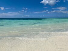
Beach on eastern shore of the district & Mangapwani Caves of the
373:
319:
1043:
892:
294:. The district has a water border to the east and west by the
453:
405:
823:. Swedish International Center for Local Democracy. 2020
642:
236 km (91 sq mi) for Cook
Islands at
1208:
1194:
1178:
1158:
1134:
1120:
1104:
1087:
1018:
998:
984:
968:
933:
691:"2012 Population and Housing Census General Report"
259:
249:
242:
232:
224:
214:
206:
201:
191:
183:
178:
170:
158:
140:
24:
298:. The district is bordered to the south west by
1201:Nungwi Mnarani Marine Turtle Conservation Pond
1055:
904:
282:) is one of two administrative districts of
8:
868:"Kaskazini B District education and health"
1062:
1048:
1040:
911:
897:
889:
21:
19:District in Unguja North Region, Tanzania
16:District of Unguja North Region, Tanzania
596:
340:Kidogo shehia, has only 391 residents.
241:
231:
200:
177:
169:
139:
104:
92:
84:
39:
258:
248:
223:
213:
205:
190:
182:
157:
7:
100:Kaskazini B District in Unguja North
843:"Kaskazini b District subdivisions"
14:
793:"Kaskazini B District government"
743:"Kaskazini B district Population"
1235:Districts of Unguja North Region
718:"Kaskazini B district geography"
187:234 km (90 sq mi)
145:
94:
58:
47:
991:Mangpwani Caves of the enslaved
1026:Kiwengwa-Pongwe Forest Reserve
818:"Local Government in Tanzania"
768:"Kaskazini B District economy"
619:"Kaskazini B district Profile"
1:
1195:National Parks and Reserves
1019:National Parks and Reserves
393:Administrative subdivisions
1251:
1077:
926:
228:430/km (1,100/sq mi)
105:
93:
88:Zanzibar's spice district
85:
40:
31:
125:5.9921000°S 39.2583000°E
1121:National Historic Sites
1030:Kichwele Forest Reserve
985:National Heritage Sites
1179:Major Cities and Towns
999:Major Cities and Towns
645:"Area size comparison"
605:"Kaskazini B District"
582:Education & Health
300:Mjini Magharibi Region
130:-5.9921000; 39.2583000
671:www.citypopulation.de
647:. Nation master. 2022
276:Wilaya ya Kaskazini B
920:Kaskazini B District
308:Kaskazini A District
306:and to the north by
272:Kaskazini B District
250: • Settler
225: • Density
1071:Unguja North Region
304:Unguja South Region
302:, the southeast by
284:Unguja North Region
260: • Native
219:2nd in Unguja North
196:1st in Unguja North
165:Unguja North Region
121: /
71:From top to bottom:
1209:National Landmarks
207: • Total
184: • Total
1222:
1221:
1037:
1036:
578:
577:
445:
444:
269:
268:
215: • Rank
192: • Rank
1242:
1159:Rivers and Lakes
1064:
1057:
1050:
1041:
928:Capital: Mahonda
913:
906:
899:
890:
883:
882:
880:
878:
872:
864:
858:
857:
855:
853:
847:
839:
833:
832:
830:
828:
822:
814:
808:
807:
805:
803:
797:
789:
783:
782:
780:
778:
772:
764:
758:
757:
755:
753:
747:
739:
733:
732:
730:
728:
722:
714:
708:
707:
705:
704:
696:. Government of
695:
687:
681:
680:
678:
677:
663:
657:
656:
654:
652:
640:
634:
633:
631:
629:
623:
615:
609:
608:
601:
454:
406:
151:
149:
148:
136:
135:
133:
132:
131:
126:
122:
119:
118:
117:
114:
98:
62:
51:
22:
1250:
1249:
1245:
1244:
1243:
1241:
1240:
1239:
1225:
1224:
1223:
1218:
1204:
1190:
1174:
1154:
1130:
1116:
1100:
1083:
1073:
1068:
1038:
1033:
1014:
994:
980:
964:
929:
922:
917:
887:
886:
876:
874:
870:
866:
865:
861:
851:
849:
845:
841:
840:
836:
826:
824:
820:
816:
815:
811:
801:
799:
795:
791:
790:
786:
776:
774:
770:
766:
765:
761:
751:
749:
745:
741:
740:
736:
726:
724:
720:
716:
715:
711:
702:
700:
693:
689:
688:
684:
675:
673:
665:
664:
660:
650:
648:
643:
641:
637:
627:
625:
621:
617:
616:
612:
603:
602:
598:
593:
584:
579:
477:Donge Vijibweni
451:
446:
403:
395:
386:
346:
337:
316:
146:
144:
129:
127:
123:
120:
115:
112:
110:
108:
107:
101:
89:
86:Nickname:
81:
73:
68:
67:
66:
65:
64:
63:
54:
53:
52:
36:
27:
20:
17:
12:
11:
5:
1248:
1246:
1238:
1237:
1227:
1226:
1220:
1219:
1217:
1216:
1212:
1210:
1206:
1205:
1203:
1202:
1198:
1196:
1192:
1191:
1189:
1188:
1182:
1180:
1176:
1175:
1173:
1172:
1169:
1168:Bwabwaja River
1166:
1165:Lake Mayugwani
1162:
1160:
1156:
1155:
1153:
1152:
1149:
1147:Tumbatu Island
1144:
1138:
1136:
1132:
1131:
1129:
1128:
1124:
1122:
1118:
1117:
1115:
1114:
1108:
1106:
1105:Native Peoples
1102:
1101:
1099:
1098:
1095:
1091:
1089:
1085:
1084:
1078:
1075:
1074:
1069:
1067:
1066:
1059:
1052:
1044:
1035:
1034:
1032:
1031:
1028:
1022:
1020:
1016:
1015:
1013:
1012:
1009:
1006:
1002:
1000:
996:
995:
993:
992:
988:
986:
982:
981:
979:
978:
972:
970:
969:Native Peoples
966:
965:
963:
962:
959:
956:
953:
950:
947:
944:
941:
937:
935:
931:
930:
927:
924:
923:
918:
916:
915:
908:
901:
893:
885:
884:
873:. Unicef. 2017
859:
848:. Unicef. 2017
834:
809:
798:. Unicef. 2017
784:
773:. Unicef. 2017
759:
748:. Unicef. 2017
734:
723:. Unicef. 2017
709:
682:
658:
635:
624:. Unicef. 2017
610:
595:
594:
592:
589:
583:
580:
576:
575:
571:
570:
567:
564:
561:
558:
555:
552:
549:
546:
543:
540:
537:
532:
531:
530:
527:
524:
521:
518:
515:
512:
509:
506:
503:
500:
499:Kiongwe Kidogo
497:
492:
491:
490:
487:
484:
481:
478:
475:
474:Donge Mtambile
472:
469:
466:
463:
460:
452:
450:
447:
443:
442:
438:
437:
434:
431:
428:
423:
422:
421:
418:
415:
412:
404:
402:
399:
394:
391:
385:
384:Administration
382:
358:sweet potatoes
345:
342:
336:
333:
315:
312:
267:
266:
261:
257:
256:
251:
247:
246:
240:
239:
236:
230:
229:
226:
222:
221:
216:
212:
211:
208:
204:
203:
199:
198:
193:
189:
188:
185:
181:
180:
176:
175:
172:
168:
167:
162:
156:
155:
142:
138:
137:
103:
102:
99:
91:
90:
87:
83:
82:
69:
57:
56:
55:
46:
45:
44:
43:
42:
41:
38:
37:
32:
29:
28:
25:
18:
15:
13:
10:
9:
6:
4:
3:
2:
1247:
1236:
1233:
1232:
1230:
1214:
1213:
1211:
1207:
1200:
1199:
1197:
1193:
1187:
1184:
1183:
1181:
1177:
1170:
1167:
1164:
1163:
1161:
1157:
1151:Daloni Island
1150:
1148:
1145:
1143:
1142:Mnemba Island
1140:
1139:
1137:
1133:
1126:
1125:
1123:
1119:
1113:
1110:
1109:
1107:
1103:
1096:
1093:
1092:
1090:
1086:
1082:
1076:
1072:
1065:
1060:
1058:
1053:
1051:
1046:
1045:
1042:
1029:
1027:
1024:
1023:
1021:
1017:
1010:
1007:
1004:
1003:
1001:
997:
990:
989:
987:
983:
977:
974:
973:
971:
967:
960:
957:
954:
951:
948:
945:
942:
939:
938:
936:
932:
925:
921:
914:
909:
907:
902:
900:
895:
894:
891:
869:
863:
860:
844:
838:
835:
819:
813:
810:
794:
788:
785:
769:
763:
760:
744:
738:
735:
719:
713:
710:
699:
692:
686:
683:
672:
668:
662:
659:
646:
639:
636:
620:
614:
611:
606:
600:
597:
590:
588:
581:
574:
568:
565:
562:
559:
556:
553:
550:
547:
544:
541:
539:Njia ya Mtoni
538:
535:
534:
533:
528:
525:
522:
519:
516:
513:
510:
507:
504:
501:
498:
495:
494:
493:
488:
485:
482:
479:
476:
473:
471:Donge Mnyimbi
470:
467:
465:Donge Kipange
464:
462:Donge Karange
461:
459:Done Mchagani
458:
457:
456:
455:
448:
441:
435:
432:
429:
426:
425:
424:
419:
416:
413:
410:
409:
408:
407:
400:
398:
392:
390:
383:
381:
379:
375:
371:
367:
363:
359:
355:
351:
343:
341:
334:
332:
329:
325:
321:
313:
311:
309:
305:
301:
297:
293:
289:
285:
281:
277:
273:
265:
262:
255:
252:
245:
244:Ethnic groups
238:WaKaskazini B
237:
235:
227:
220:
217:
209:
197:
194:
186:
173:
166:
163:
161:
154:
143:
134:
116:39°15′29.88″E
106:Coordinates:
97:
80:
76:
72:
61:
50:
35:
30:
23:
1215:Nungwi Beach
1171:Pwezaa River
919:
875:. Retrieved
862:
850:. Retrieved
837:
825:. Retrieved
812:
800:. Retrieved
787:
775:. Retrieved
762:
750:. Retrieved
737:
725:. Retrieved
712:
701:. Retrieved
685:
674:. Retrieved
670:
661:
649:. Retrieved
638:
626:. Retrieved
613:
599:
585:
572:
548:Zingwezingwe
439:
396:
387:
347:
338:
335:Demographics
317:
296:Indian Ocean
292:Cook Islands
275:
271:
270:
113:5°59′31.56″S
70:
1097:Kaskazini B
1094:Kaskazini A
468:Donge Mbiji
128: /
26:Kaskazini B
703:2022-06-10
676:2024-02-10
591:References
569:Mangapwani
489:Kiombamvua
202:Population
1088:Districts
1081:Mkokotoni
1079:Capital:
949:Mkataleni
946:Vijibweni
566:Mkataleni
505:Kisongoni
496:Kilombero
420:Mkataleni
417:Vijibweni
314:Geography
1229:Category
1008:Bumbwini
1005:Kiwengwa
952:Kiwengwa
943:Mafufuni
940:Misufini
698:Tanzania
526:Misufini
520:Mafufuni
511:Kiwengwa
483:kidazini
427:Kiwengwa
414:Mafufuni
411:Misufini
328:tropical
288:Tanzania
153:Tanzania
79:enslaved
75:Kiwengwa
34:District
1135:Islands
1127:Tumbatu
1011:Mahonda
961:Mahonda
955:Mbaleni
877:23 July
852:23 July
827:23 July
802:23 July
777:23 July
752:23 July
727:23 July
651:23 July
628:23 July
563:Mkadini
557:Majenzi
551:Mahonda
542:Pangeni
536:Muwanda
529:Mkadini
517:Mbaleni
514:Kwagube
502:Kinduni
486:Kinduni
449:Shehias
436:Mahonda
430:Mbaleni
378:bananas
362:cassava
350:Tourism
344:Economy
324:lowland
280:Swahili
254:Swahili
234:Demonym
174:Mahonda
171:Capital
141:Country
1186:Nungwi
1112:Hadimu
976:Hadimu
958:Fujoni
573:
560:Makoba
554:Mgambo
545:Upenja
523:Mgambo
508:Kitope
480:Fujoni
440:
433:Fujoni
374:spices
370:millet
264:Hadimu
210:99,921
160:Region
150:
934:Wards
871:(PDF)
846:(PDF)
821:(PDF)
796:(PDF)
771:(PDF)
746:(PDF)
721:(PDF)
694:(PDF)
622:(PDF)
401:Wards
354:Paddy
320:coral
879:2022
854:2022
829:2022
804:2022
779:2022
754:2022
729:2022
653:2022
630:2022
366:yams
179:Area
286:in
278:in
1231::
669:.
376:,
372:,
368:,
364:,
360:,
356:,
1063:e
1056:t
1049:v
912:e
905:t
898:v
881:.
856:.
831:.
806:.
781:.
756:.
731:.
706:.
679:.
655:.
632:.
607:.
274:(
Text is available under the Creative Commons Attribution-ShareAlike License. Additional terms may apply.