1294:, the town of Karatsu and the villages of Hamasaki, Irino, Kagami, Karatsu, Kirigo, Kitahata, Kuri, Kyūragi, Minato, Mitsushima, Nagoya, Nanayama, Ōchi, Ōmura, Onizuka, Sashi, Uchiage and Yobuko were established with the creation of the modern municipalities system. Ōmura was renamed Tamashima in July 28, 1896. Hamasaki was elevated to town status on July 1, 1922. Karatsu annexed Mitsushima on January 1, 1924. Yobuko was elevated to town status on August 1, 1928. Karatsu Village was incorporated into Karatsu Town on January 1, 1932, and on September 1, 1935 both Sashi and Ōchi were elevated to town status. Sashi was subsequently annexed by Karatsu on November 11, 1941. Kyūragi was elevated to town status on May 3, 1952. On November 1, 1954 Karatsu annexed Kagami, Kuri, Minato and Onizuka. Hamasaki and Tamashima were merged to create the town of Hamasaki-Tamashima; and Nagoya and Uchiage were merge to create the town of Chinzei on September 30, 1956. On November 1, 1958 Kirigo was split and its parts were incorporated into Karatsu and Irino (respectively), and Irino was elevated to town status and was renamed Hizen. On November 1, 1966 Hamasaki-Tamashima was renamed Hamatama.
128:
51:
1627:
108:
1596:
1586:
1576:
1566:
1556:
1546:
93:
2022:
83:
1377:
the rice production reduction policy, there has been a shift to the production of soybeans and other beans, and barley, wheat, and other grains. Large-scale orchards are spread out in the
Hamatama area, and greenhouse mandarin oranges are a specialty. The main industrial clusters are the Karatsu Ironworks Complex (Nakahara area), the Karatsu Ishishi Industrial Complex (Ishishi area), and the Kishiyama Industrial Complex (Kitahata Kishiyama area).
1656:
1640:
387:
1493:
1453:
1401:
1930:
1536:
363:
1976:
379:
1614:
371:
135:
563:) characterized by warm summers and cool winters with light to no snowfall. The average annual temperature in Karatsu is 15.6 °C. The average annual rainfall is 1760 mm with September as the wettest month. The temperatures are highest on average in August, at around 26.3 °C, and lowest in January, at around 5.5 °C.
1376:
Karatsu has a diverse economy. The main agricultural products are fruit trees, rice, vegetables, and beef cattle. In the plains of Kagami and Kuri, there are vast rice paddies developed as an ancillary project of the river improvement project in the Edo period. Rice is still the main crop, but due to
1385:
Karatsu has 30 public elementary schools and 18 public junior high schools operated by the city government, and one public junior high schools operated by the Saga
Prefectural Board of Education. The prefecture also operates a six public high schools and one special education school for the
50:
475:
tcoast with many inlets and outlets, and due to its geographical features, this area has been a base for maritime traffic to the continent since ancient times. The city also includes a number of populated offshore islands
462:
Karatsu is located in northern Saga
Prefecture. The city area consists of the plains (Karatsu Plain) created by the Matsuura River and Tamashima River, and a hilly basalt plateau called Uwaba. It faces the
1726:. Regularly during Karatsu Kunchi, people in this town open their homes to friends and strangers to eat and drink; the primary focus is enjoying food, beer, and shochu, and having lively conversation.
1722:(floats made of many layers of paper mache) being carried around the city's narrow streets to calls of "Enya!". Some hikiyama members say "Yoisa!". This accompaniment is one of the
1871:
127:
1844:
442:(port), signifies its historical importance as an ancient trading port between Japan with China and Korea. As of 1 June 2024, the city had an estimated
2224:
1718:, which runs annually from November 2 to November 4 and is visited by approximately 500,000 visitors from all over Japan. The festival consists of 14
1965:
1356:
city council of 28 members. Karatsu contributes six members to the Saga
Prefectural Assembly. In terms of national politics, the city is part of the
491:
159:
107:
1689:
487:
1386:
handicapped. There is also one private high school. There is one vocational training school, the
Karatsu Maritime Polytechnical School.
450:
of 200 persons per km. The total area of the city is 487.60 km (188.26 sq mi). The city has the same Hanja name (唐津市) as
2219:
2214:
2190:
1920:
1361:
298:
495:
2104:
1337:
1326:
1264:
1958:
1539:
92:
2172:
2021:
1877:
1850:
1138:
1975:
1943:
1993:
556:
303:
1951:
1723:
1599:
1589:
1579:
1569:
1559:
1549:
199:
82:
2003:
1477:
1473:
1433:
2209:
2128:
2116:
2092:
1897:
1786:
1496:
1456:
1404:
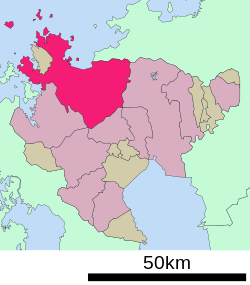
1832:
1819:
2150:
1445:
1518:
1739:
1421:
211:
1684:
282:
1514:
1272:
538:
447:
1417:
2121:
1782:
1719:
1618:
1510:
1429:
1357:
1291:
1276:
1091:
544:
431:
1755:
1749:
1469:
1310:
1263:. In 1591, on the coast of the northern part of the city (formerly the town of Chinzei),
315:
2143:
1979:
1775:
1485:
1441:
1437:
506:
419:
415:
216:
63:
41:
2138:
2133:
1425:
2155:
2076:
1745:
1712:
1673:
1481:
1333:
1322:
1302:
1284:
1280:
1260:
386:
231:
69:
58:
2203:
2051:
2041:
1938:
1699:
1365:
1349:
1314:
1298:
970:
471:(Karatsu Bay) to the north, into which the Matsuura River flows. The northwest is a
2165:
2160:
2109:
1790:
1735:
1678:
1522:
1500:
1460:
1408:
1318:
512:
464:
362:
1934:
2177:
2061:
2036:
2011:
1988:
1769:
1655:
1648:
1639:
1306:
527:
517:
467:
to the east, Imari Bay to the west, the
Kishima Mountains to the south, and the
1492:
1452:
1400:
2097:
2071:
2066:
1809:
The New
Encyclopædia Britannica, Micropædia, Vol:6,, 15th edition, 2003. p.740
1694:
1353:
532:
522:
468:
443:
278:
174:
161:
2056:
1268:
378:
273:
1267:
was constructed. The following year, it became the location from which the
370:
1660:
1631:
480:
340:
1152:
Per
Japanese census data, the population of Karatsu is as shown below.
1715:
451:
423:
204:
570:
Climate data for
Karatsu (2010−2020 normals, extremes 2010−present)
1912:
1644:
1626:
1613:
483:: Mt. Sakurei (887.1 m), Mt. Hachiman (763.6 m), Mt. Tonbo (535 m)
427:
385:
377:
369:
361:
1169:
350:
1947:
472:
1164:
1767:
Karatsu is the setting for two manga and anime series,
1352:
form of government with a directly elected mayor and a
1833:
1287:
was constructed in what is now the heart of Karatsu.
438:(China, or continental East Asia in general), and 津
2085:
2029:
2002:
346:
336:
309:
297:
289:
272:
264:
256:
251:
243:
238:
227:
222:
210:
198:
190:
21:
55:Top: View of Matsuura River and downtown Karatsu
405:
399:
293:1-1 Nishijōnai, Karatsu-shi, Saga-ken 847-8511
28:
1959:
454:in South Chungcheong Province, South Korea.
8:
1155:
382:Karatsu Castle overlooks the city of Karatsu
57:2nd left: Oteguchi Bus Terminal, 2nd right:
1966:
1952:
1944:
1898:Saga Prefecture population by municipality
1491:
1451:
1399:
1154:
566:
18:
1259:The area of Karatsu was part of ancient
492:Sefuri-Kitayama Prefectural Natural Park
1802:
446:of 114,695 in 51375 households, and a
331:
308:
296:
288:
271:
250:
247:487.60 km (188.26 sq mi)
237:
221:
189:
154:
120:
104:
76:
47:
112:Location of Karatsu in Saga Prefecture
1690:Saga Prefectural Nagoya Castle Museum
488:Hachimandake Prefectural Natural Park
345:
335:
263:
255:
242:
226:
209:
197:
116:
7:
1283:. In 1602, replacing Nagoya Castle,
1507:
1332:On January 1, 2006, the village of
2191:List of mergers in Saga Prefecture
1820:"Karatsu City official statistics"
1756:Toshiro Miyazaki (Baseball Player)
14:
2225:Populated coastal places in Japan
1297:On January 1, 2005, the towns of
2020:
1974:
1928:
1654:
1638:
1625:
1612:
1594:
1584:
1574:
1564:
1554:
1544:
1534:
133:
126:
106:
91:
81:
49:
496:Tenzan Prefectural Natural Park
134:
1:
1921:Karatsu City official website
1913:Karatsu City official website
430:. Its name, formed from the
1329:) were merged into Karatsu.
1933:Geographic data related to
1789:was both filmed and set in
1340:) was merged into Karatsu.
1043:Average precipitation days
829:Mean daily minimum °C (°F)
689:Mean daily maximum °C (°F)
406:
2241:
1711:Karatsu is famous for its
1136:
569:
2220:Port settlements in Japan
2215:Cities in Saga Prefecture
2188:
2018:
1986:
1730:Notable people from Imari
1275:. In the middle of 1593,
1182:—
1089:
1042:
968:
898:
828:
758:
688:
618:
613:
610:
607:
604:
601:
598:
595:
592:
589:
586:
583:
580:
577:
574:
557:humid subtropical climate
400:
356:
332:
327:
323:
155:
121:
117:
105:
77:
48:
39:
29:
2105:Higashimatsuura District
1872:
1845:
1724:100 Soundscapes of Japan
1338:Higashimatsuura District
1327:Higashimatsuura District
502:Adjoining municipalities
25:
1600:National Route 382
1590:National Route 323
1580:National Route 204
1570:National Route 203
1560:National Route 202
1550:National Route 202
1540:Nishi-Kyūshū Expressway
268:240/km (610/sq mi)
2173:Nishimatsuura District
1787:Fireworks over the Sea
391:
383:
375:
367:
175:33.45000°N 129.96833°E
1846:観測史上1~10位の値(年間を通じての値)
1822:(in Japanese). Japan.
1156:Historical population
390:Fresh squid in Yobuko
389:
381:
373:
365:
16:City in Kyushu, Japan
619:Record high °C (°F)
265: • Density
234:(from February 2017)
1785:award-winning film
1783:Keisuke Kinoshita's
1685:Kawamura Art Museum
1321:and the village of
1157:
899:Record low °C (°F)
759:Daily mean °C (°F)
180:33.45000; 129.96833
171: /
1873:気象庁 / 平年値(年・月ごとの値)
1762:In popular culture
1273:Toyotomi Hideyoshi
539:Fukuoka Prefecture
448:population density
392:
384:
376:
368:
257: • Total
244: • Total
228: • Mayor
2197:
2196:
1997:
1668:Local attractions
1619:Reihoku, Kumamoto
1358:Saga 2nd district
1292:Meiji restoration
1277:Terazawa Hirotaka
1252:
1251:
1144:
1143:
422:on the island of
366:Karatsu City Hall
360:
359:
290:City hall address
147:Location in Japan
2232:
2129:Kishima District
2117:Kanzaki District
2093:Fujitsu District
2024:
1991:
1978:
1968:
1961:
1954:
1945:
1932:
1931:
1925:
1917:
1900:
1895:
1889:
1888:
1886:
1884:
1868:
1862:
1861:
1859:
1857:
1841:
1835:
1830:
1824:
1823:
1816:
1810:
1807:
1750:Badminton player
1659:
1658:
1643:
1642:
1630:
1629:
1617:
1616:
1598:
1597:
1588:
1587:
1578:
1577:
1568:
1567:
1558:
1557:
1548:
1547:
1538:
1537:
1509:
1495:
1468:
1455:
1416:
1403:
1271:was launched by
1171:
1166:
1158:
1046:
567:
465:Sefuri Mountains
413:
412:
409:
403:
402:
319:
318:
316:Official website
186:
185:
183:
182:
181:
176:
172:
169:
168:
167:
164:
137:
136:
130:
110:
95:
85:
66:pine forest area
53:
34:
33:
32:
31:
19:
2240:
2239:
2235:
2234:
2233:
2231:
2230:
2229:
2200:
2199:
2198:
2193:
2184:
2151:Miyaki District
2081:
2025:
2016:
1998:
1982:
1980:Saga Prefecture
1972:
1929:
1923:
1915:
1909:
1904:
1903:
1896:
1892:
1882:
1880:
1874:
1870:
1869:
1865:
1855:
1853:
1847:
1843:
1842:
1838:
1831:
1827:
1818:
1817:
1813:
1808:
1804:
1799:
1776:Zombieland Saga
1764:
1732:
1709:
1670:
1653:
1637:
1624:
1611:
1608:
1595:
1585:
1575:
1565:
1555:
1545:
1535:
1531:
1478:Higashi-Karatsu
1474:Nijinomatsubara
1466:
1414:
1397:
1392:
1383:
1374:
1346:
1257:
1150:
1145:
1044:
1037:
1032:
1027:
1022:
1017:
1012:
1007:
1002:
997:
992:
987:
982:
977:
963:
958:
953:
948:
943:
938:
933:
928:
923:
918:
913:
908:
903:
893:
888:
883:
878:
873:
868:
863:
858:
853:
848:
843:
838:
833:
823:
818:
813:
808:
803:
798:
793:
788:
783:
778:
773:
768:
763:
753:
748:
743:
738:
733:
728:
723:
718:
713:
708:
703:
698:
693:
683:
678:
673:
668:
663:
658:
653:
648:
643:
638:
633:
628:
623:
553:
507:Saga Prefecture
504:
486:Natural Parks:
460:
420:Saga Prefecture
410:
397:
314:
313:
179:
177:
173:
170:
165:
162:
160:
158:
157:
151:
150:
149:
148:
145:
144:
143:
142:
138:
113:
101:
100:
99:
98:
89:
88:
73:
67:
64:Nijinomatsubara
61:
56:
44:
35:
27:
26:
24:
17:
12:
11:
5:
2238:
2236:
2228:
2227:
2222:
2217:
2212:
2202:
2201:
2195:
2194:
2189:
2186:
2185:
2183:
2182:
2181:
2180:
2170:
2169:
2168:
2163:
2158:
2148:
2147:
2146:
2141:
2136:
2126:
2125:
2124:
2114:
2113:
2112:
2102:
2101:
2100:
2089:
2087:
2083:
2082:
2080:
2079:
2074:
2069:
2064:
2059:
2054:
2049:
2044:
2039:
2033:
2031:
2027:
2026:
2019:
2017:
2015:
2014:
2008:
2006:
2000:
1999:
1987:
1984:
1983:
1973:
1971:
1970:
1963:
1956:
1948:
1942:
1941:
1926:
1918:
1908:
1907:External links
1905:
1902:
1901:
1890:
1863:
1836:
1825:
1811:
1801:
1800:
1798:
1795:
1794:
1793:
1780:
1763:
1760:
1759:
1758:
1753:
1746:Takeshi Kamura
1743:
1731:
1728:
1713:Karatsu Kunchi
1708:
1705:
1704:
1703:
1697:
1692:
1687:
1682:
1676:
1674:Karatsu Castle
1669:
1666:
1665:
1664:
1651:
1635:
1622:
1607:
1604:
1603:
1602:
1592:
1582:
1572:
1562:
1552:
1542:
1530:
1527:
1526:
1525:
1489:
1488:
1449:
1448:
1396:
1393:
1391:
1388:
1382:
1379:
1373:
1370:
1348:Karatsu has a
1345:
1342:
1290:Following the
1285:Karatsu Castle
1281:Karatsu Domain
1261:Hizen Province
1256:
1253:
1250:
1249:
1246:
1243:
1239:
1238:
1235:
1232:
1228:
1227:
1224:
1221:
1217:
1216:
1213:
1210:
1206:
1205:
1202:
1199:
1195:
1194:
1191:
1188:
1184:
1183:
1180:
1177:
1173:
1172:
1167:
1162:
1149:
1146:
1142:
1141:
1134:
1133:
1130:
1127:
1124:
1121:
1118:
1115:
1112:
1109:
1106:
1103:
1100:
1097:
1094:
1092:sunshine hours
1087:
1086:
1083:
1080:
1077:
1074:
1071:
1068:
1065:
1062:
1059:
1056:
1053:
1050:
1047:
1040:
1039:
1034:
1029:
1024:
1019:
1014:
1009:
1004:
999:
994:
989:
984:
979:
974:
966:
965:
960:
955:
950:
945:
940:
935:
930:
925:
920:
915:
910:
905:
900:
896:
895:
890:
885:
880:
875:
870:
865:
860:
855:
850:
845:
840:
835:
830:
826:
825:
820:
815:
810:
805:
800:
795:
790:
785:
780:
775:
770:
765:
760:
756:
755:
750:
745:
740:
735:
730:
725:
720:
715:
710:
705:
700:
695:
690:
686:
685:
680:
675:
670:
665:
660:
655:
650:
645:
640:
635:
630:
625:
620:
616:
615:
612:
609:
606:
603:
600:
597:
594:
591:
588:
585:
582:
579:
576:
572:
571:
565:
555:Karatsu has a
552:
549:
548:
547:
536:
535:
530:
525:
520:
515:
503:
500:
499:
498:
484:
459:
456:
374:Karatsu Castle
358:
357:
354:
353:
348:
344:
343:
338:
334:
333:
330:
329:
325:
324:
321:
320:
311:
307:
306:
301:
295:
294:
291:
287:
286:
276:
270:
269:
266:
262:
261:
258:
254:
253:
249:
248:
245:
241:
240:
236:
235:
229:
225:
224:
220:
219:
214:
208:
207:
202:
196:
195:
192:
188:
187:
153:
152:
146:
140:
139:
132:
131:
125:
124:
123:
122:
119:
118:
115:
114:
111:
103:
102:
96:
90:
86:
80:
79:
78:
75:
74:
70:Karatsu Kunchi
59:Karatsu Castle
54:
46:
45:
40:
37:
36:
22:
15:
13:
10:
9:
6:
4:
3:
2:
2237:
2226:
2223:
2221:
2218:
2216:
2213:
2211:
2210:Karatsu, Saga
2208:
2207:
2205:
2192:
2187:
2179:
2176:
2175:
2174:
2171:
2167:
2164:
2162:
2159:
2157:
2154:
2153:
2152:
2149:
2145:
2142:
2140:
2137:
2135:
2132:
2131:
2130:
2127:
2123:
2120:
2119:
2118:
2115:
2111:
2108:
2107:
2106:
2103:
2099:
2096:
2095:
2094:
2091:
2090:
2088:
2084:
2078:
2075:
2073:
2070:
2068:
2065:
2063:
2060:
2058:
2055:
2053:
2050:
2048:
2045:
2043:
2040:
2038:
2035:
2034:
2032:
2028:
2023:
2013:
2010:
2009:
2007:
2005:
2001:
1995:
1990:
1985:
1981:
1977:
1969:
1964:
1962:
1957:
1955:
1950:
1949:
1946:
1940:
1939:OpenStreetMap
1936:
1935:Karatsu, Saga
1927:
1922:
1919:
1916:(in Japanese)
1914:
1911:
1910:
1906:
1899:
1894:
1891:
1879:
1875:
1867:
1864:
1852:
1848:
1840:
1837:
1834:
1829:
1826:
1821:
1815:
1812:
1806:
1803:
1796:
1792:
1788:
1784:
1781:
1778:
1777:
1772:
1771:
1766:
1765:
1761:
1757:
1754:
1751:
1747:
1744:
1741:
1737:
1734:
1733:
1729:
1727:
1725:
1721:
1717:
1714:
1706:
1701:
1698:
1696:
1693:
1691:
1688:
1686:
1683:
1680:
1677:
1675:
1672:
1671:
1667:
1663:, South Korea
1662:
1657:
1652:
1650:
1646:
1641:
1636:
1633:
1628:
1623:
1620:
1615:
1610:
1609:
1606:Sister cities
1605:
1601:
1593:
1591:
1583:
1581:
1573:
1571:
1563:
1561:
1553:
1551:
1543:
1541:
1533:
1532:
1528:
1524:
1520:
1516:
1512:
1506:
1505:
1504:
1502:
1498:
1494:
1487:
1483:
1479:
1475:
1471:
1465:
1464:
1463:
1462:
1458:
1454:
1447:
1446:Nishi-Karatsu
1443:
1439:
1435:
1431:
1427:
1423:
1419:
1413:
1412:
1411:
1410:
1406:
1402:
1394:
1389:
1387:
1380:
1378:
1371:
1369:
1367:
1366:Diet of Japan
1363:
1359:
1355:
1351:
1350:mayor-council
1343:
1341:
1339:
1335:
1330:
1328:
1324:
1320:
1316:
1312:
1308:
1304:
1300:
1295:
1293:
1288:
1286:
1282:
1278:
1274:
1270:
1266:
1265:Nagoya Castle
1262:
1254:
1247:
1244:
1241:
1240:
1236:
1233:
1230:
1229:
1225:
1222:
1219:
1218:
1214:
1211:
1208:
1207:
1203:
1200:
1197:
1196:
1192:
1189:
1186:
1185:
1181:
1178:
1175:
1174:
1168:
1163:
1160:
1159:
1153:
1147:
1140:
1135:
1131:
1128:
1125:
1122:
1119:
1116:
1113:
1110:
1107:
1104:
1101:
1098:
1095:
1093:
1090:Mean monthly
1088:
1084:
1081:
1078:
1075:
1072:
1069:
1066:
1063:
1060:
1057:
1054:
1051:
1048:
1041:
1035:
1030:
1025:
1020:
1015:
1010:
1005:
1000:
995:
990:
985:
980:
975:
972:
971:precipitation
967:
961:
956:
951:
946:
941:
936:
931:
926:
921:
916:
911:
906:
901:
897:
891:
886:
881:
876:
871:
866:
861:
856:
851:
846:
841:
836:
831:
827:
821:
816:
811:
806:
801:
796:
791:
786:
781:
776:
771:
766:
761:
757:
751:
746:
741:
736:
731:
726:
721:
716:
711:
706:
701:
696:
691:
687:
681:
676:
671:
666:
661:
656:
651:
646:
641:
636:
631:
626:
621:
617:
573:
568:
564:
562:
558:
550:
546:
543:
542:
541:
540:
534:
531:
529:
526:
524:
521:
519:
516:
514:
511:
510:
509:
508:
501:
497:
493:
489:
485:
482:
479:
478:
477:
474:
470:
466:
457:
455:
453:
449:
445:
441:
437:
434:word roots 唐
433:
429:
425:
421:
417:
408:
396:
388:
380:
372:
364:
355:
352:
349:
342:
339:
326:
322:
317:
312:
305:
302:
300:
292:
284:
280:
277:
275:
267:
259:
246:
233:
230:
218:
215:
213:
206:
203:
201:
193:
184:
156:Coordinates:
129:
109:
94:
84:
71:
65:
60:
52:
43:
38:
20:
2046:
2004:Special city
1924:(in English)
1893:
1883:February 27,
1881:. Retrieved
1866:
1856:February 27,
1854:. Retrieved
1839:
1828:
1814:
1805:
1774:
1768:
1736:Ken Hisatomi
1710:
1700:Kagami Jinja
1679:Karatsu ware
1501:Chikuhi Line
1490:
1461:Chikuhi Line
1450:
1409:Karatsu Line
1398:
1384:
1375:
1347:
1331:
1296:
1289:
1258:
1151:
1148:Demographics
973:mm (inches)
560:
554:
537:
505:
461:
439:
435:
394:
393:
232:Tatsurō Mine
72:in November.
2122:Yoshinogari
1770:Yuri on Ice
1649:South Korea
1362:lower house
418:located in
407:Karatsu-shi
178: /
166:129°58′06″E
2204:Categories
1797:References
1740:Footballer
1695:Matsurokan
1519:Nishi-Ōchi
1515:Hizen-Kubo
1354:unicameral
1344:Government
1325:(all from
1045:(≥ 1.0 mm)
469:Genkai Sea
444:population
252:Population
223:Government
212:Prefecture
163:33°27′00″N
2144:Shiroishi
2086:Districts
1707:Festivals
1511:Honmutabe
1497:JR Kyushu
1457:JR Kyushu
1430:Honmutabe
1405:JR Kyushu
1390:Transport
1381:Education
1269:Imjin War
481:Mountains
458:Geography
279:UTC+09:00
274:Time zone
2156:Kamimine
2077:Ureshino
1720:hikiyama
1716:festival
1661:Seogwipo
1632:Yangzhou
1529:Highways
1470:Hamasaki
1434:Yamamoto
1334:Nanayama
1323:Kitahata
1303:Hamatama
1279:created
1137:Source:
1132:1,890.3
1038:(77.93)
1013:(12.37)
1008:(13.74)
1003:(11.02)
969:Average
559:(Köppen
545:Itoshima
432:Japanese
341:Wisteria
68:Bottom:
2052:Kashima
2047:Karatsu
2042:Kanzaki
1994:capital
1791:Yobuko.
1681:pottery
1634:, China
1621:, Japan
1503:(West)
1486:Karatsu
1442:Karatsu
1438:Onizuka
1418:Kyūragi
1395:Railway
1372:Economy
1364:of the
1360:of the
1311:Kyūragi
1299:Chinzei
1255:History
1245:117,373
1234:126,926
1223:134,144
1212:139,888
1201:142,224
1190:141,171
1179:173,866
1036:1,979.3
1033:(3.72)
1028:(3.37)
1023:(4.99)
1018:(7.53)
998:(4.94)
993:(5.76)
988:(4.61)
983:(3.36)
978:(2.97)
964:(23.7)
959:(30.2)
954:(35.4)
949:(46.0)
944:(54.7)
939:(63.9)
934:(63.3)
929:(55.8)
924:(44.4)
919:(37.8)
914:(30.0)
909:(24.3)
904:(23.7)
894:(55.2)
889:(40.1)
884:(49.1)
879:(59.9)
874:(69.3)
869:(75.9)
864:(74.5)
859:(66.7)
854:(58.5)
849:(50.4)
844:(43.3)
839:(37.9)
834:(36.9)
824:(61.7)
819:(46.6)
814:(56.5)
809:(66.2)
804:(74.7)
799:(81.7)
794:(79.5)
789:(72.0)
784:(66.4)
779:(58.1)
774:(50.7)
769:(45.0)
764:(43.3)
754:(69.1)
749:(53.6)
744:(64.0)
739:(73.0)
734:(81.3)
729:(89.1)
724:(86.4)
719:(78.8)
714:(75.2)
709:(66.4)
704:(58.6)
699:(52.2)
694:(50.0)
684:(99.1)
679:(76.6)
674:(80.6)
669:(88.9)
664:(96.4)
659:(99.1)
654:(96.4)
649:(92.3)
644:(90.0)
639:(80.8)
634:(76.8)
629:(73.0)
624:(67.1)
551:Climate
452:Dangjin
395:Karatsu
328:Symbols
310:Website
299:Climate
260:114,695
191:Country
141:Karatsu
23:Karatsu
2166:Miyaki
2161:Kiyama
2139:Ōmachi
2134:Kōhoku
2110:Genkai
2030:Cities
1482:Watada
1336:(from
1319:Yobuko
1193:−18.8%
1129:101.5
1126:141.3
1123:166.7
1120:151.4
1117:219.7
1114:175.2
1111:124.2
1108:213.4
1105:186.8
1102:172.0
1099:118.0
1096:111.2
1085:113.3
575:Month
513:Genkai
424:Kyushu
337:Flower
205:Kyushu
200:Region
97:Emblem
2178:Arita
2062:Takeo
2037:Imari
1645:Yeosu
1422:Iwaya
1307:Hizen
1248:−7.5%
1242:2020
1237:−5.4%
1231:2010
1226:−4.1%
1220:2000
1215:−1.6%
1209:1990
1204:+0.7%
1198:1980
1187:1970
1176:1960
1073:11.2
1067:12.5
1064:11.9
1021:126.7
1016:191.3
1011:314.1
1006:349.0
1001:280.0
996:125.5
991:146.3
986:117.0
614:Year
528:Takeo
518:Imari
428:Japan
414:is a
194:Japan
62:3rd:
2098:Tara
2072:Tosu
2067:Taku
2012:Saga
1989:Saga
1885:2022
1858:2022
1773:and
1523:Sari
1426:Ōchi
1315:Ōchi
1165:Pop.
1161:Year
1082:9.2
1079:8.6
1076:7.4
1070:8.9
1061:7.4
1058:9.3
1055:9.7
1052:9.4
1049:7.8
1031:94.6
1026:85.7
981:85.4
976:75.4
962:−4.6
957:−1.0
942:12.6
937:17.7
932:17.4
927:13.2
912:−1.1
907:−4.3
902:−4.6
892:12.9
877:15.5
872:20.7
867:24.4
862:23.6
857:19.3
852:14.7
847:10.2
822:16.5
812:13.6
807:19.0
802:23.7
797:27.6
792:26.4
787:22.2
782:19.1
777:14.5
772:10.4
752:20.6
747:12.0
742:17.8
737:22.8
732:27.4
727:31.7
722:30.2
717:26.0
712:24.0
707:19.1
702:14.8
697:11.2
692:10.0
682:37.3
677:24.8
672:27.0
667:31.6
662:35.8
657:37.3
652:35.8
647:33.5
642:32.2
637:27.1
632:24.9
627:22.8
622:19.5
611:Dec
608:Nov
605:Oct
602:Sep
599:Aug
596:Jul
593:Jun
590:May
587:Apr
584:Mar
581:Feb
578:Jan
533:Taku
523:Saga
436:kara
416:city
351:Pine
347:Tree
239:Area
217:Saga
87:Flag
42:City
2057:Ogi
1937:at
1878:JMA
1851:JMA
1499:-
1459:-
1407:-
1139:JMA
952:1.9
947:7.8
922:6.9
917:3.2
887:4.5
882:9.5
842:6.3
837:3.3
832:2.7
817:8.1
767:7.2
762:6.3
561:Cfa
473:ria
440:tsu
401:唐津市
304:Cfa
283:JST
30:唐津市
2206::
1876:.
1849:.
1647:,
1521:-
1517:-
1513:-
1484:-
1480:-
1476:-
1472:-
1467:JK
1444:-
1440:-
1436:-
1432:-
1428:-
1424:-
1420:-
1415:JK
1368:.
1317:,
1313:,
1309:,
1305:,
1301:,
1170:±%
494:,
490:,
426:,
404:,
1996:)
1992:(
1967:e
1960:t
1953:v
1887:.
1860:.
1779:.
1752:)
1748:(
1742:)
1738:(
1702:.
1508:■
411:)
398:(
285:)
281:(
Text is available under the Creative Commons Attribution-ShareAlike License. Additional terms may apply.