402:
269:, in which residents reported seeing unidentifiable creatures and lights at a rural farmhouse. In honor of this event, the community hosts the Kelly "Little Green Men" Days festival each year, where visitors can buy "intergalactic souvenirs". The 2017 anniversary and festival coincided with a
45:
556:
320:
561:
313:
58:
306:
270:
225:
141:
298:
433:
282:
266:
112:
44:
330:
215:
117:
211:
178:
90:
526:
413:
35:
376:
352:
183:
483:
473:
533:
498:
468:
151:
448:
386:
381:
503:
427:
421:
391:
478:
458:
371:
493:
463:
438:
488:
550:
254:
345:
100:
240:
227:
73:
60:
132:
517:‡This populated place also has portions in an adjacent county or counties
219:
166:
105:
158:
137:
363:
302:
265:
The community is best known for being the location of the 1955
401:
400:
294:
194:
557:
Unincorporated communities in
Christian County, Kentucky
512:
447:
412:
362:
189:
177:
165:
148:
131:
123:
111:
99:
89:
26:
16:
Unincorporated community in
Kentucky, United States
314:
8:
222:, in the United States. Kelly is located at
321:
307:
299:
23:
188:
164:
130:
122:
88:
53:
41:
562:Unincorporated communities in Kentucky
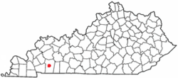
405:Location of Christian County, Kentucky
176:
147:
110:
98:
7:
21:Community in Kentucky, United States
329:Municipalities and communities of
267:Kelly-Hopkinsville alien encounter
14:
43:
1:
283:Kelly-Hopkinsville encounter
253:(38.218373, -85.353058), on
49:Location of Kelly, Kentucky
578:
332:Christian County, Kentucky
522:
398:
343:
54:
42:
33:
212:unincorporated community
127:797 ft (243 m)
406:
404:
241:36.97056°N 87.47694°W
150: • Summer (
74:36.97056°N 87.47694°W
535:United States portal
434:Fort Campbell North
271:total solar eclipse
246:36.97056; -87.47694
237: /
79:36.97056; -87.47694
70: /
407:
28:Community of Kelly
544:
543:
205:
204:
569:
536:
529:
403:
355:
348:
338:
333:
323:
316:
309:
300:
252:
251:
249:
248:
247:
242:
238:
235:
234:
233:
230:
216:Christian County
201:
198:
196:
155:
85:
84:
82:
81:
80:
75:
71:
68:
67:
66:
63:
47:
24:
577:
576:
572:
571:
570:
568:
567:
566:
547:
546:
545:
540:
534:
528:Kentucky portal
527:
518:
508:
450:
443:
408:
396:
358:
353:
346:
339:
336:
331:
327:
291:
279:
263:
245:
243:
239:
236:
231:
228:
226:
224:
223:
193:
173:
149:
78:
76:
72:
69:
64:
61:
59:
57:
56:
50:
38:
29:
22:
17:
12:
11:
5:
575:
573:
565:
564:
559:
549:
548:
542:
541:
539:
538:
531:
523:
520:
519:
516:
514:
510:
509:
507:
506:
501:
496:
491:
486:
481:
476:
471:
466:
461:
455:
453:
449:Unincorporated
445:
444:
442:
441:
436:
431:
425:
418:
416:
410:
409:
399:
397:
395:
394:
389:
384:
379:
374:
368:
366:
360:
359:
344:
341:
340:
328:
326:
325:
318:
311:
303:
297:
296:
290:
287:
286:
285:
278:
275:
262:
259:
203:
202:
191:
187:
186:
181:
175:
174:
171:
169:
163:
162:
156:
146:
145:
135:
129:
128:
125:
121:
120:
115:
109:
108:
103:
97:
96:
93:
87:
86:
52:
51:
48:
40:
39:
34:
31:
30:
27:
20:
15:
13:
10:
9:
6:
4:
3:
2:
574:
563:
560:
558:
555:
554:
552:
537:
532:
530:
525:
524:
521:
515:
511:
505:
502:
500:
497:
495:
492:
490:
487:
485:
482:
480:
477:
475:
472:
470:
467:
465:
462:
460:
457:
456:
454:
452:
446:
440:
437:
435:
432:
429:
426:
423:
420:
419:
417:
415:
411:
393:
390:
388:
385:
383:
380:
378:
375:
373:
370:
369:
367:
365:
361:
357:
356:
349:
342:
337:United States
334:
324:
319:
317:
312:
310:
305:
304:
301:
295:
293:
292:
288:
284:
281:
280:
276:
274:
272:
268:
260:
258:
256:
255:U.S. Route 41
250:
221:
217:
213:
209:
200:
192:
185:
184:270 & 364
182:
180:
170:
168:
160:
157:
153:
143:
142:Eastern (CST)
139:
136:
134:
126:
119:
116:
114:
107:
104:
102:
95:United States
94:
92:
83:
55:Coordinates:
46:
37:
32:
25:
19:
377:Hopkinsville
354:Hopkinsville
351:
264:
207:
206:
179:Area code(s)
18:
484:Honey Grove
474:Hensleytown
451:communities
347:County seat
244: /
77: /
551:Categories
499:Mannington
469:Fearsville
289:References
232:87°28′37″W
229:36°58′14″N
65:87°28′37″W
62:36°58′14″N
513:Footnotes
387:Oak Grove
382:LaFayette
133:Time zone
124:Elevation
118:Christian
36:Community
504:Newstead
428:Fairview
422:Cerulean
392:Pembroke
277:See also
220:Kentucky
197:.kellyky
167:ZIP code
106:Kentucky
479:Herndon
459:Edgoten
372:Crofton
261:History
190:Website
91:Country
494:Julien
464:Empire
439:Gracey
364:Cities
210:is an
113:County
489:Howel
208:Kelly
172:40067
161:(CST)
159:UTC-4
138:UTC-5
101:State
414:CDPs
199:.com
214:in
195:www
152:DST
553::
350::
335:,
273:.
257:.
218:,
430:‡
424:‡
322:e
315:t
308:v
154:)
144:)
140:(
Text is available under the Creative Commons Attribution-ShareAlike License. Additional terms may apply.