1687:) were corn mills, and were fed by long leats. The weir for Millness Mill was next to Peasey Bridge, which now carries the A65 road. The mill race for Milton Mill started at the point where the tail race of Millness Mill discharged water back into the river. Milton Mill was a lowder mill, where the high breast-shot water wheel is located inside the building. An annular ring was attached to the side of the wheel, which meshed with a wallower, fixed to a vertical shaft. On the floor above the wheel, a great spur wheel was attached to the vertical shaft, and a triangular lowder frame carried three smaller cogs or stone nuts, which drove the three pairs of stones resting on the frame. A fourth pair of stones was added around 1900, giving the lowder frame a bulge on one side. When the mill was listed in 1962, the mill wheel and all of the machinery were still in situ, and this was still the case in 1978.
1506:
settled in
November 1912, when the High Court ruled that the canal company did not inherit the fishing rights. The rights are managed by the Killington Reservoir Fishery Charity, which has three trustees, one appointed by each of the parishes. They have been rented by the Kent Angling Association for many years, and the £750 income is split between the Old Hutton Mole Fund, the New Hutton Institute and Killington Village Hall. Residents of the parishes can obtain fishing licences at reduced fees. By 1976, Old Hutton's income from the fishing rights was no longer adequate to employ a full-time mole catcher, and the trust deed governing the Mole Fund was amended, with funds now being used for the benefit of residents in Old Hutton and Homescales.
1558:
1470:. They bought 86 acres (35 ha) of land in 1810, in order to build the reservoir, but over-stretched themselves, and construction had to wait until they had raised more money. William Crossley was the Canal company's engineer from 10 May 1817, while James Briggs was the superintendent. Crossley oversaw the construction of the reservoir. The contract was initially awarded to Millington, Bainbridge & Kelly, but there was a problem with their tender, and William Seed carried out the work. Two dams were required to impound the water, both of which had clay cores. The larger one (
42:
1582:
1675:) started as a corn mill. The wheel was driven by a long leat which left the beck around 550 yards (500 m) upstream, and provided a fall of 20 feet (6 m). From 1805 it was used to mill flax and to produce ropes. This continued for 50 years, and it was then used to produce bobbins for the Lancashire cotton industry, until its closure in the 1930s. The mill race ran along the right bank of the river, and the weir was just downstream of the point at which the Lancaster Canal feeder left the river. Both Millness Mill (
1632:), just above Bridge End Bridge. A mill race left the river on its left bank and fed a mill much closer to the bridge. In the late 1600s, it was a corn mill and some of the first machinery for cleaning grain to be used in the region was described by Thomas Machell, the rector of Kirkby Thore, who collected a huge amount of data about Cumbria until his death in 1698. At that time, the mill was used for grinding the barrels of guns as well as grinding, threshing and winnowing corn. It had become a bobbin mill and woollen
61:
1522:
buildings were sited as far away from the motorway as possible, but were quite small, initially having parking for 64 cars and 13 heavy goods vehicles. The building was replaced in 1985, using a standard design, but with larger windows to take advantage of the views across the reservoir. The service area gained a hotel in 1994 and a tourist information centre in 1997. Planning permission to expand the amenity building was granted in 2019{.{cn|date=August 2024}}
1669:) is known to have been in existence since 1184, and during the 14th century was worked by monks who owned Challon Hall. It was a corn mill, and closed during the Second World War. The wheel was fed from a weir at Challon Hall, which ran along the eastern edge of the road, and passed under the road near the mill. The mill race was supplemented by water from Birks Beck. At Park End Mill, just below Kaker Mill, marble was cut and polished. Crooklands Mill (
1482:) was 360 feet (110 m) long and just 10 feet (3 m) high. The reservoir was eventually completed in 1819. It now covers an area of 140 acres (57 ha), as its banks have been raised twice. A wave wall was built along the top of the dams in the late 1970s, to prevent erosion of the face of the dam in high winds. When full the reservoir holds 3,236 Ml of water, and supplies around 22.7 Ml per day to the Lancaster Canal.
1228:
1194:
1175:
1028:
482:
1148:
1141:
1114:
1107:
1054:
982:
905:
898:
824:
757:
677:
657:
637:
590:
536:
516:
435:
415:
335:
301:
274:
1221:
1201:
548:
496:
355:
313:
1272:
1061:
975:
817:
717:
617:
570:
489:
254:
1168:
1080:
1035:
1008:
953:
946:
932:
871:
851:
844:
797:
777:
737:
697:
375:
1498:
allowing further common land to be divided into fields which were given to those with grazing rights. The canal company obtained an additional 26 acres (11 ha) at this time, and the original three parishes received payment. Old Hutton received £321 9s 3d (£321.46) as part of the deal, which they used to set up a Mole Fund, and to employ Thomas
Woodhouse, a mole catcher resident in
1250:
1087:
1001:
939:
878:
462:
455:
395:
2457:
68:
1606:
Construction of the scheme began in 2016, with 86 per cent of the materials and labour being procured locally. The total cost of the project was £240,000, including the design work. A crossflow turbine was installed into the existing drawdown pipe, designed to produce 30 kW from a flow of 300 litres per second.
1654:
were manufactured each week. It was shipped to northern
England and Wales, and was also exported to West Africa and India. The site occupied around 70 acres (28 ha), with the area now occupied by Gatebeck Caravan Park and Millbrook Caravan Park being used first. Mills were built on both sides of
1392:
Beyond the bridge on the eastern bank of the river are the remains of Low
Gatebeck gunpowder works. Although the northern part of the site has been demolished and levelled, much of the southern part of the site remains, and is one of the better preserved gunpowder works dating from the 19th and early
1695:
The
Environment Agency measure water quality of the river systems in England. Each is given an overall ecological status, which may be one of five levels: high, good, moderate, poor and bad. There are several components that are used to determine this, including biological status, which looks at the
1659:
by closed horsedrawn carts. From 1874, a tramway was used to move the gunpowder to the station. It ran alongside Peasey Beck to the A65 road, but motive power was still provided by horses, which were shod with brass shoes to prevent the risk of sparks. The site closed in 1937, the last such facility
1505:
Landowners in the three parishes maintained that although they had sold the land, that did not include the fishing rights, and appointed a bailiff to enforce this in 1840. However, the canal company claimed they owned the fishing rights in 1880, and a long-running dispute followed, which was finally
1380:
Two dams impound the water of
Killington Reservoir, and the main outflow for Peasey Beck runs through the longer of the two. The beck is crossed by Reservoir Road, a minor road that follows the southern shore of the reservoir, and then by another unnamed road at Low Bendrigg. Near Crooks Plantation,
1649:
At
Gatebeck, there was a network of weirs and channels which supplied water to industrial buildings to the north of the Gatebeck Bridge. Four weirs are marked on old maps, and the buildings are also served by the Gatebeck Tramway. Below Gatebeck Bridge there is another weir and a long mill race to
1497:
to the south-east. Landowners who had grazing rights on the land were compensated for their loss, and the rights of turbary were also lost, as the main peat workings for the villages were flooded. The New Hutton, Old Hutton, Killington, Mansergh and Lupton
Enclosure Award Act was obtained in 1841,
1593:
power. Killington was chosen as a potential site for a community hydro-electric project because of its size, as it impounds some 3.2 billion litres of water, rainfall data for over 30 years was available, and there was already an outflow pipe running through the dam 49 feet (15 m) below the
1417:
Beyond the canal there are weirs associated with a water mill at
Millness and another at Milton. The mill at Millness was a corn mill, and was fed by a long lade which began at a weir at Crooklands. At Milton, the mill is attached to the rear of the former miller's house, built in the early 18th
1521:
were keen that service areas in
Cumbria should be notable for their scenery, and the views over the reservoir were the main factor for the services only catering for southbound travellers. They were built in 1972, soon after the motorway opened, and were officially opened on 17 May 1972. The
1605:
Divers installed a fish pass to prevent bottom feeding fish from entering the outflow pipe during 2014, and in 2015 a community benefit society called Community Energy Cumbria was formed. Around 100 people subscribed to the share issue launched in July 2015, most from the local community.
1408:
over the river, and immediately beyond it, Peasey Beck passes under the Lancaster Canal through an aqueduct. The aqueduct dates from around 1818, and consists of two shallow arches, built at an angle to the line of the canal, with curved retaining walls at either side. It is about 30 feet
1389:. A minor road from Old Hutton crosses at Beckside, and then Popplemire Lane is carried over the waterway by Blaystone Bridge. Shortly afterwards, the beck turns to the south. Gatebeck Bridge carries Gatebeck Lane over the river at Gatebeck, and there is a weir to the south of the bridge.
1549:
Water sports also take place on the reservoir. The Killington Sailing Association has a clubhouse and floating jetty on the east side of the lake, next to the main dam, and has facilities for dinghy sailing, canoeing, paddle-boarding and wind-surfing. They are affiliated to the
1613:
MP. During its first year of operation it generated income of £33,500. Of this, £21,500 was available to fund interest payments and repayment of capital to the shareholders, as well as for community benefits, which are expected to be around £50,000 over the first 20 years.
1381:
it turns to the east before sweeping round in a large loop to head westwards. It is joined by Gillsmere Sike on its left bank, which flows northwards, passing close to a small lake called Tarneybank Tarn, the outflow from which supplements that of Gillsmere Sike.
1400:, where there is another weir, and is crossed by a minor road carried by Challon Hall Bridge, near to Challon Hall. At Kaker Mill or Preston Patrick, there is another weir, and the beck turns to the south-west. The beck falls over a weir where the feeder for the
1655:
Peasey Beck, which were linked together by internal tramways. Peasey Beck provided the power, but later on, steam engines were used. The finished product was packed into barrels, which were manufactured by Gatebeck Cooperage, and was transported to
1384:
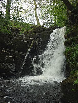
Peasey Beck is crossed by another minor road as it approaches the hamlet of Little Brunthwaite, after which it is crossed by the M6 motorway. The next crossing is the B6254 at Bridge End, and there are waterfalls as it passes to the south of
1393:
20th centuries in northern England. Many of the buildings still stand, as well as parts of the water management system. The weir by Gatebeck Bridge provided water power for some of the production processes, and fed waterwheels and turbines.
1754:
Like many waterways in the UK, the chemical status changed from good to fail in 2019, due to the presence of polybrominated diphenyl ethers (PBDE) and mercury compounds, neither of which had previously been included in the assessment.
1413:
structure. The canal feeder continues a little further south around the back of Crooklands coach garage, before passing under the A65 road and through the grounds of Mill Outstation, a depot for National Highways, to enter the canal.
1525:
The reservoir contains populations of both game fish and coarse fish, and fishing rights are rented by the Kent (Westmorland) Angling Association. For game fishing, the association stocks the reservoir with
1594:
surface level of the reservoir. The scheme was initiated by Cumbria Action for Sustainability, who funded the feasibility studies, with engineering design carried out by Ellergreen Hydro of nearby
1418:
century, with an extension constructed in 1863 for Jacob Wakefield, whose initials appear on the end gable. The water wheel and internal machinery remain in situ. The beck passes under the
1546:. Season tickets and day tickets are available for those who are not members of the association, and fishing is only allowed from the banks of the reservoir, with no fishing from boats.
599:
1650:
the east of the main channel within the powder works. Gatebeck Mill produced gunpowder. Production of gunpowder for use in mines and quarries began in 1852 and around 20
1530:
between March and June each year, and the game fishing season runs from 15 March until 30 September. Coarse fishing is available all year round, and the reservoir contains
1671:
1829:
1677:
1642:
1683:
1628:
1478:
1665:
1472:
1357:
1557:
217:
2312:
Jecock, Marcus; Dunn, Christopher; et al. (2009). "Gatebeck Low Gunpowder Works and the Workers' Settlements of Endmoor and Gatebeck, Cumbria".
2281:
2125:
2089:
2219:
1602:, and planning permission was obtained in September 2013, to which there were no objections, in part due to the level of community involvement.
1476:) crossed the valley of the Peasey Beck, and was 830 feet (253 m) long and 52 feet (15.8 m) high. The second dam further to the west (
1881:
1862:
2143:
1704:
and fish. Chemical status, which compares the concentrations of various chemicals against known safe concentrations, is rated good or fail.
147:
60:
1845:
1404:
diverges, before it passes through a sluice, and runs parallel to the river for most of the way to the canal. Peasey Bridge carries the
2052:
2007:
1983:
41:
2487:
2047:
2026:
2002:
1978:
1707:
The water quality of the Peasey Beck was as follows in 2019. The data only includes a short section above Killington Reservoir.
1422:
and Wath Sutton Bridge at Wath Sutton. It is joined by Farleton Beck on its left bank, and the combined flow join that of
1353:
210:
1374:
552:
317:
2169:
1822:
2492:
2477:
1656:
1551:
1490:
1764:
1123:
283:
235:
1581:
1518:
1514:
914:
203:
1569:; the reservoir merely controls the flow in the beck. A small dam about 6 miles (9.7 km) downstream near
2429:
1915:
1775:
2482:
1566:
2461:
2277:
2121:
2085:
1517:, which is only accessible to southbound drivers, is situated on the bank. When it was being planned, the
2215:
1599:
1494:
2403:
1802:
2139:
1797:
1841:
2325:
1877:
1858:
1585:
The outfow from the Reservoir. The hydro-electric plant is in the white building on the right.
1459:
1455:
1369:, where it is known as the Sparishaw Beck. It heads towards the south, and is crossed by the
2321:
2043:
1998:
1974:
1792:
1590:
1499:
1451:
1410:
1401:
961:
1622:
Despite its relatively small size, the waters of Peasey Beck have powered at least eight
2022:
2471:
1463:
1423:
1349:
1329:
1317:
1309:
1236:
2404:"Glossary (see Biological quality element; Chemical status; and Ecological status)"
1697:
1531:
1427:
1646:), a weir and mill race was constructed for a corn mill which was by the bridge.
1458:
obtained in 1807 to deviate from their original route, and to extract water from
1527:
1510:
114:
17:
1701:
1610:
1570:
1486:
1467:
1439:
1435:
1431:
1386:
1337:
1333:
1258:
133:
129:
47:
2450:
2329:
163:
149:
1623:
1595:
1419:
1370:
1787:
1554:
and offer training to members, youth groups and people with disadvantages.
2456:
2165:
196:
1651:
1450:
Killington Reservoir or Killington Lake was built to supply water to the
1405:
1366:
1340:. Prior to 1913, it was known as the River Beela throughout its length.
1660:
in the area to do so, and the caravan parks opened in the early 1970s.
1633:
1397:
1313:
102:
92:
1561:
Water diverted from Peasey Beck entering Lancaster Canal at Crooklands
1589:
Since 2017, the outflow from the reservoir has been used to generate
1362:
2065:
2063:
1609:
The scheme was switched on in January 2017, and formally opened by
1580:
1556:
1543:
1539:
1637:
1535:
1466:
and Crooklands Beck (later called Peasey Beck), rather than the
1895:. Written to celebrate the building of a new school at Endmoor.
1454:. The proprietors for the Lancaster Canal were empowered by an
2003:"Aqueduct carrying Lancaster Canal over Peasey Beck (1336111)"
1485:
Land for the reservoir consisted of parts of the parishes of
1565:
Below the dam, the water is not carried to the canal in an
1636:
mill by the mid-19th century, and was processing Italian
2295:
2293:
2291:
1842:"Hydroelectric Scheme – Killington Reservoir Overspill"
1513:
passes immediately to the west of the reservoir, and
2122:"Killington Reservoir and the Old Hutton Mole Fund"
1377:and Fairthorns Road to reach Killington Reservoir.
187:
139:
123:
113:
108:
98:
88:
83:
34:
2101:
2099:
1874:The Canals of North West England, Vol 1 (pp.1-236)
1352:, close to the 1,015-foot (310 m) contour (
2048:"Milton Mill House and attached Mill (1086529)"
1598:. A lease for 40 years was negotiated with the
2069:
211:
8:
2390:
2378:
2264:
2116:
2114:
2080:
2078:
1893:A journey through Endmoor in times gone by
1872:Hadfield, Charles; Biddle, Gordon (1970).
243:
218:
204:
2251:
2249:
2247:
2245:
2243:
2241:
2255:Ordnance Survey, Six inch map, 1888-1913
2038:
2036:
1979:"Low Gatebeck gunpowder works (1018135)"
1964:Ordnance Survey, 1:25,000 map, Sheet OL7
1709:
1308:is a 19.6-kilometre-long (12.2 mi)
2366:
2354:
2342:
2299:
1960:
1958:
1956:
1954:
1952:
1950:
1948:
1946:
1907:
1848:from the original on 26 September 2022.
1835:from the original on 24 September 2021.
201:
2222:from the original on 15 December 2015.
1940:Ordnance Survey, 6 inch map, 1888-1913
1438:, which flows into the estuary of the
31:
1828:. Cumbria Action for Sustainability.
1626:. Furthest upstream was Hutton mill (
7:
2232:
2202:
2190:
2128:from the original on 1 October 2022.
2029:from the original on 1 October 2022.
725:site of Low Gatebeck gunpowder work
75:Location of the mouth within Cumbria
2172:from the original on 1 October 2022
2146:from the original on 1 October 2022
2105:
2092:from the original on 3 August 2020.
67:
2284:from the original on 7 March 2022.
2168:. Killington Sailing Association.
2053:National Heritage List for England
2008:National Heritage List for England
1984:National Heritage List for England
1745:15.48 square miles (40.1 km)
1147:
1140:
1113:
1106:
904:
897:
756:
676:
656:
636:
589:
535:
515:
434:
414:
334:
300:
273:
46:Waterfall on the Peasey Beck near
25:
2314:Research Department Report Series
1227:
1220:
1200:
1193:
1174:
1027:
495:
481:
354:
2455:
2280:. Cumbria County History Trust.
1271:
1270:
1248:
1226:
1219:
1199:
1192:
1173:
1166:
1146:
1139:
1112:
1105:
1085:
1078:
1060:
1059:
1053:
1052:
1033:
1026:
1006:
999:
981:
980:
974:
973:
951:
944:
937:
930:
903:
896:
876:
869:
849:
842:
823:
822:
816:
815:
795:
775:
755:
735:
716:
715:
695:
675:
655:
635:
616:
615:
588:
569:
568:
546:
534:
514:
494:
488:
487:
480:
460:
453:
433:
413:
393:
373:
353:
333:
311:
299:
272:
253:
252:
66:
59:
40:
2088:. Engineering Timelines. 2020.
1396:The beck passes to the east of
1167:
1079:
1034:
1007:
952:
945:
931:
886:site of Crooklands Bobbin Mill
870:
850:
843:
796:
776:
736:
696:
374:
1573:diverts water into the canal.
1249:
1086:
1000:
938:
877:
461:
454:
394:
141: • coordinates
1:
2278:"Old Hutton with Holmescales"
1640:in 1885. At Beckside Bridge (
1348:The source of the beck is on
109:Physical characteristics
2142:. Kent Angling Association.
1844:. Community Energy Cumbria.
1409:(9.1 m) wide, and is a
2218:. Ellergreen Energy. 2011.
1853:Davies-Shiel, Mike (1978).
1803:GPX (secondary coordinates)
625:site of Beckside corn mill
191:19.6 km (12.2 mi)
125: • location
2509:
2070:Hadfield & Biddle 1970
1742:12.2 miles (19.6 km)
1696:quantity and varieties of
1657:Milnthorpe railway station
1552:Royal Yachting Association
1491:Old Hutton and Holmescales
920:Peasey Bridge, Crooklands
524:Little Brunthwaite bridge
262:Source of Killington Beck
27:Stream in Cumbria, England
2025:. Old Cumbria Gazetteer.
2023:"Millness Mill, Millness"
1798:GPX (primary coordinates)
1773:Map all coordinates using
1765:List of rivers of England
1320:where it is known as the
1279:
1264:
1257:
1242:
1235:
1213:
1208:
1186:
1182:
1160:
1155:
1133:
1121:
1099:
1094:
1072:
1068:
1046:
1042:
1020:
1015:
993:
989:
967:
960:
924:
912:
890:
885:
863:
858:
836:
831:
809:
804:
789:
784:
769:
764:
749:
744:
729:
724:
709:
704:
689:
684:
669:
664:
649:
644:
629:
624:
609:
597:
582:
577:
562:
543:
528:
523:
508:
503:
474:
469:
447:
442:
427:
422:
407:
402:
387:
382:
367:
362:
347:
342:
327:
308:
293:
281:
266:
261:
246:
54:
39:
2430:"Peasey Beck Water Body"
2369:, p.13 (Rebecca Hunter).
2345:, p.34 (Colin Redmayne).
1781:Download coordinates as:
1515:Killington Lake Services
2488:South Lakeland District
2434:Catchment Data Explorer
2408:Catchment Data Explorer
1920:Catchment Data Explorer
1857:. Dalesman Publishing.
1733:Peasey Beck Water Body
1493:to the south-west, and
1316:, England. It rises on
383:Hydro-electric station
343:Fairthorns Road bridge
2357:, p.14 (Olive Clarke).
2216:"Killington Reservoir"
2140:"Killington Reservoir"
2124:. Old Hutton website.
2086:"Killington Reservoir"
1823:"A Tale of Two Hydros"
1586:
1562:
1502:, from December 1853.
1016:site of Millness Mill
423:Reservoir Road bridge
2436:. Environment Agency.
1876:. David and Charles.
1855:Watermills of Cumbria
1793:GPX (all coordinates)
1600:Canal and River Trust
1584:
1560:
1519:Ministry of Transport
578:site of Hutton mills
363:Killington Reservoir
2464:at Wikimedia Commons
2410:. Environment Agency
1922:. Environment Agency
1577:Hydro-electric power
1446:Killington Reservoir
1326:Killington Reservoir
1156:Wath Sutton Bridges
1095:site of Milton Mill
765:Challon Hall Bridge
443:Low Bendrigg bridge
2072:, pp. 192–193.
1681:) and Milton Mill (
1328:and converges with
601: B6254
159: /
1587:
1563:
1125: A590
605:Bridge End bridge
285: A684
164:54.2245°N 2.7407°W
2493:Beck watercourses
2478:Rivers of Cumbria
2460:Media related to
2391:Davies-Shiel 1978
2381:, pp. 80–81.
2379:Davies-Shiel 1978
2267:, pp. 73–74.
2265:Davies-Shiel 1978
1883:978-0-7153-4956-4
1864:978-0-85206-467-2
1752:
1751:
1748:heavily modified
1716:Ecological status
1456:Act of Parliament
1303:
1302:
1299:
1298:
916: A65
665:Blaystone Bridge
195:
194:
16:(Redirected from
2500:
2459:
2438:
2437:
2426:
2420:
2419:
2417:
2415:
2400:
2394:
2388:
2382:
2376:
2370:
2364:
2358:
2352:
2346:
2340:
2334:
2333:
2322:English Heritage
2309:
2303:
2297:
2286:
2285:
2274:
2268:
2262:
2256:
2253:
2236:
2230:
2224:
2223:
2212:
2206:
2200:
2194:
2188:
2182:
2181:
2179:
2177:
2162:
2156:
2155:
2153:
2151:
2136:
2130:
2129:
2118:
2109:
2103:
2094:
2093:
2082:
2073:
2067:
2058:
2057:
2044:Historic England
2040:
2031:
2030:
2019:
2013:
2012:
1999:Historic England
1995:
1989:
1988:
1975:Historic England
1971:
1965:
1962:
1941:
1938:
1932:
1931:
1929:
1927:
1912:
1896:
1891:Various (1990).
1887:
1868:
1849:
1836:
1834:
1827:
1710:
1686:
1680:
1674:
1668:
1645:
1631:
1481:
1475:
1434:, to become the
1360:
1324:, flows through
1312:flowing through
1274:
1273:
1252:
1251:
1230:
1229:
1223:
1222:
1203:
1202:
1196:
1195:
1177:
1176:
1170:
1169:
1150:
1149:
1143:
1142:
1128:
1126:
1116:
1115:
1109:
1108:
1089:
1088:
1082:
1081:
1063:
1062:
1056:
1055:
1037:
1036:
1030:
1029:
1010:
1009:
1003:
1002:
984:
983:
977:
976:
955:
954:
948:
947:
941:
940:
934:
933:
919:
917:
907:
906:
900:
899:
880:
879:
873:
872:
859:Weir and sluice
853:
852:
846:
845:
826:
825:
819:
818:
799:
798:
779:
778:
759:
758:
739:
738:
719:
718:
699:
698:
685:Gatebeck Bridge
679:
678:
659:
658:
645:Beckside bridge
639:
638:
619:
618:
604:
602:
592:
591:
572:
571:
557:
555:
554: M6
551:
550:
549:
538:
537:
518:
517:
498:
497:
491:
490:
484:
483:
470:Tarneybank Tarn
464:
463:
457:
456:
437:
436:
417:
416:
397:
396:
377:
376:
357:
356:
337:
336:
322:
320:
319: M6
316:
315:
314:
303:
302:
288:
286:
276:
275:
256:
255:
244:
220:
213:
206:
197:
183:
182:
180:
179:
178:
176:
171:
170:
169:54.2245; -2.7407
165:
160:
157:
156:
155:
152:
70:
69:
63:
44:
32:
21:
2508:
2507:
2503:
2502:
2501:
2499:
2498:
2497:
2468:
2467:
2451:Lancaster Canal
2447:
2442:
2441:
2428:
2427:
2423:
2413:
2411:
2402:
2401:
2397:
2389:
2385:
2377:
2373:
2365:
2361:
2353:
2349:
2341:
2337:
2311:
2310:
2306:
2298:
2289:
2276:
2275:
2271:
2263:
2259:
2254:
2239:
2231:
2227:
2214:
2213:
2209:
2201:
2197:
2193:, pp. 3–4.
2189:
2185:
2175:
2173:
2164:
2163:
2159:
2149:
2147:
2138:
2137:
2133:
2120:
2119:
2112:
2104:
2097:
2084:
2083:
2076:
2068:
2061:
2042:
2041:
2034:
2021:
2020:
2016:
1997:
1996:
1992:
1973:
1972:
1968:
1963:
1944:
1939:
1935:
1925:
1923:
1914:
1913:
1909:
1904:
1899:
1890:
1884:
1871:
1865:
1852:
1839:
1832:
1825:
1820:
1816:
1811:
1810:
1809:
1808:
1807:
1761:
1719:Chemical status
1693:
1682:
1676:
1670:
1664:
1641:
1627:
1620:
1579:
1500:Preston Patrick
1489:, to the west,
1477:
1471:
1452:Lancaster Canal
1448:
1426:to the east of
1411:grade II listed
1402:Lancaster Canal
1356:
1346:
1275:
1253:
1231:
1224:
1204:
1197:
1178:
1171:
1151:
1144:
1124:
1122:
1117:
1110:
1090:
1083:
1064:
1057:
1038:
1031:
1011:
1004:
985:
978:
962:Lancaster Canal
956:
949:
942:
935:
915:
913:
908:
901:
881:
874:
854:
847:
827:
820:
800:
780:
760:
740:
720:
700:
680:
660:
640:
620:
600:
598:
593:
573:
553:
547:
545:
544:
539:
519:
504:Gillsmere Sike
499:
492:
485:
465:
458:
438:
418:
398:
378:
358:
338:
318:
312:
310:
309:
304:
284:
282:
277:
257:
238:
229:
228:
224:
174:
172:
168:
166:
162:
161:
158:
153:
150:
148:
146:
145:
142:
126:
79:
78:
77:
76:
73:
72:
71:
50:
28:
23:
22:
18:Killington Lake
15:
12:
11:
5:
2506:
2504:
2496:
2495:
2490:
2485:
2483:Kent catchment
2480:
2470:
2469:
2466:
2465:
2453:
2446:
2445:External links
2443:
2440:
2439:
2421:
2395:
2393:, p. 113.
2383:
2371:
2359:
2347:
2335:
2304:
2287:
2269:
2257:
2237:
2225:
2207:
2195:
2183:
2157:
2131:
2110:
2095:
2074:
2059:
2032:
2014:
1990:
1966:
1942:
1933:
1906:
1905:
1903:
1900:
1898:
1897:
1888:
1882:
1869:
1863:
1850:
1837:
1817:
1815:
1812:
1806:
1805:
1800:
1795:
1790:
1784:
1778:
1771:
1770:
1769:
1768:
1767:
1760:
1757:
1750:
1749:
1746:
1743:
1740:
1737:
1734:
1730:
1729:
1726:
1723:
1720:
1717:
1714:
1692:
1689:
1619:
1616:
1591:hydro-electric
1578:
1575:
1447:
1444:
1354:grid reference
1345:
1342:
1322:Sparishaw Beck
1301:
1300:
1297:
1296:
1294:
1292:
1290:
1288:
1286:
1284:
1281:
1280:
1278:
1276:
1269:
1267:
1265:
1262:
1261:
1256:
1254:
1247:
1245:
1243:
1240:
1239:
1234:
1232:
1225:
1218:
1216:
1214:
1211:
1210:
1209:Farleton Beck
1207:
1205:
1198:
1191:
1189:
1187:
1184:
1183:
1181:
1179:
1172:
1165:
1163:
1161:
1158:
1157:
1154:
1152:
1145:
1138:
1136:
1134:
1131:
1130:
1120:
1118:
1111:
1104:
1102:
1100:
1097:
1096:
1093:
1091:
1084:
1077:
1075:
1073:
1070:
1069:
1067:
1065:
1058:
1051:
1049:
1047:
1044:
1043:
1041:
1039:
1032:
1025:
1023:
1021:
1018:
1017:
1014:
1012:
1005:
998:
996:
994:
991:
990:
988:
986:
979:
972:
970:
968:
965:
964:
959:
957:
950:
943:
936:
929:
927:
925:
922:
921:
911:
909:
902:
895:
893:
891:
888:
887:
884:
882:
875:
868:
866:
864:
861:
860:
857:
855:
848:
841:
839:
837:
834:
833:
830:
828:
821:
814:
812:
810:
807:
806:
805:Park End Mill
803:
801:
794:
792:
790:
787:
786:
783:
781:
774:
772:
770:
767:
766:
763:
761:
754:
752:
750:
747:
746:
743:
741:
734:
732:
730:
727:
726:
723:
721:
714:
712:
710:
707:
706:
703:
701:
694:
692:
690:
687:
686:
683:
681:
674:
672:
670:
667:
666:
663:
661:
654:
652:
650:
647:
646:
643:
641:
634:
632:
630:
627:
626:
623:
621:
614:
612:
610:
607:
606:
596:
594:
587:
585:
583:
580:
579:
576:
574:
567:
565:
563:
560:
559:
542:
540:
533:
531:
529:
526:
525:
522:
520:
513:
511:
509:
506:
505:
502:
500:
493:
486:
479:
477:
475:
472:
471:
468:
466:
459:
452:
450:
448:
445:
444:
441:
439:
432:
430:
428:
425:
424:
421:
419:
412:
410:
408:
405:
404:
401:
399:
392:
390:
388:
385:
384:
381:
379:
372:
370:
368:
365:
364:
361:
359:
352:
350:
348:
345:
344:
341:
339:
332:
330:
328:
325:
324:
307:
305:
298:
296:
294:
291:
290:
280:
278:
271:
269:
267:
264:
263:
260:
258:
251:
249:
247:
240:
239:
234:
231:
230:
226:
225:
223:
222:
215:
208:
200:
193:
192:
189:
185:
184:
143:
140:
137:
136:
127:
124:
121:
120:
117:
111:
110:
106:
105:
100:
96:
95:
90:
86:
85:
81:
80:
74:
65:
64:
58:
57:
56:
55:
52:
51:
45:
37:
36:
26:
24:
14:
13:
10:
9:
6:
4:
3:
2:
2505:
2494:
2491:
2489:
2486:
2484:
2481:
2479:
2476:
2475:
2473:
2463:
2458:
2454:
2452:
2449:
2448:
2444:
2435:
2431:
2425:
2422:
2409:
2405:
2399:
2396:
2392:
2387:
2384:
2380:
2375:
2372:
2368:
2363:
2360:
2356:
2351:
2348:
2344:
2339:
2336:
2331:
2327:
2323:
2319:
2315:
2308:
2305:
2302:, p. 11.
2301:
2296:
2294:
2292:
2288:
2283:
2279:
2273:
2270:
2266:
2261:
2258:
2252:
2250:
2248:
2246:
2244:
2242:
2238:
2234:
2229:
2226:
2221:
2217:
2211:
2208:
2204:
2199:
2196:
2192:
2187:
2184:
2171:
2167:
2161:
2158:
2145:
2141:
2135:
2132:
2127:
2123:
2117:
2115:
2111:
2107:
2102:
2100:
2096:
2091:
2087:
2081:
2079:
2075:
2071:
2066:
2064:
2060:
2055:
2054:
2049:
2045:
2039:
2037:
2033:
2028:
2024:
2018:
2015:
2010:
2009:
2004:
2000:
1994:
1991:
1986:
1985:
1980:
1976:
1970:
1967:
1961:
1959:
1957:
1955:
1953:
1951:
1949:
1947:
1943:
1937:
1934:
1921:
1917:
1916:"Peasey Beck"
1911:
1908:
1901:
1894:
1889:
1885:
1879:
1875:
1870:
1866:
1860:
1856:
1851:
1847:
1843:
1838:
1831:
1824:
1821:CAfS (2019).
1819:
1818:
1813:
1804:
1801:
1799:
1796:
1794:
1791:
1789:
1786:
1785:
1783:
1782:
1777:
1776:OpenStreetMap
1774:
1766:
1763:
1762:
1758:
1756:
1747:
1744:
1741:
1738:
1735:
1732:
1731:
1727:
1724:
1721:
1718:
1715:
1712:
1711:
1708:
1705:
1703:
1699:
1698:invertebrates
1691:Water quality
1690:
1688:
1685:
1679:
1673:
1667:
1661:
1658:
1653:
1647:
1644:
1639:
1635:
1630:
1625:
1617:
1615:
1612:
1607:
1603:
1601:
1597:
1592:
1583:
1576:
1574:
1572:
1568:
1559:
1555:
1553:
1547:
1545:
1541:
1537:
1533:
1529:
1523:
1520:
1516:
1512:
1507:
1503:
1501:
1496:
1492:
1488:
1483:
1480:
1474:
1469:
1465:
1464:Stainton Beck
1461:
1460:Farleton Beck
1457:
1453:
1445:
1443:
1441:
1437:
1433:
1429:
1425:
1424:Stainton Beck
1421:
1415:
1412:
1407:
1403:
1399:
1394:
1390:
1388:
1382:
1378:
1376:
1372:
1368:
1364:
1359:
1355:
1351:
1350:Lambrigg Fell
1343:
1341:
1339:
1335:
1331:
1330:Stainton Beck
1327:
1323:
1319:
1318:Lambrigg Fell
1315:
1311:
1307:
1295:
1293:
1291:
1289:
1287:
1285:
1283:
1282:
1277:
1268:
1266:
1263:
1260:
1255:
1246:
1244:
1241:
1238:
1237:Stainton Beck
1233:
1217:
1215:
1212:
1206:
1190:
1188:
1185:
1180:
1164:
1162:
1159:
1153:
1137:
1135:
1132:
1127:
1119:
1103:
1101:
1098:
1092:
1076:
1074:
1071:
1066:
1050:
1048:
1045:
1040:
1024:
1022:
1019:
1013:
997:
995:
992:
987:
971:
969:
966:
963:
958:
928:
926:
923:
918:
910:
894:
892:
889:
883:
867:
865:
862:
856:
840:
838:
835:
832:Canal feeder
829:
813:
811:
808:
802:
793:
791:
788:
782:
773:
771:
768:
762:
753:
751:
748:
742:
733:
731:
728:
722:
713:
711:
708:
702:
693:
691:
688:
682:
673:
671:
668:
662:
653:
651:
648:
642:
633:
631:
628:
622:
613:
611:
608:
603:
595:
586:
584:
581:
575:
566:
564:
561:
556:
541:
532:
530:
527:
521:
512:
510:
507:
501:
478:
476:
473:
467:
451:
449:
446:
440:
431:
429:
426:
420:
411:
409:
406:
400:
391:
389:
386:
380:
371:
369:
366:
360:
351:
349:
346:
340:
331:
329:
326:
321:
306:
297:
295:
292:
287:
279:
270:
268:
265:
259:
250:
248:
245:
242:
241:
237:
233:
232:
221:
216:
214:
209:
207:
202:
199:
198:
190:
186:
181:
144:
138:
135:
131:
128:
122:
118:
116:
112:
107:
104:
101:
97:
94:
91:
87:
82:
62:
53:
49:
43:
38:
33:
30:
19:
2433:
2424:
2412:. Retrieved
2407:
2398:
2386:
2374:
2367:Various 1990
2362:
2355:Various 1990
2350:
2343:Various 1990
2338:
2317:
2313:
2307:
2300:Various 1990
2272:
2260:
2235:, p. 6.
2228:
2210:
2205:, p. 5.
2198:
2186:
2176:27 September
2174:. Retrieved
2160:
2150:27 September
2148:. Retrieved
2134:
2051:
2017:
2006:
1993:
1982:
1969:
1936:
1924:. Retrieved
1919:
1910:
1892:
1873:
1854:
1840:CEC (2018).
1814:Bibliography
1780:
1779:
1772:
1753:
1706:
1694:
1663:Kaker Mill (
1662:
1648:
1621:
1608:
1604:
1588:
1564:
1548:
1524:
1508:
1504:
1484:
1449:
1428:Ackenthwaite
1416:
1395:
1391:
1383:
1379:
1347:
1332:to form the
1325:
1321:
1305:
1304:
403:Peasey Beck
29:
2462:Peasey Beck
1702:angiosperms
1528:brown trout
1511:M6 motorway
1375:M6 motorway
1306:Peasey Beck
785:Kaker Mill
227:Peasey Beck
167: /
35:Peasey Beck
2472:Categories
1926:1 November
1902:References
1624:watermills
1611:Tim Farron
1571:Crooklands
1495:Killington
1487:New Hutton
1468:River Mint
1440:River Kent
1436:River Bela
1432:Milnthorpe
1387:Old Hutton
1361:) between
1338:Milnthorpe
1334:River Bela
1259:River Bela
173: (
151:54°13′28″N
134:Milnthorpe
130:River Bela
48:Old Hutton
2330:1749-8775
2233:CAfS 2019
2203:CAfS 2019
2191:CAfS 2019
1725:Catchment
1596:Burneside
1420:A590 road
1371:A684 road
154:2°44′27″W
2282:Archived
2220:Archived
2170:Archived
2144:Archived
2126:Archived
2106:CEC 2018
2090:Archived
2027:Archived
1846:Archived
1830:Archived
1759:See also
1728:Channel
1684:SD530828
1678:SD535829
1672:SD535837
1666:SD542842
1643:SD558881
1629:SD565884
1567:aqueduct
1479:SD585904
1473:SD590907
1406:A65 road
1367:Sedbergh
1358:SD589940
1129:bridges
84:Location
2166:"About"
1713:Section
1634:worsted
1398:Endmoor
1314:Cumbria
558:bridge
323:bridge
289:bridge
103:Cumbria
93:England
89:Country
2414:17 May
2328:
1880:
1861:
1722:Length
1373:, the
1363:Kendal
1344:Course
236:Legend
188:Length
119:
99:County
1833:(PDF)
1826:(PDF)
1739:Fail
1736:Good
1618:Mills
1544:bream
1540:perch
1532:roach
745:weir
705:weir
175:mouth
115:Mouth
2416:2017
2326:ISSN
2178:2022
2152:2022
1928:2017
1878:ISBN
1859:ISBN
1652:tons
1638:flax
1542:and
1536:pike
1509:The
1430:and
1365:and
1310:beck
1788:KML
1336:at
132:at
2474::
2432:.
2406:.
2324:.
2320:.
2318:63
2316:.
2290:^
2240:^
2113:^
2098:^
2077:^
2062:^
2050:.
2046:.
2035:^
2005:.
2001:.
1981:.
1977:.
1945:^
1918:.
1700:,
1538:,
1534:,
1462:,
1442:.
2418:.
2332:.
2180:.
2154:.
2108:.
2056:.
2011:.
1987:.
1930:.
1886:.
1867:.
219:e
212:t
205:v
177:)
20:)
Text is available under the Creative Commons Attribution-ShareAlike License. Additional terms may apply.