47:
31:
260:. Two large waterfalls are on the lower reaches of the River Twiss; Thornton Force is 49 feet (15 m) high over one drop, whereas Pecca Falls are a series of waterfall drops covering 115 feet (35 m). The ledge at the top of the waterfall of Thornton Force is made up of the Great Scar Limestone, the middle is cobbles from a sea of the Carboniferous period (350 million years ago), and the lower part, where the basin is, is composed of Ordovician slate which dates back 530 million years.
1047:
279:, when it was re-laid with tarmac, and reaches a height of 1,552 feet (473 m). On the west high ground of the valley is a track known as Turbary Road (turbary being an ancient right to cut peat or turf for fuel). The route is so named as it was where the peat-cutters would transport their peat down the valley. There are several nationally important caves within the valley (such as
54:
263:
Kingsdale Beck is frequently dry on the surface between
Kingsdale Head and Keld Head, with the water travelling underground before resurfacing at Keld Head. The same thing happens to the River Skirfare in Littondale. Spells of wet weather often bring about a wall of water that travels down the valley
887:
217:, the local legend being that the stones fell from the devil's apron. The site was excavated in 1972 and is a Bronze Age burial mound, though not made with limestone boulders, but from gritstone from outside of the valley.
208:
era (6850–6840 BC), provide evidence of humans using the dale, but only for hunting during the summer months, with the people expected to be from the lowlands. More permanent occupancy of the dale occurred during the
224:
of the land in the valley around 1820, involved the reclamation of some areas, and the beck was also straightened. This gives the valley, what W. R. Mitchell calls, "..an unusually neat appearance."
213:, with sooty mounds found in Kingsdale dating back to 1500 BC. The mounds consist of ash, charcoal, sooty remnants and rock fragments, though it is unclear what the mounds were for. Another named mound is the
880:
873:
267:
The single minor public road which serves the valley is an old packhorse route that connected
Ingleton with Deepdale, then Dentdale, and which also forms the
46:
200:, when many of the dales were affected by ice, a glacier carved out the valley of Kingsdale, and left behind a lake impounded at its southern end by a
1122:
678:
442:
831:
516:
116:
1148:
860:
184:. Humans were active in Kingsdale from 6,700 BC onwards. Evidence of fire-pits used by hunter-gatherers have been found in the dale.
772:
753:
712:
488:
389:
361:
591:
791:
649:
295:. Several other caves exist under the valley; Kail Pot, Swinsto Cave, King Pot, Jingling Pot, Valley Entrance, and Bull Pot.
204:
Raven Ray, a piece of land higher than the broad valley beyond it. The presence of fire-pits in the dale dating back to the
1112:
109:
1153:
931:
946:
1066:
926:
253:
1158:
1143:
272:
30:
1096:
936:
268:
705:
The
Yorkshire Dales: south and west : Wharfedale, Littondale, Malhamdale, Dentdale and Ribblesdale
481:
The
Yorkshire Dales: south and west : Wharfedale, Littondale, Malhamdale, Dentdale and Ribblesdale
244:
to its west. Kingsdale is drained by the south-westward flowing
Kingsdale Beck which assumes the name
288:
197:
193:
801:
Waltham, T.; Murphy, P.; Batty, A. (November 2010). "Kingsdale: the evolution of a
Yorkshire dale".
1046:
865:
315:
257:
292:
956:
941:
818:
787:
768:
749:
708:
645:
484:
385:
357:
810:
276:
201:
1117:
897:
229:
154:
1081:
981:
916:
221:
1137:
157:
1026:
1006:
284:
245:
169:
861:
Video of the flash flooding of one of the rivers in
Kingsdale after heavy rains
1031:
1021:
996:
991:
986:
921:
280:
210:
205:
822:
192:
Kingsdale is a short narrow dale, that measures 5.5 miles (8.9 km) from
131:
118:
1076:
1016:
971:
249:
241:
237:
165:
814:
1091:
1011:
966:
961:
911:
1071:
1036:
1001:
951:
233:
161:
1086:
1061:
869:
746:
The place names of
Yorkshire; cities, towns, rivers and dales
832:
Yorkshire Dales
National Park landscape character assessment
316:"Kingsdale, Craven - area information, map, walks and more"
354:
Place-names of the
Yorkshire Dales: origins and meanings
228:
The larger part of the valley lies within the county of
443:"Mystery Iron Age find is unearthed in Yorkshire Dales"
592:"Video shows effects of heavy rain in Yorkshire Dales"
356:. Harrogate: North Yorkshire Marketing. p. 51.
196:
in the south, to High Moss in the north. During the
1105:
1054:
904:
803:
The Proceedings of the Yorkshire Geological Society
275:. This road was a rough track until just after the
164:. The name Kingsdale derives from a combination of
108:
100:
92:
87:
79:
71:
23:
841:(Report). Yorkshire Dales National Park Authority
809:(2). The Yorkshire geological Society: 95–105.
881:
679:"The daring explorers of Craven's underworld"
8:
517:"Weekend Walk: Turbary Road & Kingsdale"
627:Ordnance Survey 1:63,360 scale Touring Map
888:
874:
866:
20:
232:but its highest reaches fall just within
1123:Geology of Yorkshire Dales National Park
664:
553:
541:
503:
384:. Ashbourne: Horizon Press. p. 48.
339:
304:
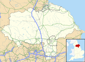
153:is a valley on the western edge of the
615:
404:
707:. Milnthorpe: Cicerone. p. 232.
483:. Milnthorpe: Cicerone. p. 234.
7:
375:
373:
310:
308:
727:
677:Mitchell, Bill (20 November 2010).
577:
565:
466:
428:
416:
182:The valley where the cows were kept
644:. Keighley: Hillside. p. 34.
441:Addison, Mike (18 December 2009).
14:
53:
1045:
784:The story of the Yorkshire Dales
236:. It is defined by the hills of
52:
45:
29:
896:Valleys and settlements in the
590:Westcott, Matt (20 July 2017).
320:getoutside.ordnancesurvey.co.uk
1:
1113:Yorkshire Dales National Park
830:Warren, Estelle, ed. (2001).
782:Mitchell, W. R. (1999).
16:Valley in Yorkshire, England
767:. London: William Collins.
1175:
1149:Valleys of North Yorkshire
786:. Chichester: Phillimore.
763:Lee, John Anthony (2015).
1043:
642:Yorkshire Dales Cycle Way
273:Yorkshire Dales Cycle Way
264:across the dry riverbed.
40:
28:
703:Kelsall, Dennis (2017).
479:Kelsall, Dennis (2017).
352:Metcalfe, Peter (1992).
744:Chrystal, Paul (2017).
640:Peace, Richard (1996).
447:The Westmorland Gazette
83:5.5 miles (8.9 km)
75:857 feet (261.3 m)
839:yorkshiredales.org.uk
815:10.1144/pygs.58.1.277
748:. Catrine: Stenlake.
380:Scholes, Ron (2011).
215:Apron Full of Stones
198:Last Glacial Maximum
194:Thornton-in-Lonsdale
248:before joining the
128: /
1154:Valleys of Cumbria
667:, pp. 34, 60.
521:The Yorkshire Post
1131:
1130:
1055:Major settlements
596:The Northern Echo
523:. 28 January 2017
148:
147:
1166:
1049:
890:
883:
876:
867:
850:
848:
846:
836:
826:
797:
778:
759:
731:
725:
719:
718:
700:
694:
693:
691:
689:
674:
668:
662:
656:
655:
637:
631:
625:
619:
613:
607:
606:
604:
602:
587:
581:
575:
569:
563:
557:
551:
545:
539:
533:
532:
530:
528:
513:
507:
501:
495:
494:
476:
470:
464:
458:
457:
455:
453:
438:
432:
426:
420:
414:
408:
402:
396:
395:
377:
368:
367:
349:
343:
337:
331:
330:
328:
326:
312:
277:Second World War
240:to its east and
202:terminal moraine
143:
142:
140:
139:
138:
133:
132:54.193°N 2.457°W
129:
126:
125:
124:
121:
56:
55:
49:
33:
21:
1174:
1173:
1169:
1168:
1167:
1165:
1164:
1163:
1159:Yorkshire Dales
1144:Craven District
1134:
1133:
1132:
1127:
1118:Nidderdale AONB
1101:
1050:
1041:
900:
898:Yorkshire Dales
894:
857:
844:
842:
834:
829:
800:
794:
781:
775:
765:Yorkshire Dales
762:
756:
743:
740:
735:
734:
726:
722:
715:
702:
701:
697:
687:
685:
676:
675:
671:
663:
659:
652:
639:
638:
634:
629:Yorkshire Dales
626:
622:
614:
610:
600:
598:
589:
588:
584:
576:
572:
564:
560:
552:
548:
540:
536:
526:
524:
515:
514:
510:
502:
498:
491:
478:
477:
473:
465:
461:
451:
449:
440:
439:
435:
427:
423:
415:
411:
403:
399:
392:
382:Yorkshire Dales
379:
378:
371:
364:
351:
350:
346:
338:
334:
324:
322:
314:
313:
306:
301:
230:North Yorkshire
190:
155:Yorkshire Dales
136:
134:
130:
127:
122:
119:
117:
115:
114:
104:North Yorkshire
72:Floor elevation
67:
66:
65:
64:
63:
62:
61:
57:
36:
17:
12:
11:
5:
1172:
1170:
1162:
1161:
1156:
1151:
1146:
1136:
1135:
1129:
1128:
1126:
1125:
1120:
1115:
1109:
1107:
1103:
1102:
1100:
1099:
1094:
1089:
1084:
1082:Pateley Bridge
1079:
1074:
1069:
1064:
1058:
1056:
1052:
1051:
1044:
1042:
1040:
1039:
1034:
1029:
1024:
1019:
1014:
1009:
1004:
999:
994:
989:
984:
982:Langstrothdale
979:
974:
969:
964:
959:
954:
949:
944:
939:
937:Chapel-le-Dale
934:
929:
924:
919:
917:Arkengarthdale
914:
908:
906:
902:
901:
895:
893:
892:
885:
878:
870:
864:
863:
856:
855:External links
853:
852:
851:
827:
798:
792:
779:
773:
760:
754:
739:
736:
733:
732:
730:, p. 251.
720:
713:
695:
669:
657:
650:
632:
620:
608:
582:
580:, p. 230.
570:
558:
556:, p. 106.
546:
544:, p. 103.
534:
508:
496:
489:
471:
459:
433:
421:
409:
397:
390:
369:
362:
344:
332:
303:
302:
300:
297:
256:to become the
189:
186:
180:) which means
146:
145:
137:54.193; -2.457
112:
106:
105:
102:
101:State/Province
98:
97:
94:
90:
89:
85:
84:
81:
77:
76:
73:
69:
68:
59:
58:
51:
50:
44:
43:
42:
41:
38:
37:
35:Kingsdale Head
34:
26:
25:
15:
13:
10:
9:
6:
4:
3:
2:
1171:
1160:
1157:
1155:
1152:
1150:
1147:
1145:
1142:
1141:
1139:
1124:
1121:
1119:
1116:
1114:
1111:
1110:
1108:
1104:
1098:
1095:
1093:
1090:
1088:
1085:
1083:
1080:
1078:
1075:
1073:
1070:
1068:
1065:
1063:
1060:
1059:
1057:
1053:
1048:
1038:
1035:
1033:
1030:
1028:
1025:
1023:
1020:
1018:
1015:
1013:
1010:
1008:
1005:
1003:
1000:
998:
995:
993:
990:
988:
985:
983:
980:
978:
975:
973:
970:
968:
965:
963:
960:
958:
955:
953:
950:
948:
945:
943:
940:
938:
935:
933:
930:
928:
925:
923:
920:
918:
915:
913:
910:
909:
907:
903:
899:
891:
886:
884:
879:
877:
872:
871:
868:
862:
859:
858:
854:
840:
833:
828:
824:
820:
816:
812:
808:
804:
799:
795:
789:
785:
780:
776:
774:9780007503698
770:
766:
761:
757:
755:9781840337532
751:
747:
742:
741:
737:
729:
724:
721:
716:
714:9781852848859
710:
706:
699:
696:
684:
683:Craven Herald
680:
673:
670:
666:
665:Mitchell 1999
661:
658:
653:
647:
643:
636:
633:
630:
624:
621:
618:, p. 38.
617:
612:
609:
597:
593:
586:
583:
579:
574:
571:
568:, p. 23.
567:
562:
559:
555:
554:Chrystal 2017
550:
547:
543:
542:Chrystal 2017
538:
535:
522:
518:
512:
509:
506:, p. 22.
505:
504:Mitchell 1999
500:
497:
492:
490:9781852848859
486:
482:
475:
472:
469:, p. 51.
468:
463:
460:
448:
444:
437:
434:
431:, p. 50.
430:
425:
422:
419:, p. 36.
418:
413:
410:
407:, p. 77.
406:
401:
398:
393:
391:9781843065081
387:
383:
376:
374:
370:
365:
363:1-873214-03-0
359:
355:
348:
345:
342:, p. 50.
341:
340:Chrystal 2017
336:
333:
321:
317:
311:
309:
305:
298:
296:
294:
290:
286:
282:
278:
274:
270:
265:
261:
259:
255:
251:
247:
243:
239:
235:
231:
226:
223:
218:
216:
212:
207:
203:
199:
195:
187:
185:
183:
179:
175:
171:
167:
163:
159:
158:National Park
156:
152:
141:
113:
111:
107:
103:
99:
95:
91:
86:
82:
78:
74:
70:
48:
39:
32:
27:
22:
19:
976:
843:. Retrieved
838:
806:
802:
783:
764:
745:
723:
704:
698:
686:. Retrieved
682:
672:
660:
641:
635:
628:
623:
611:
599:. Retrieved
595:
585:
573:
561:
549:
537:
525:. Retrieved
520:
511:
499:
480:
474:
462:
450:. Retrieved
446:
436:
424:
412:
400:
381:
353:
347:
335:
323:. Retrieved
319:
266:
262:
227:
219:
214:
191:
181:
177:
173:
160:in northern
150:
149:
18:
1027:Wensleydale
1007:Ribblesdale
616:Warren 2001
405:Warren 2001
285:Yordas Cave
258:River Greta
246:River Twiss
170:Old English
135: /
110:Coordinates
1138:Categories
1032:Wharfedale
1022:Waldendale
997:Nidderdale
992:Malhamdale
987:Littondale
932:Bishopdale
922:Barbondale
793:1860770886
651:1870141288
299:References
289:resurgence
287:) and the
281:Rowten Pot
211:Bronze Age
206:Mesolithic
120:54°11′35″N
1077:Middleham
1017:Swaledale
977:Kingsdale
972:Grisedale
947:Coverdale
823:0044-0604
293:Keld Head
250:River Doe
242:Gragareth
238:Whernside
222:enclosing
166:Old Norse
151:Kingsdale
123:2°27′25″W
88:Geography
60:Kingsdale
24:Kingsdale
1106:See also
1092:Sedbergh
1067:Ingleton
1012:Sleddale
967:Garsdale
962:Dentdale
957:Deepdale
942:Clapdale
927:Birkdale
912:Airedale
728:Lee 2015
688:9 August
578:Lee 2015
566:Lee 2015
527:17 March
467:Lee 2015
452:9 August
429:Lee 2015
417:Lee 2015
271:and the
254:Ingleton
1072:Leyburn
1037:Widdale
1002:Raydale
952:Cowside
845:2 March
738:Sources
601:6 March
325:2 March
234:Cumbria
188:History
162:England
144:
96:England
93:Country
1097:Settle
821:
790:
771:
752:
711:
648:
487:
388:
360:
269:NCR 68
80:Length
1087:Reeth
1062:Hawes
905:Dales
835:(PDF)
847:2024
819:ISSN
788:ISBN
769:ISBN
750:ISBN
709:ISBN
690:2019
646:ISBN
603:2024
529:2018
485:ISBN
454:2019
386:ISBN
358:ISBN
327:2024
283:and
220:The
178:Dael
176:and
174:Kyen
168:and
811:doi
291:of
252:at
1140::
837:.
817:.
807:58
805:.
681:.
594:.
519:.
445:.
372:^
318:.
307:^
889:e
882:t
875:v
849:.
825:.
813::
796:.
777:.
758:.
717:.
692:.
654:.
605:.
531:.
493:.
456:.
394:.
366:.
329:.
172:(
Text is available under the Creative Commons Attribution-ShareAlike License. Additional terms may apply.