103:
92:
81:
141:
378:
644:(a major food). A total of 30,000 hectares, or 0.78%, of the district's 380,000 hectares of arable land have been cultivated. Numerous crops can be cultivated because to the rich soil and abundant rainfall in the district. The primary crop farmed in Kisarawe is cassava, which is both a food crop and a source of income. The best cassava in the area is grown in Kisarawe, and the biggest cassava markets are in Dar es Salaam, Kibaha, Mkuranga, and Rufiji.
192:
395:
588:," begin in October and go through December, while the long rains begin in March and last through early June. The district's eastern portion, which includes the Sungwi division, averages 1400 to 1,600 millimetres of rain per year; the western portion, which includes the Chole and Mzenga divisions, averages 1000 millimetres.
665:
A significant portion of the forest reserves in the
Kisarawe District provide many of the district's resources. Up until 2006, there were five forest reserves totaling roughly 10,588.5 Hectares, namely; Masanganya Forest Reserve, Chakenge Forest Reserve,
850:
Kabote, Samwel J., Elliott P. Niboye, and Justin J. Ringo. "International Land Deals and Rural
Poverty Reduction in Kisarawe District, Coast Region, Tanzania." Organization for Social Science Research in Eastern and Southern Africa (OSSREA), 2014,
656:
in
Kisarawe Town; a detergent factory is currently being built. The district has designated a 500 Ha industrial area in Visegese, Kisarawe ward, as a designated location for investments in the manufacturing businesses.
860:
Samwel, DERICK TIMOTHY. Socio-economic implications of brown streak disease on cassava production among smallholder farmers in
Kisarawe district, coast region, Tanzania. Diss. Sokoine University of Agriculture,
487:
The district is divided into four administrative divisions, Mzenga, Chole, Sungwi, and
Maneromango, each of which has 17 Wards and 235 hamlets. The Kisarawe District is administratively divided into 17 wards:
686:. The district has a total population of 101,598 as of the 2012 Census, 50,631 males and 50,967 females, with an annual growth rate of 2.1% and an average family size of 4 people.
1612:
976:
902:
Kashaigili, J. J., et al. "Analysis of climate variability, perceptions and coping strategies of
Tanzanian coastal forest dependent communities." (2014).
154:
870:
Kashaigili, J. J., et al. "Analysis of climate variability, perceptions and coping strategies of
Tanzanian coastal forest dependent communities."
935:
912:
880:
828:
805:
782:
102:
1686:
140:
290:
479:
serves as its administrative capital. According to the 2022 Tanzania
National Census, the population of the District was 159,226.
1605:
1148:
766:
91:
444:
440:
1598:
969:
1507:
1106:
962:
671:
122:
1502:
1101:
1032:
995:
667:
520:
476:
229:
118:
580:
Temperatures in the
District range from 28 °C to 30 °C, with a mean of 29 °C. There are two main
1497:
1487:
80:
464:
1492:
1141:
1621:
1579:
1482:
1196:
424:
275:
252:
61:
1052:
718:
544:
435:. The District covers an area of 5,031 km (1,942 sq mi). It is bordered to the east by
377:
1414:
1375:
1014:
502:
436:
1009:
497:
1322:
741:"Tanzania: Administrative Division (Regions and Districts) - Population Statistics, Charts and Map"
472:
204:
1527:
1337:
1288:
1019:
507:
652:
The
District does not have any other major industrial enterprises other from a privately owned
1660:
1650:
1640:
1555:
1247:
1216:
1206:
1186:
1181:
985:
314:
1027:
515:
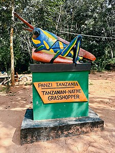
1406:
1370:
1060:
552:
420:
330:
49:
703:
1665:
1645:
1537:
1342:
1221:
1201:
1191:
770:
468:
460:
456:
383:
1655:
1532:
1362:
1352:
1332:
1293:
1211:
1134:
653:
400:
300:
1590:
1680:
1262:
1252:
1242:
1085:
704:"Tanzania: Coastal Zone(Districts and Wards) - Population Statistics, Charts and Map"
683:
581:
310:
763:
1625:
1560:
1391:
1347:
1327:
1314:
1237:
1157:
740:
625:
428:
209:
65:
1357:
1283:
596:
In Kisarawe, the agricultural sector employs practically all of the population.
1401:
1396:
1257:
169:
156:
1298:
621:
617:
609:
321:
394:
1629:
1457:
1278:
452:
432:
216:
197:
17:
641:
637:
601:
597:
125:
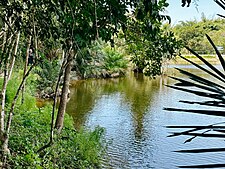
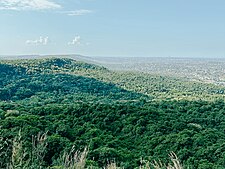
sculpture in Kisarawe & View of Dar es Salaam from the Pugu Hills
1167:
605:
448:
326:
954:
471:
to the west. The district is comparable in size to the land area of
629:
613:
451:
and Kibaha Town Council border the district to the north, and the
716:
5,130 km (1,980 sq mi) for Trinidad and Tobago at
633:
1594:
1130:
1126:
958:
41:
491:
393:
376:
352:
624:
are also abundantly grown. Grown food crops include
1569:
1548:
1475:
1450:
1384:
1307:
1271:
1230:
1174:
1094:
1078:
1002:
389:
372:
347:
337:
320:
306:
296:
289:
281:
271:
263:
258:
248:
240:
235:
225:
215:
203:
185:
35:
1606:
1142:
970:
8:
30:District of Pwani in Pwani Region, Tanzania
1613:
1599:
1591:
1149:
1135:
1127:
977:
963:
955:
32:
695:
367:
346:
336:
319:
288:
257:
234:
224:
184:
149:
137:
129:
71:
682:Kisarawe is the ancestral home of the
388:
371:
305:
295:
280:
270:
262:
247:
244:5,031 km (1,942 sq mi)
239:
214:
202:
7:
459:border it to the south-east. By the
936:"Kisarawe District Investment Plan"
913:"Kisarawe District Investment Plan"
881:"Kisarawe District Investment Plan"
829:"Kisarawe District Investment Plan"
806:"Kisarawe District Investment Plan"
783:"Kisarawe District Investment Plan"
27:District of Pwani Region, Tanzania
25:
423:) is one of eight administrative
190:
139:
101:
90:
79:
1524:Mafia Islands Marine Reserves
674:, and Kisanga Forest Reserve.
1:
661:Tourism and natural resources
608:nuts are among the principal
1095:National Parks and Reserves
1570:Heritage Monuments of Pwani
1476:National Parks and Reserves
364:Symbols of Tanzania
1703:
1508:Kazimzumbwi Forest Reserve
1107:Kazimzumbwi Forest Reserve
672:Kazimzumbwi Forest Reserve
145:Kisarawe District in Pwani
1687:Districts of Pwani Region
1636:
1503:Pugu Hills Forest Reserve
1498:Masanganya Forest Reserve
1164:
1102:Pugu Hills Forest Reserve
992:
668:Pugu Hills Forest Reserve
413:Kisarawe District Council
406:
368:
363:
359:
353:Kisarawe District Council
150:
138:
130:
119:Pugu Hills Forest Reserve
72:
59:
1488:Mafia Island Marine Park
447:Municipal Councils. The
1521:Mangrove Forest Reserve
1512:Chakenge Forest Reserve
1272:National Historic Sites
1111:Chakenge Forest Reserve
612:. Tropical fruits like
584:: the short rains, or "
1518:Malenda Forest Reserve
1515:Kisanga Forest Reserve
1493:Vikindu Forest Reserve
1451:Major Cities and Towns
1419:Mbezi River (Mkuranga)
1279:Bagamoyo Historic Town
1117:Malenda Forest Reserve
1114:Kisanga Forest Reserve
719:"Area size comparison"
463:to the south, and the
398:
381:
133:Home of the Pugu Hills
42:
1580:Ras Mkumbi Lighthouse
1483:Saadani National Park
745:www.citypopulation.de
721:. Nation master. 2022
397:
380:
285:32/km (82/sq mi)
123:Tanzanian Grasshopper
1376:North Fanjove Island
764:2012 Census database
437:Dar es Salaam Region
297: • Settler
282: • Density
170:7.26222°S 38.73667°E
473:Trinidad and Tobago
307: • Native
166: /
114:From top to bottom:
1549:Landmarks of Pwani
1338:Shungumbili Island
769:2016-03-05 at the
417:Wilaya ya Kisarawe
399:
382:
338:Tanzanian Postcode
264: • Total
241: • Total
175:-7.26222; 38.73667
43:Wilaya ya Kisarawe
1674:
1673:
1588:
1587:
1556:Mafia Archipelago
1217:Mkuranga District
1207:Kisarawe District
1187:Chalinze District
1182:Bagamoyo District
1124:
1123:
986:Kisarawe District
572:
571:
465:Morogoro District
453:Mkuranga District
410:
409:
272: • Rank
249: • Rank
37:Kisarawe District
16:(Redirected from
1694:
1615:
1608:
1601:
1592:
1407:Ngerengere River
1385:Rivers and Lakes
1371:Pemba Juu Island
1151:
1144:
1137:
1128:
979:
972:
965:
956:
949:
948:
946:
945:
940:
932:
926:
925:
923:
922:
917:
909:
903:
900:
894:
893:
891:
890:
885:
877:
871:
868:
862:
858:
852:
848:
842:
841:
839:
838:
833:
825:
819:
818:
816:
815:
810:
802:
796:
795:
793:
792:
787:
779:
773:
761:
755:
754:
752:
751:
737:
731:
730:
728:
726:
714:
708:
707:
700:
492:
355:
196:
194:
193:
181:
180:
178:
177:
176:
171:
167:
164:
163:
162:
159:
143:
105:
94:
83:
54:
53:
45:
33:
21:
1702:
1701:
1697:
1696:
1695:
1693:
1692:
1691:
1677:
1676:
1675:
1670:
1632:
1619:
1589:
1584:
1576:Bagamoyo Church
1565:
1544:
1471:
1446:
1415:Kogamimba River
1380:
1343:Barakuni Island
1303:
1267:
1226:
1222:Rufiji District
1202:Kibiti District
1192:Kibaha District
1170:
1160:
1155:
1125:
1120:
1090:
1074:
998:
988:
983:
953:
952:
943:
941:
938:
934:
933:
929:
920:
918:
915:
911:
910:
906:
901:
897:
888:
886:
883:
879:
878:
874:
869:
865:
859:
855:
849:
845:
836:
834:
831:
827:
826:
822:
813:
811:
808:
804:
803:
799:
790:
788:
785:
781:
780:
776:
771:Wayback Machine
762:
758:
749:
747:
739:
738:
734:
724:
722:
717:
715:
711:
702:
701:
697:
692:
680:
663:
650:
594:
578:
573:
485:
469:Morogoro Region
461:Rufiji District
457:Kibiti District
449:Kibaha District
384:Eastern Nicator
351:
343:
191:
189:
174:
172:
168:
165:
160:
157:
155:
153:
152:
146:
134:
131:Nickname:
126:
117:Minaki dam in
116:
111:
110:
109:
108:
107:
106:
97:
96:
95:
86:
85:
84:
68:
55:
47:
40:
38:
31:
28:
23:
22:
15:
12:
11:
5:
1700:
1698:
1690:
1689:
1679:
1678:
1672:
1671:
1669:
1668:
1663:
1658:
1653:
1648:
1643:
1637:
1634:
1633:
1620:
1618:
1617:
1610:
1603:
1595:
1586:
1585:
1583:
1582:
1577:
1573:
1571:
1567:
1566:
1564:
1563:
1558:
1552:
1550:
1546:
1545:
1543:
1542:
1541:
1540:
1535:
1530:
1522:
1519:
1516:
1513:
1510:
1505:
1500:
1495:
1490:
1485:
1479:
1477:
1473:
1472:
1470:
1469:
1466:
1463:
1460:
1454:
1452:
1448:
1447:
1445:
1444:
1441:
1438:
1435:
1432:
1429:
1426:
1423:
1420:
1417:
1412:
1409:
1404:
1399:
1394:
1388:
1386:
1382:
1381:
1379:
1378:
1373:
1368:
1365:
1363:Fanjove Island
1360:
1355:
1353:Jibondo Island
1350:
1345:
1340:
1335:
1333:Nyororo Island
1330:
1325:
1320:
1317:
1311:
1309:
1305:
1304:
1302:
1301:
1296:
1294:Kisimani Mafia
1291:
1286:
1281:
1275:
1273:
1269:
1268:
1266:
1265:
1260:
1255:
1250:
1245:
1240:
1234:
1232:
1231:Native Peoples
1228:
1227:
1225:
1224:
1219:
1214:
1212:Mafia District
1209:
1204:
1199:
1194:
1189:
1184:
1178:
1176:
1172:
1171:
1165:
1162:
1161:
1156:
1154:
1153:
1146:
1139:
1131:
1122:
1121:
1119:
1118:
1115:
1112:
1109:
1104:
1098:
1096:
1092:
1091:
1089:
1088:
1082:
1080:
1079:Native Peoples
1076:
1075:
1073:
1072:
1069:
1066:
1063:
1058:
1055:
1050:
1047:
1044:
1041:
1038:
1035:
1030:
1025:
1022:
1017:
1012:
1006:
1004:
1000:
999:
993:
990:
989:
984:
982:
981:
974:
967:
959:
951:
950:
927:
904:
895:
872:
863:
853:
843:
820:
797:
774:
756:
732:
709:
694:
693:
691:
688:
679:
676:
662:
659:
654:cement factory
649:
646:
626:sweet potatoes
593:
590:
577:
574:
570:
569:
565:
564:
561:
558:
555:
550:
547:
542:
539:
534:
533:
532:
529:
526:
523:
518:
513:
510:
505:
500:
490:
484:
483:Administration
481:
475:. The town of
408:
407:
404:
403:
401:Bohor reedbuck
391:
387:
386:
374:
370:
369:
366:
365:
361:
360:
357:
356:
349:
345:
344:
341:
339:
335:
334:
324:
318:
317:
308:
304:
303:
298:
294:
293:
287:
286:
283:
279:
278:
273:
269:
268:
265:
261:
260:
256:
255:
250:
246:
245:
242:
238:
237:
233:
232:
227:
223:
222:
219:
213:
212:
207:
201:
200:
187:
183:
182:
148:
147:
144:
136:
135:
132:
128:
127:
112:
100:
99:
98:
89:
88:
87:
78:
77:
76:
75:
74:
73:
70:
69:
60:
57:
56:
39:
36:
29:
26:
24:
14:
13:
10:
9:
6:
4:
3:
2:
1699:
1688:
1685:
1684:
1682:
1667:
1664:
1662:
1659:
1657:
1654:
1652:
1649:
1647:
1644:
1642:
1639:
1638:
1635:
1631:
1627:
1623:
1616:
1611:
1609:
1604:
1602:
1597:
1596:
1593:
1581:
1578:
1575:
1574:
1572:
1568:
1562:
1559:
1557:
1554:
1553:
1551:
1547:
1539:
1536:
1534:
1531:
1529:
1526:
1525:
1523:
1520:
1517:
1514:
1511:
1509:
1506:
1504:
1501:
1499:
1496:
1494:
1491:
1489:
1486:
1484:
1481:
1480:
1478:
1474:
1467:
1464:
1461:
1459:
1456:
1455:
1453:
1449:
1442:
1439:
1436:
1434:Lake Nzerkera
1433:
1430:
1428:Lake Tagalala
1427:
1424:
1421:
1418:
1416:
1413:
1411:Mligasi River
1410:
1408:
1405:
1403:
1400:
1398:
1395:
1393:
1390:
1389:
1387:
1383:
1377:
1374:
1372:
1369:
1367:Kuruti Island
1366:
1364:
1361:
1359:
1356:
1354:
1351:
1349:
1346:
1344:
1341:
1339:
1336:
1334:
1331:
1329:
1326:
1324:
1321:
1318:
1316:
1313:
1312:
1310:
1306:
1300:
1297:
1295:
1292:
1290:
1287:
1285:
1282:
1280:
1277:
1276:
1274:
1270:
1264:
1261:
1259:
1256:
1254:
1251:
1249:
1246:
1244:
1241:
1239:
1236:
1235:
1233:
1229:
1223:
1220:
1218:
1215:
1213:
1210:
1208:
1205:
1203:
1200:
1198:
1195:
1193:
1190:
1188:
1185:
1183:
1180:
1179:
1177:
1173:
1169:
1163:
1159:
1152:
1147:
1145:
1140:
1138:
1133:
1132:
1129:
1116:
1113:
1110:
1108:
1105:
1103:
1100:
1099:
1097:
1093:
1087:
1084:
1083:
1081:
1077:
1070:
1067:
1064:
1062:
1059:
1056:
1054:
1051:
1048:
1045:
1042:
1039:
1036:
1034:
1031:
1029:
1026:
1023:
1021:
1018:
1016:
1013:
1011:
1008:
1007:
1005:
1001:
997:
991:
987:
980:
975:
973:
968:
966:
961:
960:
957:
937:
931:
928:
914:
908:
905:
899:
896:
882:
876:
873:
867:
864:
857:
854:
847:
844:
830:
824:
821:
807:
801:
798:
784:
778:
775:
772:
768:
765:
760:
757:
746:
742:
736:
733:
720:
713:
710:
705:
699:
696:
689:
687:
685:
684:Zaramo people
677:
675:
673:
669:
660:
658:
655:
647:
645:
643:
639:
635:
631:
627:
623:
619:
615:
611:
607:
603:
599:
591:
589:
587:
583:
582:rainy seasons
575:
568:
562:
559:
556:
554:
551:
548:
546:
543:
540:
537:
536:
535:
530:
527:
524:
522:
519:
517:
514:
511:
509:
506:
504:
501:
499:
496:
495:
494:
493:
489:
482:
480:
478:
474:
470:
466:
462:
458:
454:
450:
446:
442:
438:
434:
430:
426:
422:
418:
414:
405:
402:
396:
392:
385:
379:
375:
362:
358:
354:
350:
340:
332:
328:
325:
323:
316:
312:
309:
302:
299:
292:
291:Ethnic groups
284:
277:
274:
266:
254:
251:
243:
231:
228:
221:Kisarawe Town
220:
218:
211:
208:
206:
199:
188:
179:
151:Coordinates:
142:
124:
121:of Kisarawe,
120:
115:
104:
93:
82:
67:
63:
58:
51:
44:
34:
19:
1626:Pwani Region
1561:Rufiji River
1440:Lake Siwandu
1437:Lake Mzizima
1422:Mzinga River
1392:Rufiji River
1348:Chole Island
1328:Juani Island
1323:Kwale Island
1315:Mafia Island
1158:Pwani Region
942:. Retrieved
930:
919:. Retrieved
907:
898:
887:. Retrieved
875:
866:
856:
846:
835:. Retrieved
823:
812:. Retrieved
800:
789:. Retrieved
777:
759:
748:. Retrieved
744:
735:
725:16 September
723:. Retrieved
712:
698:
681:
678:Demographics
664:
651:
595:
585:
579:
566:
486:
429:Pwani Region
416:
412:
411:
276:5th in Pwani
253:4th in Pwani
210:Pwani Region
113:
1528:Shungumbili
1431:Lake Utenge
1358:Koma Island
1319:Jina Island
1284:Kaole Ruins
1043:Maneromango
1020:Kazimzumbwi
531:Maneromango
508:Kazimzumbwi
173: /
1443:Lake Mkube
1425:Lake Manze
1402:Ruvu River
1397:Wami River
1248:Ndengereko
944:2023-09-16
921:2023-09-16
889:2023-09-16
837:2023-09-16
814:2023-09-16
791:2023-09-16
750:2024-02-11
690:References
610:cash crops
315:Ndengereko
259:Population
161:38°44′12″E
1622:Districts
1299:Kua Ruins
1175:Districts
1166:Capital:
1071:Vikumburu
994:Capital:
622:pineapple
618:jackfruit
576:Geography
563:Vikumburu
425:districts
322:Time zone
217:Named for
158:7°15′44″S
1681:Category
1661:Mkuranga
1651:Kisarawe
1641:Bagamoyo
1630:Tanzania
1538:Barakuni
1458:Bagamoyo
1033:Kisarawe
996:Kisarawe
767:Archived
602:coconuts
521:Kisarawe
477:Kisarawe
433:Tanzania
230:Kisarawe
198:Tanzania
62:District
18:Kisarawe
1533:Nyororo
1308:Islands
1068:Vihingo
1049:Marumbo
1028:Kiluvya
642:cassava
638:sorghum
614:mangoes
598:Cassava
592:Economy
560:Vihingo
541:Marumbo
516:Kiluvya
467:of the
421:Swahili
348:Website
301:Swahili
267:159,226
226:Capital
186:Country
50:Swahili
1666:Rufiji
1646:Kibaha
1468:Kibiti
1462:Kibaha
1253:Rufiji
1243:Zaramo
1197:Kibaha
1168:Kibaha
1086:Zaramo
1065:Mzenga
1061:Msimbu
1057:Msanga
1053:Masaki
1040:Mafizi
1024:Kibuta
640:, and
620:, and
606:cashew
604:, and
567:
557:Mzenga
553:Msimbu
549:Msanga
545:Masaki
528:Mafizi
512:Kibuta
445:Ubungo
390:Mammal
313:&
311:Zaramo
205:Region
195:
46:
1656:Mafia
1465:Msata
1289:Chole
1263:Zigua
1238:Kwere
1046:Marui
1037:Kurui
1015:Chole
1003:Wards
939:(PDF)
916:(PDF)
884:(PDF)
861:2018.
851:2014.
832:(PDF)
809:(PDF)
786:(PDF)
648:Trade
630:maize
538:Marui
525:Kurui
503:Chole
441:Ilala
419:, in
327:UTC+3
66:Pwani
1010:Boga
727:2023
634:rice
586:Vuli
498:Boga
455:and
443:and
373:Bird
236:Area
1624:of
1258:Doe
439:'s
431:in
427:of
342:614
331:EAT
64:of
1683::
1628:,
743:.
670:,
636:,
632:,
628:,
616:,
600:,
1614:e
1607:t
1600:v
1150:e
1143:t
1136:v
978:e
971:t
964:v
947:.
924:.
892:.
840:.
817:.
794:.
753:.
729:.
706:.
415:(
333:)
329:(
52:)
48:(
20:)
Text is available under the Creative Commons Attribution-ShareAlike License. Additional terms may apply.