54:
961:
560:, kayaking, and rafting. Paths and trails provide opportunities for scenic hikes. The 31-mile-long (50 km) Klickitat Trail is on the route of the former railroad tracks, now a biking and hiking trail. The trail follows the Klickitat River north from the Columbia River past the town of Klickitat. Washington State Route 142 provides a scenic drive through the canyon. Two miles east of town is the ruins of the dry ice plant with a single remaining building. The site is now a public campsite.
42:
564:
542:
The first non-native settlers arrived in 1890 seeking land to homestead. The abundance of timber drew in other settlers during the early 1900s. Travel through the
Klickitat canyon and up to the plateau was arduous until the completion of a rail line in 1903. The rail line eased travel and facilitated
498:
In the CDP, the population was spread out, with 35.5% under the age of 18, 7.7% from 18 to 24, 26.4% from 25 to 44, 20.6% from 45 to 64, and 9.8% who were 65 years of age or older. The median age was 30 years. For every 100 females, there were 84.5 males. For every 100 females age 18 and over, there
494:
living together, 10.2% had a female householder with no husband present, and 24.5% were non-families. 21.1% of all households were made up of individuals, and 5.4% had someone living alone who was 65 years of age or older. The average household size was 2.84 and the average family size was 3.28.
538:
and the railroad later switched the two signs when the carbonated beverage company
Klickitat Pop (operating near the town) gained fame. On February 7, 1910, the name of the town post office was officially changed to "Klickitat".
533:
The site where the town is located was originally called "Wrights" after one of the original settlers. This was the name given to the rail stop there. The rail stop down the river at milepost 7.2 was named "Klickitat", after the
517:
of 2020, there were 320 people, 132 households, 160 housing units in the CDP. The racial makeup of the CDP was 275 Whites, 3 American
Indians, 2 Asians, 9 Hispanic or Latino, 9 Some Other Race, and 32 of Two or More Races.
53:
543:
the transportation of people, crops, livestock and timber. The lumber mill was the primary employer in town, with the first major mill formed 1909, until 1994 when the mill was permanently closed. The naturally carbonated
555:
The area surrounding the town of
Klickitat and the river which shares its name are renowned for their seasonal hunting and fishing. During summer, popular activities on the Klickitat River include recreational
1155:
1160:
889:
502:
The median income for a household in the CDP was $ 28,750, and the median income for a family was $ 29,688. Males had a median income of $ 30,500 versus $ 16,250 for females. The
833:
1035:
463:
was 161.9 people per square mile (62.4/km). There were 173 housing units at an average density of 67.2/sq mi (25.9/km). The racial makeup of the CDP was 92.33%
972:
882:
521:
The median income for a household in the CDP was $ 60,893, and the median income for a family was $ 61,964. About 5.7% of the population were below the
671:
1093:
628:
249:
67:
995:
875:
619:
259:
313:
1070:
867:
547:
just east of town gave rise to health spas, a carbonated beverage company, and a large dry ice plant which operated until 1957.
624:
349:
passes through
Klickitat, leading southwest (downstream) 3 miles (5 km) to Pitt and east (upstream) the same distance to
468:
121:
817:
758:
645:
472:
932:
899:
283:
126:
862:
705:
649:
593:
365:
346:
679:
1125:
1101:
544:
432:
417:
402:
291:
41:
950:
275:
237:
99:
614:
985:
490:
There were 147 households, out of which 43.5% had children under the age of 18 living with them, 58.5% were
279:
32:
1050:
1020:
990:
945:
921:
480:
342:
1078:
1060:
1015:
980:
350:
1132:
1045:
1010:
484:
210:
1025:
476:
464:
1083:
940:
827:
460:
287:
114:
1055:
701:
503:
295:
200:
506:
for the CDP was $ 11,717. About 27.8% of families and 29.7% of the population were below the
1005:
535:
354:
459:
of 2000, there were 417 people, 147 households, and 110 families residing in the CDP. The
307:
368:, the Klickitat CDP has a total area of 0.93 square miles (2.4 km), all of it land.
358:
672:"Geographic Identifiers: 2010 Census Summary File 1 (G001), Klickitat CDP, Washington"
1149:
242:
522:
507:
563:
914:
789:"KTC :: Dedicated to the preservation and promotion of the Klickitat Trail"
766:
557:
109:
847:
328:
315:
82:
69:
191:
510:, including 32.5% of those under age 18 and 11.5% of those age 65 or over.
1116:‡This populated place also has portions in an adjacent county or counties
525:, including 6.3% of those under age 18 and 7.6% of those age 65 or over.
491:
225:
740:
960:
514:
456:
852:
788:
857:
562:
217:
196:
871:
959:
361:, is 13 miles (21 km) to the southwest via Route 142.
589:
1156:
Census-designated places in
Klickitat County, Washington
294:. Once the site of a lumber mill, it is now primarily a
341:(45.816412, -121.163790). The closest major town is
18:
Census-designated place in
Washington, United States
1111:
1092:
1069:
1034:
971:
931:
258:
248:
236:
224:
207:
190:
182:
174:
169:
161:
153:
145:
137:
132:
120:
108:
98:
23:
832:: CS1 maint: bot: original URL status unknown (
964:Map of Washington highlighting Klickitat County
290:, United States. The population was 320 at the
1161:Census-designated places in Washington (state)
822:. Archived from the original on March 5, 2012.
702:"Census Bureau profile: Klickitat, Washington"
883:
8:
890:
876:
868:
646:"US Gazetteer files: 2010, 2000, and 1990"
487:of any race were 2.64% of the population.
375:
20:
629:United States Department of the Interior
58:Location in Klickitat County, Washington
741:"Klickitat County -- Thumbnail History"
576:
247:
223:
189:
168:
160:
131:
97:
62:
50:
38:
825:
395:
640:
638:
584:
582:
580:
345:, 21 miles (34 km) to the east.
257:
235:
206:
181:
173:
152:
144:
136:
119:
107:
7:
678:. U.S. Census Bureau. Archived from
479:, and 2.88% from two or more races.
759:"Klickitat Mineral Springs History"
620:Geographic Names Information System
149:0.94 sq mi (2.43 km)
141:0.94 sq mi (2.43 km)
898:Municipalities and communities of
385:
14:
819:Klickitat Mineral Springs History
157:0.0 sq mi (0.0 km)
52:
40:
625:United States Geological Survey
306:Klickitat is located along the
1:
901:Klickitat County, Washington
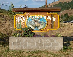
46:Sign at the entrance of town
858:Klickitat Historical Museum
853:Klickitat community website
812:. Metropolitan Press, 1967.
706:United States Census Bureau
650:United States Census Bureau
594:United States Census Bureau
366:United States Census Bureau
1177:
1121:
1102:Yakama Indian Reservation
957:
912:
863:About the Klickitat Trail
848:Klickitat School District
545:Klickitat Mineral Springs
446:
431:
416:
401:
394:
389:
384:
381:
63:
51:
39:
30:
276:unincorporated community
165:479 ft (146 m)
793:www.klickitat-trail.org
280:census-designated place
186:340/sq mi (130/km)
33:Census-designated place
965:
568:
329:45.81639°N 121.16389°W
83:45.81639°N 121.16389°W
963:
590:"U.S. Census website"
566:
377:Historical population
209: • Summer (
25:Klickitat, Washington
1134:United States portal
810:So This Is Klickitat
763:www.walkaboutmag.com
728:So This Is Klickitat
682:on February 13, 2020
334:45.81639; -121.16389
183: • Density
88:45.81639; -121.16389
816:Robinson, Barbara.
745:www.historylink.org
676:American FactFinder
652:. February 12, 2011
447:US Decennial Census
378:
325: /
79: /
1094:Indian reservation
966:
569:
461:population density
376:
175: • Total
154: • Water
138: • Total
1143:
1142:
1127:Washington portal
808:Niels, Selma M.,
504:per capita income
499:were 94.9 males.
453:
452:
364:According to the
296:bedroom community
269:
268:
146: • Land
1168:
1135:
1128:
962:
924:
917:
907:
902:
892:
885:
878:
869:
837:
831:
823:
797:
796:
785:
779:
778:
776:
774:
769:on March 5, 2012
765:. Archived from
755:
749:
748:
737:
731:
724:
718:
717:
715:
713:
698:
692:
691:
689:
687:
668:
662:
661:
659:
657:
642:
633:
632:
611:
605:
604:
602:
600:
586:
536:Klickitat people
469:African American
397:
392:
387:
379:
340:
339:
337:
336:
335:
330:
326:
323:
322:
321:
318:
284:Klickitat County
214:
94:
93:
91:
90:
89:
84:
80:
77:
76:
75:
72:
56:
44:
21:
1176:
1175:
1171:
1170:
1169:
1167:
1166:
1165:
1146:
1145:
1144:
1139:
1133:
1126:
1117:
1107:
1088:
1065:
1037:
1030:
967:
955:
927:
922:
915:
908:
905:
900:
896:
844:
824:
815:
805:
803:Further reading
800:
787:
786:
782:
772:
770:
757:
756:
752:
739:
738:
734:
725:
721:
711:
709:
700:
699:
695:
685:
683:
670:
669:
665:
655:
653:
644:
643:
636:
613:
612:
608:
598:
596:
588:
587:
578:
574:
553:
531:
492:married couples
473:Native American
448:
390:
374:
347:State Route 142
333:
331:
327:
324:
319:
316:
314:
312:
311:
308:Klickitat River
304:
232:
208:
87:
85:
81:
78:
73:
70:
68:
66:
65:
59:
47:
35:
26:
19:
12:
11:
5:
1174:
1172:
1164:
1163:
1158:
1148:
1147:
1141:
1140:
1138:
1137:
1130:
1122:
1119:
1118:
1115:
1113:
1109:
1108:
1106:
1105:
1098:
1096:
1090:
1089:
1087:
1086:
1081:
1075:
1073:
1067:
1066:
1064:
1063:
1058:
1053:
1048:
1042:
1040:
1036:Unincorporated
1032:
1031:
1029:
1028:
1023:
1018:
1013:
1008:
1003:
998:
993:
988:
983:
977:
975:
969:
968:
958:
956:
954:
953:
948:
943:
937:
935:
929:
928:
913:
910:
909:
897:
895:
894:
887:
880:
872:
866:
865:
860:
855:
850:
843:
842:External links
840:
839:
838:
813:
804:
801:
799:
798:
780:
750:
732:
726:Niels, Selma.
719:
693:
663:
634:
606:
575:
573:
570:
552:
549:
530:
527:
451:
450:
444:
443:
440:
438:
435:
429:
428:
425:
423:
420:
414:
413:
410:
408:
405:
399:
398:
393:
388:
383:
373:
370:
359:Columbia River
303:
300:
267:
266:
263:
256:
255:
252:
246:
245:
240:
234:
233:
230:
228:
222:
221:
215:
205:
204:
194:
188:
187:
184:
180:
179:
176:
172:
171:
167:
166:
163:
159:
158:
155:
151:
150:
147:
143:
142:
139:
135:
134:
130:
129:
124:
118:
117:
112:
106:
105:
102:
96:
95:
61:
60:
57:
49:
48:
45:
37:
36:
31:
28:
27:
24:
17:
13:
10:
9:
6:
4:
3:
2:
1173:
1162:
1159:
1157:
1154:
1153:
1151:
1136:
1131:
1129:
1124:
1123:
1120:
1114:
1110:
1103:
1100:
1099:
1097:
1095:
1091:
1085:
1082:
1080:
1077:
1076:
1074:
1072:
1068:
1062:
1059:
1057:
1054:
1052:
1049:
1047:
1044:
1043:
1041:
1039:
1033:
1027:
1024:
1022:
1019:
1017:
1014:
1012:
1009:
1007:
1004:
1002:
999:
997:
994:
992:
989:
987:
984:
982:
979:
978:
976:
974:
970:
952:
949:
947:
944:
942:
939:
938:
936:
934:
930:
926:
925:
918:
911:
906:United States
903:
893:
888:
886:
881:
879:
874:
873:
870:
864:
861:
859:
856:
854:
851:
849:
846:
845:
841:
835:
829:
821:
820:
814:
811:
807:
806:
802:
794:
790:
784:
781:
768:
764:
760:
754:
751:
746:
742:
736:
733:
729:
723:
720:
707:
703:
697:
694:
681:
677:
673:
667:
664:
651:
647:
641:
639:
635:
630:
626:
622:
621:
616:
610:
607:
595:
591:
585:
583:
581:
577:
571:
565:
561:
559:
558:drift boating
550:
548:
546:
540:
537:
528:
526:
524:
519:
516:
511:
509:
505:
500:
496:
493:
488:
486:
482:
478:
474:
470:
466:
462:
458:
445:
441:
439:
436:
434:
430:
426:
424:
421:
419:
415:
411:
409:
406:
404:
400:
380:
371:
369:
367:
362:
360:
356:
352:
348:
344:
338:
309:
301:
299:
297:
293:
289:
285:
281:
277:
273:
264:
261:
253:
251:
244:
241:
239:
229:
227:
219:
216:
212:
202:
201:Pacific (PST)
198:
195:
193:
185:
177:
164:
156:
148:
140:
128:
125:
123:
116:
113:
111:
104:United States
103:
101:
92:
64:Coordinates:
55:
43:
34:
29:
22:
16:
1000:
951:White Salmon
920:
818:
809:
792:
783:
771:. Retrieved
767:the original
762:
753:
744:
735:
727:
722:
710:. Retrieved
696:
684:. Retrieved
680:the original
675:
666:
654:. Retrieved
618:
609:
597:. Retrieved
554:
541:
532:
523:poverty line
520:
512:
508:poverty line
501:
497:
489:
454:
372:Demographics
363:
357:, along the
305:
271:
270:
231:98628, 98670
15:
1071:Ghost towns
1038:communities
986:Centerville
916:County seat
773:January 15,
615:"Klickitat"
599:January 31,
449:2020 Census
332: /
292:2020 census
86: /
1150:Categories
1051:Blockhouse
1021:Trout Lake
991:Dallesport
946:Goldendale
923:Goldendale
708:. May 2023
572:References
551:Recreation
513:As of the
455:As of the
343:Goldendale
320:121°9′50″W
317:45°48′59″N
288:Washington
262:feature ID
170:Population
115:Washington
74:121°9′50″W
71:45°48′59″N
1112:Footnotes
1079:Alderdale
1061:Wahkiacus
1016:Roosevelt
1001:Klickitat
981:Bickleton
828:cite book
656:April 23,
567:Klickitat
351:Wahkiacus
302:Geography
282:(CDP) in
272:Klickitat
250:FIPS code
238:Area code
226:ZIP codes
192:Time zone
162:Elevation
127:Klickitat
1046:Appleton
1011:Maryhill
996:Glenwood
686:July 10,
481:Hispanic
475:, 0.96%
471:, 3.60%
467:, 0.24%
254:53-36115
1026:Wishram
730:(1967)
712:May 13,
529:History
265:1521721
100:Country
1084:Gilmer
941:Bingen
933:Cities
515:census
485:Latino
457:census
442:−11.6%
427:−13.2%
382:Census
274:is an
122:County
1056:Husum
477:Asian
465:White
220:(PDT)
218:UTC-7
197:UTC-8
110:State
1006:Lyle
973:CDPs
834:link
775:2022
714:2024
688:2019
658:2011
601:2008
433:2020
418:2010
403:2000
391:Note
386:Pop.
355:Lyle
278:and
260:GNIS
133:Area
483:or
437:320
422:362
407:417
310:at
243:509
211:DST
178:320
1152::
919::
904:,
830:}}
826:{{
791:.
761:.
743:.
704:.
674:.
648:.
637:^
627:,
623:.
617:.
592:.
579:^
396:%±
353:.
298:.
286:,
1104:‡
891:e
884:t
877:v
836:)
795:.
777:.
747:.
716:.
690:.
660:.
631:.
603:.
412:—
213:)
203:)
199:(
Text is available under the Creative Commons Attribution-ShareAlike License. Additional terms may apply.