670:
unified Oblast Soviet and the executive committee. Nevertheless, on
February 1, 1963, the Decree by the Presidium of the Supreme Soviet of the RSFSR established the new structure of the districts of Murmansk Oblast, which classified Kolsky District as rural. However, this classification only lasted for less than two years. The November 21, 1964 Decree by the Presidium of the Supreme Soviet of the RSFSR restored the unified Soviets of People's Deputies and the executive committees of the krais and oblasts where the division into the urban and rural districts was introduced in 1962, and the districts of Murmansk Oblast were re-categorized as regular districts again by the January 12, 1965 Presidium of the Supreme Soviet of the RSFSR Decree.
50:
1167:Совет депутатов муниципального образования Кольский район. Решение №32/2 от 25 мая 2005 г. «Устав муниципального образования Кольский район Мурманской области», в ред. Решения №50/1 от 8 апреля 2010 г «О внесении изменений и дополнений в Устав муниципального образования Кольский район Мурманской области». Вступил в силу с 1 января 2006 г., за исключением подпункта 8 пункта 1 статьи 8, а также статей 18–29, вступающих в силу в соответствии с пунктами 2 и 3 статьи 51. Опубликован: "Кольское слово", №24, стр. 5–6, 11–13, 24 июня 2005 г.
1151:Мурманская областная Дума. Закон №577-01-ЗМО от 29 декабря 2004 г. «О статусе, наименованиях и составе территорий муниципального образования Кольский район и муниципальных образований, входящих в его состав», в ред. Закона №1601-01-ЗМО от 24 апреля 2013 г. «Об упразднении некоторых населённых пунктов Мурманской области и о внесении изменений в отдельные законодательные акты Мурманской области». Вступил в силу 1 января 2005 г. Опубликован: "Мурманский Вестник", №249, стр. 5, 30 декабря 2004 г.
339:
65:
1135:Мурманская областная Дума. Закон №96-01-ЗМО от 6 января 1998 г. «Об административно-территориальном устройстве Мурманской области», в ред. Закона №1953-01-ЗМО от 24 декабря 2015 г. «О внесении изменений в Закон Мурманской области "Об административно-территориальном устройстве Мурманской области"». Опубликован: "Мурманский Вестник", №10, стр. 3, 16 января 1998 г.
1192:Президиум Верховного Совета РСФСР. Указ №741/18 от 9 июля 1960 г. «Об упразднении Полярного района, объединении Североморского городского и Териберского районного советов и переименовании Териберского района Мурманской области». Опубликован: "Ведомости ВС РСФСР", №25, ст. 371, 1960.
632:
by the
Resolution of the Presidium of Murmansk Okrug Executive Committee. By the Act of the conciliatory committee on October 20, 1935, the selsoviet was transferred to Kirovsky District—a decision approved by the Presidium of Murmansk Okrug Executive Committee on December 4, 1935 and by
560:
and Kolsky
Districts to be established in its place. On February 15, 1935, the VTsIK approved the redistricting of the okrug into seven districts, but did not specify what territories the new districts were to include. On February 26, 1935, the Presidium of the Leningrad Oblast Executive
669:
On
December 26, 1962, when the Presidium of the Supreme Soviet of the RSFSR decreed to re-organize the Soviets of People's Deputies and the executive committees of the krais, oblasts, and districts into the industrial and agricultural soviets, Murmansk Oblast was not affected and kept one
1178:. Effective as of January 1, 2006, with the exception of subitem 8 of item 1 of Article 8, as well as Articles 18–29, which take effect in accordance with the provisions specified by items 2 and 3 of Article 51.).
624:
The provisions of the
February 26, 1935 Resolution, however, were not fully implemented. The station of Laplandiya ultimately never became the administrative center of the district, because Kola was not included into Murmansk as originally intended.
931:Численность населения России, субъектов Российской Федерации в составе федеральных округов, районов, городских поселений, сельских населённых пунктов – районных центров и сельских населённых пунктов с населением 3 тысячи и более человек
958:[All Union Population Census of 1989: Present Population of Union and Autonomous Republics, Autonomous Oblasts and Okrugs, Krais, Oblasts, Districts, Urban Settlements, and Villages Serving as District Administrative Centers].
709:
The local representative body is the
Council of Deputies of Kolsky District. It has twenty members elected for a term of five years. The Head of the District is the highest executive post and is elected by the Council of Deputies.
1003:
555:
on
December 28-29, 1934 and by the Resolution of the Presidium of the Murmansk Okrug Executive Committee on February 2, 1935. According to this proposal, Kolsko-Loparsky District was to be abolished, with
617:, as well as the northern part of Ekostrovsky Selsoviet remained in Kolsko-Loparsky District, which was renamed Kolsky. The administrative center of Kolsky District was slated to be moved to the station of
955:Всесоюзная перепись населения 1989 г. Численность наличного населения союзных и автономных республик, автономных областей и округов, краёв, областей, районов, городских поселений и сёл-райцентров
561:
Committee worked out the details of the new district scheme and issued a resolution which established
Kirovsky District on part of the territory of Kolsko-Loparsky District, including the town of
934:[Population of Russia, Its Federal Districts, Federal Subjects, Districts, Urban Localities, Rural Localities—Administrative Centers, and Rural Localities with Population of Over 3,000]
551:
In 1934, the
Murmansk Okrug Executive Committee developed a redistricting proposal, which was approved by the Resolution of the 4th Plenary Session of the Murmansk Okrug Committee of the
522:(VTsIK) issued two Resolutions: "On the Establishment of Leningrad Oblast" and "On the Borders and Composition of the Okrugs of Leningrad Oblast". According to these resolutions,
1548:
1196:
656:
1490:
49:
1201:
On the
Abolition of Polyarny District, the Merger of Severomorsk Town and Teribersky District Soviets, and the Renaming of Teribersky District of Murmansk Oblast
1280:
1261:
1223:
393:
1252:
925:
858:
1156:
On the Status, Names, and Composition of the Territories of the Municipal Formation of Kolsky District and of the Municipal Formations It Comprises
519:
433:
287:
279:
273:
1543:
552:
88:
557:
899:
673:
By the August 2, 1965 Presidium of the Supreme Soviet of the RSFSR Decree, the work settlement of Kola was granted a status of
621:, but temporarily remained in Kola. On June 1, 1936, the renaming of the district was approved by the Resolution of the VTsIK.
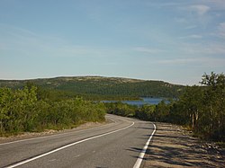
480:, and on the north by the Barents Sea. The terrain is mostly flat forest (taiga) and rocky tundra. The district mostly covers the
1319:
1170:(Council of Deputies of the Municipal Formation of Kolsky District. Decision #32/2 of May 25, 2005
782:
823:
526:
was transformed into Murmansk Okrug, which was divided into six districts (Kolsko-Loparsky being one of them) and included into
962:(in Russian). Институт демографии Национального исследовательского университета: Высшая школа экономики . 1989 – via
1442:
1337:
1245:
674:
257:
1160:
On Abolishing Several Inhabited Localities of Murmansk Oblast and on Amending Various Legislative Acts of Murmansk Oblast
64:
1452:
1417:
977:
628:
On April 21, 1935, the territory of Ekostrovsky Selsoviet which remained in Kolsky District was re-organized as
1422:
1342:
128:
1500:
1427:
1553:
1392:
1238:
610:
582:
562:
537:
848:
574:
871:
The count of urban-type settlements may include the work settlements, the resort settlements, the suburban (
629:
578:
1495:
1294:
1176:
On Amending and Supplementing the Charter of the Municipal Formation of Kolsky District of Murmansk Oblast
614:
606:
545:
405:
314:
301:
251:
594:
586:
541:
1462:
1270:
637:
566:
429:
283:
261:
148:
1144:
On Amending the Law of Murmansk Oblast "On the Administrative-Territorial Structure of Murmansk Oblast"
651:
and its settlement soviet were transferred from Kolsky District to the administrative jurisdiction of
602:
523:
1314:
1309:
1182:Архивный отдел Администрации Мурманской области. Государственный Архив Мурманской области. (1995).
598:
473:
451:
443:
40:
1304:
648:
459:
666:
was abolished on July 9, 1960, a part of its territory was transferred to Kolsky District.
428:
in the west. The area of the district is 27,600 square kilometers (10,700 sq mi). Its
338:
1230:
663:
590:
685:
Kolsky District has many natural resources, including forests, ore deposits and water life.
527:
381:
1515:
1154:(Murmansk Oblast Duma. Law #577-01-ZMO of December 29, 2004
827:
786:
686:
397:
133:
1432:
1138:(Murmansk Oblast Duma. Law #96-01-ZMO of January 6, 1998
417:
1184:Административно-территориальное деление Мурманской области (1920-1993 гг.). Справочник
779:
1537:
820:
570:
497:
493:
16:
For the administrative division of the Tsardom of Russia and the Russian Empire, see
1520:
1510:
1397:
929:
481:
17:
1470:
1437:
1407:
1387:
1347:
641:
464:. The population of Kola accounts for 23.4% of the district's total population.
437:
421:
333:
153:
1215:
953:
1382:
1142:, as amended by the Law #1953-01-ZMO of December 24, 2015
618:
485:
235:
224:
633:
the Presidium of Leningrad Oblast Executive Committee on April 5, 1936.
103:
90:
1447:
1357:
1352:
324:
265:
1158:, as amended by the Law #1601-01-ZMO of April 24, 2013
981:
1174:, as amended by the Resolution #50/1 of April 8, 2010
1480:
1475:
1412:
1275:
698:
652:
644:. At the same time, it was transferred from Kolsky to Kirovsky District.
489:
1172:
Charter of the Municipal Formation of Kolsky District of Murmansk Oblast
1505:
1377:
1186:. Мурманск: Мурманское издательско-полиграфическое предприятие "Север".
532:
477:
425:
1402:
694:
690:
413:
401:
329:
496:, which in turn is fed from the southwest by the Nota River and the
1485:
872:
389:
347:
640:
status to the inhabited locality of Moncha-Guba, and renamed it
1234:
1199:. Decree #741/18 of July 9, 1960
1140:
On the Administrative-Territorial Structure of Murmansk Oblast
689:
is fished in the rivers of the district. Ore deposits include
636:
On November 25, 1935, the Presidium of the VTsIK granted
853:[2010 All-Russian Population Census, vol. 1].
369:
536:
of Kola. Upon establishment, the territory of the former
875:) settlements, as well as urban-type settlements proper.
530:. The administrative center of the district was in the
1118:
Administrative-Territorial Division of Murmansk Oblast
1088:
Administrative-Territorial Division of Murmansk Oblast
1076:
Administrative-Territorial Division of Murmansk Oblast
1037:
Administrative-Territorial Division of Murmansk Oblast
1025:
Administrative-Territorial Division of Murmansk Oblast
850:Всероссийская перепись населения 2010 года. Том 1
808:
Administrative-Territorial Division of Murmansk Oblast
492:
and the Barents Sea. The Tuloma River flows out of
1461:
1366:
1328:
1287:
1197:
Presidium of the Supreme Soviet of the Russian SFSR
657:
Presidium of the Supreme Soviet of the Russian SFSR
365:
357:
346:
323:
312:
298:
293:
271:
249:
244:
233:
222:
214:
206:
201:
193:
188:
180:
172:
164:
159:
147:
139:
127:
119:
28:
847:Russian Federal State Statistics Service (2011).
701:. The area also produces construction materials.
940:Всероссийская перепись населения 2002 года
855:Всероссийская перепись населения 2010 года
904:Официальный интернет-портал правовой информации
589:of Kolsko-Loparsky District was transferred to
1162:. Effective as of January 1, 2005.).
79:Location of Kolsky District in Murmansk Oblast
1246:
1190:
1165:
1149:
1133:
1071:
1069:
1067:
1065:
980:(in Russian). Kolsky District. Archived from
960:Всесоюзная перепись населения 1989 года
513:
8:
1113:
1111:
1109:
1107:
1105:
1063:
1061:
1059:
1057:
1055:
1053:
1051:
1049:
1047:
1045:
842:
840:
838:
1262:Administrative divisions of Murmansk Oblast
1224:University of North Carolina at Chapel Hill
803:
801:
799:
797:
472:Kolsky District is bordered on the west by
1549:States and territories established in 1927
1253:
1239:
1231:
337:
25:
885:
883:
881:
756:
754:
752:
750:
748:
746:
744:
734:
732:
730:
728:
412:. It is located in the northwest of the
319:6 urban settlements, 5 rural settlements
1216:"Lighthouses of Russia: Kola Peninsula"
774:
772:
770:
768:
766:
724:
520:All-Russian Central Executive Committee
364:
356:
322:
292:
243:
200:
197:27,600 km (10,700 sq mi)
187:
158:
146:
138:
118:
83:
76:
58:
46:
819:Official website of Kolsky District.
778:Official website of Kolsky District.
345:
311:
297:
270:
248:
232:
221:
213:
205:
192:
179:
171:
163:
126:
7:
1004:"Kolsky District, Murmansk, Russia"
518:) on August 1, 1927, when the
23:District in Murmansk Oblast, Russia
14:
1329:Closed administrative-territorial
655:City Soviet by the Decree of the
548:were included into the district.
388:) is an administrative district (
926:Federal State Statistics Service
859:Federal State Statistics Service
675:town under district jurisdiction
63:
48:
780:Information About the District
1:
1544:Districts of Murmansk Oblast
54:Landscape in Kolsky District
577:, and the southern part of
1570:
906:(in Russian). June 3, 2011
760:Charter of Kolsky District
515:Ко́льско-Лопа́рский райо́н
15:
1268:
1191:
1166:
1150:
1134:
826:October 19, 2012, at the
785:October 19, 2012, at the
514:
410:Kolsky Municipal District
385:
308:Kolsky Municipal District
84:
77:
59:
47:
38:
1288:Administrative districts
1220:The Lighthouse Directory
959:
954:
939:
930:
854:
849:
659:of August 5, 1953.
538:Kolsko-Loparskaya Volost
510:Kolsko-Loparsky District
488:, which flow north into
416:, partially lies on the
408:, it is incorporated as
302:Municipally incorporated
252:Administrative divisions
245:Administrative structure
900:"Об исчислении времени"
647:The work settlement of
575:Yena-Babinsky Selsoviet
420:, and borders with the
370:http://kola.murmansk.ru
218:1.6/km (4.2/sq mi)
1463:Urban-type settlements
821:Head of Administration
546:Alexandrovskaya Volost
508:It was established as
476:, on the southwest by
284:Urban-type settlements
262:Urban-type settlements
1271:Administrative center
978:"General Information"
630:Imandrovsky Selsoviet
615:Pulozersky Selsoviets
579:Ekostrovsky Selsoviet
573:in its jurisdiction,
430:administrative center
149:Administrative center
581:with the station of
524:Murmansk Governorate
274:Inhabited localities
215: • Density
599:Lovozersky District
595:Kildinsky Selsoviet
587:Minkinsky Selsoviet
542:Minkinsky Selsoviet
474:Pechengsky District
315:Municipal divisions
294:Municipal structure
176:Council of Deputies
143:August 1, 1927
100: /
984:on October 6, 2018
460:1989 Soviet census
406:municipal division
266:Territorial okrugs
207: • Total
194: • Total
1529:
1528:
664:Polyarny District
591:Polyarny District
424:in the north and
375:
374:
184:Mikhail Chekrygin
181: • Head
173: • Body
165: • Type
104:68.883°N 33.050°E
1561:
1371:
1367:Cities and towns
1281:Rural localities
1255:
1248:
1241:
1232:
1227:
1194:
1193:
1187:
1169:
1168:
1153:
1152:
1137:
1136:
1121:
1120:, pp. 55–56
1115:
1100:
1097:
1091:
1090:, pp. 62–63
1085:
1079:
1078:, pp. 47–49
1073:
1040:
1034:
1028:
1022:
1016:
1015:
1013:
1011:
1000:
994:
993:
991:
989:
974:
968:
967:
964:Demoscope Weekly
950:
944:
943:
937:
928:(May 21, 2004).
922:
916:
915:
913:
911:
896:
890:
887:
876:
869:
863:
862:
844:
833:
832:
817:
811:
810:, pp. 34–35
805:
792:
791:
776:
761:
758:
739:
736:
528:Leningrad Oblast
517:
516:
463:
455:
447:
387:
386:Ко́льский райо́н
341:
305:
288:rural localities
168:Local government
115:
114:
112:
111:
110:
105:
101:
98:
97:
96:
93:
67:
52:
26:
1569:
1568:
1564:
1563:
1562:
1560:
1559:
1558:
1554:Kolsky District
1534:
1533:
1530:
1525:
1516:Verkhnetulomsky
1457:
1369:
1368:
1362:
1330:
1324:
1283:
1264:
1259:
1214:Rowlett, Russ.
1213:
1210:
1181:
1130:
1125:
1124:
1116:
1103:
1098:
1094:
1086:
1082:
1074:
1043:
1035:
1031:
1023:
1019:
1009:
1007:
1002:
1001:
997:
987:
985:
976:
975:
971:
961:
956:
952:
951:
947:
941:
935:
932:
924:
923:
919:
909:
907:
898:
897:
893:
889:Law #577-01-ZMO
888:
879:
870:
866:
856:
851:
846:
845:
836:
830:
828:Wayback Machine
818:
814:
806:
795:
789:
787:Wayback Machine
777:
764:
759:
742:
737:
726:
721:
716:
707:
687:Atlantic salmon
683:
638:work settlement
611:Peyvo-Yarvinsky
567:work settlement
506:
470:
457:
449:
441:
440:. Population:
398:Murmansk Oblast
378:Kolsky District
300:
134:Murmansk Oblast
129:Federal subject
108:
106:
102:
99:
94:
91:
89:
87:
86:
80:
73:
72:
71:
70:
55:
43:
34:
31:
30:Kolsky District
24:
21:
12:
11:
5:
1567:
1565:
1557:
1556:
1551:
1546:
1536:
1535:
1527:
1526:
1524:
1523:
1518:
1513:
1508:
1503:
1498:
1493:
1488:
1483:
1478:
1473:
1467:
1465:
1459:
1458:
1456:
1455:
1450:
1445:
1440:
1435:
1433:Polyarnye Zori
1430:
1425:
1420:
1415:
1410:
1405:
1400:
1395:
1390:
1385:
1380:
1374:
1372:
1364:
1363:
1361:
1360:
1355:
1350:
1345:
1340:
1334:
1332:
1326:
1325:
1323:
1322:
1317:
1312:
1307:
1302:
1297:
1291:
1289:
1285:
1284:
1269:
1266:
1265:
1260:
1258:
1257:
1250:
1243:
1235:
1229:
1228:
1209:
1208:External links
1206:
1205:
1204:
1188:
1179:
1163:
1147:
1129:
1126:
1123:
1122:
1101:
1099:Decree #741/18
1092:
1080:
1041:
1029:
1017:
995:
969:
945:
917:
891:
877:
864:
857:(in Russian).
834:
812:
793:
762:
740:
738:Law #96-01-ZMO
723:
722:
720:
717:
715:
712:
706:
703:
682:
679:
544:of the former
505:
502:
469:
466:
458:73,555 (
450:51,125 (
442:44,670 (
418:Kola Peninsula
392:), one of the
373:
372:
367:
363:
362:
359:
355:
354:
351:
344:
343:
327:
321:
320:
317:
310:
309:
306:
296:
295:
291:
290:
276:
269:
268:
254:
247:
246:
242:
241:
238:
231:
230:
227:
220:
219:
216:
212:
211:
208:
204:
203:
199:
198:
195:
191:
190:
186:
185:
182:
178:
177:
174:
170:
169:
166:
162:
161:
157:
156:
151:
145:
144:
141:
137:
136:
131:
125:
124:
121:
117:
116:
109:68.883; 33.050
82:
81:
78:
75:
74:
68:
62:
61:
60:
57:
56:
53:
45:
44:
39:
36:
35:
33:Кольский район
32:
29:
22:
13:
10:
9:
6:
4:
3:
2:
1566:
1555:
1552:
1550:
1547:
1545:
1542:
1541:
1539:
1532:
1522:
1519:
1517:
1514:
1512:
1509:
1507:
1504:
1502:
1499:
1497:
1494:
1492:
1489:
1487:
1484:
1482:
1479:
1477:
1474:
1472:
1469:
1468:
1466:
1464:
1460:
1454:
1451:
1449:
1446:
1444:
1441:
1439:
1436:
1434:
1431:
1429:
1426:
1424:
1421:
1419:
1416:
1414:
1411:
1409:
1406:
1404:
1401:
1399:
1396:
1394:
1391:
1389:
1386:
1384:
1381:
1379:
1376:
1375:
1373:
1365:
1359:
1356:
1354:
1351:
1349:
1346:
1344:
1341:
1339:
1336:
1335:
1333:
1327:
1321:
1318:
1316:
1313:
1311:
1308:
1306:
1303:
1301:
1298:
1296:
1295:Kandalakshsky
1293:
1292:
1290:
1286:
1282:
1278:
1277:
1272:
1267:
1263:
1256:
1251:
1249:
1244:
1242:
1237:
1236:
1233:
1225:
1221:
1217:
1212:
1211:
1207:
1202:
1198:
1189:
1185:
1180:
1177:
1173:
1164:
1161:
1157:
1148:
1145:
1141:
1132:
1131:
1127:
1119:
1114:
1112:
1110:
1108:
1106:
1102:
1096:
1093:
1089:
1084:
1081:
1077:
1072:
1070:
1068:
1066:
1064:
1062:
1060:
1058:
1056:
1054:
1052:
1050:
1048:
1046:
1042:
1038:
1033:
1030:
1026:
1021:
1018:
1006:. Google Maps
1005:
999:
996:
983:
979:
973:
970:
965:
957:
949:
946:
942:(in Russian).
933:
927:
921:
918:
905:
901:
895:
892:
886:
884:
882:
878:
874:
868:
865:
860:
852:
843:
841:
839:
835:
829:
825:
822:
816:
813:
809:
804:
802:
800:
798:
794:
788:
784:
781:
775:
773:
771:
769:
767:
763:
757:
755:
753:
751:
749:
747:
745:
741:
735:
733:
731:
729:
725:
718:
713:
711:
704:
702:
700:
696:
692:
688:
680:
678:
676:
671:
667:
665:
660:
658:
654:
650:
645:
643:
639:
634:
631:
626:
622:
620:
616:
612:
608:
604:
600:
596:
592:
588:
584:
580:
576:
572:
571:Kukisvumchorr
568:
564:
559:
554:
549:
547:
543:
539:
535:
534:
529:
525:
521:
511:
503:
501:
499:
498:Lutto (river)
495:
494:Lake Notozero
491:
487:
483:
479:
475:
467:
465:
461:
453:
445:
439:
435:
431:
427:
423:
419:
415:
411:
407:
403:
399:
395:
391:
383:
379:
371:
368:
361:August 1
360:
352:
349:
340:
335:
331:
328:
326:
318:
316:
313: •
307:
303:
299: •
289:
285:
281:
277:
275:
272: •
267:
263:
259:
255:
253:
250: •
239:
237:
234: •
228:
226:
223: •
217:
209:
196:
183:
175:
167:
155:
152:
150:
142:
135:
132:
130:
122:
113:
85:Coordinates:
66:
51:
42:
37:
27:
19:
1531:
1521:Zelenoborsky
1443:Snezhnogorsk
1370:(all levels)
1338:Alexandrovsk
1299:
1274:
1219:
1200:
1183:
1175:
1171:
1159:
1155:
1143:
1139:
1117:
1095:
1087:
1083:
1075:
1039:, p. 67
1036:
1032:
1027:, p. 86
1024:
1020:
1010:November 28,
1008:. Retrieved
998:
988:November 28,
986:. Retrieved
982:the original
972:
963:
948:
920:
908:. Retrieved
903:
894:
867:
831:(in Russian)
815:
807:
790:(in Russian)
708:
684:
672:
668:
661:
646:
635:
627:
623:
550:
531:
509:
507:
482:Tuloma River
471:
409:
377:
376:
280:cities/towns
69:Coat of arms
18:Kolsky Uyezd
1471:Kildinstroy
1438:Severomorsk
1408:Monchegorsk
1388:Kandalaksha
1348:Severomorsk
910:January 19,
649:Nagornovsky
642:Monchegorsk
452:2002 Census
444:2010 Census
422:Barents Sea
140:Established
107: /
1538:Categories
1453:Zapolyarny
1418:Olenegorsk
1383:Gadzhiyevo
1331:formations
1315:Pechengsky
1310:Lovozersky
714:References
619:Laplandiya
607:Notozersky
486:Kola River
202:Population
160:Government
1448:Zaozyorsk
1423:Ostrovnoy
1358:Zaozyorsk
1353:Vidyayevo
1343:Ostrovnoy
1305:Kovdorsky
565:with the
468:Geography
325:Time zone
1501:Safonovo
1491:Pechenga
1481:Murmashi
1476:Molochny
1428:Polyarny
1413:Murmansk
1276:Murmansk
824:Archived
783:Archived
705:Politics
699:titanium
653:Murmansk
558:Kirovsky
490:Kola Bay
484:and the
353:47605000
41:District
1506:Tumanny
1393:Kirovsk
1378:Apatity
1128:Sources
681:Economy
583:Khibiny
563:Kirovsk
540:and of
504:History
478:Finland
432:is the
426:Finland
404:. As a
382:Russian
366:Website
358:Holiday
120:Country
95:33°03′E
92:68°53′N
1403:Kovdor
1320:Tersky
1300:Kolsky
697:, and
695:nickel
691:copper
613:, and
603:Kolsky
593:, and
553:VKP(b)
414:oblast
402:Russia
336:
210:44,670
123:Russia
1496:Revda
1486:Nikel
936:(XLS)
873:dacha
719:Notes
662:When
390:raion
348:OKTMO
330:UTC+3
286:, 26
258:Towns
240:23.6%
236:Rural
229:76.4%
225:Urban
1511:Umba
1398:Kola
1203:. ).
1146:. ).
1012:2016
990:2016
912:2019
597:—to
533:selo
438:Kola
434:town
282:, 5
264:, 5
260:, 5
189:Area
154:Kola
938:.
569:of
436:of
396:in
394:six
334:MSK
1540::
1279:•
1273::
1222:.
1218:.
1104:^
1044:^
902:.
880:^
837:^
796:^
765:^
743:^
727:^
693:,
677:.
609:,
605:,
601:.
585:.
500:.
456:;
448:;
400:,
384::
350:ID
304:as
278:1
256:1
1254:e
1247:t
1240:v
1226:.
1195:(
1014:.
992:.
966:.
914:.
861:.
512:(
462:)
454:)
446:)
380:(
342:)
332:(
20:.
Text is available under the Creative Commons Attribution-ShareAlike License. Additional terms may apply.