28:
321:
279:
200:
240:
189:
571:
212:
607:
130:
is the species primarily fished, with most of the catch processed on the mainland for export. Overfishing is a concern. Other economic activities include
267:
602:
566:
758:
753:
435:
94:, the nearest large town. The coordinates of Koome Island are:00 05 06S, 32 45 00E (Latitude:-0.0850; Longitude:32.7500).
623:
260:
561:
245:
216:
592:
494:
427:
709:
509:
504:
479:
556:
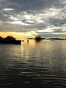
576:
748:
459:
253:
75:
639:
122:
The principal economic activity on Koome, as is the case with most adjacent islands in the Ssese
Islands is
499:
170:
514:
489:
83:
79:
71:
66:. Koome is the largest island in the northeastern group. Other islands in the same group include:
644:
597:
484:
440:
160:
86:
and others. This location lies approximately 63 kilometres (39 mi), by water, northeast of
27:
474:
320:
106:, located on the northwestern shore of the island. There is a health center on the island,
695:
685:
680:
283:
111:
55:
675:
670:
464:
365:
350:
742:
690:
660:
535:
530:
406:
165:
155:
59:
39:
90:. Koome also lies approximately 35 kilometres (22 mi), by water, southeast of
67:
340:
293:
131:
665:
540:
345:
127:
114:
announced that they will soon open a brick and mortar branch on Koome Island.
724:
711:
469:
422:
335:
87:
17:
401:
385:
380:
393:
375:
370:
143:
139:
123:
91:
58:, in northwestern Lake Victoria, in Uganda. The island is separated to
360:
355:
43:
26:
135:
249:
608:
Uganda Campus of
Limkokwing University of Creative Technology
190:
Nautical
Distance Between Kalangala And Koome Island With Map
201:
Map
Showing Entebbe And Koome Island With Distance Marker
653:
632:
616:
585:
549:
523:
452:
415:
328:
300:
102:The largest urban area on the island is called
261:
8:
268:
254:
246:
110:, not far from Bugombe. In February 2011,
213:"PostBank Uganda Opens Branch In Koome"
182:
7:
603:Mount Saint Mary's College Namagunga
241:Map of Koome Island At Google Maps
25:
572:Mukono–Kyetume–Katosi–Nyenga Road
541:Ssekabaka Kintu's Palace at Dindo
319:
277:
436:Kampala Cement Company Limited
1:
624:Namanve Thermal Power Station
593:Uganda Christian University
495:Stanbic Bank Uganda Limited
428:East African Medical Vitals
54:Koome Island is located in
775:
510:Pride Microfinance Limited
480:Equity Bank Uganda Limited
317:
577:Tondeka Metro Bus Service
567:Mukono–Kayunga–Njeru Road
290:
759:Islands of Lake Victoria
562:Kampala–Jinja Expressway
460:Absa Bank Uganda Limited
76:Ngamba-Chimpanzee Island
640:Mukono Health Centre IV
505:Opportunity Bank Uganda
423:Namanve Coca Cola Plant
108:Koome Health Center III
754:Lake islands of Uganda
500:United Bank for Africa
171:Central Region, Uganda
138:and animal husbandry,
32:
557:Kampala–Jinja Highway
30:
725:0.08500°S 32.75000°E
515:FINCA Uganda Limited
490:Housing Finance Bank
432:Global Paper Limited
721: /
118:Economic activities
730:-0.08500; 32.75000
645:Naggalama Hospital
598:Namilyango College
485:Finance Trust Bank
441:Katosi Water Works
329:Towns and villages
161:Kalangala District
33:
704:
703:
524:Notable landmarks
16:(Redirected from
766:
736:
735:
733:
732:
731:
726:
722:
719:
718:
717:
714:
323:
282:
281:
280:
270:
263:
256:
247:
228:
227:
225:
224:
215:. Archived from
209:
203:
198:
192:
187:
38:is an island in
31:Sunrise on Koome
21:
774:
773:
769:
768:
767:
765:
764:
763:
749:Mukono District
739:
738:
729:
727:
723:
720:
715:
712:
710:
708:
707:
705:
700:
696:Teacher Mpamire
686:Joseph Semwanga
681:Jennifer Musisi
649:
628:
612:
581:
545:
519:
448:
445:Tian Tang Group
411:
324:
315:
312:Nakifuma County
302:
296:
286:
284:Mukono District
278:
276:
274:
237:
232:
231:
222:
220:
211:
210:
206:
199:
195:
188:
184:
179:
152:
120:
112:PostBank Uganda
100:
56:Mukono District
52:
23:
22:
15:
12:
11:
5:
772:
770:
762:
761:
756:
751:
741:
740:
702:
701:
699:
698:
693:
688:
683:
678:
676:Betty Nambooze
673:
671:Ronald Kibuule
668:
663:
657:
655:
654:Notable people
651:
650:
648:
647:
642:
636:
634:
630:
629:
627:
626:
620:
618:
614:
613:
611:
610:
605:
600:
595:
589:
587:
583:
582:
580:
579:
574:
569:
564:
559:
553:
551:
547:
546:
544:
543:
538:
533:
527:
525:
521:
520:
518:
517:
512:
507:
502:
497:
492:
487:
482:
477:
472:
467:
465:Centenary Bank
462:
456:
454:
450:
449:
447:
446:
443:
438:
433:
430:
425:
419:
417:
413:
412:
410:
409:
404:
399:
396:
391:
388:
383:
378:
373:
368:
363:
358:
353:
348:
343:
338:
332:
330:
326:
325:
318:
316:
314:
313:
310:
306:
304:
298:
297:
291:
288:
287:
275:
273:
272:
265:
258:
250:
244:
243:
236:
235:External links
233:
230:
229:
204:
193:
181:
180:
178:
175:
174:
173:
168:
163:
158:
151:
148:
119:
116:
99:
96:
51:
48:
24:
14:
13:
10:
9:
6:
4:
3:
2:
771:
760:
757:
755:
752:
750:
747:
746:
744:
737:
734:
697:
694:
692:
691:Lydia Jazmine
689:
687:
684:
682:
679:
677:
674:
672:
669:
667:
664:
662:
661:Janat Mukwaya
659:
658:
656:
652:
646:
643:
641:
638:
637:
635:
631:
625:
622:
621:
619:
615:
609:
606:
604:
601:
599:
596:
594:
591:
590:
588:
584:
578:
575:
573:
570:
568:
565:
563:
560:
558:
555:
554:
552:
548:
542:
539:
537:
536:Lake Victoria
534:
532:
531:Sezibwa River
529:
528:
526:
522:
516:
513:
511:
508:
506:
503:
501:
498:
496:
493:
491:
488:
486:
483:
481:
478:
476:
473:
471:
468:
466:
463:
461:
458:
457:
455:
451:
444:
442:
439:
437:
434:
431:
429:
426:
424:
421:
420:
418:
414:
408:
405:
403:
400:
397:
395:
392:
389:
387:
384:
382:
379:
377:
374:
372:
369:
367:
364:
362:
359:
357:
354:
352:
349:
347:
344:
342:
339:
337:
334:
333:
331:
327:
322:
311:
309:Mukono County
308:
307:
305:
299:
295:
289:
285:
271:
266:
264:
259:
257:
252:
251:
248:
242:
239:
238:
234:
219:on 2012-10-01
218:
214:
208:
205:
202:
197:
194:
191:
186:
183:
176:
172:
169:
167:
166:Lake Victoria
164:
162:
159:
157:
156:Ssese Islands
154:
153:
149:
147:
145:
141:
137:
133:
129:
125:
117:
115:
113:
109:
105:
97:
95:
93:
89:
85:
84:Kayaga Island
81:
80:Bulago Island
77:
73:
69:
65:
64:Koome Channel
61:
60:Ssese Islands
57:
49:
47:
45:
41:
40:Lake Victoria
37:
29:
19:
706:
303:sub-counties
301:Counties and
221:. Retrieved
217:the original
207:
196:
185:
121:
107:
103:
101:
72:Lwaje Island
68:Damba Island
63:
53:
35:
34:
728: /
132:agriculture
98:Urban areas
18:Kome Island
743:Categories
716:32°45′00″E
713:00°05′06″S
666:David Kato
346:Namilyango
223:2011-02-18
177:References
128:Nile Perch
586:Education
550:Transport
470:DFCU Bank
398:Namagunga
336:Bukeerere
292:Capital:
88:Kalangala
402:Namataba
386:Nagalama
381:Nakifuma
150:See also
50:Location
475:Ecobank
453:Banking
416:Economy
394:Nagojje
390:Kabembe
376:Mbalala
371:Kyetume
144:tourism
140:logging
134:, both
124:fishing
104:Bugombe
92:Entebbe
62:by the
633:Health
617:Energy
366:Kisoga
361:Kasawo
356:Katosi
351:Kalagi
341:Mukono
294:Mukono
44:Uganda
407:Seeta
36:Koome
142:and
136:crop
46:.
745::
146:.
126:.
82:,
78:,
74:,
70:,
42:,
269:e
262:t
255:v
226:.
20:)
Text is available under the Creative Commons Attribution-ShareAlike License. Additional terms may apply.