53:
144:
78:
111:
217:
151:
118:
85:
504:
As per 2011 Census of India, the population of
Konvade is 2282. The village has a lower literacy rate compared to Maharashtra as a whole. In 2011, literacy rate of Konvade was 80.95 % compared to 82.34 % of Maharashtra. The Male literacy stands at 90.81 % while female literacy rate was
521:
Farming is the primary business of most of the residents. Fertile soil, abundance of water and use of modern farming techniques along with advanced machineries have greatly influenced the farming and have helped to attain maximum productivity. The type of climate and soil that exist in
Konavade is
522:
favorable for sugarcane production, which is the primary crop here. The abundant availability of water and well-spread irrigation enables farmers to take more than one crop per year which is usually rice followed by sugarcane or groundnuts.
52:
496:
Konavade is situated in the southwest part of
Maharashtra. Being close to the Western Ghats, locally known as Sahyadri, it is surrounded by a number of sub-ranges of the Sahyadri.
505:
70.28 %. Scheduled Castes (SC) constitutes 9.11 % of the total population in
Konvade. The village currently doesn't have any Scheduled Tribes (ST) population.
746:
460:
for living and subsistence at the village
Komnijavada in Kodavali division of Mirinji country. According to scholars, Mirinji country is present-day
143:
513:
All the inhabitants of the village follow
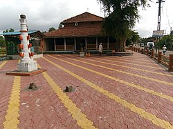
Hinduism. Consequently, there are several temples of Hindu deities, Yamai Devi being the most prominent.
770:
765:
572:
179:
77:
525:
Animal husbandry is a common practice among the residents and as a side business, it helps the people to earn some extra income.
110:
739:
424:. In ancient times, Konavade was known as Konijavada. Konavade, spelt officially as 'Konvade', is located on the banks of
620:
732:
645:
542:
398:
239:
441:
604:
673:
370:
440:
The ancient name of
Konavade was Konijavada. It is mentioned on a copper plate inscription found at
456:
1048, King
Gandaraditya granted two nivartan (contemporary unit of land measurement) of land to 12
378:
704:
568:
480:
tehsil. This copper plate inscription is preserved in the
Rajaram College Museum in Kolhapur.
244:
488:
The modern name of the village, Konavade is an abbreviation of its ancient name
Komnijavada.
543:"Konvade Village | Map of Konvade Village in Bhudargad Tehsil, Kolhapur of Maharashtra"
429:
354:
588:
716:
425:
271:
759:
593:(in French). DIRECTOR GENERAL ARCHAEOLOGICAL SURVEY OF INDIA, NEW DELHI. p. 225.
445:
562:
708:
421:
232:
194:
181:
477:
453:
449:
366:
361:
256:
473:
417:
609:(in French). DIRECTOR GENERAL ARCHAEOLOGICAL SURVEY OF INDIA, NEW DELHI.
564:
A Cultural History of Maharashtra and Goa: From Place Name Inscriptions
457:
336:
38:
469:
465:
251:
646:"Map of Konvade Village in Bhudargad Tehsil, Kolhapur, Maharashtra"
712:
461:
222:
621:"Konvade Village Population - Bhudargad, Kolhapur, Maharashtra"
674:"Konvade Population (2019/2020), Village in Bhudargad Taluka"
668:
666:
444:, Kolhapur. This inscription dates back to the time of King
720:
397:
389:
377:
360:
350:
345:
335:
327:
322:
314:
306:
301:
293:
285:
277:
267:
262:
250:
238:
228:
210:
26:
452:. According to the text on this inscription, in
740:
476:, and Komnijavada is the Konavade village in
8:
747:
733:
23:
534:
376:
359:
344:
334:
321:
313:
310:3.3417 km (1.2902 sq mi)
300:
261:
209:
174:
69:
61:
49:
44:
396:
388:
349:
326:
305:
292:
284:
276:
266:
249:
237:
227:
7:
700:
698:
556:
554:
552:
606:CORPUS INSCRIPTIONS INDICARUM VOL 6
590:CORPUS INSCRIPTIONS INDICARUM VOL 6
567:. Sundeep Prakashan. p. 176.
14:
215:
150:
149:
142:
117:
116:
109:
84:
83:
76:
51:
318:545.6 m (1,790.0 ft)
1:
771:Pune Division geography stubs
766:Villages in Kolhapur district
21:Village in Maharashtra, India
719:. You can help Knowledge by
428:, a tributary of the river
787:
697:
294: • Vice Sarpanch
175:
70:
62:
50:
45:
36:
561:Mahajan, Malati (1989).
468:, Kodavalli division is
297:Mr. Subhash Patil (Nana)
281:Gram Panchayat, Konavade
30:
100:Show map of Maharashtra
715:location article is a
57:Yamai Temple, Konavade
16:Village in Maharashtra
351: • Language
286: • Sarpanch
195:16.37111°N 74.13861°E
678:www.indiagrowing.com
399:Vehicle registration
650:www.mapsofindia.com
625:Censusindia2011.com
191: /
416:) is a village in
328: • Total
307: • Total
289:Mrs. Rani S. Patil
200:16.37111; 74.13861
728:
727:
705:Kolhapur district
574:978-81-85067-23-0
407:
406:
278: • Body
268: • Type
166:Show map of Earth
133:Show map of India
778:
749:
742:
735:
699:
689:
688:
686:
684:
670:
661:
660:
658:
656:
642:
636:
635:
633:
631:
617:
611:
610:
601:
595:
594:
585:
579:
578:
558:
547:
546:
539:
450:Shilahar dynasty
221:
219:
218:
206:
205:
203:
202:
201:
196:
192:
189:
188:
187:
184:
167:
163:Konavade (Earth)
153:
152:
146:
134:
130:Konavade (India)
120:
119:
113:
101:
87:
86:
80:
55:
24:
786:
785:
781:
780:
779:
777:
776:
775:
756:
755:
754:
753:
695:
693:
692:
682:
680:
672:
671:
664:
654:
652:
644:
643:
639:
629:
627:
619:
618:
614:
603:
602:
598:
587:
586:
582:
575:
560:
559:
550:
541:
540:
536:
531:
519:
511:
502:
494:
486:
442:Khasbagh Maidan
438:
385:
216:
214:
199:
197:
193:
190:
185:
182:
180:
178:
177:
171:
170:
169:
168:
165:
164:
161:
160:
159:
158:
154:
137:
136:
135:
132:
131:
128:
127:
126:
125:
121:
104:
103:
102:
99:
98:
95:
94:
93:
92:
88:
66:
63:Nickname:
58:
41:
32:
29:
22:
17:
12:
11:
5:
784:
782:
774:
773:
768:
758:
757:
752:
751:
744:
737:
729:
726:
725:
691:
690:
662:
637:
612:
596:
580:
573:
548:
533:
532:
530:
527:
518:
515:
510:
507:
501:
498:
493:
490:
485:
482:
437:
434:
405:
404:
401:
395:
394:
391:
390:Telephone code
387:
386:
383:
381:
375:
374:
364:
358:
357:
352:
348:
347:
343:
342:
339:
333:
332:
329:
325:
324:
320:
319:
316:
312:
311:
308:
304:
303:
299:
298:
295:
291:
290:
287:
283:
282:
279:
275:
274:
272:Gram Panchayat
269:
265:
264:
260:
259:
254:
248:
247:
242:
236:
235:
230:
226:
225:
212:
208:
207:
173:
172:
162:
156:
155:
148:
147:
141:
140:
139:
138:
129:
123:
122:
115:
114:
108:
107:
106:
105:
96:
90:
89:
82:
81:
75:
74:
73:
72:
71:
68:
67:
64:
60:
59:
56:
48:
47:
43:
42:
37:
34:
33:
27:
20:
15:
13:
10:
9:
6:
4:
3:
2:
783:
772:
769:
767:
764:
763:
761:
750:
745:
743:
738:
736:
731:
730:
724:
722:
718:
714:
710:
706:
701:
696:
679:
675:
669:
667:
663:
651:
647:
641:
638:
626:
622:
616:
613:
608:
607:
600:
597:
592:
591:
584:
581:
576:
570:
566:
565:
557:
555:
553:
549:
544:
538:
535:
528:
526:
523:
516:
514:
508:
506:
499:
497:
491:
489:
483:
481:
479:
475:
471:
467:
463:
459:
455:
451:
447:
443:
435:
433:
431:
427:
423:
419:
415:
411:
402:
400:
392:
382:
380:
372:
368:
365:
363:
356:
353:
340:
338:
330:
317:
309:
296:
288:
280:
273:
270:
258:
255:
253:
246:
243:
241:
234:
231:
224:
213:
204:
176:Coordinates:
145:
112:
79:
54:
40:
35:
25:
19:
721:expanding it
702:
694:
681:. Retrieved
677:
653:. Retrieved
649:
640:
628:. Retrieved
624:
615:
605:
599:
589:
583:
563:
537:
524:
520:
512:
503:
500:Demographics
495:
487:
446:Gandaraditya
439:
413:
409:
408:
18:
709:Maharashtra
422:Maharashtra
233:Maharashtra
198: /
760:Categories
683:31 January
655:31 January
630:31 January
529:References
454:Shaka year
430:Panchganga
341:Konavdekar
323:Population
263:Government
183:16°22′16″N
492:Geography
484:Etymology
478:Bhudargad
362:Time zone
315:Elevation
257:Bhudargad
186:74°8′19″E
509:Religion
474:Kolhapur
458:Brahmins
426:Vedganga
418:Kolhapur
414:Konawade
410:Konavade
367:UTC+5:30
346:Official
245:Kolhapur
240:District
157:Konavade
124:Konavade
97:Location
91:Konavade
65:Konawade
28:Konavade
517:Economy
448:of the
436:History
355:Marathi
337:Demonym
211:Country
46:Konvade
39:Village
571:
470:Kodoli
466:Sangli
384:416209
252:Tehsil
220:
31:कोनवडे
713:India
703:This
472:near
462:Miraj
403:MH-09
331:2,282
229:State
223:India
717:stub
685:2021
657:2021
632:2021
569:ISBN
412:(or
393:0231
302:Area
464:in
379:PIN
371:IST
762::
711:,
707:,
676:.
665:^
648:.
623:.
551:^
432:.
420:,
748:e
741:t
734:v
723:.
687:.
659:.
634:.
577:.
545:.
373:)
369:(
Text is available under the Creative Commons Attribution-ShareAlike License. Additional terms may apply.