55:
486:
39:
1947:
386:
62:
437:
438:"Search results for 'Kongorong, LOCB' with the following datasets being selected - 'Suburbs and Localities', 'Counties', 'Government towns', 'Local Government Areas', 'SA Government Regions' and 'Gazetteer'"
779:
1233:
202:
190:
772:
1991:
765:
54:
178:
87:
1274:
1003:
154:
2020:
373:
Kongorong was officially named by the South
Australian Government on 30 March 1922 for the cadastral land division in which the township lay, the
1251:
1984:
1851:
1450:
393:
Kongorong is a service town for the surrounding community involved in dairy and sheep farming, timber plantations, and grape growing in the
1745:
1670:
1398:
1264:
410:
195:
1861:
1833:
1800:
1765:
1522:
1494:
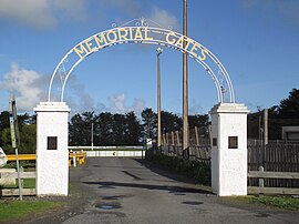
1485:
2010:
1790:
1780:
1705:
1575:
1570:
855:
485:
1977:
1841:
1750:
1735:
1725:
1424:
917:
830:
597:
312:
293:
1846:
1770:
1695:
1595:
1259:
922:
800:
463:
625:
1775:
1690:
1645:
1590:
1560:
1535:
1512:
1368:
1332:
907:
358:
1685:
1755:
1710:
1700:
1635:
1600:
1585:
1403:
1211:
1131:
996:
891:
860:
845:
820:
732:
326:
305:
277:
272:
805:
317:
1874:
1680:
1640:
1630:
1565:
1302:
896:
321:
166:
80:
1894:
1720:
1555:
1550:
1545:
1363:
1151:
1071:
1056:
938:
932:
865:
810:
281:
1675:
1650:
912:
1823:
1785:
1730:
1620:
1615:
1605:
1530:
1161:
1121:
1091:
959:
1869:
1665:
927:
1909:
1760:
1715:
1660:
1655:
1540:
1455:
1297:
1287:
1206:
1186:
1076:
944:
881:
850:
825:
789:
414:
394:
362:
159:
2015:
1904:
1808:
1740:
1610:
1580:
1307:
1292:
1086:
989:
949:
876:
815:
840:
835:
286:
650:
1813:
1625:
1337:
1166:
1081:
954:
886:
301:
1899:
1818:
1106:
467:
144:
126:
1919:
1507:
1502:
1282:
1181:
970:
757:
724:
567:
1312:
965:
374:
1470:
749:
Aboriginal taken from D Black's station in 1846 - meaning 'the corner of it'. Area 91 square miles.
528:
1241:
499:
406:
207:
680:
681:"Monthly climate statistics: Summary statistics Mount Gambier Aero (nearest weather station)"
1914:
1393:
1373:
1954:
1171:
1066:
1016:
1012:
354:
171:
38:
29:
1961:
1388:
1046:
183:
2004:
1030:
1946:
1924:
1465:
1419:
1358:
1342:
981:
385:
1460:
1383:
1378:
1101:
1475:
1445:
1440:
1191:
1176:
1136:
1096:
1061:
529:"GEOGRAPHICAL NAMES ACT 1991, Notice to Assign Boundaries and Names to Places"
377:. Kongorong is thought to mean "the corner of it" in an indigenous language.
102:
89:
1957:
1146:
1116:
1111:
1051:
1196:
1141:
365:
team and netball team. Kongorong
Primary School had 61 students in 2010.
574:. Government of South Australia. 4 March 2010. SA0015112. Archived from
1201:
1156:
901:
1126:
384:
705:. Department for Education and Child Development. 19 October 2010
1216:
702:
985:
761:
736:
575:
1965:
1887:
1860:
1832:
1799:
1521:
1493:
1484:
1433:
1412:
1351:
1325:
1273:
1250:
1232:
1225:
1039:
1023:
340:
201:
189:
177:
165:
153:
143:
133:
118:
79:
23:
683:. Commonwealth of Australia, Bureau of Meteorology
261:
214:
626:"District of Mount Gambier Background Profile"
1985:
997:
773:
8:
735:. 29 January 2009. SA0037333. Archived from
123:
1992:
1978:
1490:
1229:
1004:
990:
982:
780:
766:
758:
509:. South Australian Government. p. 943
484:
37:
20:
725:"Placename Details: Hundred of Kongorong"
675:
673:
671:
353:is a locality in the Australian state of
405:Kongorong is located within the federal
536:The South Australian Government Gazette
507:The South Australian Government Gazette
426:
651:"Federal electoral division of Barker"
620:
618:
598:"Limestone Coast SA Government region"
1352:Caves, sinkholes and freshwater lakes
645:
643:
562:
560:
558:
556:
554:
552:
432:
430:
413:and the local government area of the
310:
291:
270:
263:
234:
216:
7:
1943:
1941:
1265:Electoral district of Mount Gambier
603:. The Government of South Australia
411:electoral district of Mount Gambier
14:
656:. Australian Electoral Commission
472:Australian Census 2021 QuickStats
468:"Kongorong (suburb and locality)"
61:
1945:
729:Property Location Browser Report
60:
53:
2021:South Australia geography stubs
1260:Electoral district of MacKillop
498:Bice, John G. (30 March 1922).
464:Australian Bureau of Statistics
444:. Government of South Australia
1326:Hills, mountains and volcanoes
568:"Placename Details: Kongorong"
1:
733:Government of South Australia
703:"Kongorong Primary & CPC"
1964:. You can help Knowledge by
1303:Naracoorte Lucindale Council
788:Towns and localities of the
266:Localities around Kongorong:
1508:Coorong (southern end only)
2037:
1940:
139:31 October 1996 (locality)
1888:Related and uncategorised
1456:Discovery Bay (part only)
1298:Kingston District Council
1288:District Council of Grant
1252:State electoral districts
796:
790:District Council of Grant
628:. Electoral Commission SA
572:Property Location Browser
415:District Council of Grant
395:Mount Gambier wine region
363:Australian rules football
332:
264:
260:
252:
213:
160:District Council of Grant
48:
36:
2011:Towns in South Australia
1308:Tatiara District Council
1293:District Council of Robe
43:Kongorong memorial gates
538:: 1517, 31 October 1996
18:Town in South Australia
442:Location SA Map Viewer
390:
1834:Conservation reserves
1283:City of Mount Gambier
388:
357:located southwest of
1895:Limestone Coast zone
1313:Wattle Range Council
1040:Towns and localities
375:Hundred of Kongorong
344:Adjoining localities
137:30 March 1922 (town)
103:37.8999°S 140.5549°E
1686:Lower Glenelg River
1471:Margaret Brock Reef
1451:Cape Northumberland
500:"TOWN OF KONGORONG"
203:Federal division(s)
191:State electorate(s)
99: /
1523:Conservation parks
1242:Division of Barker
806:Blackfellows Caves
739:on 7 December 2015
578:on 7 December 2015
407:division of Barker
391:
318:Blackfellows Caves
108:-37.8999; 140.5549
1973:
1972:
1935:
1934:
1883:
1882:
1746:Piccaninnie Ponds
1671:Lake Hawdon South
1399:Piccaninnie Ponds
1321:
1320:
979:
978:
348:
347:
336:
335:
256:
255:
2028:
1994:
1987:
1980:
1949:
1942:
1875:Lower South East
1870:Upper South East
1852:Hardings Springs
1766:Tantanoola Caves
1513:Naracoorte Caves
1491:
1434:Coastal features
1394:Little Blue Lake
1275:Local Government
1234:Federal division
1230:
1006:
999:
992:
983:
856:Eight Mile Creek
782:
775:
768:
759:
752:
751:
746:
744:
721:
715:
714:
712:
710:
699:
693:
692:
690:
688:
677:
666:
665:
663:
661:
655:
647:
638:
637:
635:
633:
622:
613:
612:
610:
608:
602:
594:
588:
587:
585:
583:
564:
547:
546:
545:
543:
533:
525:
519:
518:
516:
514:
504:
495:
489:
488:
482:
480:
478:
466:(28 June 2022).
460:
454:
453:
451:
449:
434:
262:
215:
125:
114:
113:
111:
110:
109:
104:
100:
97:
96:
95:
92:
64:
63:
57:
41:
32:
26:
21:
2036:
2035:
2031:
2030:
2029:
2027:
2026:
2025:
2016:Limestone Coast
2001:
2000:
1999:
1998:
1955:South Australia
1938:
1936:
1931:
1879:
1856:
1828:
1795:
1791:Wolseley Common
1781:Vivigani Ardune
1706:Mullinger Swamp
1576:Christmas Rocks
1571:Carpenter Rocks
1517:
1486:Protected areas
1480:
1429:
1408:
1347:
1317:
1269:
1246:
1221:
1172:Port MacDonnell
1067:Carpenter Rocks
1035:
1019:
1017:South Australia
1013:Limestone Coast
1010:
980:
975:
918:Port MacDonnell
831:Carpenter Rocks
792:
786:
756:
755:
742:
740:
723:
722:
718:
708:
706:
701:
700:
696:
686:
684:
679:
678:
669:
659:
657:
653:
649:
648:
641:
631:
629:
624:
623:
616:
606:
604:
600:
596:
595:
591:
581:
579:
566:
565:
550:
541:
539:
531:
527:
526:
522:
512:
510:
502:
497:
496:
492:
476:
474:
462:
461:
457:
447:
445:
436:
435:
428:
423:
403:
389:Kongorong mural
383:
371:
355:South Australia
320:
313:Carpenter Rocks
304:
294:Carpenter Rocks
280:
247:
242:
237:
230:Annual rainfall
221:
172:Limestone Coast
138:
107:
105:
101:
98:
93:
90:
88:
86:
85:
75:
74:
73:
72:
71:
70:
69:
65:
44:
30:South Australia
28:
27:
24:
19:
12:
11:
5:
2034:
2032:
2024:
2023:
2018:
2013:
2003:
2002:
1997:
1996:
1989:
1982:
1974:
1971:
1970:
1950:
1933:
1932:
1930:
1929:
1928:
1927:
1922:
1917:
1912:
1907:
1902:
1891:
1889:
1885:
1884:
1881:
1880:
1878:
1877:
1872:
1866:
1864:
1858:
1857:
1855:
1854:
1849:
1844:
1838:
1836:
1830:
1829:
1827:
1826:
1821:
1816:
1811:
1805:
1803:
1797:
1796:
1794:
1793:
1788:
1783:
1778:
1773:
1768:
1763:
1758:
1753:
1751:Pine Hill Soak
1748:
1743:
1738:
1736:Penguin Island
1733:
1728:
1726:Paranki Lagoon
1723:
1718:
1713:
1708:
1703:
1698:
1693:
1688:
1683:
1678:
1673:
1668:
1663:
1658:
1653:
1648:
1643:
1638:
1633:
1628:
1623:
1618:
1613:
1608:
1603:
1598:
1593:
1588:
1583:
1578:
1573:
1568:
1563:
1558:
1553:
1548:
1543:
1538:
1533:
1527:
1525:
1519:
1518:
1516:
1515:
1510:
1505:
1499:
1497:
1495:National parks
1488:
1482:
1481:
1479:
1478:
1473:
1468:
1463:
1458:
1453:
1448:
1443:
1437:
1435:
1431:
1430:
1428:
1427:
1422:
1416:
1414:
1410:
1409:
1407:
1406:
1401:
1396:
1391:
1389:Lake Bonney SE
1386:
1381:
1376:
1371:
1366:
1361:
1355:
1353:
1349:
1348:
1346:
1345:
1340:
1335:
1329:
1327:
1323:
1322:
1319:
1318:
1316:
1315:
1310:
1305:
1300:
1295:
1290:
1285:
1279:
1277:
1271:
1270:
1268:
1267:
1262:
1256:
1254:
1248:
1247:
1245:
1244:
1238:
1236:
1227:
1223:
1222:
1220:
1219:
1214:
1209:
1204:
1199:
1194:
1189:
1184:
1179:
1174:
1169:
1164:
1159:
1154:
1149:
1144:
1139:
1134:
1129:
1124:
1119:
1114:
1109:
1104:
1099:
1094:
1089:
1084:
1079:
1074:
1069:
1064:
1059:
1054:
1049:
1047:Allendale East
1043:
1041:
1037:
1036:
1034:
1033:
1027:
1025:
1021:
1020:
1011:
1009:
1008:
1001:
994:
986:
977:
976:
974:
973:
968:
963:
957:
952:
947:
942:
936:
930:
925:
923:Racecourse Bay
920:
915:
910:
905:
899:
894:
889:
884:
879:
874:
869:
863:
858:
853:
848:
843:
838:
833:
828:
823:
818:
813:
808:
803:
801:Allendale East
797:
794:
793:
787:
785:
784:
777:
770:
762:
754:
753:
716:
694:
667:
639:
614:
589:
548:
520:
490:
455:
425:
424:
422:
419:
402:
399:
382:
379:
370:
367:
346:
345:
342:
338:
337:
334:
333:
330:
329:
324:
315:
309:
308:
299:
296:
290:
289:
284:
275:
269:
268:
258:
257:
254:
253:
250:
249:
244:
239:
233:
232:
227:
222:
211:
210:
205:
199:
198:
193:
187:
186:
181:
175:
174:
169:
163:
162:
157:
151:
150:
147:
141:
140:
135:
131:
130:
120:
116:
115:
83:
77:
76:
67:
66:
59:
58:
52:
51:
50:
49:
46:
45:
42:
34:
33:
17:
13:
10:
9:
6:
4:
3:
2:
2033:
2022:
2019:
2017:
2014:
2012:
2009:
2008:
2006:
1995:
1990:
1988:
1983:
1981:
1976:
1975:
1969:
1967:
1963:
1960:article is a
1959:
1956:
1951:
1948:
1944:
1939:
1926:
1923:
1921:
1918:
1916:
1913:
1911:
1910:Mount Gambier
1908:
1906:
1903:
1901:
1898:
1897:
1896:
1893:
1892:
1890:
1886:
1876:
1873:
1871:
1868:
1867:
1865:
1863:
1859:
1853:
1850:
1848:
1845:
1843:
1840:
1839:
1837:
1835:
1831:
1825:
1824:Poocher Swamp
1822:
1820:
1817:
1815:
1812:
1810:
1807:
1806:
1804:
1802:
1801:Game reserves
1798:
1792:
1789:
1787:
1784:
1782:
1779:
1777:
1774:
1772:
1771:Telford Scrub
1769:
1767:
1764:
1762:
1759:
1757:
1754:
1752:
1749:
1747:
1744:
1742:
1739:
1737:
1734:
1732:
1729:
1727:
1724:
1722:
1719:
1717:
1714:
1712:
1709:
1707:
1704:
1702:
1699:
1697:
1696:Mount Monster
1694:
1692:
1689:
1687:
1684:
1682:
1679:
1677:
1676:Lake St Clair
1674:
1672:
1669:
1667:
1664:
1662:
1659:
1657:
1654:
1652:
1649:
1647:
1644:
1642:
1639:
1637:
1634:
1632:
1629:
1627:
1624:
1622:
1619:
1617:
1614:
1612:
1609:
1607:
1604:
1602:
1599:
1597:
1596:Douglas Point
1594:
1592:
1589:
1587:
1584:
1582:
1579:
1577:
1574:
1572:
1569:
1567:
1564:
1562:
1559:
1557:
1554:
1552:
1549:
1547:
1544:
1542:
1539:
1537:
1534:
1532:
1529:
1528:
1526:
1524:
1520:
1514:
1511:
1509:
1506:
1504:
1501:
1500:
1498:
1496:
1492:
1489:
1487:
1483:
1477:
1474:
1472:
1469:
1467:
1464:
1462:
1459:
1457:
1454:
1452:
1449:
1447:
1444:
1442:
1439:
1438:
1436:
1432:
1426:
1423:
1421:
1418:
1417:
1415:
1411:
1405:
1402:
1400:
1397:
1395:
1392:
1390:
1387:
1385:
1382:
1380:
1377:
1375:
1372:
1370:
1367:
1365:
1362:
1360:
1357:
1356:
1354:
1350:
1344:
1341:
1339:
1338:Mount Gambier
1336:
1334:
1331:
1330:
1328:
1324:
1314:
1311:
1309:
1306:
1304:
1301:
1299:
1296:
1294:
1291:
1289:
1286:
1284:
1281:
1280:
1278:
1276:
1272:
1266:
1263:
1261:
1258:
1257:
1255:
1253:
1249:
1243:
1240:
1239:
1237:
1235:
1231:
1228:
1224:
1218:
1215:
1213:
1210:
1208:
1205:
1203:
1200:
1198:
1195:
1193:
1190:
1188:
1185:
1183:
1180:
1178:
1175:
1173:
1170:
1168:
1165:
1163:
1160:
1158:
1155:
1153:
1150:
1148:
1145:
1143:
1140:
1138:
1135:
1133:
1130:
1128:
1125:
1123:
1120:
1118:
1115:
1113:
1110:
1108:
1105:
1103:
1100:
1098:
1095:
1093:
1090:
1088:
1085:
1083:
1080:
1078:
1075:
1073:
1070:
1068:
1065:
1063:
1060:
1058:
1055:
1053:
1050:
1048:
1045:
1044:
1042:
1038:
1032:
1031:Mount Gambier
1029:
1028:
1026:
1022:
1018:
1014:
1007:
1002:
1000:
995:
993:
988:
987:
984:
972:
969:
967:
964:
961:
958:
956:
953:
951:
948:
946:
943:
940:
937:
934:
931:
929:
926:
924:
921:
919:
916:
914:
913:Pleasant Park
911:
909:
908:Pelican Point
906:
903:
900:
898:
895:
893:
890:
888:
885:
883:
880:
878:
875:
873:
870:
867:
864:
862:
859:
857:
854:
852:
849:
847:
844:
842:
839:
837:
834:
832:
829:
827:
824:
822:
819:
817:
814:
812:
809:
807:
804:
802:
799:
798:
795:
791:
783:
778:
776:
771:
769:
764:
763:
760:
750:
738:
734:
730:
726:
720:
717:
704:
698:
695:
682:
676:
674:
672:
668:
652:
646:
644:
640:
627:
621:
619:
615:
599:
593:
590:
577:
573:
569:
563:
561:
559:
557:
555:
553:
549:
537:
530:
524:
521:
508:
501:
494:
491:
487:
473:
469:
465:
459:
456:
443:
439:
433:
431:
427:
420:
418:
416:
412:
408:
400:
398:
396:
387:
380:
378:
376:
368:
366:
364:
360:
359:Mount Gambier
356:
352:
343:
339:
331:
328:
325:
323:
319:
316:
314:
311:
307:
303:
300:
297:
295:
292:
288:
285:
283:
279:
276:
274:
271:
267:
259:
251:
245:
240:
235:
231:
228:
226:
225:Mean min temp
223:
220:
219:Mean max temp
217:
212:
209:
206:
204:
200:
197:
196:Mount Gambier
194:
192:
188:
185:
182:
180:
176:
173:
170:
168:
164:
161:
158:
156:
152:
148:
146:
142:
136:
132:
128:
121:
117:
112:
84:
82:
78:
56:
47:
40:
35:
31:
22:
16:
1966:expanding it
1952:
1937:
1925:Wrattonbully
1905:Mount Benson
1862:Marine parks
1776:Tilley Swamp
1691:Mary Seymour
1651:Hanson Scrub
1646:Hacks Lagoon
1591:Dingley Dell
1561:Butchers Gap
1536:Baudin Rocks
1466:Lacepede Bay
1420:Baudin Rocks
1369:Cave Gardens
1359:Blanche Cave
1343:Mount Schank
1333:Mount Benson
1212:Wrattonbully
1132:Mount Benson
892:Mount Schank
871:
861:German Creek
846:Dismal Swamp
821:Cape Douglas
748:
741:. Retrieved
737:the original
728:
719:
707:. Retrieved
697:
685:. Retrieved
658:. Retrieved
630:. Retrieved
605:. Retrieved
592:
580:. Retrieved
576:the original
571:
540:, retrieved
535:
523:
511:. Retrieved
506:
493:
475:. Retrieved
471:
458:
446:. Retrieved
441:
409:, the state
404:
392:
372:
361:. It has an
350:
349:
327:Cape Douglas
306:Mount Schank
278:German Creek
273:German Creek
265:
229:
224:
218:
15:
1842:Desert Camp
1809:Bool Lagoon
1756:Reedy Creek
1711:Nene Valley
1701:Mount Scott
1636:Guichen Bay
1601:Ewens Ponds
1586:Desert Camp
1461:Guichen Bay
1404:Valley Lake
1384:Fossil Cave
1379:Ewens Ponds
1374:Engelbrecht
1102:Kingston SE
928:Square Mile
897:Nene Valley
322:Nene Valley
145:Postcode(s)
134:Established
106: /
94:140°33′18″E
81:Coordinates
2005:Categories
1900:Coonawarra
1847:Bernouilli
1814:Bucks Lake
1681:Little Dip
1666:Lake Frome
1641:Gum Lagoon
1631:Grass Tree
1566:Calectasia
1476:Rivoli Bay
1446:Cape Jaffa
1441:Cape Banks
1226:Governance
1192:Tantanoola
1177:Rendelsham
1152:Naracoorte
1137:Mount Burr
1097:Kalangadoo
1072:Coonawarra
1062:Cape Jaffa
1057:Bordertown
939:Tantanoola
933:Suttontown
866:Glenburnie
811:Burrungule
743:23 January
607:10 October
582:23 January
421:References
401:Governance
282:Burrungule
119:Population
91:37°54′00″S
1958:geography
1920:Padthaway
1819:Lake Robe
1721:Padthaway
1556:Big Heath
1551:Belt Hill
1546:Beachport
1364:Blue Lake
1162:Padthaway
1147:Nangwarry
1122:Millicent
1117:Lucindale
1112:Kongorong
1092:Greenways
1052:Beachport
960:Worrolong
872:Kongorong
687:21 August
351:Kongorong
341:Footnotes
298:Kongorong
246:708.4 mm
68:Kongorong
25:Kongorong
1786:Woakwine
1731:Penambol
1621:Glen Roy
1616:Geegeela
1606:Fairview
1531:Aberdour
1207:Wolseley
1197:Tarpeena
1187:Southend
1142:Mundulla
1077:Donovans
945:Tarpeena
882:Mingbool
851:Donovans
826:Caroline
660:28 March
632:28 March
542:17 April
513:18 April
448:18 April
236:19.0 °C
1761:Talapar
1716:Ngarkat
1661:Kungari
1656:Jip Jip
1541:Bangham
1503:Canunda
1425:Penguin
1413:Islands
1202:Wandilo
1157:OB Flat
1087:Glencoe
950:Wandilo
902:OB Flat
877:Mil-Lel
841:Compton
836:Caveton
816:Canunda
709:29 July
477:28 June
381:Economy
369:History
287:Compton
248:27.9 in
241:8.2 °C
1741:Penola
1611:Furner
1581:Custon
1167:Penola
1127:Moorak
1082:Furner
1024:Cities
962:(part)
941:(part)
935:(part)
904:(part)
887:Moorak
868:(part)
483:
302:Moorak
208:Barker
179:County
167:Region
155:LGA(s)
1953:This
1626:Gower
1107:Keith
955:Wepar
654:(PDF)
601:(PDF)
532:(PDF)
503:(PDF)
243:47 °F
238:66 °F
122:221 (
1962:stub
1915:Robe
1217:Yahl
1182:Robe
971:Yahl
745:2019
711:2015
689:2016
662:2016
634:2016
609:2014
584:2019
544:2018
515:2018
479:2022
450:2018
184:Grey
149:5291
127:2021
966:Wye
124:SAL
2007::
1015:,
747:.
731:.
727:.
670:^
642:^
617:^
570:.
551:^
534:,
505:.
470:.
440:.
429:^
417:.
397:.
1993:e
1986:t
1979:v
1968:.
1005:e
998:t
991:v
781:e
774:t
767:v
713:.
691:.
664:.
636:.
611:.
586:.
517:.
481:.
452:.
129:)
Text is available under the Creative Commons Attribution-ShareAlike License. Additional terms may apply.