36:
132:
182:
139:
175:
356:). As a result, the west side of the North Cascades experiences high precipitation, especially during the winter months in the form of snowfall. During winter months, weather is usually cloudy, but, due to high pressure systems over the Pacific Ocean that intensify during summer months, there is often little or no cloud cover during the summer. Because of
422:
period dating back over two million years ago, glaciation advancing and retreating repeatedly scoured and shaped the landscape. A small glacial remnant lies on the south slope of Dorado Needle, whereas the northern slope maintains the extensive
297:. It is notable for its large local relief and isolated position on a far-flung eastern ridge of the Pickets. For example, it rises over 6,560 ft (2,000 m) in 1.8 mi (2.9 km) above McMillan Creek to the south.
304:
and Big Beaver Creek. It requires strenuous off-trail hiking including bushwhacking and tricky route-finding, but offers the promise of solitude, as the peak is rarely climbed. The final climb to the true summit involves exposed
35:
636:
380:. Geological events occurring many years ago created the diverse topography and drastic elevation changes over the Cascade Range leading to the various climate differences.
708:
87:
703:
131:
698:
487:
352:, they are forced upward by the peaks of the Cascade Range, causing them to drop their moisture in the form of rain or snowfall onto the Cascades (
300:
Luna Peak was first climbed in early
September 1938, by Bill Cox and Will F. Thompson. The standard route is the Southwest Ridge, approached from
174:
435:
in combination with glaciation have been the dominant processes which have created the tall peaks and deep valleys of the North
Cascades area.
713:
580:
545:
478:
483:
231:
294:
151:
80:
20:
683:
155:
509:
473:
572:
404:
290:
159:
62:
301:
70:
675:
600:
Beckey, Fred W. Cascade Alpine Guide, Climbing and High Routes. Seattle, WA: Mountaineers Books, 2008.
388:
316:
The north and east faces of Luna Peak are steep and dramatic, but are not popular with mountaineers.
400:
383:
The history of the formation of the
Cascade Mountains dates back millions of years ago to the late
424:
576:
541:
345:
329:
310:
265:
432:
357:
353:
226:
412:
377:
349:
320:
stated, "the peak lacks the compelling appeal of attractive alpine climbing problems."
282:
219:
208:
692:
392:
373:
341:
337:
333:
286:
427:. The U-shaped cross section of the river valleys is a result of recent glaciation.
278:
254:
244:
215:
569:
Cascade Alpine Guide: climbing and high routes, Vol. 3, Rainy Pass to Fraser River
535:
564:
419:
317:
455:
659:
306:
261:
41:
102:
89:
361:
647:
428:
408:
396:
372:
The North
Cascades features some of the most rugged topography in the
384:
55:
671:
596:
594:
592:
19:
For Luna Peak in
British Columbia (Coast Range), see
360:, snow tends to be wet and heavy, resulting in high
253:
243:
238:
225:
207:
118:
79:
69:
54:
49:
28:
309:on loose rock, and some parties will want a rope (
249:September 1938, by Bill Cox and Will F. Thompson
399:persisted. In addition, small fragments of the
510:"Luna, East Fury, West Fury Theodolite Survey"
8:
612:
610:
608:
606:
376:with craggy peaks, spires, ridges, and deep
619:The Natural History of Puget Sound Country
25:
508:Gilbertson PhD, Eric (October 27, 2022).
540:. Van Winkle Publishing Co. p. 31.
488:United States Department of the Interior
709:Mountains of Whatcom County, Washington
559:
557:
444:
281:, an extremely rugged subrange of the
277:is the second highest mountain in the
16:Mountain in Washington, United States
7:
704:North Cascades of Washington (state)
450:
448:
479:Geographic Names Information System
344:, and travel northeast toward the
14:
621:. University of Washington Press.
181:
138:
180:
173:
137:
130:
34:
699:Mountains of Washington (state)
484:United States Geological Survey
164:Show map of Washington (state)
1:
197:Show map of the United States
194:Luna Peak (the United States)
714:North Cascades National Park
415:about 50 million years ago.
328:Luna Peak is located in the
295:North Cascades National Park
152:North Cascades National Park
60:8,311 ft (2,533 m)
21:Luna Peak (British Columbia)
617:Kruckeberg, Arthur (1991).
730:
75:3,105 ft (946 m)
18:
534:Majors, Harry M. (1975).
397:volcanic igneous activity
348:. As fronts approach the
123:
33:
672:"Cascades National Park"
332:climate zone of western
456:"Luna Peak, Washington"
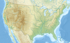
405:continental lithosphere
293:. It is located within
40:Luna Peak far left and
103:48.83056°N 121.27306°W
676:National Park Service
537:Exploring Washington
389:North American Plate
108:48.83056; -121.27306
99: /
573:Mountaineers Books
514:Country Highpoints
425:McAllister Glacier
358:maritime influence
63: NGVD 29
50:Highest point
682:Luna Peak photo:
582:978-1-59485-136-0
547:978-0-918664-00-6
346:Cascade Mountains
340:originate in the
330:marine west coast
272:
271:
65:
721:
679:
667:
655:
643:
642:. TopoQuest.com.
641:
623:
622:
614:
601:
598:
587:
586:
571:(3rd ed.).
561:
552:
551:
531:
525:
524:
522:
520:
505:
499:
498:
496:
494:
470:
464:
463:
452:
387:Epoch. With the
257:
234:Mount Challenger
211:
198:
184:
183:
177:
165:
160:Washington, U.S.
141:
140:
134:
114:
113:
111:
110:
109:
104:
100:
97:
96:
95:
92:
61:
38:
26:
729:
728:
724:
723:
722:
720:
719:
718:
689:
688:
670:
658:
646:
639:
635:
632:
627:
626:
616:
615:
604:
599:
590:
583:
575:. p. 118.
565:Beckey, Fred W.
563:
562:
555:
548:
533:
532:
528:
518:
516:
507:
506:
502:
492:
490:
472:
471:
467:
454:
453:
446:
441:
391:overriding the
378:glacial valleys
370:
354:Orographic lift
326:
255:
209:
203:
202:
201:
200:
199:
196:
195:
192:
191:
190:
189:
185:
168:
167:
166:
163:
162:
149:
148:
147:
146:
142:
107:
105:
101:
98:
93:
90:
88:
86:
85:
45:
24:
17:
12:
11:
5:
727:
725:
717:
716:
711:
706:
701:
691:
690:
687:
686:
680:
668:
656:
652:SummitPost.org
644:
631:
630:External links
628:
625:
624:
602:
588:
581:
553:
546:
526:
500:
465:
460:Peakbagger.com
443:
442:
440:
437:
413:North Cascades
395:, episodes of
369:
366:
350:North Cascades
338:weather fronts
325:
322:
283:North Cascades
270:
269:
259:
251:
250:
247:
241:
240:
236:
235:
229:
223:
222:
220:North Cascades
213:
205:
204:
193:
187:
186:
179:
178:
172:
171:
170:
169:
156:Whatcom County
150:
144:
143:
136:
135:
129:
128:
127:
126:
125:
124:
121:
120:
116:
115:
83:
77:
76:
73:
67:
66:
58:
52:
51:
47:
46:
39:
31:
30:
15:
13:
10:
9:
6:
4:
3:
2:
726:
715:
712:
710:
707:
705:
702:
700:
697:
696:
694:
685:
681:
677:
673:
669:
665:
661:
657:
653:
649:
645:
638:
634:
633:
629:
620:
613:
611:
609:
607:
603:
597:
595:
593:
589:
584:
578:
574:
570:
566:
560:
558:
554:
549:
543:
539:
538:
530:
527:
515:
511:
504:
501:
489:
485:
481:
480:
475:
469:
466:
461:
457:
451:
449:
445:
438:
436:
434:
430:
426:
421:
416:
414:
410:
406:
402:
398:
394:
393:Pacific Plate
390:
386:
381:
379:
375:
374:Cascade Range
367:
365:
363:
359:
355:
351:
347:
343:
342:Pacific Ocean
339:
335:
334:North America
331:
323:
321:
319:
314:
312:
308:
303:
298:
296:
292:
288:
284:
280:
276:
267:
263:
260:
258:
256:Easiest route
252:
248:
246:
242:
237:
233:
230:
228:
224:
221:
217:
214:
212:
206:
176:
161:
157:
153:
133:
122:
117:
112:
84:
82:
78:
74:
72:
68:
64:
59:
57:
53:
48:
43:
37:
32:
27:
22:
663:
651:
618:
568:
536:
529:
517:. Retrieved
513:
503:
491:. Retrieved
477:
468:
459:
417:
411:created the
382:
371:
327:
315:
299:
279:Picket Range
274:
273:
245:First ascent
216:Picket Range
210:Parent range
44:at far right
664:Bivouac.com
660:"Luna Peak"
648:"Luna Peak"
637:"Luna Peak"
474:"Luna Peak"
420:Pleistocene
418:During the
318:Fred Beckey
106: /
94:121°16′23″W
81:Coordinates
693:Categories
439:References
307:scrambling
291:Washington
91:48°49′50″N
71:Prominence
42:Mount Fury
362:avalanche
311:Class 3/4
302:Ross Lake
289:state of
275:Luna Peak
266:class 3/4
188:Luna Peak
145:Luna Peak
119:Geography
56:Elevation
29:Luna Peak
567:(2009).
433:faulting
409:terranes
364:danger.
287:American
262:scramble
239:Climbing
227:Topo map
519:June 4,
493:June 8,
407:called
401:oceanic
368:Geology
336:. Most
324:Climate
285:in the
684:Flickr
579:
544:
429:Uplift
385:Eocene
640:(map)
577:ISBN
542:ISBN
521:2023
495:2013
431:and
403:and
232:USGS
313:).
264:, (
695::
674:.
662:.
650:.
605:^
591:^
556:^
512:.
486:,
482:.
476:.
458:.
447:^
218:,
158:,
154:,
678:.
666:.
654:.
585:.
550:.
523:.
497:.
462:.
268:)
23:.
Text is available under the Creative Commons Attribution-ShareAlike License. Additional terms may apply.