51:
710:
1186:
42:
1075:
1066:
1057:
1048:
1039:
1030:
1021:
796:
728:
In the town, the population was spread out, with 18.4% under the age of 18, 1.5% from 18 to 24, 22.1% from 25 to 44, 38.2% from 45 to 64, and 19.9% who were 65 years of age or older. The median age was 48 years. For every 100 females, there were 97.1 males. For every 100 females age 18 and over,
724:
living together, 8.5% had a female householder with no husband present, and 23.7% were non-families. 23.7% of all households were made up of individuals, and 6.8% had someone living alone who was 65 years of age or older. The average household size was 2.31 and the average family size was 2.71.
50:
682:
was 85.5 people per square mile (33.0 per square km). There were 69 housing units, at an average density of 43.4 per square mile (16.8/km). The racial makeup of the town was 83.09%
732:
The median income for a household in the town was $ 53,214, and the median income for a family was $ 63,333. Males had a median income of $ 36,875 versus $ 16,875 for females. The
1103:
821:
296:
709:
1329:
973:
1261:
1096:
246:
64:
714:
292:
256:
1339:
1089:
310:
197:
974:"Incorporated Places and Minor Civil Divisions Datasets: Subcounty Resident Population Estimates: April 1, 2010 to July 1, 2012"
875:
1081:
687:
922:
691:
118:
1334:
952:
926:
850:
376:
900:
1159:
1113:
653:
638:
623:
608:
593:
578:
563:
548:
533:
518:
503:
488:
473:
458:
443:
428:
413:
353:
288:
123:
1299:
1251:
349:
234:
96:
338:(35.045629, -89.234349). It sits on a ridge 200 feet (60 m) above and 1 mile (1.6 km) north of the
720:
There were 59 households, out of which 18.6% had children under the age of 18 living with them, 66.1% were
1245:
699:
339:
981:
1225:
1135:
361:
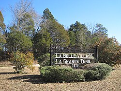
291:, United States. The population was 133 at the 2010 census. A large area in the town is listed on the
1306:
1220:
1175:
703:
207:
1235:
1170:
1154:
776:
736:
for the town was $ 38,626. There were 2.2% of families and 4.4% of the population living below the
695:
683:
1271:
1256:
1215:
679:
369:
948:
1205:
1165:
761:
733:
357:
343:
1276:
1266:
749:
1074:
1065:
1056:
1047:
1038:
1029:
1020:
41:
901:"Geographic Identifiers: 2010 Demographic Profile Data (G001): La Grange town, Tennessee"
769:
1323:
239:
755:
737:
678:, there were 136 people, 59 households, and 45 families residing in the town. The
1128:
365:
765:
106:
325:
312:
79:
66:
188:
111:
1290:‡This populated place also has portions in an adjacent county or counties
721:
379:, the town has a total area of 1.8 square miles (4.7 km), all land.
222:
816:
814:
675:
758:, socialite "Queen of the Confederacy" born at a nearby plantation
708:
214:
193:
352:
passes through the town, leading east 3.5 miles (5.6 km) to
1197:
1146:
32:
1085:
740:, including 3.2% of under eighteens and 8.3% of those over 64.
1006:
1184:
871:
271:
846:
307:
La Grange is located in southeastern
Fayette County at
949:"Census of Population and Housing: Decennial Censuses"
368:, is 16 miles (26 km) to the north, and downtown
1285:
1234:
1196:
1145:
266:
255:
245:
233:
221:
204:
187:
179:
171:
166:
158:
150:
142:
134:
129:
117:
105:
95:
55:
Location of La Grange in
Fayette County, Tennessee.
23:
1097:
895:
893:
713:The Immanuel Episcopal Church, listed on the
8:
1185:
1104:
1090:
1082:
923:"US Gazetteer files: 2010, 2000, and 1990"
706:of any race were 2.94% of the population.
386:
20:
903:. U.S. Census Bureau, American Factfinder
1016:
788:
265:
244:
220:
186:
165:
157:
128:
94:
59:
47:
38:
406:
372:is 47 miles (76 km) to the west.
841:
839:
356:and west 9.5 miles (15.3 km) to
254:
232:
203:
178:
170:
149:
141:
133:
116:
104:
7:
980:. U.S. Census Bureau. Archived from
715:National Register of Historic Places
698:, and 1.47% from two or more races.
293:National Register of Historic Places
154:0.00 sq mi (0.00 km)
146:2.01 sq mi (5.20 km)
138:2.01 sq mi (5.20 km)
1330:Towns in Fayette County, Tennessee
1112:Municipalities and communities of
1007:Town of La Grange official website
396:
14:
1073:
1064:
1055:
1046:
1037:
1028:
1019:
797:"ArcGIS REST Services Directory"
49:
40:
18:Town in Tennessee, United States
876:United States Geological Survey
872:"US Board on Geographic Names"
1:
824:. United States Census Bureau
799:. United States Census Bureau
775:Franklin Cossitt, founder of
752:, Wisconsin state legislator
953:United States Census Bureau
927:United States Census Bureau
851:United States Census Bureau
377:United States Census Bureau
297:La Grange Historic District
183:61.29/sq mi (23.66/km)
1356:
1340:Memphis metropolitan area
1295:
1182:
1126:
1115:Fayette County, Tennessee
667:
652:
637:
622:
607:
592:
577:
562:
547:
532:
517:
502:
487:
472:
457:
442:
427:
412:
405:
400:
395:
392:
289:Fayette County, Tennessee
60:
48:
39:
30:
350:Tennessee State Route 57
162:554 ft (169 m)
822:"Census Population API"
729:there were 91.4 males.
1190:
717:
674:According to the 2000
1188:
847:"U.S. Census website"
712:
388:Historical population
342:, a tributary of the
326:35.04556°N 89.23444°W
206: • Summer (
80:35.04556°N 89.23444°W
1308:United States portal
978:Population Estimates
180: • Density
25:La Grange, Tennessee
929:. February 12, 2011
777:La Grange, Illinois
389:
331:35.04556; -89.23444
322: /
85:35.04556; -89.23444
76: /
1335:Towns in Tennessee
1191:
1189:Fayette County map
878:. October 25, 2007
718:
680:population density
387:
172: • Total
151: • Water
135: • Total
1317:
1316:
762:Daniel D. Stevens
734:per capita income
672:
671:
375:According to the
282:
281:
143: • Land
1347:
1309:
1302:
1301:Tennessee portal
1187:
1138:
1131:
1121:
1116:
1106:
1099:
1092:
1083:
1077:
1068:
1059:
1050:
1041:
1032:
1023:
994:
993:
991:
989:
984:on June 11, 2013
970:
964:
963:
961:
959:
945:
939:
938:
936:
934:
919:
913:
912:
910:
908:
897:
888:
887:
885:
883:
868:
862:
861:
859:
857:
843:
834:
833:
831:
829:
818:
809:
808:
806:
804:
793:
750:La Tonya Johnson
688:African American
408:
403:
398:
390:
337:
336:
334:
333:
332:
327:
323:
320:
319:
318:
315:
278:
275:
273:
211:
91:
90:
88:
87:
86:
81:
77:
74:
73:
72:
69:
53:
44:
21:
1355:
1354:
1350:
1349:
1348:
1346:
1345:
1344:
1320:
1319:
1318:
1313:
1307:
1300:
1291:
1281:
1237:
1230:
1192:
1180:
1141:
1136:
1129:
1122:
1119:
1114:
1110:
1078:
1069:
1060:
1051:
1042:
1033:
1024:
1015:
1003:
998:
997:
987:
985:
972:
971:
967:
957:
955:
947:
946:
942:
932:
930:
921:
920:
916:
906:
904:
899:
898:
891:
881:
879:
870:
869:
865:
855:
853:
845:
844:
837:
827:
825:
820:
819:
812:
802:
800:
795:
794:
790:
785:
746:
722:married couples
692:Native American
401:
385:
330:
328:
324:
321:
316:
313:
311:
309:
308:
305:
270:
229:
205:
84:
82:
78:
75:
70:
67:
65:
63:
62:
56:
35:
26:
19:
12:
11:
5:
1353:
1351:
1343:
1342:
1337:
1332:
1322:
1321:
1315:
1314:
1312:
1311:
1304:
1296:
1293:
1292:
1289:
1287:
1283:
1282:
1280:
1279:
1274:
1269:
1264:
1259:
1254:
1249:
1242:
1240:
1236:Unincorporated
1232:
1231:
1229:
1228:
1223:
1218:
1213:
1208:
1202:
1200:
1194:
1193:
1183:
1181:
1179:
1178:
1173:
1168:
1163:
1160:Grand Junction
1157:
1151:
1149:
1143:
1142:
1127:
1124:
1123:
1111:
1109:
1108:
1101:
1094:
1086:
1080:
1079:
1072:
1070:
1063:
1061:
1054:
1052:
1045:
1043:
1036:
1034:
1027:
1025:
1018:
1014:
1011:
1010:
1009:
1002:
1001:External links
999:
996:
995:
965:
940:
914:
889:
863:
835:
810:
787:
786:
784:
781:
780:
779:
773:
770:Medal of Honor
759:
753:
745:
744:Notable people
742:
670:
669:
665:
664:
661:
659:
656:
650:
649:
646:
644:
641:
635:
634:
631:
629:
626:
620:
619:
616:
614:
611:
605:
604:
601:
599:
596:
590:
589:
586:
584:
581:
575:
574:
571:
569:
566:
560:
559:
556:
554:
551:
545:
544:
541:
539:
536:
530:
529:
526:
524:
521:
515:
514:
511:
509:
506:
500:
499:
496:
494:
491:
485:
484:
481:
479:
476:
470:
469:
466:
464:
461:
455:
454:
451:
449:
446:
440:
439:
436:
434:
431:
425:
424:
421:
419:
416:
410:
409:
404:
399:
394:
384:
381:
354:Grand Junction
304:
301:
280:
279:
268:
264:
263:
260:
253:
252:
249:
243:
242:
237:
231:
230:
227:
225:
219:
218:
212:
202:
201:
191:
185:
184:
181:
177:
176:
173:
169:
168:
164:
163:
160:
156:
155:
152:
148:
147:
144:
140:
139:
136:
132:
131:
127:
126:
121:
115:
114:
109:
103:
102:
99:
93:
92:
58:
57:
54:
46:
45:
37:
36:
31:
28:
27:
24:
17:
13:
10:
9:
6:
4:
3:
2:
1352:
1341:
1338:
1336:
1333:
1331:
1328:
1327:
1325:
1310:
1305:
1303:
1298:
1297:
1294:
1288:
1284:
1278:
1275:
1273:
1270:
1268:
1265:
1263:
1260:
1258:
1255:
1253:
1252:Hickory Withe
1250:
1247:
1244:
1243:
1241:
1239:
1233:
1227:
1224:
1222:
1219:
1217:
1214:
1212:
1209:
1207:
1204:
1203:
1201:
1199:
1195:
1177:
1174:
1172:
1169:
1167:
1164:
1161:
1158:
1156:
1153:
1152:
1150:
1148:
1144:
1140:
1139:
1132:
1125:
1120:United States
1117:
1107:
1102:
1100:
1095:
1093:
1088:
1087:
1084:
1076:
1071:
1067:
1062:
1058:
1053:
1049:
1044:
1040:
1035:
1031:
1026:
1022:
1017:
1012:
1008:
1005:
1004:
1000:
983:
979:
975:
969:
966:
954:
950:
944:
941:
928:
924:
918:
915:
902:
896:
894:
890:
877:
873:
867:
864:
852:
848:
842:
840:
836:
823:
817:
815:
811:
798:
792:
789:
782:
778:
774:
771:
767:
763:
760:
757:
754:
751:
748:
747:
743:
741:
739:
735:
730:
726:
723:
716:
711:
707:
705:
701:
697:
693:
689:
685:
681:
677:
666:
662:
660:
657:
655:
651:
647:
645:
642:
640:
636:
632:
630:
627:
625:
621:
617:
615:
612:
610:
606:
602:
600:
597:
595:
591:
587:
585:
582:
580:
576:
572:
570:
567:
565:
561:
557:
555:
552:
550:
546:
542:
540:
537:
535:
531:
527:
525:
522:
520:
516:
512:
510:
507:
505:
501:
497:
495:
492:
490:
486:
482:
480:
477:
475:
471:
467:
465:
462:
460:
456:
452:
450:
447:
445:
441:
437:
435:
432:
430:
426:
422:
420:
417:
415:
411:
391:
382:
380:
378:
373:
371:
367:
363:
359:
355:
351:
347:
345:
341:
335:
302:
300:
298:
294:
290:
287:is a town in
286:
277:
269:
261:
258:
250:
248:
241:
238:
236:
226:
224:
216:
213:
209:
199:
198:Central (CST)
195:
192:
190:
182:
174:
161:
153:
145:
137:
125:
122:
120:
113:
110:
108:
101:United States
100:
98:
89:
61:Coordinates:
52:
43:
34:
29:
22:
16:
1262:Liberty Hill
1210:
1134:
988:December 11,
986:. Retrieved
982:the original
977:
968:
956:. Retrieved
943:
931:. Retrieved
917:
905:. Retrieved
880:. Retrieved
866:
854:. Retrieved
826:. Retrieved
801:. Retrieved
791:
756:Lucy Pickens
738:poverty line
731:
727:
719:
673:
383:Demographics
374:
348:
306:
284:
283:
15:
1246:Fisherville
1238:communities
1130:County seat
882:January 31,
856:January 31,
828:October 15,
803:October 15,
768:sailor and
366:county seat
344:Mississippi
329: /
274:.lagrangetn
83: /
1324:Categories
1226:Somerville
1137:Somerville
907:August 16,
783:References
766:Union Navy
362:Somerville
340:Wolf River
259:feature ID
167:Population
1286:Footnotes
1221:Rossville
1211:La Grange
1176:Williston
933:April 23,
772:recipient
686:, 12.50%
317:89°14′4″W
314:35°2′44″N
303:Geography
285:La Grange
247:FIPS code
235:Area code
189:Time zone
159:Elevation
112:Tennessee
71:89°14′4″W
68:35°2′44″N
1171:Piperton
1155:Gallaway
958:March 4,
700:Hispanic
694:, 2.21%
690:, 0.74%
668:Sources:
251:47-40200
223:ZIP code
1272:Yum Yum
1257:Laconia
1216:Oakland
1013:Gallery
370:Memphis
267:Website
262:1303479
124:Fayette
97:Country
1206:Braden
1166:Moscow
1147:Cities
704:Latino
676:census
633:−18.6%
603:−13.1%
573:−10.0%
528:−10.1%
513:−19.5%
498:−13.2%
483:−29.0%
453:−63.6%
438:−31.7%
393:Census
364:, the
358:Moscow
119:County
1277:Zu Zu
1267:Macon
1198:Towns
696:Asian
684:White
663:−7.5%
648:−2.2%
618:−9.7%
588:−1.8%
558:−0.8%
468:80.5%
418:1,112
228:38046
217:(CDT)
215:UTC-5
194:UTC-6
107:State
990:2013
960:2012
935:2011
909:2016
884:2008
858:2008
830:2022
805:2022
654:2020
639:2010
624:2000
609:1990
594:1980
579:1970
564:1960
549:1950
543:9.0%
534:1940
519:1930
504:1920
489:1910
474:1900
459:1890
444:1880
429:1870
414:1860
402:Note
397:Pop.
276:.com
257:GNIS
130:Area
33:Town
702:or
658:123
643:133
628:136
613:167
598:185
583:213
568:217
553:241
538:243
523:223
508:248
493:308
478:355
463:500
448:277
433:760
295:as
272:www
240:901
208:DST
175:123
1326::
1133::
1118:,
976:.
951:.
925:.
892:^
874:.
849:.
838:^
813:^
764:,
407:%±
360:.
346:.
299:.
1248:‡
1162:‡
1105:e
1098:t
1091:v
992:.
962:.
937:.
911:.
886:.
860:.
832:.
807:.
423:—
210:)
200:)
196:(
Text is available under the Creative Commons Attribution-ShareAlike License. Additional terms may apply.