34:
64:
71:
41:
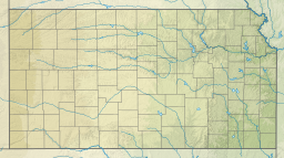
218:. It is a manmade lake contained by a 33 ft (10 m) high dam on its southwest. It is bounded by Indian Hills Road on the east, El Cerrito Drive on the south, Lagito Drive on the west and SW 29th Street on the north. If filled to the dam's brim, the lake would have a 340-acre (1,400,000 m) capacity. It normally has a 306-acre (1,240,000 m) capacity.
221:
Lake
Vaquero was built in the early 1960s. It has always been a lake and over the years residences have been built around it. Today, it is completely surrounded by houses. Periodically the lake has been dredged, because runoff from nearby construction and fields has resulted in the lake bottom
222:
being covered in silt. In 2010, the lake's owners, represented by the
Vaquero Lake Club, faced costly upgrades to the dam to increase the safety of persons and property downstream from it.
287:
33:
63:
110:
249: ; Barbara Hollingsworth, "Costly fix needed for dam: High price of repair means Lake Vaquero suddenly not as tranquil,"
282:
225:
Being a private lake, Vaquero Lake Club members enjoy boating, fishing and swimming at the beach on Lake
Vaquero.
246:
215:
96:
169:
254:
214:
is a private lake located two blocks southwest of Topeka, Kansas, and about three blocks northwest of
203:
152:
276:
158:
125:
112:
247:
http://www.fishingworks.com/lakes/kansas/shawnee/siver-lake/sherwood-lake/
255:
http://cjonline.com/news/local/2010-06-26/costly_fix_needed_for_dam
142:
242:
198:
194:
186:
178:
168:
164:
151:
141:
102:
92:
21:
16:Manmade freshwater lake in Shawnee County, Kansas
103:
8:
18:
234:
7:
70:
40:
14:
69:
62:
39:
32:
288:Lakes of Shawnee County, Kansas
253:online website, June 26, 2010,
245: ; Fishing Works website,
185:
177:
167:
1:
182:approx. 27 ft (8 m)
91:
83:Show map of the United States
304:
190:1,004 ft (306 m)
243:http://www.wikimapia.org/
26:
174:306 acres (124 ha)
147:manmade freshwater lake
251:Topeka Capital-Journal
216:Lake Sherwood (Kansas)
97:Shawnee County, Kansas
283:Reservoirs in Kansas
241:Wikimapia website,
126:39.0108°N 95.8011°W
122: /
202:just southwest of
53:Show map of Kansas
209:
208:
187:Surface elevation
131:39.0108; -95.8011
295:
267:
264:
258:
239:
137:
136:
134:
133:
132:
127:
123:
120:
119:
118:
115:
105:
84:
73:
72:
66:
54:
43:
42:
36:
19:
303:
302:
298:
297:
296:
294:
293:
292:
273:
272:
271:
270:
265:
261:
240:
236:
231:
155: countries
130:
128:
124:
121:
116:
113:
111:
109:
108:
88:
87:
86:
85:
82:
81:
80:
79:
78:
74:
57:
56:
55:
52:
51:
50:
49:
48:
44:
17:
12:
11:
5:
301:
299:
291:
290:
285:
275:
274:
269:
268:
266:Hollingsworth.
259:
233:
232:
230:
227:
207:
206:
204:Topeka, Kansas
200:
196:
195:
192:
191:
188:
184:
183:
180:
176:
175:
172:
166:
165:
162:
161:
156:
149:
148:
145:
139:
138:
106:
100:
99:
94:
90:
89:
76:
75:
68:
67:
61:
60:
59:
58:
46:
45:
38:
37:
31:
30:
29:
28:
27:
24:
23:
15:
13:
10:
9:
6:
4:
3:
2:
300:
289:
286:
284:
281:
280:
278:
263:
260:
256:
252:
248:
244:
238:
235:
228:
226:
223:
219:
217:
213:
205:
201:
197:
193:
189:
181:
173:
171:
163:
160:
159:United States
157:
154:
150:
146:
144:
140:
135:
107:
101:
98:
95:
65:
35:
25:
20:
262:
250:
237:
224:
220:
212:Lake Vaquero
211:
210:
170:Surface area
77:Lake Vaquero
47:Lake Vaquero
22:Lake Vaquero
199:Settlements
129: /
104:Coordinates
277:Categories
229:References
179:Max. depth
117:95°48′04″W
114:39°00′39″N
143:Lake type
93:Location
153:Basin
279::
257:.
Text is available under the Creative Commons Attribution-ShareAlike License. Additional terms may apply.