548:
44:
491:
402:
205:
51:
31:
382:, and development. The settlers of the communities around the lake are dedicated to the cultivation of fruits, vegetables and basic grains. Nevertheless, many of these inhabitants earn their living from the sale of fish originating from the lake.
363:. For many people traveling between the cities, the lake serves as a rest area where they can appreciate the view and enjoy the fresh fried fish and other foods that are offered by the restaurants located on its banks.
324:
with a surface area of 79 square kilometers (31 square miles) and an average depth of 15 meters (49 feet). At an altitude of 700 meters (2,300 feet), it lies in a depression formed by volcanoes. The Lake Yojoa
547:
532:
385:
People dedicate surrounding areas to the growing of coffee plants. Coffee grown near Lake Yojoa, in Santa
Barbara, is particularly well-known.
43:
585:
78:
619:
614:
470:
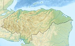
352:
525:
609:
348:
237:
394:
374:—almost 400 species of birds and 800 plant species have been identified in the region. However, it also is threatened by
230:
302:
604:
518:
458:
578:
463:
289:
624:
571:
431:
154:
555:
502:
406:
379:
360:
326:
294:
110:
598:
375:
355:. The lake is situated on the highway that connects the two largest Honduran cities,
490:
371:
356:
337:
330:
453:
204:
252:
239:
93:
80:
341:
498:
334:
321:
277:
476:
367:
30:
220:
426:
317:
347:
The west side of the lake is bordered by steep mountains and
559:
506:
301:
288:
283:
273:
268:
229:
219:
214:
197:
177:
169:
161:
152:
148:
140:
132:
124:
120:
109:
70:
21:
370:destination and the surrounding area has a rich
71:
50:
579:
526:
8:
586:
572:
533:
519:
194:
18:
418:
176:
168:
160:
151:
7:
544:
542:
487:
485:
351:while the east side is adjacent to
558:. You can help Knowledge (XXG) by
505:. You can help Knowledge (XXG) by
14:
546:
489:
400:
353:Cerro Azul Meambar National Park
203:
49:
42:
29:
554:This article about a lake is a
139:
131:
128:79 km (31 sq mi)
123:
1:
427:"Subcuenca del Lago de Yojoa"
395:List of volcanoes in Honduras
209:Satellite photo of Lake Yojoa
144:c. 700 m (2,300 ft)
477:Lake Yojoa, Interactive Maps
16:The largest lake in Honduras
349:Santa Bárbara National Park
165:Subcuenca del Lago de Yojoa
641:
541:
484:
225:700 m (2,300 ft)
434:Sites Information Service
202:
189:
185:
37:
28:
620:Honduras geography stubs
615:Ramsar sites in Honduras
459:Global Volcanism Program
366:Lake Yojoa is a popular
464:Smithsonian Institution
501:location article is a
136:15 m (49 ft)
610:Volcanoes of Honduras
297:with lava-dammed lake
473:, Birds of Honduras
407:Honduras portal
249: /
90: /
215:Highest point
178:Reference no.
605:Lakes of Honduras
567:
566:
514:
513:
311:
310:
253:14.867°N 87.983°W
193:
192:
141:Surface elevation
94:14.867°N 87.983°W
632:
588:
581:
574:
550:
543:
535:
528:
521:
493:
486:
467:
445:
444:
442:
440:
423:
405:
404:
403:
264:
263:
261:
260:
259:
254:
250:
247:
246:
245:
242:
207:
195:
105:
104:
102:
101:
100:
95:
91:
88:
87:
86:
83:
73:
53:
52:
46:
33:
19:
640:
639:
635:
634:
633:
631:
630:
629:
595:
594:
593:
592:
540:
539:
482:
452:
449:
448:
438:
436:
425:
424:
420:
415:
401:
399:
391:
380:cattle ranching
340:, craters, and
316:is the largest
258:14.867; -87.983
257:
255:
251:
248:
243:
240:
238:
236:
235:
210:
157:
113: countries
99:14.867; -87.983
98:
96:
92:
89:
84:
81:
79:
77:
76:
66:
65:
64:
63:
62:
61:
60:
58:
54:
23:
17:
12:
11:
5:
638:
636:
628:
627:
622:
617:
612:
607:
597:
596:
591:
590:
583:
576:
568:
565:
564:
551:
538:
537:
530:
523:
515:
512:
511:
494:
480:
479:
474:
468:
447:
446:
417:
416:
414:
411:
410:
409:
397:
390:
387:
361:San Pedro Sula
327:volcanic field
309:
308:
305:
299:
298:
295:Volcanic field
292:
286:
285:
281:
280:
275:
271:
270:
266:
265:
233:
227:
226:
223:
217:
216:
212:
211:
208:
200:
199:
191:
190:
187:
186:
183:
182:
179:
175:
174:
171:
167:
166:
163:
159:
158:
155:Ramsar Wetland
153:
150:
149:
146:
145:
142:
138:
137:
134:
130:
129:
126:
122:
121:
118:
117:
114:
107:
106:
74:
68:
67:
56:
55:
48:
47:
41:
40:
39:
38:
35:
34:
26:
25:
15:
13:
10:
9:
6:
4:
3:
2:
637:
626:
623:
621:
618:
616:
613:
611:
608:
606:
603:
602:
600:
589:
584:
582:
577:
575:
570:
569:
563:
561:
557:
552:
549:
545:
536:
531:
529:
524:
522:
517:
516:
510:
508:
504:
500:
495:
492:
488:
483:
478:
475:
472:
469:
465:
461:
460:
455:
451:
450:
435:
433:
428:
422:
419:
412:
408:
398:
396:
393:
392:
388:
386:
383:
381:
377:
376:deforestation
373:
369:
364:
362:
358:
354:
350:
345:
343:
339:
336:
332:
328:
323:
319:
315:
306:
304:
303:Last eruption
300:
296:
293:
291:
290:Mountain type
287:
282:
279:
276:
272:
267:
262:
234:
232:
228:
224:
222:
218:
213:
206:
201:
196:
188:
184:
180:
172:
164:
162:Official name
156:
147:
143:
135:
133:Average depth
127:
119:
115:
112:
108:
103:
75:
69:
59:Lago de Yojoa
45:
36:
32:
27:
24:Lago de Yojoa
20:
560:expanding it
553:
507:expanding it
496:
481:
457:
454:"Lake Yojoa"
437:. Retrieved
430:
421:
384:
372:biodiversity
365:
346:
338:scoria cones
329:consists of
313:
312:
125:Surface area
357:Tegucigalpa
331:Pleistocene
256: /
231:Coordinates
173:5 June 2005
97: /
72:Coordinates
625:Lake stubs
599:Categories
471:Lake Yojoa
413:References
342:lava flows
314:Lake Yojoa
244:87°58′59″W
241:14°52′01″N
198:Lake Yojoa
170:Designated
85:87°58′59″W
82:14°52′01″N
57:Lake Yojoa
22:Lake Yojoa
269:Geography
221:Elevation
499:Honduras
439:25 April
389:See also
335:Holocene
322:Honduras
278:Honduras
274:Location
116:Honduras
368:fishing
307:Unknown
284:Geology
432:Ramsar
497:This
111:Basin
556:stub
503:stub
441:2018
359:and
318:lake
181:1467
333:to
320:in
601::
462:.
456:.
429:.
378:,
344:.
587:e
580:t
573:v
562:.
534:e
527:t
520:v
509:.
466:.
443:.
Text is available under the Creative Commons Attribution-ShareAlike License. Additional terms may apply.