48:
81:
659:
154:
88:
55:
842:
47:
837:
551:
540:
518:
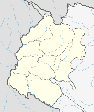
313:. Laljhadi has a population of 22569.The land area is 154.65 km. It was formed by merging Shankarpur, Baise Bichwa (ward 1–4) and Dekhtabhul (ward 1–3, 5–7,9) VDCs.
116:
529:
581:
484:
80:
691:
491:
574:
440:
832:
811:
667:
567:
446:
In terms of literacy, 61.7% could read and write, 2.6% could only read and 35.7% could neither read nor write.
807:
610:
306:
171:
774:
432:
744:
633:
495:
401:
658:
590:
302:
267:
183:
734:
178:
166:
463:
779:
739:
648:
428:
366:
322:
794:
759:
198:
769:
764:
358:
354:
350:
346:
342:
338:
326:
290:
789:
826:
699:
638:
417:
393:
373:
784:
719:
405:
325:, Laljhadi Rural Municipality had a population of 22,569. Of these, 76.7% spoke
206:
618:
601:
263:
33:
131:
118:
298:
258:
754:
709:
704:
675:
623:
749:
729:
724:
643:
436:
397:
377:
559:
714:
628:
413:
381:
334:
330:
421:
409:
389:
385:
362:
310:
159:
563:
485:"National Population and Housing Census 2011(National Report)"
278:
689:
666:
609:
274:
257:
249:
241:
236:
228:
223:
215:
204:
194:
189:
177:
165:
147:
87:
54:
21:
16:
369:and 0.2% other languages as their first language.
843:Rural municipalities of Nepal established in 2017
575:
8:
838:Rural municipalities in Kanchanpur District
494:. Government of Nepal. 2012. Archived from
582:
568:
560:
18:
372:In terms of ethnicity/caste, 77.0% were
455:
273:
256:
235:
222:
188:
146:
111:
39:
232:154.65 km (59.71 sq mi)
248:
240:
227:
214:
203:
193:
176:
164:
7:
388:, 1.5% Sanyasi/Dasnami, 1.3% other
100:Laljhadi Rural Municipality (Nepal)
70:Show map of Sudurpashchim Province
14:
427:In terms of religion, 92.5% were
657:
216: • Administrative Head
152:
86:
79:
53:
46:
412:/Dholi, 0.2% other Terai, 0.1%
1:
464:"Ministry of Federal Affairs"
492:Central Bureau of Statistics
94:Laljhadi Rural Municipality
61:Laljhadi Rural Municipality
23:Laljhadi Rural Municipality
859:
803:
655:
597:
294:
279:http://laljhadimun.gov.np
112:
40:
31:
253:150/km (380/sq mi)
307:Sudurpashchim Province
172:Sudurpashchim Province
812:rural municipalities
668:Rural municipalities
250: • Density
833:Kanchanpur District
591:Kanchanpur District
321:At the time of the
303:Kanchanpur District
268:Nepal Standard Time
184:Kanchanpur District
128: /
67:लालझाँडी गाउँपालिका
26:लालझाँडी गाउँपालिका
242: • Total
229: • Total
157:
34:Rural Municipality
820:
819:
815:
552:NepalMap Literacy
541:NepalMap Religion
519:NepalMap Language
443:and 0.1% others.
424:and 0.2% others.
323:2011 Nepal census
284:
283:
219:Sher Bahadur Buda
211:Madan Sen Badayak
195: • Type
132:28.764°N 80.427°E
103:Show map of Nepal
850:
805:
760:Raikawar Bichawa
661:
584:
577:
570:
561:
554:
549:
543:
538:
532:
527:
521:
516:
510:
509:
507:
506:
500:
489:
481:
475:
474:
472:
470:
460:
296:
199:Local government
158:
156:
155:
143:
142:
140:
139:
138:
133:
129:
126:
125:
124:
121:
104:
90:
89:
83:
71:
57:
56:
50:
19:
858:
857:
853:
852:
851:
849:
848:
847:
823:
822:
821:
816:
799:
770:Rauteli Bichawa
765:Rampur Bilaspur
685:
662:
653:
605:
593:
588:
558:
557:
550:
546:
539:
535:
528:
524:
517:
513:
504:
502:
498:
487:
483:
482:
478:
468:
466:
462:
461:
457:
452:
319:
309:of far-western
153:
151:
136:
134:
130:
127:
122:
119:
117:
115:
114:
108:
107:
106:
105:
102:
101:
98:
97:
96:
95:
91:
74:
73:
72:
69:
68:
65:
64:
63:
62:
58:
36:
27:
24:
17:
12:
11:
5:
856:
854:
846:
845:
840:
835:
825:
824:
818:
817:
808:municipalities
804:
801:
800:
798:
797:
792:
790:Tribhuwanbasti
787:
782:
777:
772:
767:
762:
757:
752:
747:
742:
737:
732:
727:
722:
717:
712:
707:
702:
696:
694:
687:
686:
684:
683:
678:
672:
670:
664:
663:
656:
654:
652:
651:
646:
641:
636:
631:
626:
621:
615:
613:
611:Municipalities
607:
606:
599:Headquarters:
598:
595:
594:
589:
587:
586:
579:
572:
564:
556:
555:
544:
533:
530:NepalMap Caste
522:
511:
476:
454:
453:
451:
448:
416:/Thakur, 0.1%
318:
315:
282:
281:
276:
272:
271:
261:
255:
254:
251:
247:
246:
243:
239:
238:
234:
233:
230:
226:
225:
221:
220:
217:
213:
212:
209:
202:
201:
196:
192:
191:
187:
186:
181:
175:
174:
169:
163:
162:
149:
145:
144:
137:28.764; 80.427
110:
109:
99:
93:
92:
85:
84:
78:
77:
76:
75:
66:
60:
59:
52:
51:
45:
44:
43:
42:
41:
38:
37:
32:
29:
28:
25:
22:
15:
13:
10:
9:
6:
4:
3:
2:
855:
844:
841:
839:
836:
834:
831:
830:
828:
813:
809:
802:
796:
793:
791:
788:
786:
783:
781:
778:
776:
773:
771:
768:
766:
763:
761:
758:
756:
753:
751:
748:
746:
743:
741:
738:
736:
733:
731:
728:
726:
723:
721:
718:
716:
713:
711:
708:
706:
703:
701:
700:Baise Bichawa
698:
697:
695:
693:
688:
682:
679:
677:
674:
673:
671:
669:
665:
660:
650:
647:
645:
642:
640:
637:
635:
632:
630:
627:
625:
622:
620:
617:
616:
614:
612:
608:
604:
603:
596:
592:
585:
580:
578:
573:
571:
566:
565:
562:
553:
548:
545:
542:
537:
534:
531:
526:
523:
520:
515:
512:
501:on 2013-04-18
497:
493:
486:
480:
477:
465:
459:
456:
449:
447:
444:
442:
438:
434:
430:
425:
423:
419:
415:
411:
407:
403:
399:
395:
391:
387:
383:
379:
375:
370:
368:
364:
360:
356:
352:
348:
344:
340:
336:
332:
328:
324:
316:
314:
312:
308:
304:
300:
292:
288:
280:
277:
269:
265:
262:
260:
252:
244:
231:
218:
210:
208:
205: •
200:
197:
185:
182:
180:
173:
170:
168:
161:
150:
141:
113:Coordinates:
82:
49:
35:
30:
20:
680:
639:Shuklaphanta
600:
547:
536:
525:
514:
503:. Retrieved
496:the original
479:
467:. Retrieved
458:
445:
426:
386:Hill Brahmin
371:
320:
317:Demographics
286:
285:
720:Dekhatbhuli
207:Chairperson
135: /
827:Categories
740:Krishnapur
649:Krishnapur
619:Bheemdatta
602:Bheemdatta
505:2012-01-01
450:References
347:Darchuleli
237:Population
190:Government
123:80°25′37″E
120:28°45′50″N
775:Sankarpur
433:Christian
339:Baitadeli
299:Gaupalika
264:UTC+05:45
259:Time zone
814:of Nepal
806:List of
755:Pipaladi
745:Laxmipur
710:Chandani
705:Beldandi
681:Laljhadi
676:Beldandi
634:Mahakali
624:Punarbas
437:Prakriti
367:Maithili
359:Bajureli
351:Bajhangi
329:, 12.0%
295:लालझाँडी
287:Laljhadi
179:District
167:Province
780:Sreepur
750:Parasan
730:Jhalari
725:Dodhara
690:Former
644:Belauri
439:, 0.4%
435:, 0.6%
431:, 6.3%
420:, 0.1%
408:, 0.3%
404:, 0.3%
400:, 0.5%
398:Thakuri
396:, 0.9%
392:, 1.0%
384:, 3.4%
380:, 3.5%
378:Chhetri
376:, 9.7%
365:, 0.1%
361:, 0.1%
357:, 0.1%
355:Achhami
353:, 0.2%
349:, 0.8%
345:, 1.5%
341:, 2.0%
337:, 2.7%
333:, 3.4%
305:in the
297:) is a
275:Website
148:Country
795:Jimuwa
735:Kalika
715:Daijee
629:Bedkot
469:6 July
441:Baháʼí
414:Hajjam
343:Nepali
331:Doteli
291:Nepali
245:22,569
499:(PDF)
488:(PDF)
429:Hindu
422:Lohar
418:Limbu
410:Damai
402:Sarki
390:Dalit
382:Magar
374:Tharu
363:Hindi
335:Magar
327:Tharu
311:Nepal
160:Nepal
810:and
785:Suda
692:VDCs
471:2020
406:Badi
394:Kami
224:Area
301:in
829::
490:.
293::
583:e
576:t
569:v
508:.
473:.
289:(
270:)
266:(
Text is available under the Creative Commons Attribution-ShareAlike License. Additional terms may apply.