58:
70:
1060:
42:
930:
947:
922:
905:
362:
440:
The township's age distribution consisted of 24.2% under the age of 18, 4.9% from 18 to 24, 20.7% from 25 to 44, 29.1% from 45 to 64, and 21.1% who were 65 years of age or older. The median age was 45.1 years. For every 100 females, there were 80.4 males. For every 100 females age 18 and over, there
436:
There were 876 households, out of which 30.50% had children under the age of 18 living with them, 46.35% were married couples living together, 14.61% had a female householder with no spouse present, and 35.05% were non-families. 31.20% of all households were made up of individuals, and 13.20% had
400:
there were 1,887 people, 876 households, and 569 families residing in the township. The population density was 36.71 inhabitants per square mile (14.17/km). There were 945 housing units at an average density of 18.38 per square mile (7.10/km). The racial makeup of the township was 95.97%
301:
According to the 2021 census gazetteer files, Lamotte
Township has a total area of 51.41 square miles (133.15 km), of which 50.79 square miles (131.55 km) (or 98.80%) is land and 0.62 square miles (1.61 km) (or 1.20%) is water. The
444:
The median income for a household in the township was $ 51,337, and the median income for a family was $ 57,899. Males had a median income of $ 46,146 versus $ 29,559 for females. The
83:
998:
57:
69:
1374:
1122:
1117:
956:
889:
1142:
961:
869:
1162:
1157:
914:
41:
1152:
1132:
1147:
1137:
842:
293:. As of the 2020 census, its population was 1,887 and it contained 945 housing units. Its name changed from Palestine Township sometime before 1921.
662:
695:
263:
991:
936:
709:
686:
984:
862:
437:
someone living alone who was 65 years of age or older. The average household size was 2.24 and the average family size was 2.66.
245:
224:
691:
1379:
976:
418:
406:
855:
768:
410:
137:
422:
351:
The township contains these seven cemeteries: Barbee, East Union, Green, Higgins, Kitchell, Neathery and Oak Grove.
1008:
847:
616:
601:
586:
571:
556:
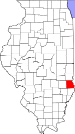
541:
526:
511:
496:
481:
397:
282:
142:
1321:
115:
681:
727:
1344:
1172:
714:
1277:
426:
1292:
1282:
1237:
1232:
1227:
1217:
1084:
728:
U.S. Geological Survey
Geographic Names Information System: Lamotte Township, Crawford County, Illinois
1351:
1272:
1262:
1257:
430:
234:
1287:
1267:
1195:
1185:
1180:
1094:
1079:
414:
402:
332:
315:
1071:
1049:
1030:
813:
448:
for the township was $ 30,072. About 6.2% of families and 8.8% of the population were below the
742:
1298:
1212:
1207:
787:
445:
365:
337:
837:
1303:
1247:
1242:
1222:
1089:
327:
1252:
1041:
799:
1109:
1099:
278:
32:
1368:
290:
449:
303:
1023:
47:
1313:
125:
98:
85:
215:
1335:‡This populated place also has portions in an adjacent county or counties
452:, including 7.5% of those under age 18 and 5.8% of those age 65 or over.
286:
130:
361:
343:(This list is based on USGS data and may include former settlements.)
1059:
241:
220:
980:
851:
878:
Places adjacent to
Lamotte Township, Crawford County, Illinois
1058:
710:
United States Census Bureau 2007 TIGER/Line
Shapefiles
1330:
1312:
1194:
1171:
1108:
1070:
1040:
262:
252:
231:
214:
206:
198:
193:
185:
177:
169:
161:
156:
148:
136:
124:
114:
23:
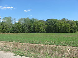
50:, an important archaeological site in the township
181:0.62 sq mi (1.6 km) 1.20%
992:
863:
682:"Lamotte Township, Crawford County, Illinois"
8:
1063:Map of Illinois highlighting Crawford County
643:Hutsonville Community Unit School District 1
999:
985:
977:
870:
856:
848:
646:Palestine Community Unit School District 3
454:
433:of any race were 0.69% of the population.
20:
649:Robinson Community Unit School District 2
696:United States Department of the Interior
937:Gill Township, Sullivan County, Indiana
720:
652:Oblong Community Unit School District 4
261:
251:
213:
192:
184:
155:
147:
113:
78:
54:
38:
1375:Townships in Crawford County, Illinois
795:
785:
663:Illinois's 15th congressional district
474:
74:Crawford County's location in Illinois
230:
205:
197:
176:
173:50.79 sq mi (131.5 km)
168:
165:51.41 sq mi (133.2 km)
160:
135:
123:
66:
7:
885:
737:
735:
425:, and 2.97% from two or more races.
687:Geographic Names Information System
18:Township in Illinois, United States
1007:Municipalities and communities of
814:"Census of Population and Housing"
464:
14:
945:
928:
920:
903:
360:
68:
56:
40:
692:United States Geological Survey
1:
946:
904:
929:
921:
715:United States National Atlas
306:defines its eastern border.
372:Airports and landing strips
62:Location in Crawford County
1396:
377:Robinson Municipal Airport
1340:
1056:
1021:
1010:Crawford County, Illinois
883:
630:
615:
600:
585:
570:
555:
540:
525:
510:
495:
480:
473:
468:
463:
460:
79:
67:
55:
39:
30:
670:State Senate District 55
667:State House District 109
189:436 ft (133 m)
843:Illinois State Archives
310:Cities, towns, villages
1064:
1380:Townships in Illinois
1062:
743:"Explore Census Data"
631:U.S. Decennial Census
456:Historical population
233: • Summer (
210:37/sq mi (14/km)
99:39.01472°N 87.62000°W
1353:United States portal
957:Honey Creek Township
890:Hutsonville Township
322:Unincorporated towns
207: • Density
962:Montgomery Township
767:Bureau, US Census.
657:Political districts
457:
104:39.01472; -87.62000
95: /
1065:
798:has generic name (
455:
199: • Total
178: • Water
162: • Total
1362:
1361:
974:
973:
969:
968:
915:Robinson Township
769:"Gazetteer Files"
635:
634:
446:per capita income
441:were 80.6 males.
366:Illinois Route 33
272:
271:
170: • Land
1387:
1354:
1347:
1061:
1033:
1026:
1016:
1011:
1001:
994:
987:
978:
949:
948:
932:
931:
926:Lamotte Township
924:
923:
907:
906:
886:
872:
865:
858:
849:
826:
825:
823:
821:
810:
804:
803:
797:
793:
791:
783:
781:
779:
764:
758:
757:
755:
753:
739:
730:
725:
706:
704:
702:
638:School districts
476:
471:
466:
458:
419:Pacific Islander
407:African American
364:
275:Lamotte Township
238:
152:November 5, 1867
110:
109:
107:
106:
105:
100:
96:
93:
92:
91:
88:
72:
60:
44:
25:Lamotte Township
21:
1395:
1394:
1390:
1389:
1388:
1386:
1385:
1384:
1365:
1364:
1363:
1358:
1352:
1346:Illinois portal
1345:
1336:
1326:
1308:
1199:
1198:unincorporated
1197:
1190:
1167:
1104:
1066:
1054:
1036:
1031:
1024:
1017:
1014:
1009:
1005:
975:
970:
933:
894:
879:
876:
834:
829:
819:
817:
812:
811:
807:
794:
784:
777:
775:
766:
765:
761:
751:
749:
747:data.census.gov
741:
740:
733:
726:
722:
700:
698:
680:
677:
659:
640:
469:
411:Native American
394:
384:
374:
357:
349:
324:
312:
299:
283:Crawford County
258:
232:
103:
101:
97:
94:
89:
86:
84:
82:
81:
75:
63:
51:
35:
26:
19:
12:
11:
5:
1393:
1391:
1383:
1382:
1377:
1367:
1366:
1360:
1359:
1357:
1356:
1349:
1341:
1338:
1337:
1334:
1332:
1328:
1327:
1325:
1324:
1322:Crawfordsville
1318:
1316:
1310:
1309:
1307:
1306:
1301:
1296:
1290:
1285:
1280:
1275:
1270:
1265:
1260:
1255:
1250:
1245:
1240:
1235:
1230:
1225:
1220:
1215:
1210:
1204:
1202:
1192:
1191:
1189:
1188:
1183:
1177:
1175:
1169:
1168:
1166:
1165:
1160:
1155:
1150:
1145:
1140:
1135:
1130:
1125:
1120:
1114:
1112:
1106:
1105:
1103:
1102:
1097:
1092:
1087:
1082:
1076:
1074:
1068:
1067:
1057:
1055:
1053:
1052:
1046:
1044:
1038:
1037:
1022:
1019:
1018:
1006:
1004:
1003:
996:
989:
981:
972:
971:
967:
966:
964:
959:
953:
952:
950:
943:
940:
939:
934:
919:
917:
911:
910:
908:
901:
898:
897:
895:
892:
884:
881:
880:
877:
875:
874:
867:
860:
852:
846:
845:
840:
833:
832:External links
830:
828:
827:
805:
759:
731:
719:
718:
717:
712:
707:
676:
673:
672:
671:
668:
665:
658:
655:
654:
653:
650:
647:
644:
639:
636:
633:
632:
628:
627:
624:
622:
619:
613:
612:
609:
607:
604:
598:
597:
594:
592:
589:
583:
582:
579:
577:
574:
568:
567:
564:
562:
559:
553:
552:
549:
547:
544:
538:
537:
534:
532:
529:
523:
522:
519:
517:
514:
508:
507:
504:
502:
499:
493:
492:
489:
487:
484:
478:
477:
472:
467:
462:
393:
390:
389:
388:
387:Leaverton Park
383:
380:
379:
378:
373:
370:
369:
368:
356:
355:Major highways
353:
348:
345:
341:
340:
335:
330:
323:
320:
319:
318:
311:
308:
298:
295:
277:is one of ten
270:
269:
266:
260:
259:
256:
254:
250:
249:
239:
229:
228:
218:
212:
211:
208:
204:
203:
200:
196:
195:
191:
190:
187:
183:
182:
179:
175:
174:
171:
167:
166:
163:
159:
158:
154:
153:
150:
146:
145:
140:
134:
133:
128:
122:
121:
118:
112:
111:
77:
76:
73:
65:
64:
61:
53:
52:
45:
37:
36:
31:
28:
27:
24:
17:
13:
10:
9:
6:
4:
3:
2:
1392:
1381:
1378:
1376:
1373:
1372:
1370:
1355:
1350:
1348:
1343:
1342:
1339:
1333:
1329:
1323:
1320:
1319:
1317:
1315:
1311:
1305:
1302:
1300:
1297:
1294:
1291:
1289:
1286:
1284:
1281:
1279:
1276:
1274:
1271:
1269:
1266:
1264:
1261:
1259:
1256:
1254:
1251:
1249:
1246:
1244:
1241:
1239:
1236:
1234:
1231:
1229:
1226:
1224:
1221:
1219:
1216:
1214:
1211:
1209:
1206:
1205:
1203:
1201:
1193:
1187:
1184:
1182:
1179:
1178:
1176:
1174:
1170:
1164:
1161:
1159:
1156:
1154:
1151:
1149:
1146:
1144:
1141:
1139:
1136:
1134:
1131:
1129:
1126:
1124:
1121:
1119:
1116:
1115:
1113:
1111:
1107:
1101:
1098:
1096:
1093:
1091:
1088:
1086:
1083:
1081:
1078:
1077:
1075:
1073:
1069:
1051:
1048:
1047:
1045:
1043:
1039:
1035:
1034:
1027:
1020:
1015:United States
1012:
1002:
997:
995:
990:
988:
983:
982:
979:
965:
963:
960:
958:
955:
954:
951:
944:
942:
941:
938:
935:
927:
918:
916:
913:
912:
909:
902:
900:
899:
896:
893:
891:
888:
887:
882:
873:
868:
866:
861:
859:
854:
853:
850:
844:
841:
839:
838:City-Data.com
836:
835:
831:
815:
809:
806:
801:
789:
774:
770:
763:
760:
748:
744:
738:
736:
732:
729:
724:
721:
716:
713:
711:
708:
697:
693:
689:
688:
683:
679:
678:
674:
669:
666:
664:
661:
660:
656:
651:
648:
645:
642:
641:
637:
629:
625:
623:
620:
618:
614:
610:
608:
605:
603:
599:
595:
593:
590:
588:
584:
580:
578:
575:
573:
569:
565:
563:
560:
558:
554:
550:
548:
545:
543:
539:
535:
533:
530:
528:
524:
520:
518:
515:
513:
509:
505:
503:
500:
498:
494:
490:
488:
485:
483:
479:
459:
453:
451:
447:
442:
438:
434:
432:
428:
424:
421:, 0.26% from
420:
416:
412:
408:
404:
399:
391:
386:
385:
381:
376:
375:
371:
367:
363:
359:
358:
354:
352:
346:
344:
339:
336:
334:
331:
329:
326:
325:
321:
317:
314:
313:
309:
307:
305:
296:
294:
292:
288:
284:
280:
276:
267:
265:
255:
247:
243:
240:
236:
226:
222:
219:
217:
209:
201:
188:
180:
172:
164:
151:
144:
141:
139:
132:
129:
127:
120:United States
119:
117:
108:
80:Coordinates:
71:
59:
49:
43:
34:
29:
22:
16:
1278:Port Jackson
1127:
1029:
925:
818:. Retrieved
816:. Census.gov
808:
776:. Retrieved
772:
762:
750:. Retrieved
746:
723:
699:. Retrieved
685:
450:poverty line
443:
439:
435:
395:
392:Demographics
350:
342:
304:Wabash River
300:
274:
273:
268:17-033-41833
257:62451, 62454
15:
1293:Riddleville
1283:Porterville
1238:Heathsville
1233:Hardinville
1228:Green Brier
1218:Duncanville
1200:communities
1123:Hutsonville
1118:Honey Creek
1085:Hutsonville
1025:County seat
796:|last=
778:January 22,
752:January 22,
701:January 10,
423:other races
398:2020 census
149:Established
102: /
48:Stoner Site
1369:Categories
1314:Ghost town
1273:Pierceburg
1263:Oil Center
1258:New Hebron
1143:Montgomery
773:Census.gov
675:References
396:As of the
347:Cemeteries
194:Population
90:87°37′12″W
87:39°00′53″N
1331:Footnotes
1288:Richwoods
1268:Oil Grove
1186:West York
1181:Annapolis
1163:Southwest
1110:Townships
1095:Palestine
1080:Flat Rock
382:Landmarks
333:Richwoods
316:Palestine
297:Geography
279:townships
264:FIPS code
253:ZIP codes
216:Time zone
186:Elevation
1158:Robinson
1072:Villages
1050:Robinson
1032:Robinson
788:cite web
427:Hispanic
417:, 0.00%
413:, 0.79%
409:, 0.00%
405:, 0.00%
287:Illinois
143:Crawford
131:Illinois
33:Township
1299:Trimble
1213:Dogwood
1208:Bellair
1153:Prairie
1133:Licking
1128:Lamotte
820:June 4,
338:Trimble
116:Country
1304:Villas
1248:Landes
1243:Kibbie
1223:Gordon
1196:Other
1148:Oblong
1138:Martin
1090:Oblong
596:−13.3%
461:Census
431:Latino
328:Gordon
138:County
1253:Morea
626:−7.8%
621:1,887
611:−2.2%
606:2,046
591:2,093
581:−6.4%
576:2,413
561:2,579
546:2,500
536:−7.4%
531:2,472
521:−2.2%
516:2,670
506:−3.8%
501:2,730
486:2,838
415:Asian
403:White
242:UTC-5
221:UTC-6
202:1,887
126:State
1173:CDPs
1100:Stoy
1042:City
822:2016
800:help
780:2023
754:2023
703:2010
617:2020
602:2010
587:2000
572:1990
566:3.2%
557:1980
551:1.1%
542:1970
527:1960
512:1950
497:1940
482:1930
470:Note
465:Pop.
157:Area
46:The
429:or
291:USA
281:in
246:CDT
235:DST
225:CST
1371::
1028::
1013:,
792::
790:}}
786:{{
771:.
745:.
734:^
694:,
690:.
684:.
475:%±
289:,
285:,
1295:‡
1000:e
993:t
986:v
871:e
864:t
857:v
824:.
802:)
782:.
756:.
705:.
491:—
248:)
244:(
237:)
227:)
223:(
Text is available under the Creative Commons Attribution-ShareAlike License. Additional terms may apply.