316:
26:
155:, rock formations, barren hillsides and rolling hills. The canyon is visited for recreational activities as rock climbing, biking, hiking, wildlife observation, photography, running, picnicking, and horseback riding. It has smooth footing with many sandy sections and a green creek-bed. It also includes a 46-acre dam that was intended for creation a recreational lake in the 1970s. Now called the Las Llajas Canyon Debris Basin.
260:
to Simi Valley and exit on
Yosemite Avenue. Head north on Yosemite Ave. until you get to Evening Sky Drive, where you are going to make a right turn. Continue on Evening Sky Dr. for a quarter mile until you arrive at its main entrance at 5715 Evening Sky Road. There are also numerous other entrances
127:(pronounced YAH huhs) Canyon within the Marr Ranch Parkland contains the 1920s residential subdivision called Marrland and the surrounding open space area administrated by the
894:
889:
899:
860:
429:
398:
879:
584:
829:
140:
575:
65:
703:
373:
816:
795:
774:
690:
669:
648:
627:
606:
544:
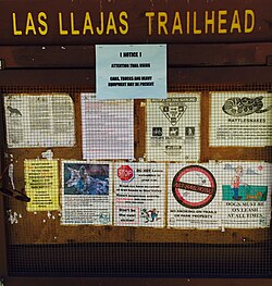
523:
464:
360:
904:
477:
884:
580:
333:
128:
108:
660:
U.S. Congressional House
Committee on Government Operations. Environment, Energy, and Natural Resources Subcommittee (1991).
225:
58:
300:. The area is vulnerable for landslides and flooding. The term "Llajas" was first used informally for series of fine,
809:
Flash Flood
Forecasting Over Complex Terrain: With an Assessment of the Sulphur Mountain NEXRAD in Southern California
257:
727:
315:
180:
who created a secluded colony in the Llajas Canyon. At one time, the cult had thirty buildings and 150 residents.
232:. The area was open for Mountain lion hunting as late as in 1934. The flora consists of native shrubs, grasses,
405:
570:
320:
274:
301:
144:
836:
261:
to the trail, for instance 0.5 miles down the street at 3446 Yosemite Avenue. Its trail connects to the
25:
167:
233:
270:
262:
136:
273:, and various other trails and public lands, and is also accessible through hiking trails from
854:
812:
791:
770:
741:
Sedimentation and
Tectonics in the Early Tertiary Continental Borderland Of Central California
686:
665:
644:
623:
602:
540:
519:
460:
423:
356:
193:
205:
707:
377:
309:
297:
201:
197:
132:
51:
289:
177:
481:
873:
189:
173:
281:
158:
The place name was first used in 1931. It is likely a misspelling of the
Spanish
241:
728:
http://www.parks.ca.gov/pages/21299/files/2%20Visitor%20use%20pages%2025-34.pdf
266:
245:
152:
80:
67:
305:
221:
312:
and outcropping by the end of what is now the mouth of Las Llajas Canyon.
237:
229:
209:
163:
148:
457:
Day Hikes in
Ventura County, California: 43 of the Best. Day Hike Books
285:
217:
213:
788:
A Paradox of Power: Voices of
Warning and Reason in the Geosciences
767:
A Paradox of Power: Voices of
Warning and Reason in the Geosciences
314:
293:
516:
Day Hikes Around
Ventura County: 116 Great Hikes. Day Hike Books
143:, and are situated at the foothills on the south side of the
558:
Lexicon of geologic names of the United States for 1936-1960
743:. United States Department of the Interior. Page 41 and 44.
162:, which translates to "the wounds", and referred to the
503:
The
Mineral Industry, Volume 28. University of Michigan
323:
from Las Llajas Canyon in the northeastern end of town.
147:. It contains panoramic mountain and city views, large
599:
1500 California Place Names: Their Origin and Meaning
353:
1500 California Place Names: Their Origin and Meaning
141:
Marr Ranch Parkland, Marrland residential subdivision
662:
Intrastate Land Exchanges: The Jordan Ranch exchange
114:
104:
96:
57:
47:
39:
18:
739:Nilsen, Tor H. and Samuel H. Clarke, Jr. (1949).
639:Hoover, Mildred and Hero Eugene Rensch (1966).
100:1,740 acres (700 ha) (i.e. open to public)
786:Welby, Charles W. and Monica E. Gowan (1998).
765:Welby, Charles W. and Monica E. Gowan (1998).
754:Lexicon of Geologic Names of the United States
444:Lexicon of Geologic Names of the United States
756:. U.S. Government Printing Office. Page 1202.
446:. U.S. Government Printing Office. Page 1202.
8:
664:. U.S. Government Printing Office. Page 38.
641:Historic Spots in California, Third Edition
601:. University of California Press. Page 81.
355:. University of California Press. Page 81.
288:-findings in the area. Llajas Canyon is an
188:Llajas Canyon is home to fauna such as the
790:. Geological Society of America. Page 60.
769:. Geological Society of America. Page 60.
43:Public open space, residential subdivision
15:
585:United States Department of the Interior
256:To get to its main entrance, follow the
129:Rancho Simi Recreation and Park District
109:Rancho Simi Recreation and Park District
895:Landforms of Ventura County, California
643:. Stanford University Press. Page 169.
344:
131:(RSRPD) and is located in northeastern
859:: CS1 maint: archived copy as title (
852:
501:Scientific Publishing Company (1920).
428:: CS1 maint: archived copy as title (
421:
622:. Arcadia Publishing. Pages 115-116.
7:
890:Geography of Simi Valley, California
113:
38:
900:Parks in Ventura County, California
576:Geographic Names Information System
560:. U.S. Govt. Print. Off. Page 2204.
807:National Research Council (2004).
14:
880:Canyons and gorges of California
248:, cactus, palm trees, and more.
46:
24:
581:United States Geological Survey
103:
95:
539:. Multi Use Trails. Page 134.
1:
334:Santa Susana Mountains topics
280:The canyon dates back to the
240:, brush, vines, wildflowers,
685:. AuthorHouse. Pages 63-66.
226:Southern Pacific rattlesnake
135:. The Las Llajas and nearby
752:Wilmarth, M. Grace (1938).
442:Wilmarth, M. Grace (1938).
284:, and there have been many
921:
556:Keroher, Grace C. (1966).
30:Sign at the main entrance.
35:
23:
704:"RSRPD las Llajas Trail"
597:Bright, William (1998).
374:"RSRPD las Llajas Trail"
351:Bright, William (1998).
905:Simi Valley, California
618:Appleton, Bill (2009).
275:Chatsworth, Los Angeles
885:Santa Susana Mountains
681:Varble, Wendy (2012).
537:Local Multi-Use Trails
535:Murphy, Kelly (2012).
514:Stone, Robert (2011).
455:Stone, Robert (1998).
324:
145:Santa Susana Mountains
81:34.29694°N 118.68028°W
478:"Honey Bee Sanctuary"
318:
296:and sandy salt-rich
168:Roman Catholic saint
86:34.29694; -118.68028
571:"Las Llajas Canyon"
234:California sycamore
77: /
683:The Summer of 1934
325:
319:Panoramic view of
194:California badger
139:are parts of the
122:
121:
19:Las Llajas Canyon
912:
865:
864:
858:
850:
848:
847:
841:
835:. Archived from
834:
826:
820:
805:
799:
784:
778:
763:
757:
750:
744:
737:
731:
725:
719:
718:
716:
715:
706:. Archived from
700:
694:
679:
673:
658:
652:
637:
631:
616:
610:
595:
589:
588:
567:
561:
554:
548:
533:
527:
512:
506:
499:
493:
492:
490:
489:
480:. Archived from
474:
468:
453:
447:
440:
434:
433:
427:
419:
417:
416:
410:
404:. Archived from
403:
395:
389:
388:
386:
385:
376:. Archived from
370:
364:
349:
206:Virginia opossum
105:Operated by
92:
91:
89:
88:
87:
82:
78:
75:
74:
73:
70:
28:
16:
920:
919:
915:
914:
913:
911:
910:
909:
870:
869:
868:
851:
845:
843:
839:
832:
830:"Archived copy"
828:
827:
823:
806:
802:
785:
781:
764:
760:
751:
747:
738:
734:
726:
722:
713:
711:
702:
701:
697:
680:
676:
659:
655:
638:
634:
617:
613:
596:
592:
569:
568:
564:
555:
551:
534:
530:
513:
509:
500:
496:
487:
485:
476:
475:
471:
454:
450:
441:
437:
420:
414:
412:
408:
401:
399:"Archived copy"
397:
396:
392:
383:
381:
372:
371:
367:
350:
346:
342:
330:
310:Sespe Formation
308:underlying the
304:sand and sandy
298:marine sediment
254:
202:Ring-tailed cat
198:Red-tailed hawk
186:
133:Simi Valley, CA
85:
83:
79:
76:
71:
68:
66:
64:
63:
52:Simi Valley, CA
31:
12:
11:
5:
918:
916:
908:
907:
902:
897:
892:
887:
882:
872:
871:
867:
866:
821:
800:
779:
758:
745:
732:
720:
695:
674:
653:
632:
611:
590:
562:
549:
528:
507:
494:
469:
448:
435:
390:
365:
343:
341:
338:
337:
336:
329:
326:
253:
250:
185:
182:
178:Christian sect
120:
119:
116:
112:
111:
106:
102:
101:
98:
94:
93:
61:
55:
54:
49:
45:
44:
41:
37:
36:
33:
32:
29:
21:
20:
13:
10:
9:
6:
4:
3:
2:
917:
906:
903:
901:
898:
896:
893:
891:
888:
886:
883:
881:
878:
877:
875:
862:
856:
842:on 2016-03-04
838:
831:
825:
822:
818:
817:9780309181327
814:
810:
804:
801:
797:
796:9780813741123
793:
789:
783:
780:
776:
775:9780813741123
772:
768:
762:
759:
755:
749:
746:
742:
736:
733:
729:
724:
721:
710:on 2015-06-12
709:
705:
699:
696:
692:
691:9781477276983
688:
684:
678:
675:
671:
670:9780160353628
667:
663:
657:
654:
650:
649:9780804740203
646:
642:
636:
633:
629:
628:9780738570495
625:
621:
615:
612:
608:
607:9780520920545
604:
600:
594:
591:
586:
582:
578:
577:
572:
566:
563:
559:
553:
550:
546:
545:9781479165599
542:
538:
532:
529:
525:
524:9781573420624
521:
517:
511:
508:
504:
498:
495:
484:on 2014-10-20
483:
479:
473:
470:
466:
465:9781573420198
462:
458:
452:
449:
445:
439:
436:
431:
425:
411:on 2016-03-04
407:
400:
394:
391:
380:on 2015-06-12
379:
375:
369:
366:
362:
361:9780520920545
358:
354:
348:
345:
339:
335:
332:
331:
327:
322:
317:
313:
311:
307:
303:
299:
295:
291:
287:
283:
278:
276:
272:
268:
264:
259:
251:
249:
247:
243:
239:
235:
231:
227:
223:
219:
215:
211:
207:
203:
199:
195:
191:
190:Mountain lion
183:
181:
179:
175:
174:Pisgah Grande
171:
169:
165:
161:
156:
154:
151:, stream and
150:
146:
142:
138:
137:Chivo Canyons
134:
130:
126:
117:
110:
107:
99:
90:
62:
60:
56:
53:
50:
42:
34:
27:
22:
17:
844:. Retrieved
837:the original
824:
808:
803:
787:
782:
766:
761:
753:
748:
740:
735:
723:
712:. Retrieved
708:the original
698:
682:
677:
661:
656:
640:
635:
620:Santa Susana
619:
614:
598:
593:
574:
565:
557:
552:
536:
531:
518:. Page 113.
515:
510:
502:
497:
486:. Retrieved
482:the original
472:
456:
451:
443:
438:
413:. Retrieved
406:the original
393:
382:. Retrieved
378:the original
368:
352:
347:
302:conglomerate
282:Eocene Epoch
279:
271:Chivo Canyon
263:Chumash Park
255:
187:
172:
159:
157:
124:
123:
811:. Page 84.
505:. Page 493.
459:. Page 39.
321:Simi Valley
292:incised in
258:118 highway
242:wild celery
236:, numerous
84: /
72:118°40′49″W
59:Coordinates
874:Categories
846:2015-06-07
730:(Page 32).
714:2015-06-07
488:2015-06-07
415:2015-06-07
384:2015-06-07
340:References
267:Rocky Peak
246:watercress
160:las llagas
153:stream bed
125:Las Llajas
69:34°17′49″N
306:siltstone
252:Geography
238:oak trees
222:Mule deer
149:oak trees
855:cite web
424:cite web
328:See also
230:Barn owl
210:Gray fox
184:Wildlife
164:stigmata
48:Location
815:
794:
773:
689:
668:
647:
626:
605:
543:
522:
463:
359:
290:arroyo
286:fossil
228:, and
218:Bobcat
214:Coyote
176:was a
115:Status
840:(PDF)
833:(PDF)
409:(PDF)
402:(PDF)
294:silty
166:of a
861:link
813:ISBN
792:ISBN
771:ISBN
687:ISBN
666:ISBN
645:ISBN
624:ISBN
603:ISBN
541:ISBN
520:ISBN
461:ISBN
430:link
357:ISBN
118:Open
97:Area
40:Type
876::
857:}}
853:{{
583:,
579:.
573:.
426:}}
422:{{
277:.
269:,
265:,
244:,
224:,
220:,
216:,
212:,
208:,
204:,
200:,
196:,
192:,
170:.
863:)
849:.
819:.
798:.
777:.
717:.
693:.
672:.
651:.
630:.
609:.
587:.
547:.
526:.
491:.
467:.
432:)
418:.
387:.
363:.
Text is available under the Creative Commons Attribution-ShareAlike License. Additional terms may apply.