383:
1039:
39:
343:
Leasingham is an agricultural district in which dry grain farming predominates. Additionally, being centrally located in quite a picturesque district, it caters for tourism and has a restaurant, caravan park, bed and breakfast accommodation and a number of tasting/cellar door sales operations of
308:
and the site was once owned by E. Campbell, who held approximately 120 hectares (60 acres) of freehold land, which he sold in 1853. By 1866 Leasingham had about 130 residents and, although ribbon development occurred around the Main North Road crossroad, it never prospered into a town.
469:
462:
455:
139:
127:
1083:
318:
108:
418:
103:
1112:
798:
1076:
322:
1107:
329:
855:
608:
1102:
964:
479:
404:
296:, passed through the district in April 1839. Surveys soon followed, the township being named after the village and civil parish of
382:
1069:
724:
628:
360:
922:
759:
703:
683:
533:
523:
865:
653:
553:
548:
891:
886:
754:
734:
729:
623:
259:
115:
970:
850:
603:
568:
518:
325:
167:
132:
870:
860:
791:
698:
678:
663:
643:
633:
171:
638:
1008:
693:
618:
593:
578:
573:
558:
543:
528:
255:
183:
447:
938:
845:
688:
658:
598:
588:
563:
513:
251:
198:
191:
176:
162:
648:
246:
Although the surrounding country is elevated, the township is located in lower country at the intersection of
943:
830:
825:
673:
668:
613:
508:
503:
273:
208:
203:
835:
538:
498:
364:
277:
240:
94:
72:
56:
784:
493:
38:
293:
998:
765:
400:
1053:
976:
948:
332:
144:
1046:
917:
896:
811:
739:
263:
247:
232:
29:
1003:
268:
1096:
272:
is on the western fringe of the township, following the former railway route between
1038:
1018:
1013:
901:
807:
749:
744:
719:
301:
228:
776:
297:
433:
420:
1049:
120:
982:
289:
236:
88:
305:
780:
451:
235:. It is approximately 117 kilometres from the state's capital,
1057:
288:
The
Leasingham district was the ancestral home of the
227:
is the name of a hamlet on the southern edge of the
991:
957:
931:
910:
879:
818:
712:
486:
138:
126:
114:
102:
81:
71:
63:
48:
23:
151:
1077:
792:
463:
319:District Council of Clare and Gilbert Valleys
258:(to the West). Leasingham is bisected by the
109:District Council of Clare and Gilbert Valleys
8:
53:
1084:
1070:
799:
785:
777:
470:
456:
448:
381:
37:
20:
352:
239:and 17 kilometres south of the town of
292:people. The first European explorer,
196:
181:
160:
153:
7:
1035:
1033:
397:South Australia – What's in a Name?
330:Australian House of Representatives
1056:. You can help Knowledge (XXG) by
365:"Leasingham (suburb and locality)"
87:117 km (73 mi) north of
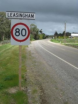
43:Northern entrance sign, Leasingham
14:
965:Clare and Gilbert Valleys Council
480:Clare and Gilbert Valleys Council
369:Australian Census 2021 QuickStats
93:17 km (11 mi) south of
1037:
1113:South Australia geography stubs
361:Australian Bureau of Statistics
923:Spring Gully Conservation Park
760:Spring Gully Conservation Park
1:
156:Localities around Leasingham:
478:Towns and localities of the
250:and the connecting roads to
1108:Mid North (South Australia)
971:Electoral district of Frome
326:electoral district of Frome
262:as it makes its way to the
1129:
1032:
1009:Lavender Federation Trail
395:Cockburn, Rodney (1999).
214:
154:
150:
36:
1103:Towns in South Australia
939:Clare Valley wine region
944:Clare Valley Racecourse
18:Town in South Australia
231:, in the Mid North of
958:Governance and people
317:Leasingham is in the
487:Towns and localities
399:. Axiom Publishing.
992:Walking and cycling
713:Geographic features
430: /
140:Federal division(s)
128:State electorate(s)
999:Rattler Rail Trail
932:Places of interest
766:Mount Lofty Ranges
434:33.967°S 138.650°E
254:(to the East) and
1065:
1064:
1027:
1026:
856:Polish Hill River
774:
773:
609:Polish Hill River
222:
221:
218:
217:
1120:
1086:
1079:
1072:
1041:
1034:
977:Division of Grey
949:Horrocks Highway
880:Rivers and hills
801:
794:
787:
778:
472:
465:
458:
449:
445:
444:
442:
441:
440:
439:-33.967; 138.650
435:
431:
428:
427:
426:
423:
411:
410:
392:
386:
385:
379:
377:
375:
363:(28 June 2022).
357:
344:local wineries.
333:Division of Grey
152:
55:
41:
32:
26:
21:
1128:
1127:
1123:
1122:
1121:
1119:
1118:
1117:
1093:
1092:
1091:
1090:
1047:South Australia
1030:
1028:
1023:
987:
953:
927:
918:Martindale Hall
911:Protected areas
906:
897:Wakefield River
875:
814:
812:South Australia
805:
775:
770:
740:Wakefield River
708:
482:
476:
438:
436:
432:
429:
424:
421:
419:
417:
416:
414:
407:
394:
393:
389:
373:
371:
359:
358:
354:
350:
341:
315:
286:
264:Wakefield River
248:Main North Road
233:South Australia
170:
44:
30:South Australia
28:
27:
24:
19:
12:
11:
5:
1126:
1124:
1116:
1115:
1110:
1105:
1095:
1094:
1089:
1088:
1081:
1074:
1066:
1063:
1062:
1042:
1025:
1024:
1022:
1021:
1016:
1011:
1006:
1004:Riesling Trail
1001:
995:
993:
989:
988:
986:
985:
980:
979:(Commonwealth)
974:
968:
961:
959:
955:
954:
952:
951:
946:
941:
935:
933:
929:
928:
926:
925:
920:
914:
912:
908:
907:
905:
904:
899:
894:
889:
883:
881:
877:
876:
874:
873:
868:
863:
858:
853:
848:
843:
838:
833:
828:
822:
820:
816:
815:
806:
804:
803:
796:
789:
781:
772:
771:
769:
768:
762:
757:
752:
747:
742:
737:
732:
727:
722:
716:
714:
710:
709:
707:
706:
701:
696:
691:
686:
681:
676:
671:
666:
661:
656:
651:
646:
641:
636:
631:
629:Salter Springs
626:
621:
616:
611:
606:
601:
596:
591:
586:
581:
576:
571:
566:
561:
556:
551:
546:
541:
536:
531:
526:
521:
516:
511:
506:
501:
496:
490:
488:
484:
483:
477:
475:
474:
467:
460:
452:
413:
412:
405:
387:
351:
349:
346:
340:
337:
314:
311:
285:
282:
269:Riesling Trail
220:
219:
216:
215:
212:
211:
206:
201:
195:
194:
189:
186:
180:
179:
174:
165:
159:
158:
148:
147:
142:
136:
135:
130:
124:
123:
118:
112:
111:
106:
100:
99:
98:
97:
91:
83:
79:
78:
75:
69:
68:
65:
61:
60:
50:
46:
45:
42:
34:
33:
17:
13:
10:
9:
6:
4:
3:
2:
1125:
1114:
1111:
1109:
1106:
1104:
1101:
1100:
1098:
1087:
1082:
1080:
1075:
1073:
1068:
1067:
1061:
1059:
1055:
1052:article is a
1051:
1048:
1043:
1040:
1036:
1031:
1020:
1017:
1015:
1012:
1010:
1007:
1005:
1002:
1000:
997:
996:
994:
990:
984:
981:
978:
975:
972:
969:
966:
963:
962:
960:
956:
950:
947:
945:
942:
940:
937:
936:
934:
930:
924:
921:
919:
916:
915:
913:
909:
903:
900:
898:
895:
893:
890:
888:
885:
884:
882:
878:
872:
869:
867:
864:
862:
859:
857:
854:
852:
849:
847:
844:
842:
839:
837:
834:
832:
829:
827:
824:
823:
821:
817:
813:
809:
802:
797:
795:
790:
788:
783:
782:
779:
767:
763:
761:
758:
756:
753:
751:
748:
746:
743:
741:
738:
736:
733:
731:
728:
726:
725:Gilbert River
723:
721:
718:
717:
715:
711:
705:
704:Woolshed Flat
702:
700:
697:
695:
692:
690:
687:
685:
684:Tothill Creek
682:
680:
677:
675:
672:
670:
667:
665:
662:
660:
657:
655:
652:
650:
647:
645:
642:
640:
637:
635:
632:
630:
627:
625:
622:
620:
617:
615:
612:
610:
607:
605:
602:
600:
597:
595:
592:
590:
587:
585:
582:
580:
577:
575:
572:
570:
567:
565:
562:
560:
557:
555:
552:
550:
547:
545:
542:
540:
537:
535:
534:Boconnoc Park
532:
530:
527:
525:
524:Black Springs
522:
520:
517:
515:
512:
510:
507:
505:
502:
500:
497:
495:
492:
491:
489:
485:
481:
473:
468:
466:
461:
459:
454:
453:
450:
446:
443:
408:
406:0-9592519-1-X
402:
398:
391:
388:
384:
370:
366:
362:
356:
353:
347:
345:
338:
336:
334:
331:
327:
324:
320:
312:
310:
307:
303:
299:
295:
291:
283:
281:
279:
275:
271:
270:
265:
261:
257:
253:
249:
244:
242:
238:
234:
230:
226:
213:
210:
207:
205:
202:
200:
197:
193:
190:
187:
185:
182:
178:
175:
173:
169:
166:
164:
161:
157:
149:
146:
143:
141:
137:
134:
131:
129:
125:
122:
119:
117:
113:
110:
107:
105:
101:
96:
92:
90:
86:
85:
84:
80:
76:
74:
70:
66:
62:
58:
51:
47:
40:
35:
31:
22:
16:
1058:expanding it
1044:
1029:
1019:Heysen Trail
1014:Mawson Trail
902:Skilly Hills
866:Stanley Flat
840:
808:Clare Valley
750:Finnis Point
745:Skilly Hills
720:Clare Valley
679:Tothill Belt
654:Stanley Flat
644:Spring Gully
583:
554:Giles Corner
549:Farrell Flat
415:
396:
390:
372:. Retrieved
368:
355:
342:
316:
302:Lincolnshire
287:
267:
245:
229:Clare Valley
224:
223:
155:
15:
755:Peters Hill
639:Spring Farm
624:Saddleworth
437: /
73:Postcode(s)
64:Established
1097:Categories
892:Hutt River
887:Hill River
851:Penwortham
841:Leasingham
819:Main towns
735:Hutt River
730:Hill River
604:Penwortham
584:Leasingham
569:Hill River
559:Gillentown
519:Benbournie
348:References
328:, and the
313:Governance
298:Leasingham
260:Eyre Creek
225:Leasingham
188:Leasingham
168:Penwortham
49:Population
25:Leasingham
1050:geography
871:Watervale
861:Sevenhill
764:Northern
699:Watervale
664:Stockport
634:Sevenhill
294:John Hill
172:Watervale
121:Mid North
983:Ngadjuri
694:Waterloo
659:Steelton
619:Riverton
594:Marrabel
579:Hoyleton
574:Hilltown
544:Emu Flat
529:Bungaree
425:138°39′E
339:Land use
290:Ngadjuri
256:Hoyleton
237:Adelaide
184:Hoyleton
89:Adelaide
82:Location
973:(state)
967:(local)
846:Mintaro
689:Undalya
649:Stanley
599:Mintaro
589:Manoora
564:Halbury
514:Barinia
422:33°58′S
374:28 June
306:England
284:History
252:Mintaro
199:Halbury
192:Manoora
177:Mintaro
163:Kybunga
831:Auburn
826:Armagh
674:Tarnma
669:Tarlee
614:Rhynie
509:Auburn
504:Armagh
403:
380:
321:, the
274:Auburn
266:. The
209:Auburn
204:Auburn
116:Region
104:LGA(s)
1045:This
836:Clare
539:Clare
499:Anama
323:state
278:Clare
241:Clare
133:Frome
95:Clare
52:114 (
1054:stub
494:Alma
401:ISBN
376:2022
276:and
145:Grey
77:5452
67:1853
57:2021
300:in
54:SAL
1099::
810:,
367:.
335:.
304:,
280:.
243:.
1085:e
1078:t
1071:v
1060:.
800:e
793:t
786:v
471:e
464:t
457:v
409:.
378:.
59:)
Text is available under the Creative Commons Attribution-ShareAlike License. Additional terms may apply.