767:
53:
78:
111:
118:
85:
540:
In the township the population was spread out, with 25.9% under the age of 18, 7.0% from 18 to 24, 30.0% from 25 to 44, 24.6% from 45 to 64, and 12.4% who were 65 years of age or older. The median age was 38 years. For every 100 females, there were 98.2 males. For every 100 females age 18 and over,
496:
of 2000, there were 13,459 people, 5,240 households, and 3,825 families residing in the township. The population density was 274.1 inhabitants per square mile (105.8/km). There were 5,568 housing units at an average density of 113.4 per square mile (43.8/km). The racial makeup of the township was
536:
living together, 11.5% had a female householder with no husband present, and 27.0% were non-families. 21.8% of all households were made up of individuals, and 8.7% had someone living alone who was 65 years of age or older. The average household size was 2.56 and the average family size was 2.97.
479:
Center Lake is on the township's southern boundary and is adjacent to
Michigan Center. Gilletts Lake, Brill Lake, and Goose Lake are in the central region of the township. The Portage River runs close to the northern border of the township. The entire township is part of the
52:
544:
The median income for a household in the township was $ 43,551, and the median income for a family was $ 47,032. Males had a median income of $ 38,306 versus $ 27,870 for females. The
476:, the township has a total area of 51.22 square miles (132.66 km), of which 48.54 square miles (125.72 km) is land and 2.68 square miles (6.94 km) (5.23%) is water.
705:
1114:
146:
863:
888:
873:
928:
374:
698:
840:
110:
845:
77:
835:
384:
691:
608:
303:
918:
1119:
650:
514:
502:
683:
923:
506:
878:
200:
938:
933:
893:
646:
576:
518:
473:
908:
898:
868:
971:
956:
641:
459:
428:
347:
62:
1046:
913:
903:
715:
416:
362:
205:
178:
58:
596:
532:
There were 5,240 households, out of which 33.4% had children under the age of 18 living with them, 56.7% were
1084:
1036:
1011:
976:
948:
778:
1001:
966:
522:
481:
791:
463:
is an unincorporated community and a census-designated place in the southwestern part of the township.
1091:
817:
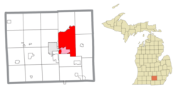
802:
526:
341:
313:
1051:
996:
986:
510:
498:
444:
1061:
1056:
961:
786:
548:
for the township was $ 19,329. About 6.5% of families and 7.9% of the population were below the
1041:
1031:
1021:
807:
797:
756:
737:
545:
448:
335:
1026:
1006:
827:
353:
1016:
812:
226:
634:"Michigan: 2010 Population and Housing Unit Counts 2010 Census of Population and Housing"
855:
412:
43:
1108:
367:
597:
U.S. Geological Survey
Geographic Names Information System: Leoni Township, Michigan
633:
549:
730:
452:
17:
420:
188:
161:
148:
294:
552:, including 10.6% of those under age 18 and 6.1% of those age 65 or over.
1075:‡This populated place also has portions in an adjacent county or counties
533:
424:
328:
193:
447:
in the southeastern part of the township, 7 miles (11 km) east of
493:
320:
299:
748:
678:
399:
687:
765:
572:
1070:
985:
947:
854:
826:
777:
747:
394:
383:
373:
361:
327:
310:
293:
285:
277:
272:
264:
256:
248:
240:
235:
224:
216:
211:
199:
187:
177:
34:
699:
8:
706:
692:
684:
529:of any race were 1.62% of the population.
31:
29:Civil township in Michigan, United States
766:
649:. September 2012. p. 26 Michigan.
561:
393:
372:
326:
292:
271:
263:
234:
210:
176:
141:
69:
49:
117:
84:
1115:Townships in Jackson County, Michigan
656:from the original on October 19, 2012
567:
565:
382:
360:
309:
284:
276:
255:
252:48.54 sq mi (125.7 km)
247:
244:51.22 sq mi (132.7 km)
239:
223:
215:
198:
186:
97:Location within the state of Michigan
7:
521:, and 1.17% from two or more races.
427:. The population was 13,847 at the
714:Municipalities and communities of
260:2.68 sq mi (6.9 km)
130:Leoni Township (the United States)
25:
116:
109:
83:
76:
51:
679:Leoni Township official website
1:
133:Show map of the United States
647:United States Census Bureau
577:United States Census Bureau
474:United States Census Bureau
61:(red) and the administered
1136:
1080:
763:
728:
642:2010 United States Census
142:
70:
50:
41:
717:Jackson County, Michigan
445:unincorporated community
268:991 ft (302 m)
36:Leoni Township, Michigan
541:there were 96.7 males.
289:270/sq mi (100/km)
217: • Supervisor
771:
1120:Townships in Michigan
769:
609:"Explore Census Data"
573:"U.S. Census website"
312: • Summer (
162:42.25472°N 84.31194°W
1093:United States portal
286: • Density
100:Show map of Michigan
167:42.25472; -84.31194
158: /
772:
278: • Total
257: • Water
241: • Total
1102:
1101:
828:Charter townships
546:per capita income
472:According to the
406:
405:
249: • Land
16:(Redirected from
1127:
1094:
1087:
768:
740:
733:
723:
718:
708:
701:
694:
685:
666:
665:
663:
661:
655:
638:
630:
624:
623:
621:
619:
605:
599:
594:
588:
587:
585:
583:
569:
515:Pacific Islander
503:African American
402:
400:Official website
317:
220:Howard Linnabary
173:
172:
170:
169:
168:
163:
159:
156:
155:
154:
151:
134:
120:
119:
113:
101:
87:
86:
80:
65:community (pink)
57:Location within
55:
32:
21:
1135:
1134:
1130:
1129:
1128:
1126:
1125:
1124:
1105:
1104:
1103:
1098:
1092:
1086:Michigan portal
1085:
1076:
1066:
988:
981:
972:Vandercook Lake
957:Michigan Center
943:
856:Civil townships
850:
822:
773:
770:Map of Michigan
761:
743:
738:
731:
724:
721:
716:
712:
675:
670:
669:
659:
657:
653:
636:
632:
631:
627:
617:
615:
613:data.census.gov
607:
606:
602:
595:
591:
581:
579:
571:
570:
563:
558:
534:married couples
507:Native American
490:
470:
460:Michigan Center
437:
398:
357:
351:
348:Michigan Center
345:
339:
311:
166:
164:
160:
157:
152:
149:
147:
145:
144:
138:
137:
136:
135:
132:
131:
128:
127:
126:
125:
121:
104:
103:
102:
99:
98:
95:
94:
93:
92:
88:
66:
63:Michigan Center
46:
37:
30:
23:
22:
18:Leoni, Michigan
15:
12:
11:
5:
1133:
1131:
1123:
1122:
1117:
1107:
1106:
1100:
1099:
1097:
1096:
1089:
1081:
1078:
1077:
1074:
1072:
1068:
1067:
1065:
1064:
1059:
1054:
1049:
1047:Rives Junction
1044:
1039:
1034:
1029:
1024:
1019:
1014:
1009:
1004:
999:
993:
991:
983:
982:
980:
979:
974:
969:
964:
959:
953:
951:
945:
944:
942:
941:
936:
931:
926:
921:
916:
911:
906:
901:
896:
891:
886:
881:
876:
871:
866:
860:
858:
852:
851:
849:
848:
843:
838:
832:
830:
824:
823:
821:
820:
815:
810:
805:
800:
795:
789:
783:
781:
775:
774:
764:
762:
760:
759:
753:
751:
745:
744:
729:
726:
725:
713:
711:
710:
703:
696:
688:
682:
681:
674:
673:External links
671:
668:
667:
625:
600:
589:
560:
559:
557:
554:
489:
486:
469:
466:
465:
464:
456:
436:
433:
417:Jackson County
413:civil township
409:Leoni Township
404:
403:
396:
392:
391:
388:
381:
380:
377:
371:
370:
365:
359:
358:
333:
331:
325:
324:
318:
308:
307:
297:
291:
290:
287:
283:
282:
279:
275:
274:
270:
269:
266:
262:
261:
258:
254:
253:
250:
246:
245:
242:
238:
237:
233:
232:
229:
222:
221:
218:
214:
213:
209:
208:
203:
197:
196:
191:
185:
184:
181:
175:
174:
140:
139:
129:
124:Leoni Township
123:
122:
115:
114:
108:
107:
106:
105:
96:
91:Leoni Township
90:
89:
82:
81:
75:
74:
73:
72:
71:
68:
67:
59:Jackson County
56:
48:
47:
44:Civil township
42:
39:
38:
35:
28:
24:
14:
13:
10:
9:
6:
4:
3:
2:
1132:
1121:
1118:
1116:
1113:
1112:
1110:
1095:
1090:
1088:
1083:
1082:
1079:
1073:
1069:
1063:
1060:
1058:
1055:
1053:
1050:
1048:
1045:
1043:
1040:
1038:
1037:Pleasant Lake
1035:
1033:
1030:
1028:
1025:
1023:
1020:
1018:
1015:
1013:
1012:Lake Columbia
1010:
1008:
1005:
1003:
1000:
998:
995:
994:
992:
990:
984:
978:
977:Vineyard Lake
975:
973:
970:
968:
965:
963:
960:
958:
955:
954:
952:
950:
946:
940:
937:
935:
932:
930:
927:
925:
922:
920:
917:
915:
912:
910:
907:
905:
902:
900:
897:
895:
892:
890:
887:
885:
882:
880:
877:
875:
872:
870:
867:
865:
862:
861:
859:
857:
853:
847:
844:
842:
839:
837:
834:
833:
831:
829:
825:
819:
816:
814:
811:
809:
806:
804:
801:
799:
796:
793:
790:
788:
785:
784:
782:
780:
776:
758:
755:
754:
752:
750:
746:
742:
741:
734:
727:
722:United States
719:
709:
704:
702:
697:
695:
690:
689:
686:
680:
677:
676:
672:
652:
648:
644:
643:
635:
629:
626:
614:
610:
604:
601:
598:
593:
590:
578:
574:
568:
566:
562:
555:
553:
551:
547:
542:
538:
535:
530:
528:
524:
520:
517:, 0.31% from
516:
512:
508:
504:
500:
495:
487:
485:
483:
477:
475:
467:
462:
461:
457:
454:
450:
446:
442:
439:
438:
434:
432:
430:
426:
422:
418:
414:
410:
401:
397:
389:
386:
378:
376:
369:
366:
364:
355:
349:
343:
337:
334:49201–49203 (
332:
330:
322:
319:
315:
305:
304:Eastern (EST)
301:
298:
296:
288:
280:
267:
259:
251:
243:
231:Kerry Pickett
230:
228:
225: •
219:
207:
204:
202:
195:
192:
190:
183:United States
182:
180:
171:
143:Coordinates:
112:
79:
64:
60:
54:
45:
40:
33:
27:
19:
1002:Farwell Lake
967:Spring Arbor
919:Spring Arbor
883:
736:
658:. Retrieved
640:
628:
616:. Retrieved
612:
603:
592:
580:. Retrieved
550:poverty line
543:
539:
531:
491:
488:Demographics
478:
471:
458:
440:
408:
407:
26:
989:communities
792:Cement City
732:County seat
582:January 31,
519:other races
484:watershed.
482:Grand River
453:county seat
443:is a small
435:Communities
429:2020 census
329:ZIP code(s)
165: /
1109:Categories
924:Springport
841:Grass Lake
818:Springport
803:Grass Lake
556:References
492:As of the
421:U.S. state
387:feature ID
342:Grass Lake
273:Population
212:Government
153:84°18′43″W
150:42°15′17″N
1071:Footnotes
1052:Sandstone
997:Clarklake
879:Henrietta
846:Sandstone
618:April 27,
468:Geography
375:FIPS code
363:Area code
295:Time zone
265:Elevation
1062:Waterloo
1057:Tompkins
962:Napoleon
939:Waterloo
934:Tompkins
894:Napoleon
864:Columbia
836:Blackman
787:Brooklyn
779:Villages
651:Archived
523:Hispanic
513:, 0.02%
509:, 0.33%
505:, 0.31%
501:, 0.82%
425:Michigan
379:26-46980
194:Michigan
1042:Pulaski
1032:Norvell
1022:Liberty
909:Pulaski
899:Norvell
889:Liberty
874:Hanover
869:Concord
808:Hanover
798:Concord
757:Jackson
739:Jackson
497:97.04%
449:Jackson
419:in the
395:Website
390:1626605
352:49259 (
346:49254 (
340:49240 (
336:Jackson
206:Jackson
179:Country
1027:Munith
1007:Horton
929:Summit
660:May 1,
527:Latino
494:census
451:, the
354:Munith
281:13,847
201:County
1017:Leoni
987:Other
914:Rives
904:Parma
884:Leoni
813:Parma
654:(PDF)
637:(PDF)
511:Asian
499:White
441:Leoni
411:is a
323:(EDT)
321:UTC-4
300:UTC-5
227:Clerk
189:State
949:CDPs
749:City
662:2020
620:2024
584:2008
385:GNIS
236:Area
525:or
423:of
415:of
368:517
314:DST
1111::
735::
720:,
645:.
639:.
611:.
575:.
564:^
431:.
794:‡
707:e
700:t
693:v
664:.
622:.
586:.
455:.
356:)
350:)
344:)
338:)
316:)
306:)
302:(
20:)
Text is available under the Creative Commons Attribution-ShareAlike License. Additional terms may apply.