
There are more than 1,500 properties and historic districts in the U.S. State of Colorado listed on the National Register of Historic Places. They are distributed over 63 of Colorado's 64 counties; only the City and County of Broomfield currently has none.
| Adams - Alamosa - Arapahoe - Archuleta - Baca - Bent - Boulder - Broomfield - Chaffee - Cheyenne - Clear Creek - Conejos - Costilla - Crowley - Custer - Delta - Denver - Dolores - Douglas - Eagle - El Paso - Elbert - Fremont - Garfield - Gilpin - Grand - Gunnison - Hinsdale - Huerfano - Jackson - Jefferson - Kiowa - Kit Carson - La Plata - Lake - Larimer - Las Animas - Lincoln - Logan - Mesa - Mineral - Moffat - Montezuma - Montrose - Morgan - Otero - Ouray - Park - Phillips - Pitkin - Prowers - Pueblo - Rio Blanco - Rio Grande - Routt - Saguache - San Juan - San Miguel - Sedgwick - Summit - Teller - Washington - Weld - Yuma |
This National Park Service list is complete through NPS recent listings posted September 27, 2024.
Current listings by county
Download coordinates as:
The following are approximate tallies of current listings by county. These counts are based on entries in the National Register Information Database as of April 24, 2008 and new weekly listings posted since then on the National Register of Historic Places web site. There are frequent additions to the listings and occasional delistings and the counts here are approximate and not official. New entries are added to the official Register on a weekly basis. Also, the counts in this table exclude boundary increase and decrease listings which modify the area covered by an existing property or district and which carry a separate National Register reference number. The numbers of NRHP listings in each county are documented by tables in each of the individual county list-articles.


| Name on the Register | Image | Date listed | Location | City or town | Description | |
|---|---|---|---|---|---|---|
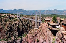
| 1 | Chimney Rock Archeological Site | 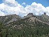 |
August 25, 1970 (#70000153) |
Off U.S. Highway 160, southeast of the community of Chimney Rock 37°11′40″N 107°18′04″W / 37.194444°N 107.301111°W / 37.194444; -107.301111 (Chimney Rock Archeological Site) | Chimney Rock | |
| 2 | Denver & Rio Grande Railroad San Juan Extension |  |
February 16, 1973 (#73000462) |
Between Antonito and Chama, New Mexico via Cumbres Pass 36°51′56″N 106°23′56″W / 36.865556°N 106.398889°W / 36.865556; -106.398889 (Denver & Rio Grande Railroad San Juan Extension) | Antonito | Now a scenic railway, the Cumbres and Toltec Scenic Railroad; extends into Conejos County; National Historic Landmark designation October 16, 2012 |
| 3 | Labo Del Rio Bridge | 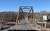 |
June 24, 1985 (#85001399) |
County Road F40 over the Piedra River 37°04′33″N 107°24′17″W / 37.075833°N 107.404722°W / 37.075833; -107.404722 (Labo Del Rio Bridge) | Arboles |
| Name on the Register | Image | Date listed | Location | City or town | Description | |
|---|---|---|---|---|---|---|
| 1 | Colorado Millennial Site | Upload image | April 8, 1980 (#80000877) |
At the source of Rule Creek, 2 miles (3.2 km) south of the junction of Baca, Bent, and Las Animas counties 37°37′01″N 103°04′43″W / 37.6169467°N 103.0786585°W / 37.6169467; -103.0786585 (Colorado Millennial Site) | Ruxton | Extends into Las Animas County |
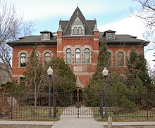
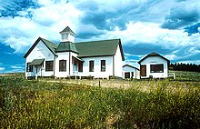
| 2 | Springfield Schoolhouse |  |
October 5, 1977 (#77000363) |
281 W. 7th Ave. 37°24′26″N 102°37′08″W / 37.407106°N 102.618892°W / 37.407106; -102.618892 (Springfield Schoolhouse) | Springfield | |
| 3 | Stonington First Methodist-Episcopal Church | 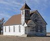 |
March 14, 1996 (#96000272) |
48854 County Road X 37°17′40″N 102°11′19″W / 37.294423°N 102.188674°W / 37.294423; -102.188674 (Stonington First Methodist-Episcopal Church) | Stonington | |
| 4 | Two Buttes Gymnasium |  |
December 22, 2009 (#09001119) |
5th and C Sts. 37°33′35″N 102°23′55″W / 37.559653°N 102.398511°W / 37.559653; -102.398511 (Two Buttes Gymnasium) | Two Buttes |
| Name on the Register | Image | Date listed | Location | City or town | Description | |
|---|---|---|---|---|---|---|
| 1 | Bent County Courthouse and Jail |  |
January 2, 1976 (#76000546) |
725 Carson Ave. 38°03′51″N 103°13′12″W / 38.064167°N 103.22°W / 38.064167; -103.22 (Bent County Courthouse and Jail) | Las Animas | |
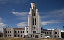
| 2 | Bent County High School |  |
July 30, 2010 (#10000505) |
1214 Ambassador Thompson Blvd. 38°03′54″N 103°13′56″W / 38.065°N 103.232222°W / 38.065; -103.232222 (Bent County High School) | Las Animas | |
| 3 | Boggsville | 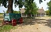 |
October 24, 1986 (#86002841) |
South of Las Animas on State Highway 101 38°02′39″N 103°12′29″W / 38.044167°N 103.208056°W / 38.044167; -103.208056 (Boggsville) | Las Animas | Boundary increase approved May 23, 2022. |
| 4 | Fort Lyon | 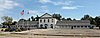 |
May 5, 2004 (#04000388) |
Junction of County Road 15 and Fort Lyon Gate Rd. 38°04′38″N 103°07′58″W / 38.077222°N 103.132778°W / 38.077222; -103.132778 (Fort Lyon) | Las Animas | |
| 5 | Fort Lyon National Cemetery |  |
January 17, 2017 (#100000472) |
15700 County Road HH 38°05′03″N 103°07′46″W / 38.084167°N 103.129444°W / 38.084167; -103.129444 (Fort Lyon National Cemetery) | Las Animas | |
| 6 | Las Animas Post Office | 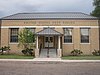 |
January 16, 2008 (#07001392) |
513 6th St. 38°03′58″N 103°13′23″W / 38.0662°N 103.2230°W / 38.0662; -103.2230 (Las Animas Post Office) | Las Animas | |
| 7 | Prowers Bridge | 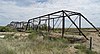 |
February 4, 1985 (#85000189) |
County Road 34 38°05′37″N 102°46′03″W / 38.093611°N 102.7675°W / 38.093611; -102.7675 (Prowers Bridge) | Prowers | |
| 8 | Santa Fe Trail Mountain Route--Bent's New Fort | 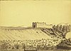 |
September 26, 2016 (#16000666) |
Address Restricted | Lamar |
Former listing
| Name on the Register | Image | Date listed | Date removed | Location | City or town | Description | |
|---|---|---|---|---|---|---|---|
| 1 | Columbian Elementary School |  |
July 9, 2004 (#04000665) | July 26, 2006 | 1026 W. 6th St. | Las Animas | Demolished in 2006 |
There are no places in the City and County of Broomfield currently listed on the National Register of Historic Places.
| Name on the Register | Image | Date listed | Location | City or town | Description | |
|---|---|---|---|---|---|---|
| 1 | Cheyenne County Courthouse |  |
July 27, 1989 (#89000997) |
51 S. 1st St. 38°49′15″N 102°20′55″W / 38.820833°N 102.348611°W / 38.820833; -102.348611 (Cheyenne County Courthouse) | Cheyenne Wells | |
| 2 | Cheyenne County Jail | 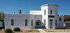 |
June 16, 1988 (#88000758) |
85 W. 2nd St. 38°49′14″N 102°21′03″W / 38.820556°N 102.350833°W / 38.820556; -102.350833 (Cheyenne County Jail) | Cheyenne Wells |
| Name on the Register | Image | Date listed | Location | City or town | Description | |
|---|---|---|---|---|---|---|
| 1 | Crowley School |  |
July 28, 1999 (#99000897) |
301 Main St. 38°11′41″N 103°51′12″W / 38.19468°N 103.85335°W / 38.19468; -103.85335 (Crowley School) | Crowley | Now the Crowley County Heritage Center. |
Former listing
| Name on the Register | Image | Date listed | Date removed | Location | City or town | Description | |
|---|---|---|---|---|---|---|---|
| 1 | Manzanola Bridge |  |
June 24, 1985 (#85001400) | July 22, 1994 | Colorado Highway 207 | Manzanola vicinity | Demolished in 1985 |
| Name on the Register | Image | Date listed | Location | City or town | Description | |
|---|---|---|---|---|---|---|
| 1 | Beckwith Ranch |  |
May 20, 1998 (#98000568) |
64159 State Highway 69 38°11′31″N 105°31′21″W / 38.191944°N 105.5225°W / 38.191944; -105.5225 (Beckwith Ranch) | Westcliffe | |
| 2 | Holdsworth House-Aspenholme-Pines Lodge |  |
October 15, 2021 (#100006742) |
379 Chalice Dr. 38°10′05″N 105°35′13″W / 38.1681°N 105.5870°W / 38.1681; -105.5870 (Holdsworth House-Aspenholme-Pines Lodge) | Westcliffe vicinity | |
| 3 | Hope Lutheran Church |  |
January 31, 1978 (#78000838) |
310 S. 3rd St. 38°07′57″N 105°28′02″W / 38.1325°N 105.467222°W / 38.1325; -105.467222 (Hope Lutheran Church) | Westcliffe | |
| 4 | Kennicott Cabin | 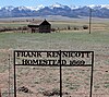 |
February 14, 1997 (#97000046) |
63161 State Highway 69 38°10′57″N 105°30′35″W / 38.1825°N 105.509722°W / 38.1825; -105.509722 (Kennicott Cabin) | Westcliffe | |
| 5 | Mingus Homestead |  |
December 4, 1990 (#90001791) |
Off State Highway 165 north of its junction with Ophir Creek Rd. in the San Isabel National Forest 38°05′55″N 105°06′37″W / 38.098611°N 105.110278°W / 38.098611; -105.110278 (Mingus Homestead) | Beulah | |
| 6 | National Hotel-Wolff Building | 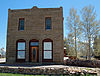 |
November 5, 1987 (#87001288) |
201 2nd St. 38°08′04″N 105°28′05″W / 38.134444°N 105.468056°W / 38.134444; -105.468056 (National Hotel-Wolff Building) | Westcliffe | |
| 7 | Westcliff School |  |
July 27, 1989 (#89000999) |
304 4th St. 38°07′57″N 105°27′57″W / 38.1325°N 105.465833°W / 38.1325; -105.465833 (Westcliff School) | Westcliffe | |
| 8 | Westcliffe Jail |  |
February 3, 1993 (#92001846) |
116 2nd St. 38°08′12″N 105°28′05″W / 38.136667°N 105.468056°W / 38.136667; -105.468056 (Westcliffe Jail) | Westcliffe | |
| 9 | Wetmore Post Office |  |
September 12, 2008 (#08000860) |
682 County Road 395 38°13′47″N 105°05′24″W / 38.229854°N 105.089917°W / 38.229854; -105.089917 (Wetmore Post Office) | Wetmore | |
| 10 | Willows School | 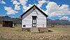 |
May 14, 1993 (#93000413) |
Willows Ln. (County Road 141) between Muddy Ln. (County Road 155) and Schoolfield Rd. (County Road 328) 38°06′39″N 105°32′15″W / 38.110833°N 105.5375°W / 38.110833; -105.5375 (Willows School) | Westcliffe |
| Name on the Register | Image | Date listed | Location | City or town | Description | |
|---|---|---|---|---|---|---|
| 1 | Ansel Hall Ruin |  |
November 25, 1997 (#97001418) |
Address Restricted | Cahone | |
| 2 | Beaver Creek Massacre Site |  |
October 2, 1986 (#86002670) |
Address Restricted | Dolores | |
| 3 | Dey Building |  |
April 15, 1999 (#99000448) |
3 N. Glasgow 37°41′33″N 108°01′53″W / 37.6925°N 108.031389°W / 37.6925; -108.031389 (Dey Building) | Rico | |
| 4 | William Kauffman House | 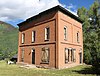 |
October 29, 1982 (#82001014) |
Silver St. 37°41′35″N 108°01′45″W / 37.693056°N 108.029167°W / 37.693056; -108.029167 (William Kauffman House) | Rico | |
| 5 | Rico City Hall |  |
December 31, 1974 (#74000574) |
Northeastern corner of Commercial and Mantz Sts. 37°41′33″N 108°01′48″W / 37.6925°N 108.03°W / 37.6925; -108.03 (Rico City Hall) | Rico |
| Name on the Register | Image | Date listed | Location | City or town | Description | |
|---|---|---|---|---|---|---|
| 1 | First National Bank of Elizabeth |  |
March 10, 2023 (#100008713) |
188 South Main St. 39°21′39″N 104°35′43″W / 39.3608°N 104.5954°W / 39.3608; -104.5954 (First National Bank of Elizabeth) | Elizabeth | |
| 2 | St. Mark United Presbyterian Church |  |
September 18, 1980 (#80000899) |
225 Main St. 39°13′13″N 104°32′14″W / 39.220278°N 104.537222°W / 39.220278; -104.537222 (St. Mark United Presbyterian Church) | Elbert |
| Name on the Register | Image | Date listed | Location | City or town | Description | |
|---|---|---|---|---|---|---|
| 1 | Bain Cabin | Upload image | April 6, 2018 (#100002289) |
501 Shoshoni Camp Rd. | Rollinsville vicinity | |
| 2 | Central City Opera House | 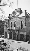 |
January 18, 1973 (#73000474) |
Eureka St. 39°48′04″N 105°30′47″W / 39.801111°N 105.513056°W / 39.801111; -105.513056 (Central City Opera House) | Central City | |
| 3 | Central City-Black Hawk Historic District |  |
October 15, 1966 (#66000246) |
On State Highway 119 39°48′04″N 105°30′27″W / 39.801111°N 105.5075°W / 39.801111; -105.5075 (Central City-Black Hawk Historic District) | Central City | |
| 4 | Denver, Northwestern and Pacific Railway Historic District |  |
September 30, 1980 (#80000881) |
Southwest of Eldora 39°54′52″N 105°41′10″W / 39.914444°N 105.686111°W / 39.914444; -105.686111 (Denver, Northwestern and Pacific Railway Historic District) | East Portal | Historic railroad route over Rollins Pass; extends into Grand and Boulder counties. |
| 5 | Frontenac and Aduddell Mine Complex | Upload image | December 31, 2020 (#100005981) |
0.25 mi. southwest of jct. of Church Placer and Pewabic Mountain Rds. 39°46′17″N 105°30′58″W / 39.7715°N 105.5161°W / 39.7715; -105.5161 (Frontenac and Aduddell Mine Complex) | Russell Gulch vicinity | |
| 6 | Russell Gulch I.O.O.F. Hall No. 47–Wagner and Askew |  |
December 15, 2011 (#11000903) |
81 Russell Gulch Rd. 39°46′48″N 105°32′06″W / 39.7801°N 105.5349°W / 39.7801; -105.5349 (Russell Gulch I.O.O.F. Hall No. 47–Wagner and Askew) | Russell Gulch | |
| 7 | Teller House | 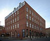 |
January 18, 1973 (#73000475) |
Eureka St. 39°48′03″N 105°30′46″W / 39.800833°N 105.512778°W / 39.800833; -105.512778 (Teller House) | Central City | |
| 8 | Winks Panorama |  |
March 28, 1980 (#80000901) |
Southwest of Pinecliffe 39°55′16″N 105°27′25″W / 39.921111°N 105.456944°W / 39.921111; -105.456944 (Winks Panorama) | Pinecliffe | Designated a National Historic Landmark in 2023. |
| Name on the Register | Image | Date listed | Location | City or town | Description | |
|---|---|---|---|---|---|---|
| 1 | Francisco Plaza | 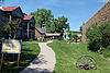 |
October 23, 1986 (#86002950) |
312 S. Main St. 37°30′27″N 105°00′33″W / 37.5075°N 105.0092°W / 37.5075; -105.0092 (Francisco Plaza) | La Veta | |
| 2 | Huerfano County Courthouse and Jail | 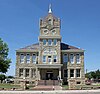 |
April 23, 1973 (#73000476) |
400 Main St. 37°37′29″N 104°46′53″W / 37.6247°N 104.7814°W / 37.6247; -104.7814 (Huerfano County Courthouse and Jail) | Walsenburg | |
| 3 | Huerfano County High School |  |
November 2, 2005 (#05001200) |
415 Walsen Ave. 37°37′51″N 104°47′10″W / 37.6308°N 104.7861°W / 37.6308; -104.7861 (Huerfano County High School) | Walsenburg | |
| 4 | La Veta Pass Narrow Gauge Railroad Depot | 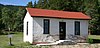 |
June 6, 1980 (#80000902) |
Off U.S. Highway 160 37°35′35″N 105°12′12″W / 37.5931°N 105.2033°W / 37.5931; -105.2033 (La Veta Pass Narrow Gauge Railroad Depot) | La Veta | |
| 5 | Lamme Hospital |  |
December 10, 1993 (#93001376) |
314 S. Main St. 37°30′26″N 105°00′31″W / 37.5072°N 105.0086°W / 37.5072; -105.0086 (Lamme Hospital) | La Veta | |
| 6 | Maitland Arroyo Bridge | 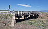 |
October 15, 2002 (#02001134) |
State Highway 69 at Milepost 3.0 37°39′57″N 104°50′00″W / 37.6658°N 104.8333°W / 37.6658; -104.8333 (Maitland Arroyo Bridge) | Walsenburg | |
| 7 | Montoya Ranch | 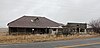 |
July 3, 2012 (#12000377) |
19176 State Highway 69 37°44′41″N 105°04′17″W / 37.7447°N 105.0713°W / 37.7447; -105.0713 (Montoya Ranch) | Farisita | |
| 8 | Edwin L. Smith Building |  |
August 17, 2020 (#100005435) |
300 South Main St. 37°30′28″N 105°00′33″W / 37.5079°N 105.0091°W / 37.5079; -105.0091 (Edwin L. Smith Building) | La Veta | |
| 9 | Veta Pass | 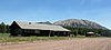 |
August 31, 2011 (#11000607) |
3652, 3665, 3688 County Road 443 37°35′35″N 105°12′12″W / 37.5931°N 105.2033°W / 37.5931; -105.2033 (Veta Pass) | La Veta |
| Name on the Register | Image | Date listed | Location | City or town | Description | |
|---|---|---|---|---|---|---|
| 1 | Colorado State Forest Building Complex |  |
January 17, 2017 (#100000474) |
Near State Highway 14 40°30′05″N 105°57′56″W / 40.501389°N 105.965556°W / 40.501389; -105.965556 (Colorado State Forest Building Complex) | Gould | |
| 2 | Hog Park Guard Station | Upload image | September 25, 2003 (#03000960) |
Routt National Forest 40°59′56″N 106°48′52″W / 40.998971°N 106.814401°W / 40.998971; -106.814401 (Hog Park Guard Station) | Cowdrey | Log cabin built in 1910-12 |
| 3 | Lake Agnes Cabin | 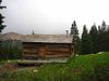 |
September 26, 2007 (#07000998) |
2.5 miles from State Highway 14 near Cameron Pass 40°29′24″N 105°54′08″W / 40.49°N 105.902222°W / 40.49; -105.902222 (Lake Agnes Cabin) | Gould |
| Name on the Register | Image | Date listed | Location | City or town | Description | |
|---|---|---|---|---|---|---|
| 1 | American Legion Hall |  |
December 11, 2007 (#07001248) |
U.S. Highway 287 north of Eads 38°29′06″N 102°47′17″W / 38.485°N 102.788056°W / 38.485; -102.788056 (American Legion Hall) | Eads | |
| 2 | Crow–Hightower House |  |
August 20, 2013 (#13000605) |
909 Maine St. 38°29′00″N 102°46′53″W / 38.4832°N 102.7814°W / 38.4832; -102.7814 (Crow–Hightower House) | Eads | |
| 3 | Eads Community Church |  |
August 20, 2013 (#13000606) |
110 E. 11th St. 38°28′56″N 102°46′51″W / 38.4821°N 102.7807°W / 38.4821; -102.7807 (Eads Community Church) | Eads | |
| 4 | Eads School Gymnasium |  |
August 20, 2013 (#13000607) |
W. 10th and Slater Sts. 38°28′59″N 102°46′58″W / 38.4830°N 102.7829°W / 38.4830; -102.7829 (Eads School Gymnasium) | Eads | |
| 5 | Hotel Holly–Haswell Hotel |  |
August 20, 2013 (#13000608) |
200 4th St. 38°27′11″N 103°09′48″W / 38.4530°N 103.1634°W / 38.4530; -103.1634 (Hotel Holly–Haswell Hotel) | Haswell | Historic district containing a two-story hotel, filling station, bunkhouse, chicken coop, and non-contributing garage. |
| 6 | Sand Creek Massacre Site |  |
September 28, 2001 (#01001055) |
Near the junction of County Roads 54 and W 38°34′13″N 102°30′11″W / 38.570278°N 102.503056°W / 38.570278; -102.503056 (Sand Creek Massacre Site) | Eads | Boundary increase approved, September 19, 2016 |
| Name on the Register | Image | Date listed | Location | City or town | Description | |
|---|---|---|---|---|---|---|
| 1 | Burlington Gymnasium |  |
December 11, 2007 (#07001249) |
450 11th St. 39°18′17″N 102°15′46″W / 39.304722°N 102.262778°W / 39.304722; -102.262778 (Burlington Gymnasium) | Burlington | |
| 2 | Burlington State Armory | 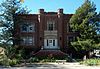 |
September 20, 1984 (#84000859) |
191 14th St. 39°18′08″N 102°16′05″W / 39.302222°N 102.268056°W / 39.302222; -102.268056 (Burlington State Armory) | Burlington | |
| 3 | Elitch Gardens Carousel | 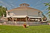 |
December 19, 1978 (#78000861) |
Kit Carson County Fairgrounds 39°18′32″N 102°16′13″W / 39.308889°N 102.270278°W / 39.308889; -102.270278 (Elitch Gardens Carousel) | Burlington | |
| 4 | Flagler Hospital |  |
January 30, 1991 (#90001421) |
311 Main Ave., P.O. Box 126 39°17′36″N 103°04′45″W / 39.293333°N 103.079167°W / 39.293333; -103.079167 (Flagler Hospital) | Flagler | |
| 5 | Sim Hudson Motor Company Building |  |
November 7, 2007 (#07001149) |
1332 Senter Ave. 39°18′17″N 102°16′00″W / 39.304722°N 102.266667°W / 39.304722; -102.266667 (Sim Hudson Motor Company Building) | Burlington | |
| 6 | Spring Creek Bridge |  |
October 15, 2002 (#02001143) |
U.S. Highway 24 at milepost 430.32 39°18′01″N 102°43′41″W / 39.300278°N 102.728056°W / 39.300278; -102.728056 (Spring Creek Bridge) | Vona |
Former listing
| Name on the Register | Image | Date listed | Date removed | Location | City or town | Description | |
|---|---|---|---|---|---|---|---|
| 1 | Winegar Building | Upload image | May 22, 1986 (#86001123) | November 9, 2015 | 494-498 14th St. 39°18′21″N 102°16′03″W / 39.305833°N 102.2675°W / 39.305833; -102.2675 (Winegar Building) | Burlington | Apparently demolished in or before 2013 |
| Name on the Register | Image | Date listed | Location | City or town | Description | |
|---|---|---|---|---|---|---|
| 1 | Limon Railroad Depot |  |
February 20, 2003 (#03000038) |
897 1st St. 39°15′37″N 103°41′14″W / 39.260278°N 103.687222°W / 39.260278; -103.687222 (Limon Railroad Depot) | Limon | |
| 2 | Hugo Municipal Pool | 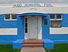 |
July 24, 2008 (#08000692) |
Junction of US 287 and 6th Ave. 39°08′00″N 103°27′57″W / 39.133454°N 103.465811°W / 39.133454; -103.465811 (Hugo Municipal Pool) | Hugo | part of the New Deal Resources on Colorado's Eastern Plains Multiple Property Submission |
| 3 | Rock Island Snow Plow No. 95580 | 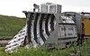 |
July 23, 2018 (#100002680) |
899 1st St. 39°15′39″N 103°41′12″W / 39.2609°N 103.6868°W / 39.2609; -103.6868 (Rock Island Snow Plow No. 95580) | Limon |
| Name on the Register | Image | Date listed | Location | City or town | Description | |
|---|---|---|---|---|---|---|
| 1 | Bachelor-Commodore Mine Complex | Upload image | July 29, 2021 (#100006753) |
Cty. Rd. 503 | Creede vicinity | |
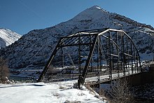
| 2 | Sevenmile Bridge |  |
July 11, 1985 (#85001552) |
County road 6 miles southwest of Creede 37°47′33″N 106°58′51″W / 37.7925°N 106.9808°W / 37.7925; -106.9808 (Sevenmile Bridge) | Creede | |
| 3 | Wagon Wheel Gap Fluorspar Mine and Mill |  |
April 22, 2019 (#100003643) |
1 Goose Creek Rd. 37°44′54″N 106°49′54″W / 37.7484°N 106.8318°W / 37.7484; -106.8318 (Wagon Wheel Gap Fluorspar Mine and Mill) | Creede vicinity | |
| 4 | Wagon Wheel Gap Hot Springs Resort | Upload image | September 26, 2019 (#100004210) |
1 Goose Creek Rd. 37°44′57″N 106°49′56″W / 37.7492°N 106.8323°W / 37.7492; -106.8323 (Wagon Wheel Gap Hot Springs Resort) | Creede vicinity | Now the 4UR Ranch. |
| 5 | Wagon Wheel Gap Railroad Station |  |
September 27, 1976 (#76000563) |
Southeast of Creede at Wagon Wheel Gap off State Highway 149 37°45′54″N 106°49′32″W / 37.765°N 106.8256°W / 37.765; -106.8256 (Wagon Wheel Gap Railroad Station) | Creede | |
| 6 | Zang's Hotel and Annex |  |
November 25, 2022 (#100008397) |
120 North Main St. 37°51′13″N 106°55′37″W / 37.8535°N 106.9270°W / 37.8535; -106.9270 (Zang's Hotel and Annex) | Creede |
| Name on the Register | Image | Date listed | Location | City or town | Description | |
|---|---|---|---|---|---|---|
| 1 | Beaumont Hotel |  |
October 30, 1973 (#73000483) |
505 Main St. 38°01′19″N 107°40′17″W / 38.02194°N 107.67125°W / 38.02194; -107.67125 (Beaumont Hotel) | Ouray | |
| 2 | George Jackson House | 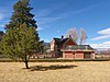 |
January 11, 1996 (#95001508) |
129 Citadel Dr., off U.S. Highway 550 38°05′13″N 107°42′12″W / 38.0869°N 107.7033°W / 38.0869; -107.7033 (George Jackson House) | Ridgway vicinity | Historic farmhouse visible from highway between Ridgway and Ouray, about midway |
| 3 | Ouray City Hall and Walsh Library |  |
April 16, 1975 (#75000528) |
6th Ave. between 3rd and 4th Sts. 38°01′23″N 107°40′12″W / 38.0231°N 107.67°W / 38.0231; -107.67 (Ouray City Hall and Walsh Library) | Ouray | |
| 4 | Ouray Historic District |  |
October 6, 1983 (#83003537) |
U.S. Highway 550 38°01′22″N 107°40′24″W / 38.0228°N 107.6733°W / 38.0228; -107.6733 (Ouray Historic District) | Ouray |
| Name on the Register | Image | Date listed | Location | City or town | Description | |
|---|---|---|---|---|---|---|
| 1 | Evergreen Corner Rural Historic District | Upload image | December 24, 2013 (#13000960) |
Junction of County Roads 17 and 30 40°38′37″N 102°30′43″W / 40.643551°N 102.512067°W / 40.643551; -102.512067 (Evergreen Corner Rural Historic District) | Haxtun | |
| 2 | First National Bank of Haxtun |  |
July 1, 1986 (#86001454) |
145 S. Colorado Ave. 40°38′30″N 102°37′42″W / 40.641667°N 102.628333°W / 40.641667; -102.628333 (First National Bank of Haxtun) | Haxtun | |
| 3 | Hargreaves Homestead Rural Historic District | Upload image | December 3, 2013 (#13000873) |
U.S. Route 385 between County Roads 10 and 12 40°30′19″N 102°17′53″W / 40.505299°N 102.298177°W / 40.505299; -102.298177 (Hargreaves Homestead Rural Historic District) | Holyoke | |
| 4 | Harms Farm | Upload image | February 2, 2016 (#15001010) |
County Road 21 between County Roads 30 and 32 40°38′51″N 102°28′29″W / 40.647415°N 102.474728°W / 40.647415; -102.474728 (Harms Farm) | Haxtun | |
| 5 | W.E. Heginbotham House |  |
March 8, 1988 (#88000170) |
539 S. Baxter 40°34′50″N 102°18′10″W / 40.580556°N 102.302778°W / 40.580556; -102.302778 (W.E. Heginbotham House) | Holyoke | Now called the Heginbotham Library and serves as Holyoke's public library. |
| 6 | Millage Farm Rural Historic District |  |
December 3, 2013 (#13000874) |
County Road 18 between U.S. Route 385 and County Road 37 40°33′20″N 102°18′23″W / 40.555466°N 102.306429°W / 40.555466; -102.306429 (Millage Farm Rural Historic District) | Holyoke | |
| 7 | Oltjenbruns Farm | Upload image | February 2, 2016 (#15001011) |
County Road 49 between Colorado Highway 23 and County Road 34 40°39′46″N 102°12′14″W / 40.662667°N 102.204024°W / 40.662667; -102.204024 (Oltjenbruns Farm) | Amherst | |
| 8 | Phillips County Courthouse |  |
December 28, 2007 (#07001306) |
221 Interocean Ave. 40°35′02″N 102°18′04″W / 40.583889°N 102.301111°W / 40.583889; -102.301111 (Phillips County Courthouse) | Holyoke | |
| 9 | Shirley Hotel |  |
March 28, 2002 (#02000263) |
101 S. Colorado Ave. 40°38′32″N 102°37′42″W / 40.642222°N 102.628333°W / 40.642222; -102.628333 (Shirley Hotel) | Haxtun |
| Name on the Register | Image | Date listed | Location | City or town | Description | |
|---|---|---|---|---|---|---|
| 1 | Bachelor Mine | Upload image | September 8, 2023 (#100009310) |
Cty. Rd. Z13 southwest of Naturita 38°08′59″N 108°50′33″W / 38.1496°N 108.8424°W / 38.1496; -108.8424 (Bachelor Mine) | Naturita vicinity | |
| 2 | Fort Peabody |  |
March 30, 2005 (#05000214) |
Uncompahgre National Forest 37°55′49″N 107°43′57″W / 37.930278°N 107.7325°W / 37.930278; -107.7325 (Fort Peabody) | Telluride | |
| 3 | Lewis Mill |  |
May 6, 2009 (#09000267) |
3.5 miles southeast of Telluride at the head of Bridal Veil Basin 37°52′44″N 107°46′30″W / 37.8790°N 107.7750°W / 37.8790; -107.7750 (Lewis Mill) | Telluride | |
| 4 | Rio Grande Southern Railroad Trout Lake Water Tank |  |
August 21, 2003 (#03000777) |
Along North Trout Lake Rd. 37°49′23″N 107°52′45″W / 37.823056°N 107.879167°W / 37.823056; -107.879167 (Rio Grande Southern Railroad Trout Lake Water Tank) | Ophir | |
| 5 | Ruble-Orendorf Mercantile | Upload image | November 27, 2023 (#100009563) |
1635 Grand Ave 38°07′51″N 108°17′21″W / 38.1308°N 108.2891°W / 38.1308; -108.2891 (Ruble-Orendorf Mercantile) | Norwood | |
| 6 | Smuggler-Union Hydroelectric Power Plant |  |
December 27, 1979 (#79000621) |
Southeast of Telluride at Bridal Veil Falls 37°55′09″N 107°46′08″W / 37.919167°N 107.768889°W / 37.919167; -107.768889 (Smuggler-Union Hydroelectric Power Plant) | Telluride | |
| 7 | Telluride Historic District |  |
October 15, 1966 (#66000256) |
State Highway 145 37°56′14″N 107°48′29″W / 37.937222°N 107.808056°W / 37.937222; -107.808056 (Telluride Historic District) | Telluride | |
| 8 | Valley View Leasing and Mining Company Mill |  |
February 24, 2010 (#10000035) |
Off State Highway 145, 2.8 miles south of Ophir 37°50′57″N 107°53′05″W / 37.84917°N 107.88466°W / 37.84917; -107.88466 (Valley View Leasing and Mining Company Mill) | Ophir | Mining flotation mill building constructed in 1920. |
| Name on the Register | Image | Date listed | Location | City or town | Description | |
|---|---|---|---|---|---|---|
| 1 | Sedgwick County Courthouse |  |
April 24, 2007 (#07000345) |
315 Cedar St. 40°59′18″N 102°15′52″W / 40.988333°N 102.264444°W / 40.988333; -102.264444 (Sedgwick County Courthouse) | Julesburg | |
| 2 | Union Pacific Railroad Julesburg Depot |  |
February 11, 2004 (#04000019) |
210 W. 1st St. 40°59′08″N 102°15′48″W / 40.985556°N 102.263333°W / 40.985556; -102.263333 (Union Pacific Railroad Julesburg Depot) | Julesburg |
| Name on the Register | Image | Date listed | Location | City or town | Description | |
|---|---|---|---|---|---|---|
| 1 | Akron Gymnasium |  |
January 16, 2008 (#07001397) |
W. 4th St. and Custer Ave. 40°09′43″N 103°13′02″W / 40.161944°N 103.217222°W / 40.161944; -103.217222 (Akron Gymnasium) | Akron | |
| 2 | Farmers State Bank of Cope |  |
May 8, 2017 (#100000952) |
45450 Washington Ave. 39°39′49″N 102°51′04″W / 39.663601°N 102.851032°W / 39.663601; -102.851032 (Farmers State Bank of Cope) | Cope | |
| 3 | Plum Bush Creek Bridge |  |
October 15, 2002 (#02001135) |
U.S. Highway 36 at milepost 138.16 39°44′24″N 103°32′46″W / 39.73989°N 103.54607°W / 39.73989; -103.54607 (Plum Bush Creek Bridge) | Last Chance | |
| 4 | West Plum Bush Creek Bridge | 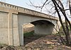 |
October 15, 2002 (#02001136) |
U.S. Highway 36 at milepost 134.59 39°44′24″N 103°36′43″W / 39.74002°N 103.61185°W / 39.74002; -103.61185 (West Plum Bush Creek Bridge) | Last Chance |
| Name on the Register | Image | Date listed | Location | City or town | Description | |
|---|---|---|---|---|---|---|
| 1 | Beecher Island Battleground |  |
October 29, 1976 (#76000569) |
16.5 miles southeast of Wray on Beecher Rd. 39°52′13″N 102°11′13″W / 39.870278°N 102.186944°W / 39.870278; -102.186944 (Beecher Island Battleground) | Wray | |
| 2 | Boggs Lumber and Hardware Building |  |
January 18, 1985 (#85000086) |
125 N. Main St. 40°06′48″N 102°29′18″W / 40.113333°N 102.488333°W / 40.113333; -102.488333 (Boggs Lumber and Hardware Building) | Eckley | |
| 3 | Cliff Theater | 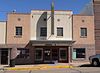 |
August 6, 2013 (#13000577) |
420 Main St. 40°04′39″N 102°13′19″W / 40.077363°N 102.221841°W / 40.077363; -102.221841 (Cliff Theater) | Wray | |
| 4 | Lett Hotel |  |
January 25, 1990 (#89002378) |
204 S. Ash 40°07′27″N 102°43′30″W / 40.124167°N 102.725°W / 40.124167; -102.725 (Lett Hotel) | Yuma | |
| 5 | Walter and Anna Zion Homestead | Upload image | July 6, 2005 (#05000652) |
Off County Road 15 39°46′59″N 102°23′15″W / 39.783056°N 102.3875°W / 39.783056; -102.3875 (Walter and Anna Zion Homestead) | Idalia |
See also
- Bibliography of Colorado
- Geography of Colorado
- History of Colorado
- Index of Colorado-related articles
- List of Colorado-related lists
- Outline of Colorado
References
- National Park Service, United States Department of the Interior, "National Register of Historic Places: Weekly List Actions", retrieved September 27, 2024.
- "National Register Information System". National Register of Historic Places. National Park Service. April 24, 2008.
- "National Register of Historic Places: Weekly List Actions". National Park Service. Archived from the original on January 26, 2011. Retrieved January 2, 2009.
- Weekly List Actions, National Register of Historic Places website
- 19th Street Bridge (Downtown Denver and West Denver), East Sixth Avenue Parkway (Northeast Denver and Southeast Denver), Monaco Street Parkway (Northeast Denver and Southeast Denver), South Platte River Bridges (Northeast Denver and West Denver), and Speer Boulevard (Downtown Denver, Northeast Denver, and Southeast Denver).
- The following sites are listed in multiple counties: Alpine Tunnel Historic District (Chaffee and Gunnison), Boreas Railroad Station Site (Park and Summit), Colorado Millennial Site (Baca and Las Animas), Denver & Rio Grande Railroad San Juan Extension (Archuleta and Conejos), Denver, Northwestern and Pacific Railway Historic District (Boulder, Gilpin and Grande), Durango-Silverton Narrow-Gauge Railroad (La Plata and San Juan), North Inlet Trail (Larimer and Grand), Riverside Cemetery (Adams and Denver), Staunton Ranch-Rural Historic Landscape (Jefferson and Park), Tobasco Mine and Mill (Hinsdale and San Juan), Tonahutu Creek Trail (Larimer and Grand), Trail Ridge Road (Larimer and Grand) and Ute Mountain Ute Mancos Canyon Historic District (La Plata and Montezuma).
- ^ Numbers represent an alphabetical ordering by significant words. Various colorings, defined here, differentiate National Historic Landmarks and historic districts from other NRHP buildings, structures, sites or objects.
- ^ The eight-digit number below each date is the number assigned to each location in the National Register Information System database, which can be viewed by clicking the number.
- Location derived from the GNIS feature record for Chimney Rock; the NRIS lists the site as "Address Restricted"
- Location derived from its GNIS feature record; the NRIS lists the site as "Address Restricted".
- "Crowley County Heritage Center". Archived 2013-09-02 at the Wayback Machine Retrieved 2012-08-27.
- "Colorado Office of Archaeology and Historic Preservation | Properties removed from the National and State Registers". Archived from the original on August 18, 2012. Retrieved August 17, 2012.
- Simmons, R. Laurie; Simmons, Thomas H. "NRHP Nomination: Hotel Holly/Haswell Hotel" (PDF). National Register of Historic Places. National Park Service.
- See minutes of the Burlington City Council meeting, May 28, 2013: on p. 2, "...a parking lot would be better use of the land where the Winegar building was instead of a park." Retrieved 2014-09-08.
External links
| Topics | |
|---|---|
| Lists by state |
|
| Lists by insular areas | |
| Lists by associated state | |
| Other areas | |
| Related | |
| |||
Denver (capital) | |
| Topics |
|
| Society | |
| Cities |
|
| Counties |
|
| Regions |
|
38°59′50″N 105°32′52″W / 38.9972°N 105.5478°W / 38.9972; -105.5478 (State of Colorado)